NALANDA(BIHAR SHARIF) DISTRICT
Nalanda became a fully-fledged district when it was split from Patna in 1976. Nalanda district is one of the thirty-eight districts of the state of Bihar in India . Bihar Sharif is the administrative headquarters of this district.
How To Reach
By Air(Airport) :-
The nearest airport is Patna Airport is around 76 km from Biharsharif.
By Rail :-
Bihar Sharif junction (BEHS) is located on the Broad gauge branch line connecting Patna, Bakhtiyarpur and Tilaiya via Raigir. It belongs to East Central Railway, Danapur division .The town is served by direct daily superfast train to New Delhi . Besides there are numerous passenger connections to the state capital Patna and Rajgir from where rest of India is well connected.
By Road :-
Well connected to other city through NH – 30A,31,82,110 State Highway – 4,71,78 and Other road -Hilsa Noorsarai Rd,Chandi Sohsarai Road,Bihar Nizain Road,Bidhipur Soradih Rd,Asthawa Saksohra Rd,Chainpur Rajgir Road
Bihar Sharif is located 72 kilometers from the state capital Patna.
Popular tourist destinations of the Nalanda (Bihar Sharif)
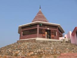
Odantapuri Monastery (Hiranyaka Parbat, Badi Pahari) :-Odantapuri, also called Odantapura or Uddandapura, was a Buddhist vihara. It is about 13 km from Nalanda. A famous University reputed for its excellence in 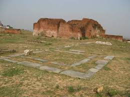 imparting Vajrayana and Tantric Buddhist studies. The monastery, traditions ascribe was built on top of a hill known as ‘Badi Pahari’ (or big hill). It was established by king Dharmapala of Pala dynasty in the 8th century. It is considered the second oldest of India’s universities and was situated in Magadha, Recently it is known as a Bihar Sharif. Acharya Shri Ganga of Vikramashila had been a student here.According to the Tibetan records there were about 12,000 students at Odantapuri. It was
 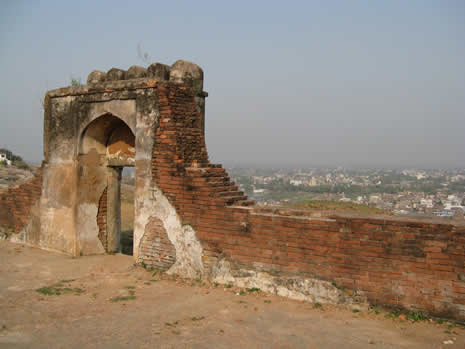 destroyed, looted and five hundred monks butchered somewhere in the 12th Century AD, when Bhaktiyar Khilji and his barbaric forces, attacked the Monastery. It is said that they looted all the images of the Tantrayana made of gold and silver and when they came across an enormous library of handwritten manuscripts, they were curious what was written in them but there was no one left to explain anything as all the monks had been killed.
Hanuman Mandir at Badi Pahari :-
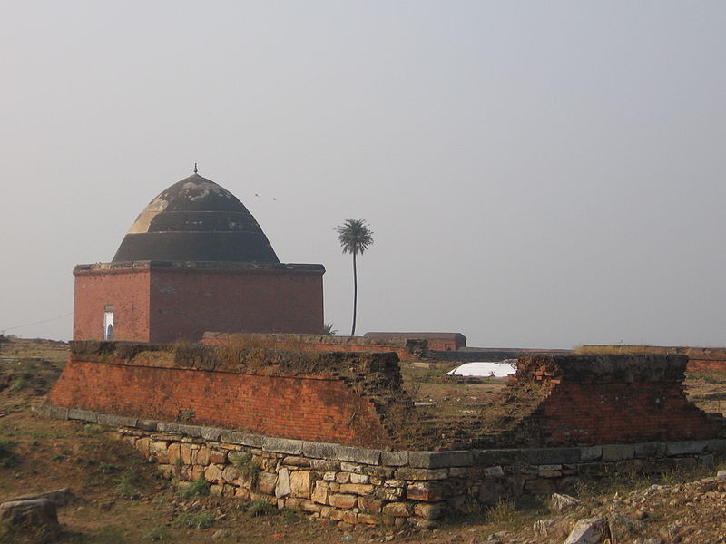
Mosque at Badi Pahari:-It was really a Temple which was constructed by Pala King Gopala founder of Odantpuri University where thousands of Brahmins brutally killed by Ibrahim Mallick, a general in Sultan Mohammad Tughlaq’s army and then the Temple is reshaped as Mosque.
Bihar Sharif Museum :-It is housed in the building named Virasat Bihar at Bihar Sharif. Museum was established in the year 1979. The stone sculptures housed in this museum mostly belong to Pal Period.The museum is known for its few good collection of stone sculptures, medieval. coins and stone inscription.
Gupta Pillar (Biharsharif) :- An Ancient sandstone pillar situated in the compound of the Magistrate’s Court. It is fourteen feet high, containing two inscriptions of the Gupta Dynasty, first of Kumar Gupta’s time (413-455) and second of Skanda Gupta’s (456-480) fixed on a brick pedestal upside down. It show dates back to the 5th century.
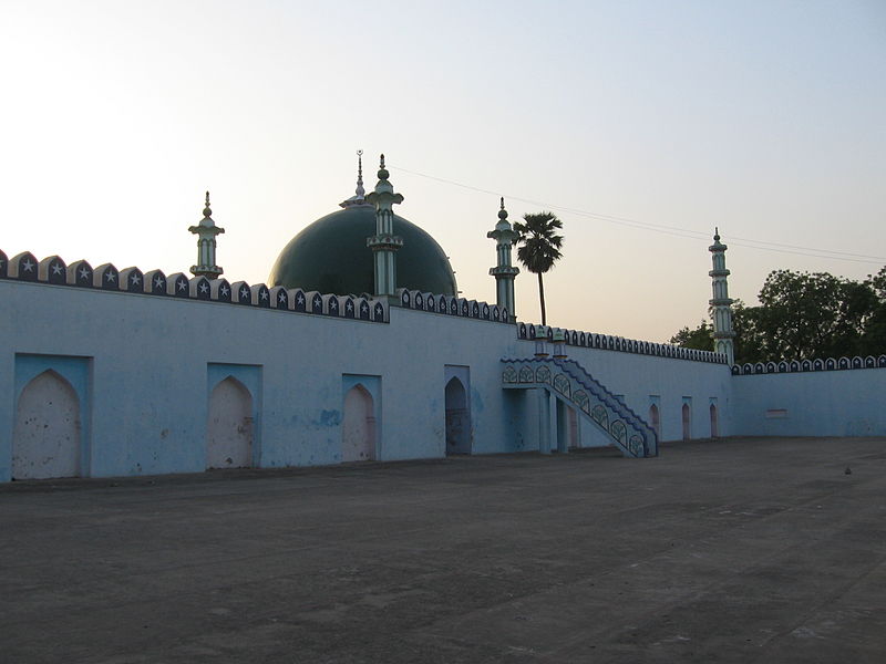
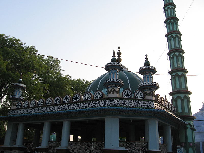
.Chhoti Dargah (Dargah of Makhdum Hazrat Sultan Ahmed Charampose):-It is the biggest and the oldest building of Mohalla-Amber in the Bihar Sharif Town (Nalanda), and crowned by the Tomb of Hazrat Makhdum Sultan Syed Shah Ahmed Charampose Teg Barhana Rohmatulla Alaib. He was born in the year 1236 and passed away in 1335 (according to Islamic calendar 657-776 Hizri). He is ranked to a very high order among other Sufi saints and Auliahs. Many stories about the Saint are prevalent among people even today. According to one such story, the Saint was once on a visit to Tibet. The Ruler and people of that state, for their misconceptions, tried to inflict harm on him. The saint, for his self-defense, just raised one of his fingers and heads of those mischievous people instantaneously fell off their bodies. After this incident, adjective of “Tang Barhana” (A Sword out of the Sheath) was added to the Saint’s name. Another adjective of “Charampose” is added to his name for that, he always wore skin of a Dumba (specie different from ordinary goat), which was offered to him by Hazrat Hussain Pyare, his chief disciple.Thousands and thousand of people participate in the ‘Urs’ celebrated here in memory of the Saint every year.
Kalisthan(Mohalla-Amber,Bihar Sharif)):-
Bukhari Mosque :-
Pir Pahari (The Dargah of Malik Ibrahim Baya) :-It is situated in midway between Bihar Sharif town and Maghara village. It is about 1 km from Biharsharif town .This is the detached hill on which Buddha lived for some time. After his death a monastery, called the Kapotica or Pigeon monastery, was built theron. Hiuen Tsiang visited this monastery.
Now a day the hill is called Pir Pahari and crowned by the Dargah or mausoleum of Malik Ibrahim Baya, round which are ten smaller toms .
It is a rare quality of bricks structure which has withstood the ravages of time and unrelenting devastation of weather for the last 660 years. It is surmounted by a dome and bears inscriptions showing that the saint died on Sunday, 13th Dul Hajj 753 AH corresponding to 20 January 1353 AD. An annual Urs is celebrated.
Besides Syed Ibrahim Malik Baya’s tomb, there are 10 graves of his wife, sons, daughters, grandson, nephew and brother inside the dome. Names of his sons Badruddin Malik, Sadaruddin Malik, Mohammad Mohsin Malik, Syed Daud Malik, one daughter Syeda Bibi Munehiya, one Nephew, one Brother, one Grandson, one Wife & two sons of the saint Mohammad Ilyas Malik or Syed Suleman Malik are buried north side of the tomb. But Malik Mohammad Usman is Died in Jalalabad, Kabul (Afghanistan). The tombs of other family members and companions of Syed Ibrahim Malik Baya are lying on the east, west and south sides of the mausoleum.Due to the high respect and reverence given to the tomb of Syed Ibrahim Malik Baya for generations, no one is buried on the north side of the dome. The south side of the burial place is still reserved only for the Syed “Maliks” family members who wish to be buried on Pir Pahari.
According to Jayaswal Research Institute Archaeological Explorations this site belongs to Early medieval. period.
Dargah of Makhdum Shah Sharif ud-din (Badi Dargah, Hiranya parvata):-It is dargah of Makhdum Shah Sharif ud-din, also called Makhdum-ul-Mulk He died here in 1379. The inscription over the entrance shows that his tomb was built in 1569. This tomb stands on the south bank of the river Panchane, and is held in great veneration by the local Mohammedans, who assemble here on the 5th day of Sawan to celebrate the anniversary of his death. In this Mazar two Hindu faqirs also lie buried.Shaikh Sharfuddin was the son of Shaikh Yahya maneri bin Taj Faqeeh from Al-Khaleel (Palestine). His birthplace is Maner sharif, a village near Patna. A love of knowledge and the religious life, and signs of spiritual greatness, were found in him from his early childhood. He acquired traditional knowledge of Arabic, Persian, logic, philosophy and religion under Ashraf-ud-din Abu Towama Bokharaei in Sonargaon near Narainganj present Dhaka, a famous professor of those days.In search of a spiritual guide he travelled to many places including Khanqah of Hazrat Nizamuddin Aulia of Delhi, and was at last initiated (at or near Delhi ) by Najib-ud-din Firdausi . The master asked him to leave the place, and quitted his body shortly after. At this stage , Sharf-ud-dîn Rahmatullahi alayh lived for many a long year in the woods of Bihiâ and the Râjgir Hills . Shaykh chose to do ascetic exercises in the lonely Rajgir hills of Bihar, where Buddhist monks and Hindu sages loved to establish their hermitages. He would go to Bihar Sharif near Patna each Friday for congregational prayers, returning to the Rajgir forest afterward. Later, in 782/1381, he was forced to settle down in Bihar Sharif , where he lived throughout the greater part of the reign of Muhòammad ibn Tughluq. He died on Thursday, the 6th of Shawwâl, 782 Hijra, in the opening years of the I5th Century A.D.
Herbal Plants are found on this hill which are used in many types of Ayurvedic and Unani medicines for curing various diseases. It is said that few parts of rock mass of Sanjiwani pahar fall down over this hill.
There are seven waterfalls on the hill. Three stream falls are perennial and rest are seasonal . They are charged by rainfalls in rainy season and stream flow is continued up to start of summer season.
Tomb of Badrudin Badar Alam: –It is also located near Bari Dargah.
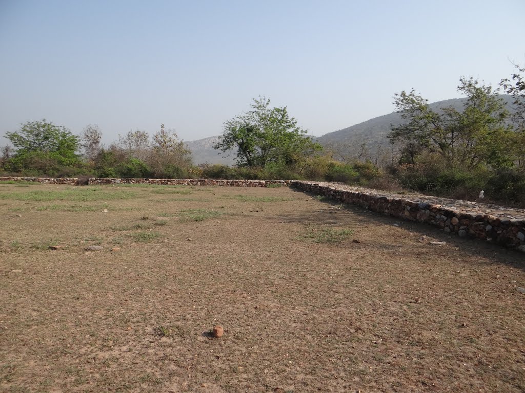
The Old Fort :-Remnants of old Fort on the river Panchane is situated.The foundation of ramparts is about twelve feet in breadth and extends over a pretty large area. It was a seat of the old Pal dynasty that ruled Magadha and Bengal for over 200 years in the 9th, 10th, and 11th centuries A.D
Queen’s Palace :-Bihar Sharif Remains of the ramparts and the mound commonly known as the ‘Queen’s Palace’ in the Killa
Chhoti Dargah :-The Chhoti Dargah is the shrine of Badruddin Badr-I-Alam, famous saint of Chittagong who settled and died here in 1440. Women possessed of Ghosts(Bhoot) assemble at this Dargah with a view to get rid of them.
Jama Masjid (Biharsharif):-It is built by Ikhtiyar Khan an eunuch and vakil of Said Khan, Governor of Bihar from 1595 to 1601 in the time of Akbar.
Habib Khan Mosque (Biharsharif) :-It was built by Habib Khan , an Afghan of the Sur clan, in 1638 almost entirely of Buddhist materials. Three inscription of Shah Jahan, all from Biharsharif, mention Habib Khan Sur as having constructed a mosque as well as a tank and built an Idgah and its floor in A.H 1047(A.D 1638) and A.H 1056 (A.D 1646) respectively.
Bayley Sarai (Biharsharif):-It is situated in the town itself the most remarkable building is huge inn, erected about 1oo year ago. The dispensary is housed in this building and in front of it is an elaborately designed clock tower.
Noratan (Biharsharif):-It is a curious structure, formally a Mohammedan nobleman’s summer house.It contains nine chambers, one in the middle, one at each corner, and one at each side.
Baba Mani Ram Akhara (Khaibai Mohalla)(25°11’14″N 85°31’28″E):-Bihar Sharif is also famous for Langot Fair at Baba Mani Ram Akhara. Sant Maniram was patronized by Raja Bitthal and local Rajputs. He started akhara for training youth to fight. Akhara of Sant Maniram was patronized by Raja Bitthal and local Rajputs.
Victoria Memorial Hall (Biharsharif) :- It was built in 1903 and used as a reading room.
Subhash Park(Circuit House Rd) :-
Hazrat Mir Fazlullah Gosain of Daira :-
Hazrat Farid-ud-din Tawaila Bux of Chandpura :-
Tawaila baba:-
Hazrat Ahmad Isa Taj of Bhaisaur :-
Hazrat Ataullah Baqhdadi of Mir Dad :-
Hazrat Syed Sadr-ud-din Zahidi (RA) :-
Mata Maya Temple (Maghra) :-
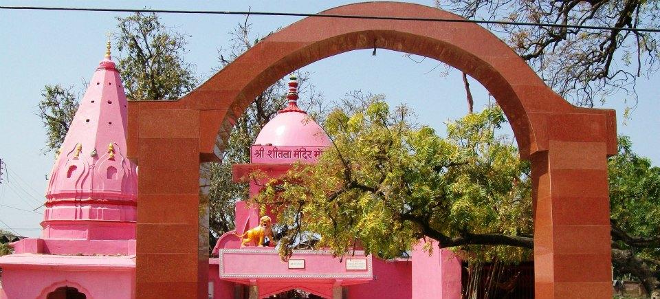
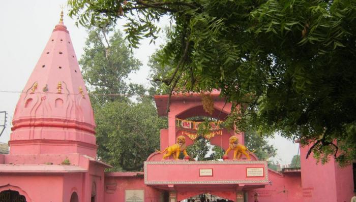
Maghra village is situated about 1.5 km west of the Biharsharif town on NH 31 which contains the ancient temple of Goddess Mata Maya. People afflicted with smallpox make a vow to offer puja to this goddess and go there to worship her.
belonging Early medieval. period.
Tiuri(Teur):-
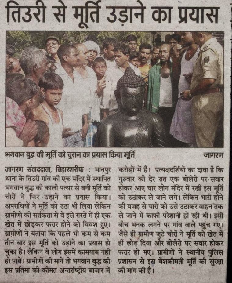 Here big statues, locally called Bhairo exist. It is a huge black stone image of Buddha in Bhumisparsa-mudra( ASI 1974-75).
According to Jayaswal Research Institute Archaeological Explorations this site belongs to NBPW Phase period.
Shri Kalisthan (Amber):-The KP Jayaswal Research Institute, during in the course of its Archaeological Explorations brought to light the site period Early medieval..
Amber Dargah :-
It is crowned by the Dargah of Makhdoom Sultan Charam Posh Tegh barhana R.A.
Nagma Dih:-The KP Jayaswal Research Institute, during in the course of its Archaeological Explorations brought to light the site period Early medieval.. Daspur:-The KP Jayaswal Research Institute, during in the course of its Archaeological Explorations brought to light the site period Early medieval.. Paharpur:-The KP Jayaswal Research Institute, during in the course of its Archaeological Explorations brought to light the site period Early medieval..
Upraura:-The KP Jayaswal Research Institute, during in the course of its Archaeological Explorations brought to light the site period Early medieval.. Muraura:-The KP Jayaswal Research Institute, during in the course of its Archaeological Explorations brought to light the site period Early medieval..
Hanuman Mandir (Dhanesher Ghat):-The KP Jayaswal Research Institute, during in the course of its Archaeological Explorations brought to light the site period Early medieval.. Dumrawan:-The KP Jayaswal Research Institute, during in the course of its Archaeological Explorations brought to light the site period NBPW phase. Haveli:-The KP Jayaswal Research Institute, during in the course of its Archaeological Explorations brought to light the site period Early medieval.. Mandachh Khurd:-The KP Jayaswal Research Institute, during in the course of its Archaeological Explorations brought to light the site period NBPW phase.
Gupapar (Bihar Sharif):-The KP Jayaswal Research Institute, during in the course of its Archaeological Explorations brought to light the site period Early medieval.. Korai:-The KP Jayaswal Research Institute, during in the course of its Archaeological Explorations brought to light the site period Early medieval.. Meghi:-The KP Jayaswal Research Institute, during in the course of its Archaeological Explorations brought to light the site period Early medieval.
According to Jayaswal Research Institute Archaeological Explorations this site belongs to Early medieval period.
Dighi Pokhar(Tetrawan) :-It is situated north of village.
Balam Pokhar (Tetrawan) :-It is situated south of village.
 The tank is irregular in shape, about 1160 feet x 750 feet. On the southern bank of which stands the colossal statue of Buddha.
Bhairav Sthan :-Just outside the village, at a short distance south-west of the hamlet stands a colossal image of the Buddha in the Bhumisparsa Mudra, it belonged to the period of the Pala art with an inscription inscribed on the petals of the lotus flower on which the image sits. The image is placed on a brick platform and is 7 feet high and 6.6 feet broad and faces to the north. Just below the plinth where the Buddha image sits, a short step way leads to what is known as the Balam pokhar,(Ballum pond) but now that the local people have become aware of the fact that the image is of the Buddha, they now refer to it as ‘the Buddha pokhar’ or Buddha pond.Older generation of villagers, aged over 60 years and above still refer to the Buddha image as ‘Bhairava.’ The image, as mentioned in Broadley’s records, was broken into two and was set up again after joining the portions. He does not mention whether he had the restoration done or if it had been done before he discovered it.
According to the myth told to the British Archaeologists by the local people who attributed the image being created by Raja Banasura, the demon king, who consecrated the image of god Balam (ri-Balam as mentioned by Cunningham) is not clear.
Shiva Asthan (Tetrawan) :-
For a long time the Shiv Linga called Sidheswair Nath was lying in the open in a maiden till 1310, when Raja Harihar Prashad had built over it a fine Shivala with a garden. Some fine pieces of sculptured stones and images are placed within this temple .They were dug out from the fields and old tanks in the vicinity.
Devi Asthan:-There is an earthen pind of Debiji with a Dhaja or flag flying.
Bari Maharani Asthan:-This is one of the chief places of interest and worship in the village.There are two enclosures,one surrounding a flower garden leading to another enclosure surrounded by brick-built walls in the midst of which there is the temple, Jagmohan and courtyard of the Bari Maharani. The present temple and enclosure have been built or repaired.Inside the temple there are four Murtis, male figures, besides the three-headed and eight-armed female figure of the Bari Maharani, the presiding deity of this place.
Choti Maharani Asthan:-A three- headed and six-armed female Murti is placed inside a small temple. A large number of broken images are kept on the outer platform of this temple.
Goraya Asthan:-It is a heap of a very large number of broken images and stones in an indiscriminate manner piled up.
Sind Bas Asthan:-There is an earthen pindi, which is worshiped by the Dhnukhs and Ghamaila Kurmis in honour of one Sind Bas who was resident of Mokameh and Dhanukh by caste. It is said Sind Bas or Sindh Das, was a Kamya or ploughman of zemindar of Mokameh. Whenever he went to plough, instead of driving the bullocks, he used to remain sitting while the oxen went on ploughing without his aid. The news spread far and wide in the village and every body began admiring him. One day he quietly left the place and came to a village called Purnama, about four or five miles to the north of Amawan. His name and fame grew in course of time and the Ghamaila Kurmis and his own castemen, the Dhanukhs, flocked to him and made him their Guru. On his death a large temple was erected in his honour.
The Garh or Citadel:-A very large and extensive mound called the garh is situated in the middle of the village. Practically the main portion of the busti Tetrawan is inside the garh, but the citadel is situated towards the west. Large pieces of stone slabs, stone pillars, images and statues have been and are even now dug out of this huge mound.
Dargah:-The Mohammedans built tombs over the tilha, a portion of which they call Dargah
Parmanand Asthan (Tetrawn) :-It consists of a mud pindi It is situated 1.5 Km to the south-east of the busti.
Nepura :-The village of Nepura is located between the famous places Rajgir and Nalanda Town, at the distance of 9 km from Rajgir and 4 km from ruins of Nalanda University . This small village is famous for weaving. Villager have retained their age-old traditional art of ‘Tassar’ silk weaving, which was very popular in Buddhist times.  Especially the people belonging to the Tati community are engaged in the occupation. They get this auspicious Tussar silk from the special variety of cocoons raised from the Sal and Arjun trees. It is said that out of the three Mango Grooves of the Nalanda University, one of the Grooves is situated here. And it is here where Lord Mahavira and Gautam Buddha stayed. It is the first place where the Lord Buddha gave his first preaching – it is so believed. So it came out to be known as the epicentre of Buddha’s preachings. It is also considered the first major social reform movement. Lord Buddha, Lord Mahavira and Sanjaya has many followers from this village .
Nepura after Endogenous Tourism Project:-
Nepura women’s cooperative is popular for their traditional stitch work called Sujuni. 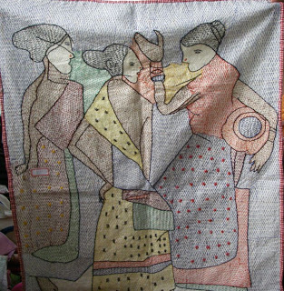 Sujuni was traditionally made by rural women, and Sujuni based quilts and bedsheets were traditional gifts exchanged in marriages and for festivals. The stitch pieces are inspired by dynamic and diverse motifs, stories from daily life, and historical and contemporary social issues. At Nepura, the artisans have made an effort to create sujuni using Buddhist motifs, recreating the life and stories of the Buddha with needle and thread.
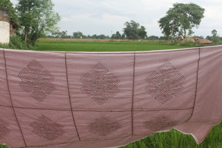 The Eternal knot iconography symbolised Samsara i.e., the endless cycle of suffering or birth, death and rebirth within Tibetan Buddhism. The Knot overlaps without a beginning or an end, symbolizing the Buddha’s endless wisdom and compassion.
 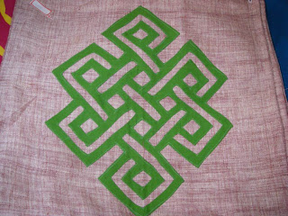 The placing of the endless knot on a gift or greeting card is understood to establish an auspicious connection between the giver and the recipient.The products with this motif are very much appreciated by the patrons and buyers
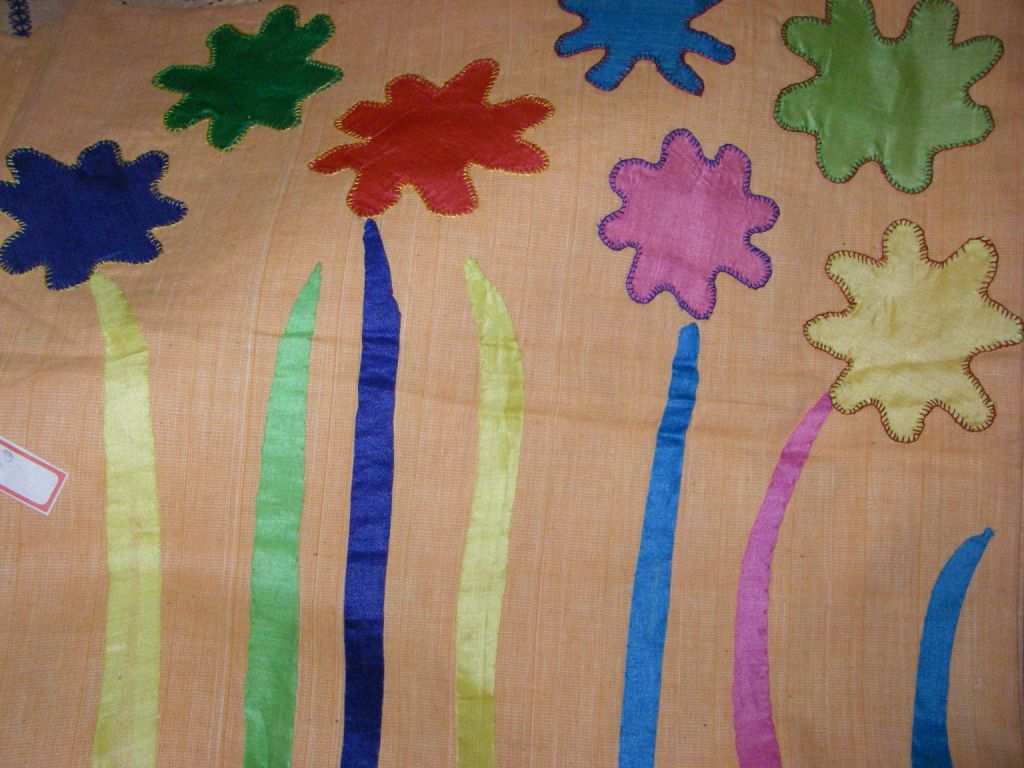
Khatwa- Traditional Applique work
Khatwa is traditional applique work popular with rural women. Traditionally it started with using old, torn pieces of cloth sewn or fixed over another. In the recent past, Khatwa has gained much appreciation from the patrons of art. The traditional use of motifs and pattern from day to day life are very popular with the buyers. At Nepura, Buddhist motifs, too, are used by the artisans.
Mustafapur:-
 It is situated 2.5 km away from ruins of Nalanda University.Statue of Lord Buddha sitting in majestic posture has been found.
Khanqah Hazrat Hamid Hamdani Manjhan Goshanashi (Chanpura):-
It is crowned by the Dargah Hazrat Syed Shah Sultan Ahmed Hamdani.
SILAO BLOCK
Silao :-In between Nalanda and Rajgir on NH 82 about 15 km to Biharsharif, there is a large village namely Silao where very a popular native sweetmeat “KHAJA” is prepared. The town is said to have been founded by Maharaja Vikramaditya.
Goraya Sthan (Silao) :-Western side of the town there is a place called Goraiya Sthan, over one acre in area. A number of old Buddhistic figures are collected here, the most prominent being a big piece of three line marked stone, breast high above the ground, stands over a tilha which is three fit high from the ground which faces west. All the Gorayas face east but this one faces west. The legend is that this figure was laid embedded in a pond near the thakurbari. People tried their best to remove this stone from that place but failed. It is said that then the figure cried out that it would be removed only by Kurmis and Malis and by no other. After that it was removed to its present side by certain Kurmis and a Mali. Now a day it is worshipped by all castes.
Silao Garh :-It is the palace and fort of the raja of Silao. The pillars, stone slabs, and other materials of the garh were removed by the Mussalmans and used in building their Mosque.
According to Jayaswal Research Institute Archaeological Explorations this site belongs to Early medieval period.
Mosque(Silao) :-South west of the railway station.Material used obtained from the Garh.
Hanuman Sthan (Silao) :-Towards the north west side of the town is a place called Hanuman Sthan, where a large number of old broken images and statues are collected underneath a pipal tree.
Ood Khanda(Ood Kuan):-About 1 km to the north- west of the northern end of the town, there is an old well called Ood kuan in the khanda named Ood Khanda.
Toms (Silao) :-There are two tombs and a musjid with numerous inscriptions in Persian and Arabic characters. It is built of stone and mortar and is of the ordinary kind. The pavement is indeed a mass of embedded pillars.
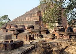
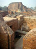
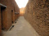
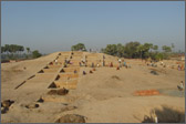
Nalanda University Ruins Archaeological Complex :-It is Located 95 km from Patna.The ruins as seen today is surrounded by villages that too have an ancient history and most possibly been built on the ruins of the ancient University. These villages are known as Baragaon, Begampur, Jagdishpur, Muzaffarpur and Kapatya which cover a square kilometer and a half around in area. Nalanda is known as the ancient seat of learning. 2,000 Teachers and 10,000 Students from all over the Buddhist world lived and studied at Nalanda. It is the first Residential International University of the World. Nalanda University, built in the 5th century BC. Patronised by royalty and eminent religious leaders like Buddha and Mahavira, it enjoyed an excellent reputation world over.
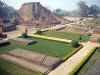 Total excavated area of the complex is about 14 hectares. The university was built in Kushan style of architecture. There are huge gardens, bronze statues and red-brick edifices all around. The buildings are divided by a central walkway that goes south to north.The monasteries or “Viharas” are east of this central alley and the temple or “Chaiyas” to the west.This place saw the rise and fall of many empires and emperors who contributed in the development of Nalanda University.
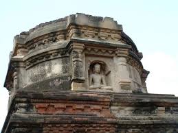
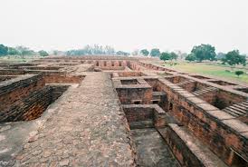
 Many monasteries and temples were built by them. King Harshavardhana gifted a 25m high copper statue of Buddha and Kumar Gupta endowed a college of fine arts ere. Nagarjuna (a Mahayana philosopher), Dinnage (founder of the school of Logic) and Dharmapala (the Brahmin scholar) taught here. Nagarjuna later became the high-priest there.The famous Chinese traveller and scholar,Hiuen-Tsang stayed here and has given a detailed description of the situations prevailing at that time. By excavation of the place has revealed many stupas, monasteries, hostels,stair cases,meditation halls, lecture halls and many other structures which speak of the splendour and grandeur this place enjoyed,when the place was a centre of serious study. A large number of ancient Buddhist establishments, stupas, chaityas, temples and monastic sites have been excavated and they show that this was one of the most important Buddhist centres of worship and culture
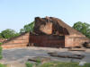 .Regarding the historicity of Nalanda, we read in Jaina texts that Mahavira Vardhamana spent as many as fourteen rainy seasons in Nalanda.Pali Buddhist Literature , too, has ample references to Nalanda, which used to be visited by Lord Buddha. During the days of Mahavira and Buddha,Nalanda was apparently a very prosperous temple city, a great place of pilgrimage and the site of a celebrated university. It is said that King Asoka gave offerings to the Chaitya of Sariputra at Nalanda and erected a temple there.
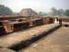
 Nalanda was put to a brutal and decisive end by Bakhtiyar Khilji, a Turkish invader (c. 1200), who is said to have looted and burned the monastery and killed its senior monks. Local legend has it that the three libraries of Nalanda were so large that they burned for six months.
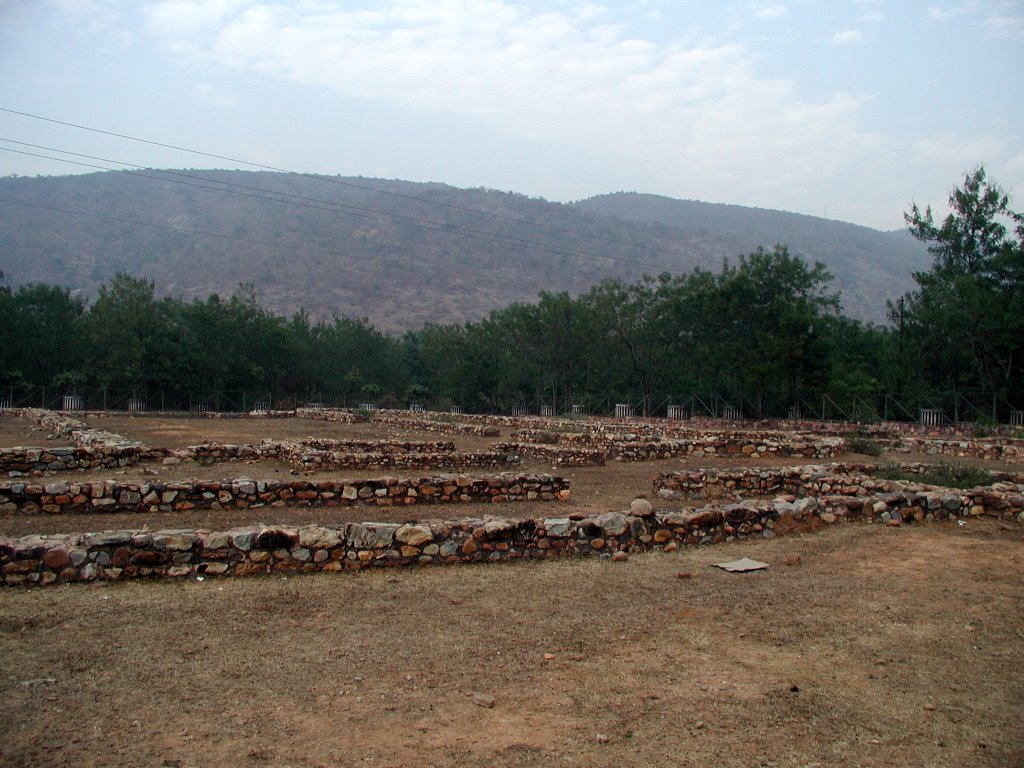
Sarari Mound :-ASI carried out an excavation at the site in 1973-74,75-76,76-77 and 79-80 and remains brought to light some beautiful sculptures, such as Uma-Mahesha, Tara, Bodhisattva, Marichi and plastered brick wall 22m in length provided with niches. The bottom of the niches were found to be decorated with pallava and kalasa designs.To the east of the brick wall, two stair case, one on each side of the sub-shrine were unearthed. A fourteen line prasasti engraved on a black stone and fixed by the side of a niche was exposed. The inscribed slab found in the excavation, records probably the installation of an image of Buddha by Prathama Shiva also called Purnawarman, the names of whose ancestors are also given. The prasati composed by Sandhi-Vigrahika Durgadutt and engraved by Madhava, the sone of Vamano was written in sanskrit language and Nagari characters of about the seventh-eight century. The excavation revealed a rectangular temple, with its entrance flanked by two projecting arm having moulded decorations, pilasters and niches for having images of deities and figures.
Sun temple (Surajpur) :-Surajpur is situated near the University of Nalanda. Named after the Sun himself has a lake with its temple of Surya, the Sun God , is a pilgrim destination twice a year in “Vaishakha” (April-May) and in “Kartika” (October-November) during the Chhath Puja or Sun worship.This temple has a number of statues of Hindu and Buddhist deities. A five feet high statue of Parvati is of particular interest. Special pujas to God Surya has been performed by the people of villages every Sunday. During exploration done by ASI in year 1973-74 a large number of Pala Sculptures including images of Avalokitesvara Vishnu, Tara, Hara-Gauri and Buddha in bhumisparsa-mudra were found.
According to Jayaswal Research Institute Archaeological Explorations this site belongs to Early medieval period.
Sun Temple (Bargaon) :-
 It is the site of great religious. The temple at the heart of village is very old and consists the black stone idols of sun god of 7 th century. At the Northwest end of the village is famous Suraj Pokhar which accommodates more than thousand pilgrims who come to present offerings to sun God on Chath festival twice a year, in the month of Kartika and Chait.The temple at the heart of the village was at the north-western side of the Suraj Pokhar and was shifted inside the village in late 17th century to protect it from mughal invasion. The sun temple of Bargaon is associated with Jarasandha, Lord Krishna and his great-grandson Sambha. According to the mythology Jarasandha was killed in a duel with Bhima a suryavanshi. The duel between the two continued for 14 days before Jarasandha was tore apart in two halves. A tradition “Ankuut” to celebrate the victory of good over the bad is continued till date.
The Suraj Pokhar has medicinal value and till recently people from different corner of Bengal and Bihar came to take dip in the pond and benefit. Till 1950’s this was also popular destination for Pind-daan a part of Shradh ritual. People after performing Pind –Daan at Gaya also performed the ritual here at Suraj Pokhar offering Pind to Lord Yama, Son of Sun god. During exploration done by ASI in year 1973-74 a large number of Pala Sculptures including images of Marichi, Buddha, Surya,Vishnu, Tara, Hara_Gauri, Chaturmukha Siva-linga and Ganesh in different sizes were discovered
According to Jayaswal Research Institute Archaeological Explorations this site belongs to NBPW phase period.
Nalanda Multimedia Museum :-
 Great place to visualize the History of Nalanda. India’s first Multimedia Museum was opened on 26 January 2008, which recreates the history of Nalanda using a 3D animation film narrated by Shekhar Suman. Besides this there are four more sections in the Multimedia Museum: Geographical Perspective, Historical Perspective, Hall of Nalanda and Revival of Nalanda.
Nav Nalanda Maha Vihar-
 It was established in 1951. The Bihar government has set up this institute that teaches Pali near the ancient university. In the institute Indian as well as foreign students study and do research
work on Buddhism and Pali, which was a widely used language in the ancient times.
Archeological Museum, Nalanda :-It was established in 1917,opposite the entrance to the ruins of the university .It houses the antiquities mainly those excavated from Nalanda, the earliest university cum monastery complex and from Rajgir. It has a small but beautiful collection of Buddhist and Hindu stone sculptures and bronze image of Gods and Goddesses and a number of  undamaged statues of the Lord Buddha that were found in the area. Two enormous terra-cotta jars of the first century stand intact behind the museum in a shaded enclosure. The collection includes copper plates and stone inscriptions, coins, pottery and samples of burnt rice (12th century AD) found among the ruins here. The key gallery displays sculptures of Trailokya Vijaya Vajrayana deity), Bodhisattva Avalokiteshvara, Maitreya, Buddha in Varada, Dharmachakra and Bhumisparsha posture, Samantabhadra, Parshvanath and Nagaraj . A scale model of excavated remains of Nalanda University occupies the central place of the hall.
The first gallery exhibits the images and sculptures of Khasarpana, Heruka, Mariachi,Vageshwari, Vaishali-miracle, Buddha in varada mudra, miracle of Sravasti, Surya, Lakshmi, Ganesh, Shiva-Parvati, Kuber and Rishabhnath.The second gallery contains one hundred and forty seven miscellaneous objects including terracotta, stuccos, iron implements and inscriptions. The central showcase exhibits a multi spouted pot related to serpent worship found from Rajgir.
In the third gallery altogether ninety-three specimens of bronzes have been displayed. Two images of Buddha in boon giving posture, Tara, Prajnaparamita, Loknath, Bodhisattva padmapani, Buddha in earth touching posture, depiction of a Buddhist temple, etc. are some important images related to Buddhist faith whereas images of Ganesh, Surya, Kamadeva, Indrani and Vishnu, etc. are examples of Brahmanical religion.
Stone sculptures and images of Kinnaras worshipping kalpadrum (2 panels), Vishnu, crowned Buddha in preaching pose with important events of his life, Buddha in Bhumisparsha-mudra with eight events, Mariachi, Vajrapani and Padmapani Bodhisattvas are kept in the fourth gallery.
Open during 10.00 to 17.00. Closed on Friday.
Pansokar Pokhar:-It is nearly one mile in length;
Gidi Pokhar :-It is nearly one mile in length;
Hsuen Tseng Statue (Hsuen Tseng Memorial orXuanzang memorial) :-In the memory of Xuanzang, a Chinese traveler who came to India in around 5th century AD, A Memorial Hall is built in the year 1960-61. Xuanzang was attracted by the glory of Nalanda University and stayed there for 12 years both as a student and as a teacher.  He gave detailed and many description of the Indian political and social conditions of that time. On January 12, 1957, Pandit Jawahar Lal Nehru, Hon’ble Prime Minister of India, on behalf of the Government of India, received the relics of Ven.
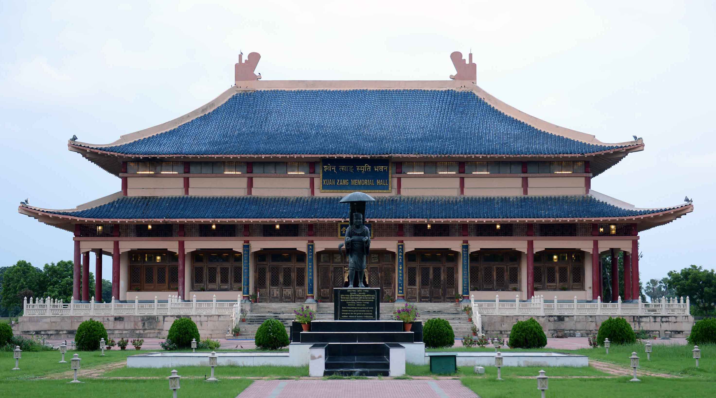 Xuanzang from His Holiness the Dalai Lama in a function at the Mahavihara, along with a cheque for the construction of a Xuanzang memorial at Nalanda. The relics, which will be enshrined in this hall, are currently kept in the Patna Museum, in Patna. The dream of Pt. Jawaharlal Nehru to develop Xuanzang Memorial Hall as a symbol of Indo-Chinese friendship has materialized. On 12th February, 2007 the Xuanzang Memorial Hall was inaugurated with the grand success and opened for public. At the occasion several dignitaries of the both countries, India and China attended the function. The Memorial hall constructed in the year 1960-61 was spread in 108 ft by 54 ft before being renovated and expanded . A Chinese delegation stayed here for about 26 days and embellished the hall with their art and culture. The shining metallic work designed by the Chinese, the wall paintings, photographs and other decorative pieces–all done by them are eye catching.The walls of the hall depict the work and contributions of Xuan
  Zang.The hall, now on a sprawling 400 sq feet area, is a cynosure for thousands of foreign and Indian tourists, who feast on the architectural grandeur of the structure and the soothe their eyes on the manicured vale stretching over 65 acres, surrounding it.Pond–rich in aquatic flora and fauna on one side of the hall is a major attraction with boats and house boats for yachting.
Mazar of Sufi Ahmad Sajjad, Panhessa :-Panhessa is a village on Biharsharif – Rajgir road. This village was abode of Maulana Abul Mohasin Mohammad Sajjad who was a great religious scholar of Islamic pantheon. He was the founder of the Emarat-e-Sharia, Phulwarisharif that has the highest order among the Muslim’s institution. Ahmad Sajjad was elder brother of the Maulana. He also was a great Sufi saint of his times. He was a very popular saint and the people had deep regards for him. Stories of the saint’s miracles are still prevalent among natives of the village. His Mazar is located near a mosque in the village where Urs of the great Sufi Saint is celebrated every year on the 27th day of Muharram. Considerably large numbers of Muslims, as well as, Hindu devotees participate in the Urs.
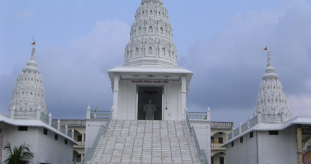
Kundalpur :-Kundalpur is located at the distance of 1.6 kilometers from the remnants of the Nalanda University,15 km from Rajgir, 15 km from Bihar Sharif , 75 km from Gaya and 100 km from Patna.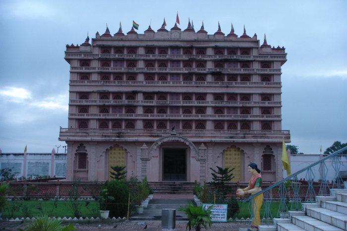 The place is an important destination for Jains, particularly for the Digambar sect of the Jains. Digambar Jain followers believe that the 24th and the last Tirthankar, Lord Mahavira was born here. Being linked to Mahavir’s, people built many temples at the place which are major tourist attractions here.A new beautiful Jaisalmer stone temple which houses statues of Lord Mahavira, Adinath Swami and Gautam Gandharva and Nandyavrat Mahal was built .There is also an ancient Jain temple , which is centuries old.A magnificent temple of Bhagwan mahavira with beautiful spires. In the temple a white coloured 4½ feet high Bhagwan Mahaveer Padmasana idol is installed. There is an ancient umbrella, outside the temple where foot images of Bhagwan are installed.
Keerti Stambha :-A big magnificent temple Keerti Stambha located near the main temple houses 8 idols of Bhagwan Mahaveer. In this temple a beautiful picturization of 16 dreams seen by Mother Trishala, the mother of Bhagwan Mahavira and foot images of her installed. In an umbrella, foot images of Gautam Ganadhara – the chief Ganadhara of Bhagwan Mahaveer are also installed. Foot images of Acharya Bhatta Akalanka Dev are also installed here. There is an art gallery of pictures and photos related to Bhagwan.
Viswa Shanti tirthankar Mahavir Mandir :-
Rukmini Asthan(Jagdishpur) :-
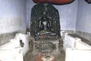 It is situated 1.5 km south west of the excavated site of ruins of Nalanda University. Here in a Hindu temple known as Mahamaya Temple on a mound or Stupa. In it is an image of a large size Buddha worshiped as Rukmini, the daughter of king Bhimika of Vidarbha . It is a figure of the ascetic Buddha, seated under the Bodhi tree, surrounded by horrible demons and alluring damsels seeking to seduce him away from his deep meditation. On each side other scenes from his life are represented, including the one of his death or Mahaparinirvana seen at the top of the slab. It is black stone statue shows Life scenes of Buddha. made jn 10th century.
According to Jayaswal Research Institute Archaeological Explorations this site belongs to NBPW phase period.
Panchawora :-During exploration done by ASI in year 1973-74 a number of images including a crowned Buddha in Bhumisparsa- mudra, a panel depicting the scenes from the life of Buddha and triple – faced Marichi, Buddha, Tara a nd Jambhola were found. Tajubigha :-During exploration done by ASI in year 1973-74 an image of crowned Buddha was found.found. Mohanpur :- During exploration done by ASI in year 1973-74 an image of Buddha with an inscription ascribable to about the ninth-tenth century A.D was found. Chandiman:-The KP Jayaswal Research Institute, during in the course of its Archaeological Explorations brought to light the site period Early medieval..
Tazu Bigha (Lat.25°08’91”N; Long. 25°25’29”E):- Village Tazu Bigha is situated 6km north-west from the ruins of Nalanda. A small mound containing potsherds of NBPW, red ware and black ware, an image of Buddha measuring 63 x 25 cm in abhaya mudra, kept outside the Siva temple having an inscription of one line on the pedestal was found.
Nanand :-The KP Jayaswal Research Institute, during in the course of its Archaeological Explorations brought to light the site period Early medieval. Dastur:-The KP Jayaswal Research Institute, during in the course of its Archaeological Explorations brought to light the site period Early medieval..
Daman Khanda (Pranganpar)(Lat. 25°8’25” N ; Long. 85° 26’55” E ):-The village Damankhanda situated at 1km. north from the ruins of the ancient Nalanda Mahavihar.
There is an elevated mound known as Pranganapar to north -west of the village.Massive brick wall , brick -on -edge pavement and a broken Buddha image made of black basalt have been revealed at the site during the cutting of the mound in order to construct a canal by the state government in year 2007.
 ASI carried out an excavation at the site in 2007-08. The objective of this excavation was to mark out the extension of ancient Nalanda Mahavihar. The remains of Buddhist temple, fragmentary architectural and sculptural remains revealed.
Antiquities recovered during the small scale excavation mostly are terracotta human figurine, animal figurine, wheel, ear-lobe, stopper, sling ball, dabber, beads and inscribed sealings. Small sculptures of Buddha in Bhumisparsa and Dharmachakra pravartan pose and Vishnu in Samabhanga pose made of stone were also found. Nail and nail parer are among the iron objects. Bone point and fragments of votive stupas made of stone were also the noteworthy findings.
According to Jayaswal Research Institute Archaeological Explorations this site belongs to Early medieval period.
Ghustawan:-The KP Jayaswal Research Institute, during in the course of its Archaeological Explorations brought to light the site period Early medieval.. Sabait:-The KP Jayaswal Research Institute, during in the course of its Archaeological Explorations brought to light the site period Early medieval..Bara:-The KP Jayaswal Research Institute, during in the course of its Archaeological Explorations brought to light the site period NBPW phase. Kapatiya:-The KP Jayaswal Research Institute, during in the course of its Archaeological Explorations brought to light the site period Early medieval.. Mitawan:-The KP Jayaswal Research Institute, during in the course of its Archaeological Explorations brought to light the site period Early medieval.. Nanana:- The KP Jayaswal Research Institute, during in the course of its Archaeological Explorations brought to light the site period Early medieval. Nona:- The KP Jayaswal Research Institute, during in the course of its Archaeological Explorations brought to light the site period Early medieval.
Sarichak:-
 It is situated 1.5 km away from ruins of Nalanda University.In the recent excavation black stone statues of Buddha’s disciple Sariputra.Proof of birth place of Sairiputra have been found here.During excavation utensils of mud and five stupas have been found. Besides these , mud utensile of Gupta period, statues of buddha and mud utensils filed with ash, believed to be that of Sariputra and several small statue have been found.Acoding to Jayaswal Research Institute Archaeological Explorations this site belong to Early medieval period.
Juafar Dih(Lat 25° 08’11” N ; Long 85° 25’68” E):-
 The ancient mound of th Juafar Dih having an area of about 105 m east-west and 100 m north-south comprises about 11 m thick cultural deposit, is situated 3 km. west of the ruins of ancient Nalanda mahavihara.
ASI carried out an excavation at the site in 2006-07. The excavations revealed that the site have been occupied first time in Chalcolithic period and inhabited till 1st–2nd Century A.D.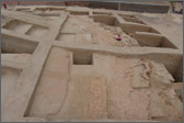
The main antiquities are terracotta hopscotches, beads, snake figurines, gamesman, dabbers, stone muller, querns, sling balls, Iron sickles, sword, chisel, hoe, axe, copper antimony rods, bone points, semiprecious stone beads etc.
Apart from identifying this site with Kolika mentioned in Buddhist literature, the remains of a stupa of NBPW phase, revealed during the excavations here, has been identified with the stupa of Moudgalyayana.
Indra Pokhar :-It is nearly half mile in length.
Kul:-The KP Jayaswal Research Institute, during in the course of its Archaeological Explorations brought to light the site period Early medieval. Bazitpur:-The KP Jayaswal Research Institute, during in the course of its Archaeological Explorations brought to light the site period Early medieval. Fatehpur:-The KP Jayaswal Research Institute, during in the course of its Archaeological Explorations brought to light the site period Early medieval. Karah dih:-The KP Jayaswal Research Institute, during in the course of its Archaeological Explorations brought to light the site period Early medieval. Mahuri:-The KP Jayaswal Research Institute, during in the course of its Archaeological Explorations brought to light the site period Early medieval. Pachwara:- The KP Jayaswal Research Institute, during in the course of its Archaeological Explorations brought to light the site period Early medieval. Bhagwanpur:-The KP Jayaswal Research Institute, during in the course of its Archaeological Explorations brought to light the site period Early medieval. Maniyawan:-The KP Jayaswal Research Institute, during in the course of its Archaeological Explorations brought to light the site period Early medieval.Barakar:-The KP Jayaswal Research Institute, during in the course of its Archaeological Explorations brought to light the site period Early medieval. Balaur:-The KP Jayaswal Research Institute, during in the course of its Archaeological Explorations brought to light the site period Early medieval. Mohanpur:-The KP Jayaswal Research Institute, during in the course of its Archaeological Explorations brought to light the site period Early medieval.
Gorawan:-The KP Jayaswal Research Institute, during in the course of its Archaeological Explorations brought to light the site period Early medieval. Surungpur:- The KP Jayaswal Research Institute, during in the course of its Archaeological Explorations brought to light the site period Early medieval. Gundhupur:- The KP Jayaswal Research Institute, during in the course of its Archaeological Explorations brought to light the site period Early medieval.
Sakraurha (Lat. 25°10’97”N;Long. 85°25’62”E):-The village Sakraurha is located about 8km north from the Nalanda ruins and about 15km southwest from Bihar Sharif. There is a mound in the south of the village extended into 60 x 40m with an extant height of 4m yielding red ware, few fragments of black stone, etc. One of them is a broken image of Buddha in dharmachakra pravartanmudra.
Aldhanna(Lat.25°15’N; Long.25°27’E);-Village is 18 km north from the ruins of Nalanda. There is a mound in the middle of the village covering an area of 100m x 60m with an extant height of 6m. Potsherds of red ware, black ware and black slipped ware were recovered during exploration.
RAJGIR BLOCK
Rajgir:-
It is 15 km from Nalanda. Its old name Rajagriha, meaning “The City of Kings,” is an ancient city and university town in the Nalanda district of Bihar, India. It was the capital of the Haryanka dynasty, the Pradyota dynasty, the Brihadratha dynasty, the Mauryan Empire, and it was the retreat center for the Buddha and his sangha. Other historical figures such as Mahavira and king Bimbisara lived there, and due to its religious significance, the city holds a place of prominence in Hindu, Buddhist and Jain scriptures.
It is the ancient capital of Magadhan empire which flourished in the 6th century BC. Its association with Lord Buddha and Lord Mahavira hallows the place. The first Buddhist council immediately after the Mahaparinirvana of Lord Buddha , to pen down his teachings , was also held at Rajgir. It was also the birthplace of Muni Suvrata, a predecessor of Lord Mahavira and the center of the Ajivika sect.Today Rajgir has come up as one of the most important pilgrimage for the Buddhist. Rajgir also has some very beautiful Hindu and Jain temples which attracts Hindus and Jains also to the place.It was also the birthplace of Muni Suvrata, a predecessor of Lord Mahavira and the center of the Ajivika sect not only as a place for worship, Rajgir has come up as health and winter resort with its warm water ponds. These ponds are said to contain some medicinal properties which help in the cure of many skin diseases. Rajgir city was in a valley surrounded by seven hills: Vaibhara, Ratna, Saila, Sona, Udaya, Chhatha, and Vipula.
Bihar State Tourism Department organizes every year, a colorful Festival of dance and music, Rajgir Mahotsav or Dance Festival, in end of October.
Rajgir wildlife Sanctuary :- It is situated about 100 km from Patna and 15 km from Biharsharif. Covers a picturesque plot that extends across an area about 36 sqm and surrounded by various hill. These hills are related to Buddhist, Jain and Hindu religion and have a very rich historical past.The place has a very beautiful classical monsoon climate. Hills are overgrown with thick and impassable jungle full of thorns and brambles. Zari Bootes (medicinal herbs) of all kinds including Shilajit are to be found in the hills and in the valleys in abundance. Trees and shrubs and grasses of all descriptions are plentiful mainly comprised of tropical deciduous forests.The sanctuary shelters various species of animals like Leopards, Nilgai, Barking Deer and Hyenas.
Zoo Safari (Rajgir):- Zoo safari project with an estimated cost of Rs 54 crore was being constructed in Mrig Vihar under Rajgir forest region for which necessary permission has been obtained from the National Zoo Authority and Bihar Wildlife Board. Rajgir would become only the second zoo after Patna to have safari. The scenic Mrig Vihar area spread over 65 acres at present was being expanded to 195 acres to have five safari parks – one each for lion, tiger, leopard, deer and aviary/butterfly, for which permission was being obtained from the central zoo authority.
Rajgir Glass Bridge :-
It is located at a distance of 6 km from Rajgir Wildlife Safari, and 10 km from Rajgir Railway Station, the Glass Bridge is a viewing platform Situated inside the Nature Safari Park.
This Glass Bridge is built to boost tourism in Bihar. It is similar to the Glass Bridge built in Hangzhou Province of China. It is made using 3 glasses of 15 mm. This is 85 feet long and 6 feet wide . It will be able to accommodate 40 visitors at a time. However, due to security reasons, only 15 to 20 people can go to its last end.
The bridge is being constructed amid five picturesque hills in the Rajgir area of Bihar. One can observe the surrounding natural beauty through the clear glass floor and the surrounding open spaces on the bridge.
Visitors can book the tickets for Rajgir Glass Bridge online from the website- rajgirzoosafari.in. Only about 25 percent of the tickets will be booked from the online website.
Timings: 9 AM – 5 PM, Closed on Monday
Entry: Rs. 50 for Person, Rs. 125 for Glass Bridge
Rajgir International Convention Centre:-
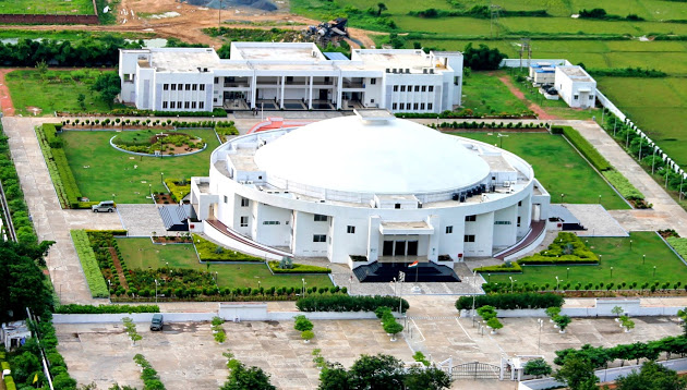 Rajgir International Convention Centre (RICC) is Bihar’s first purpose-built Green Globe project convention centre and state-of-the-art convention facility. RICC is proud to be the winner of the ‘Best Convention Centre’ of eastern region, Awarded by Incredible India , from 2012-2013, by the Government of Bihar. Developed and owned by Bihar Tourism. RICC is managed by MUSCO, the Manikaran Utility services company Limited , One of the leading Construction & hospitality management group.
CM Nitish Kumar inaugurated a state-of-the-art international convention hall built at the budget of Rs 33.56 crore at Rajgir on Friday, 28 Dec 2012. The hall with a capacity to accommodate 1,300 people is Nitish’s gift to his home district.
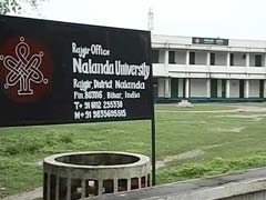
Nalanda University:- On 28 March 2006 the 11th President of India Avul Pakir Jainulabdeen Abdul Kalam proposed the idea while addressing the Joint Session of the Bihar Vidhan Mandal for revival of Nalanda university. The Nalanda University Bill, 2010 was passed on 21 August 2010 in Rajya Sabha and 26 August 2010 in Lok Sabha. The bill received Presidential assent on 21 September 2010 thereby becoming an Act.
The University came into existence on 25 November 2010, when the Act was implemented.Economist Amartya Sen is the Chairman of the Governing Body of the university, while renowned teachers from various countries are its members.Former Singapore foreign minister George Yeo and Ministry of External Affairs Secretary Anil Wadhwa are also part of the governing body.
 The Nalanda University campus will be spread over 455 acres and its construction is underway around 12 km from the site of the ancient university, which began during the Gupta period in 6th century AD and came to an end after being ransacked, looted and burnt in 1193 AD by the invading Turk army led by its commander Bakhtiyar Khilji.
The Nalanda University project is one of Bihar Chief Minister Nitish Kumar’s pet projects. He has in fact linked the resurrection of the ancient university to the building of ‘Brand Bihar’ and ‘Revival of Bihari Pride’.
Gopa Sabharwal has been appointed the first Vice-Chancellor of this university in February 2011.
The ancient Nalanda University, which had attracted students from the world over, will be formally inaugurated on September 1 , 2014 in its modern ‘avatar’ by External Affairs Minister Sushma Swaraj.Bihar Chief Minister Jitan Ram Manjhi will also be present at the inaugural function.The academic session of the University started only two of them , the School of Historical Sciences , the School of Environment and Ecology with 15 students and 11 teachers .
As the Nalanda University buildings are still under construction, the students and faculty members are housed at Bihar State Tourism Development Corporation (BSTDC) owned Hotel Tathagat Vihar. A run-down government office near Rajgir bus stand is working as temporary campus. Classes run at nearby International Convention Centre built by the Bihar government.
Several countries are pitching in with funds for the university with China contributing 1 million dollars, besides Singapore (5 million dollars), Thailand (1,00,000 dollars) and Australia (1 million Australian dollars).
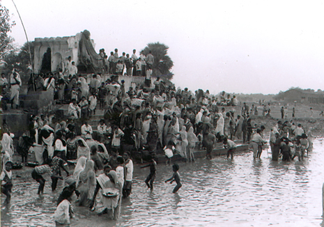
Rajgir Tirath (Markandi Kshettra) :- Rajgir has been a place of Hindu pilgrimage from pre-historic time. This is due to the numerous hot-water springs which are worshipped as revelation of the divine power.The thirth place at Rajgir is called Markandai Kskettra by the Pandas. There are three sacred kunds formed in the bed of the Sarasawti river that flows at the foot of the Baibhar hill.They are called (1) Saraswati kund, (2)Baitarni Kund and(3) Sahigram kund. At a short distance to the east of Sahgram kund is a shrine of Shiva and a curious well called Bharat Kup with step leading to the water. To the south east of this Saraswati kund on the left bank of the Saraswati river there is a small kund, called Bonari Taran, and a short distance south of this place, a rivulet named Godavan comes from the south meet here. To the south of this Sangam there are temples of Jwala Devi on the top and of Ganesh on the summit of the hill.
Pandu Pokhar:-
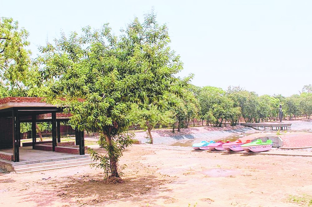 Chief minister Nitish Kumar inaugurated the ambitious Pandu Pokhar development project on Thursday, 18 August 2015 .
Spread over an area of around 22 acres in front of International Convention Centre, Pandu Pokhar has been developed by Bihar State Road Development Corporation Ltd (BSRDCL).
The pokhar site faces the majestic Vaibhav Giri Mountain towards its right and the convention centre falls on its left.
It has been developed in an eco-friendly manner and emphasis has been given on the finer details. Plantation has been done in different areas to maintain the lush greenery of the entire area.One of the most attractive components of the project is a 30-feet statue of Maharaj Pandu.A few major amenities under the park include a 4.5m-wide jogging track, children playing areas, food and beverage counters with sitting areas.
Historians seemed divided on the existence of the Maharaj. Some claimed that it is because of the location of the old pond surrounded by five hills, popularly known as “Pandav Mountains” in Rajgir.Other historians correlate the name Pandu with the Mahabharat. Some structures in Rajgir such as Jarasandha ki Baithak and Jarasandha ka Akhara are still connected with Jarasandha, the king of Magadha, in the time of the Mahabharat war.
Historical texts state that the first Buddhist council is believed to have been held here. Lord Buddha is also believed to have ventured the mountain. Ancient Buddhist stupa, Shiva and Jain temples are also situated atop the mountain.
Sapta Rishi or Saptadhara :– It is located at the foothills of the Vaibhar Hill.Here water is nearly 40 degree centigrade.There are separate bathing places in different temples with natural water sprouting out of the ground. The water comes from the seven streams known as Saptadhara that are believed to originate from the Saptarni caves at the top of the hill.
Ganga Jamuna :– It is located at the foothills of the Vaibhar Hill. Here water is nearly 41 degree centigrade.
Anant Rishi Spring:– It is located at the foothills of the Vaibhar Hill.
Brahma Kund:-
It is located at the foothills of the Vaibhar Hill. Here water is nearly 45 degree centigrade. There is a stone idol of Lord Brahma, water springs have curative properties, especially for arthritis and joint pain and are sacred to both Hindus and Buddhist.The water in the Brahma kund is the hottest of all. It does not come out from the side of the hills but bubbles out from the ground.
Kasyapa Rishi Kund:– It is located at the foothills of the Vaibhar Hill.
Vayas Kund:– It is located at the foothills of the Vaibhar Hill. Here water is nearly 40 degree centigrade.
Markandi Kund:– It is located at the foothills of the Vaibhar Hill.
Sita Kund;– It is located at the foothills of the Vipulagiri Hill. Here water is nearly 40 degree centigrade. Acoding to Jayaswal Research Institute Archaeological Explorations this site belong to Early medieval period.
Suraj Kund:- It is located at the foothills of the Vipulagiri Hill. Here water is nearly 40.5 degree centigrade.
Ram Kund:- It is located at the foothills of the Vipulagiri Hill. Here water is nearly 35 degree centigrade.
Ganesh Kund:- It is located at the foothills of the Vipulagiri Hill.
Chandrama or Soma kund:- It is located at the foothills of the Vipulagiri Hill.
Shringi Rishi kund or Makhdum kund :- It is located at the foothills of the Vipulagiri Hill. Here water is nearly 35 degree centigrade. Shringi Rishi kund also called Makhdum kund after the name of Muhammadan Saint Makhdum Shah, called Sharfuddin Ahmed.Close to the side of this spring is Makhdum Shah’s Chiliwa or a small Cavern for worship. Just over the entrance to the chilwa, there is a huge slanting rock said to have seen rolled down by two brothers Raol and Latta to kill the Saint,but it was arrested in its course by his look.
Venuvana Vihara :-
 Lat- 25° 00’ 59.14”, N, Long- 85° 25’ 06.21”E)Bimbisara gave a bamboo grove (Venuvana) to Lord Buddha for the Buddha’s rainy retreat, which was the first Buddhist monastery ever. It was given to Buddha so that he and his monks could take rest here, and give discourses to people. This was the first property turned over to the Buddhist sangha. It was also here that Jivakamrava Monastery was built in a mangrove grove, the first Buddhist monastery.
According to Jayaswal Research Institute Archaeological Explorations this site belongs to NBPW phase period.
Jivakameavan Gardens :-
 Seat of the Royal Physician’s dispensary where Lord Buddha was once brought to have wound dressed by Jivaka, the royal physician during the reign of Ajatshatru and Bimbisara.
According to Jayaswal Research Institute Archaeological Explorations this site belongs to NBPW phase period.
Rajgir Ropeway:-
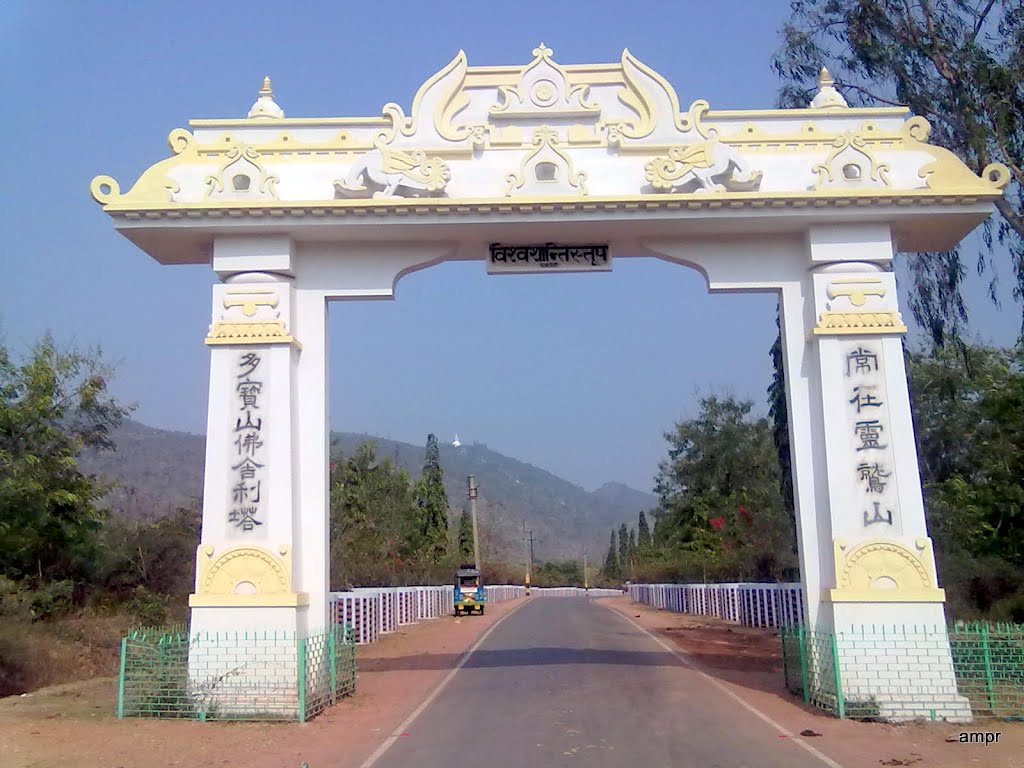
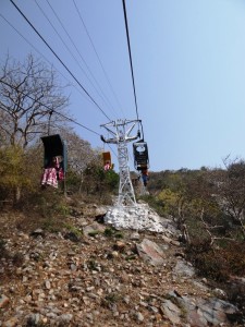 One of the attractions of Rajgir is the Rope way which takes tourist uphill to the Shanti Stupa and Monasteries built by the Japanese Devotees on top of the Ratnagiri hills.The state government’s installed a modern rope way with cabins at the Rajgir hills tourist complex.The Union Ministry of Tourism had allocated around Rs 11 crore for installing a new rope way replacing the old one. The Government of Japan had gifted the old ropeway more than 40 years ago.
Griddhakuta (Lat- 24° 59’ 55.81”, N, Long- 85° 26’ 14.17” E) :- Griddhakuta as we know it today is the remains of an old monastery at the top of a hill. The concrete paved way to the top from the base of the hill is the same that was used by King Bimbisara when he used to visit Buddha. The hill has numerous small and big stone caves where Buddha and his associates took refuge from the harsh weather while meditating. There are accounts of each particular cave linked to various disciples of Buddha and has significant importance for the Bhikkhus following in their steps. The place is very important for Mahayanist all over the world and the Mahayanists consider that the first turning of wheel took place here. The place is also site where Buddha delivered saddharmapundarika sutra. A stupa was erected to mark this event and the stupa is still present. The base of the hill also has stone rests and caves where many important disciples of Buddha meditated.
North of Griddhakuta on top of a separate hill is a massive brick stupa from the Ashoka period. Xuanzang points out that this stupa was built to mark the event when Buddha beheld the empire of Magadha and preached law for 7 consecutive days.
There is also a Vishwa Shanti Stupa on an adjacent Ratnagiri Parvat and it has a historic trolley system to take the visitors up the hill.
 .
.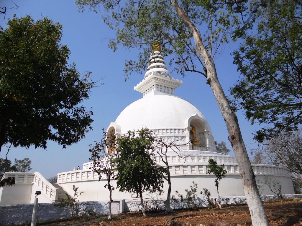
It is the Japanese-built Shanti Stupa (Peace Pagoda) and Monasteries built in 1969, one of the 80 peace pagodas in the world, to spread the message of peace and nonviolence. The stupa is built in marble and on the four corners of the stupa are four glimmering statues of Buddha.
Vulture’s Peak :-
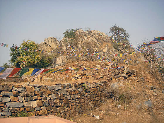
 Here is a small shrine. It is listed in Buddhist canonical texts as one of the places stayed in by the Buddha when at Rajgir, and several notable events, including an attempt on his life by his evil cousin Devadatta occurred there.
It was here that the Buddha delivered the Prajnaparamita Sutra and the Lotus Sutra and where, according to Jain legend, he twirled the flower and gave transmission to Mahakasyapa.
Sariputra Cave :-
 Just below of the peak is a Sariputra cave. A paved pathway and steps makes for an easy .
Ananda’s Cave:-
 Just below of the peak is a Ananda’s Cave.A paved pathway and steps makes for an easy .
Bimbisara Jail :-
 Bimbisara’s Jail is the site where King Bimbisara was put in prison by his son and heir, Ajatashatru. It consists of 2.00 meters thick stone wall. Each arm measuring about 60. 00 metres with circular bastions at corners.The captive king chose this site for his incarceration because from here, he could see Lord Buddha climbing up the Griddhakuta Hill to his mountain retreat , through a window. From this spot, one can also get a clear view of the Japanese Pagoda or Shanti Stupa built atop the hill.
According to Jayaswal Research Institute Archaeological Explorations this site belongs to NBPW phase period.
Ajatshatru Fort:- The Ajatashatru Fort, as the name implies, was built by King Ajatashatru of Magadha to strengthen the defenses of his capital Rajagriha (presently, Rajgir). The ruins of this fort, built on the River Panchane in the sixth century BC, can be seen on the road to Nalanda.
The Ajatashatru Fort is built with blocks of rock at a height of 1.5 to 4 m. 32 large and 64 small gates provide access into the fort. This is historically an interesting spot because Ajatashatru had imprisoned his father Bimbisara here.
Ajatshatru Stupa :- The 6.5 sq.meter Ajatshatru Stupa is built by Ajatshatru (6th century B.C.), the king of Magadha during the Buddha’s time.
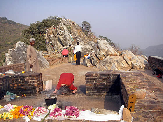
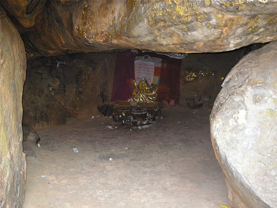
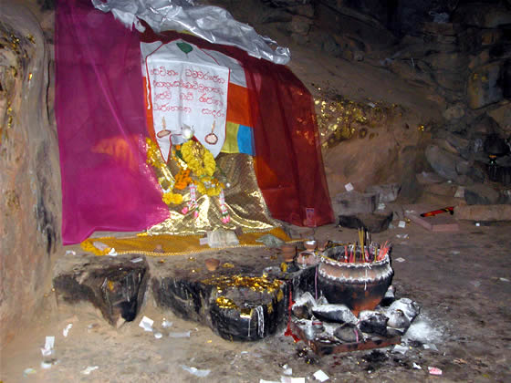
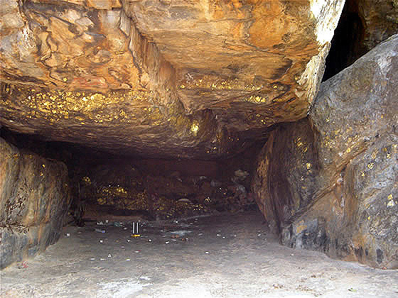
Sonbhandar Caves (Swarna Gufa)Lat- 25° 00’ 25.72”, N, Long- 85° 25’ 00.48” E) :- The Swarna Gufa is around six km from the railway station. There are two rock-cut caves, adjacent to each other, excavated on the southern face of the Vaibhara hill, facing the western portion of the valley. Of them the western one is locally called as Son-Bhandar- i.e. – Treasury of gold. 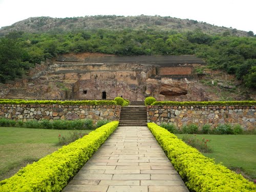
Local belief is that the piece of rock within this space is an ancient wedge blocking up the passage to the treasury of gold in the body of the hill. This cave consists of a large chamber, 34’x 17′ and is provided with a doorway and a window. The roof is of arched shape with a rise of 4’10″The cave is highly polished inside. A number of short epigraphs can also be traced on the inner walls, the doorjambs and on the front wall. The adjacent cave is in a ruinous state. It consists of a rock-cut chamber, part of its front having fallen. It had once a built-up verandah in its front as seen in the existing traces of a platform and courtyard built of bricks. Inside, on the southern wall of the cave, are six small figures of Jaina Tirthankaras carved in relief and representing Padmaprabha, Parshvanatha and Mahavira. Both the caves were excavated at one and the same time, i.e., in 3rd or 4th century A.D. as indicated by the inscriptions of Vairadeva.Sone Bhandar is a man made cave cut into a huge rock ledge, and poses to be a puzzling architecture in itself. As one exists from the 18 Km dense Rajgir valley, Sone Bhandar welcomes the visitor and have been doing so since the Mauryan era. The evidences suggest that this cave must have been built by Mauryan rulers they then donated it to the Jain followers. CM visited this place and was caught in its enigma and proposed that it should be further explored for a venue for the next annual Rajgir Mahotsav (Dec 5-6, 2010).
According to Jayaswal Research Institute Archaeological Explorations this site belongs to NBPW phase period.
Pippala Cave (Jarasandh Ki Baithak) :- There is a long stone staircase up to the top of the Vaibhava hill. Part way up the hill is Pippala Cave or Pippala Stone House.
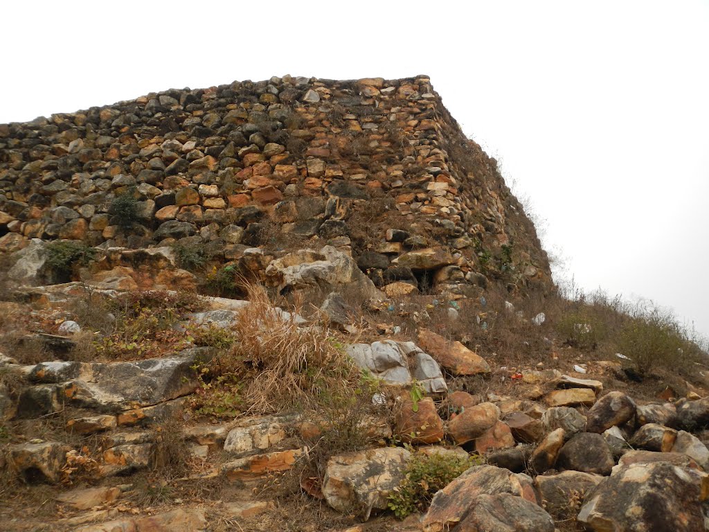 Pippala Cave is a rectangular stone shaped by nature, positioned above the hot springs on the. The Pippala Cave was a place for the hermits. It has been seen that this place was chosen by numbers of sages and hermits as a suitable abode for their meditation and penance. This was perhaps due to the absolute peace and serenity that reigns all around the Pippala Cave . It is also known as Jarasandha Ki Baithak.It is said that Jarasandh had a pleasure house and a flower garden built at this place where he used to go in the afternoon and enjoy the scenery all round.This was his favourite place of resort and amusement.The remains of a large water reservoir still marks the place of the tank near about the flower garden. It is believed that this cave was used also as a watchtower in early times. Pali texts also claim that it was the residence of Mahakasyapa. At the top of the hill there is a Hindu temple and the ruins of Jain monastery.
The Hansa Or Goose Stupa :-
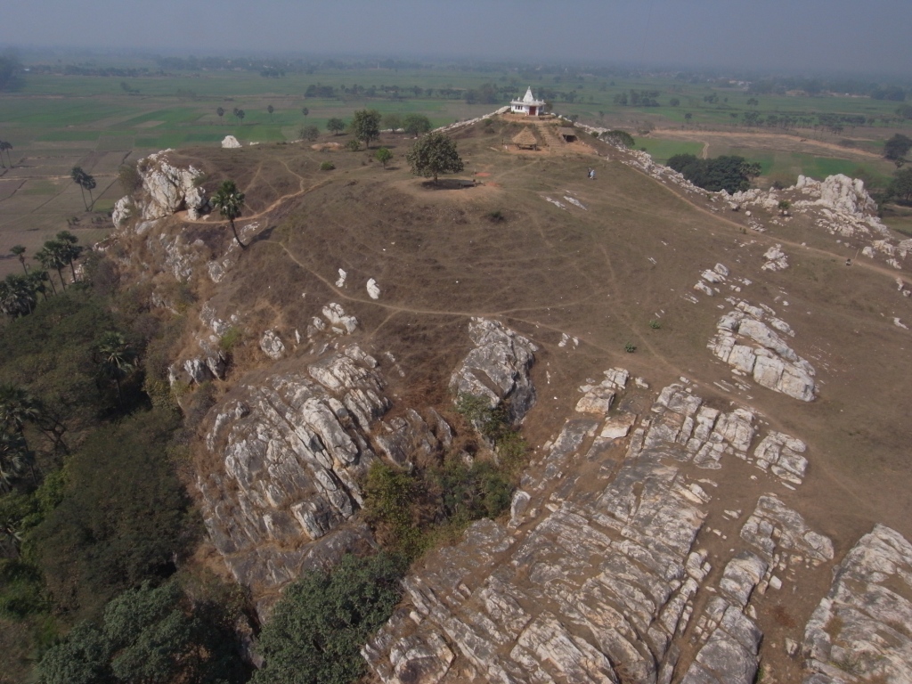 This structure is a solid cylindrical brick tower which originally surmounted by a dome.It is now only 21 ft in height, the dome and upper potion having fallen down. It is called Hansa or Groose stupa due to the Buddhist legend. According to which once upon a time the monks lived in a monastery had no food to eat for some days.Seeing a flock of geese pass overhead, one of the Monks cried out,”today the brotherhood have no food. Oh ! noble beings, take pity upon us”. Thereupon a Goose fell down dead at his feet. The Monks being forbidden by their religion could not take animal food. The Monks were so overcome with pity that they built a great stupa on the spot under which they buried the Goose. This memorial stupa was named the Hansa or Goose stupa and their own monastery was called hansa Sangharama. This Shaghrama stood on the summit of the ridge about 100 yards to the south-west of the aforesaid stupa.
Indrasaila Guha( Isolated hill at Parwati (25° 05’ 07 N, 85° 39’ 04 E)
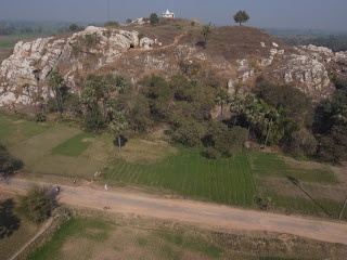 The Myth about the cave says that Indra the King of Gods himself ascended here to meet the Buddha to test his wisdom. The buddha delivered here the Sakkarpara Sutta while answering the questions asked by Indra. He also uttered version 206,207 and 208 of the Dhammapada while staying here.
South Facing Cave with The Stupa mound to its East.
Saptaparni Cave :- (Lat- 25° 00’ 37.20”, N, Long- 85° 24’. 43.81” E)
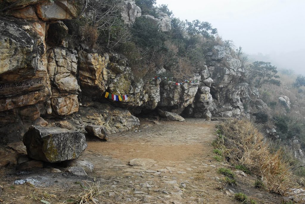 The cave of Saptaparni is where the First Buddhist Council was held under the leadership of Maha Kassapa. Also Buddha sometimes stayed there, and it was used as an accommodation for visiting monks.Also a Burmese temple, and a modern Japanese temple can be seen here.
According to Jayaswal Research Institute Archaeological Explorations this site belongs to NBPW Phase period.
Cyclopean Wall (Fortification Walls) :-
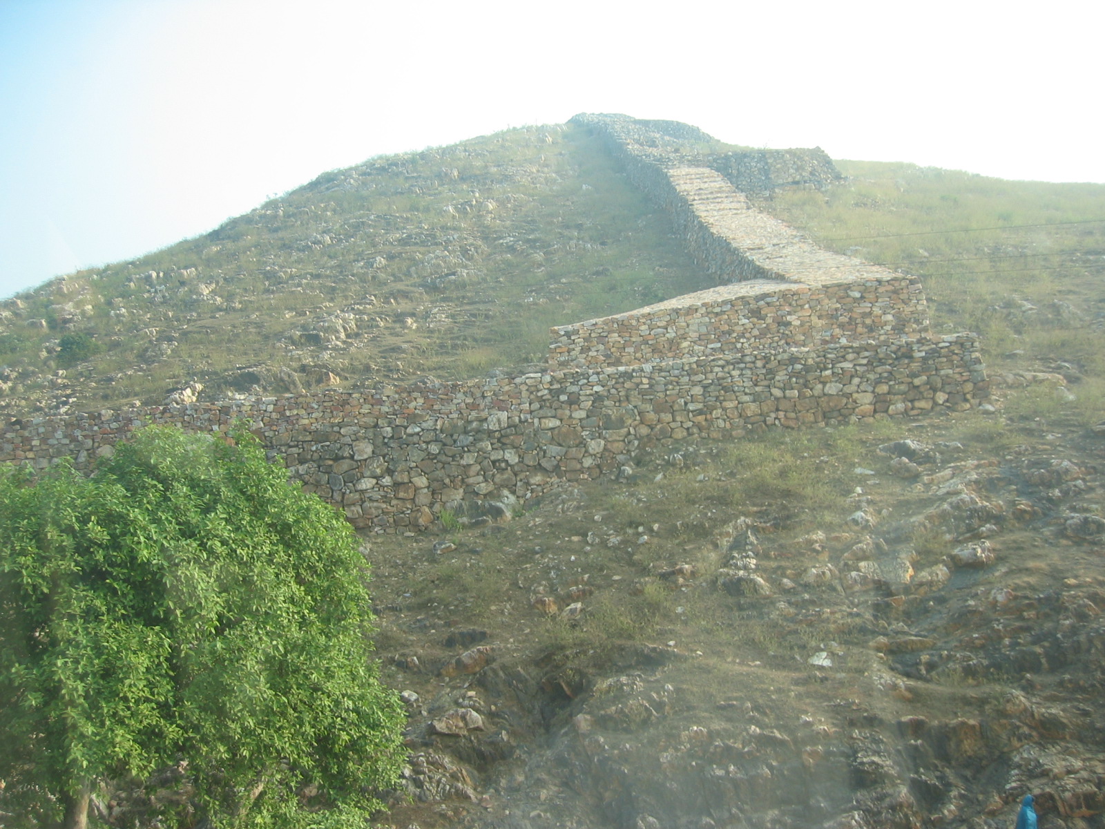 The Cyclopean wall was meant for the fortification of the capital city of Rajgir. Earlier it was 40 Km long and encircled ancient Rajgir. The construction of the wall is of stones. This Pre-Maurayan structure is a major tourist attraction among tourists. Though not in existence in its glorious form, its traces are still subsist, particularly at the exit of Rajgir to Gaya and boast the grandeur of its existence.
Jarasandha ka Akhara(Ranbhoomi) :-
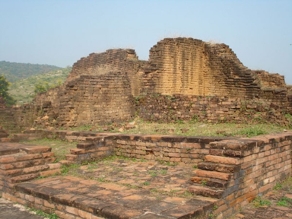 This is the Ranbhoomi where Bhima and Jarasandha fought one of the Mahabharata battles which went on for twenty eight days, is located nearby are Maniyar Math and Sonbhandar Caves. In this furious battle Jarasandha was killed by Bhim. In this battles Bhim had got great encouragenent and moral support from Lord Krishna. The akhara where the fatal duel took place contains inscribed some curious marks on the rocky ground.The marks have long attracted the attention of the visitors and are supposed to be the marks of the hands and feet and nails of the combatants.
According to Jayaswal Research Institute Archaeological Explorations this site belongs to Early Historic Period.
Veerayatan :-
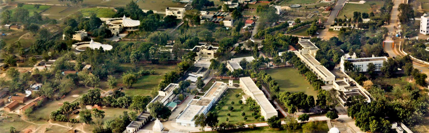 A Jain Temple and Museum Veerayatan, situated at Rajgir , was established in 1973 on the occasion of 2500th Janm Kalyank Varsh of Lord Mahavira. Veerayatan is a socio-religious institution in Bihar, striving for rendering service to humanity, for improving culture and for imparting education beyond the limitation of time and space. By providing unflinching service in the field of community health, education and employment, it has created a social reformation in the locality. Veerayatan is having a 100 bedded charitable eye hospital, which completes the motto of Seva (Services) & Devotion which are the main objectives of Veerayatan. Patients are treated in the outdoor department of eye and general medicine. Also basic pathological tests are carried out as required and all medicines are given free of cost. In the hospital a new laser technology called as Yag laser and Phaco (suture less operation) has been installed.In the hospital the polio patients are also treated. Camps for polio and artificial limbs are held every month in the orthopedic clinic. Tricycles and calipers are distributed to the disabled patients to improve their mobility to access the world more freely and live a quality life. These things are given to them free of charge. Most popular and attractive point in Veerayatan is a beautiful art gallery- Shri Brahmi Kala Mandiram. This gallery explains the life of 24 Tirthankars, Jain religion and culture. The gallery consists of more than 50 beautiful panels exhibiting the life of Mahavira and also conveys the importance of Ahimsa.
Ratha Chakra Chinha (Chariot Route Marks):-
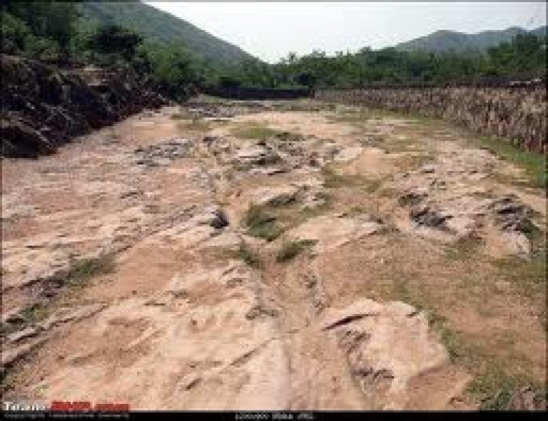 The Chariot Route and hell inscriptions are worth a visit for the strangeness of the phenomenon, two parallel furrows cut deep into rock for about thirty feet giving credence to the local belief that they were “burnt” into the rock by the speed and power of Lord Krishna’s chariot when he entered the city of Rajgir during the epic Mahabharata times. Several shell inscriptions, the undeciphered characters current in central and eastern India from the 1st to 5th centuries AD, and engraved in the rock around the chariot marks are said to be the marks of the hands and feet of Jarasandha and Bhima, who fought together until the former was slain.This clearly indicates a ritual significance.
According to Jayaswal Research Institute Archaeological Explorations this site belongs to NBPW phase period.
Karanda Tank :-
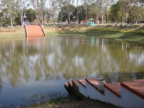 It is the tank in which Buddha used to bath.Karanda Tank is a freshwater tank located at ancient Rajgir. It’s believed that Lord Buddha used to bathe here during his stay at this place. The remains of this tank reflect the glorious past of the Mauryans and their architectural brilliance.
Gurudwara Shri Guru Nanak Sheetal Kund:-
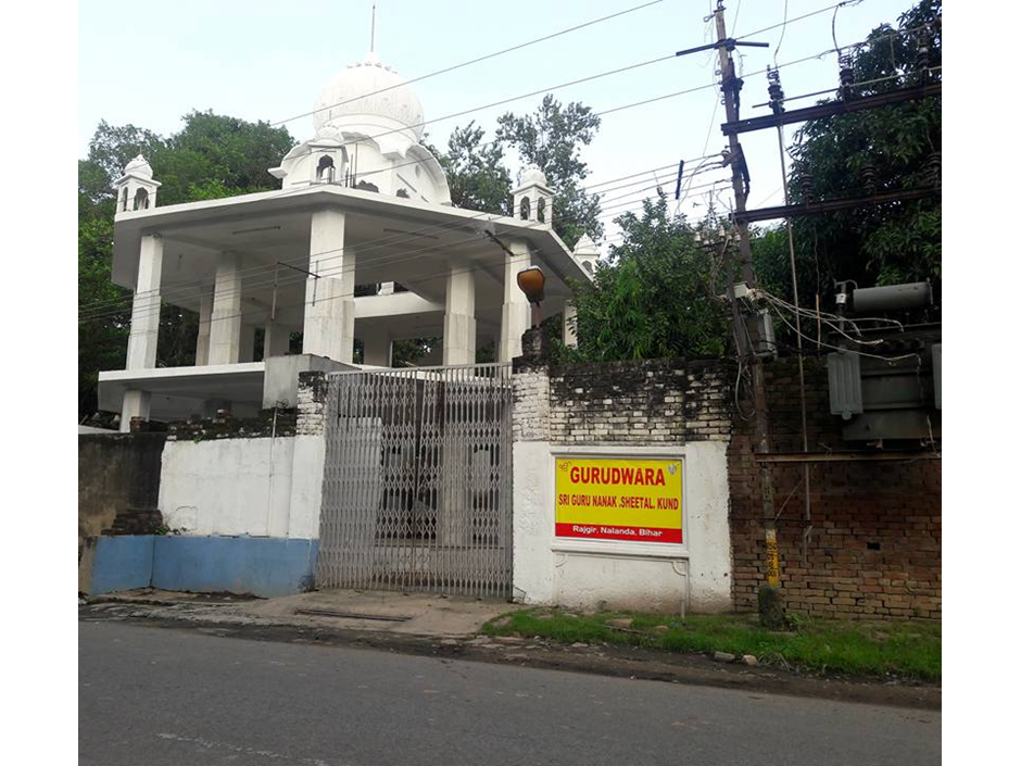 Rajgir is considered a sacred place due to long association with Buddha and Mahavira.At the time of Guru Nanak’s visit, he had long Rajgir is considered a sacred place due to long association with Buddha and Mahavira.At the time of Guru Nanak’s visit, he had long discussioned with Buddhist & Jain monks and impressed upon them towards the importance of devotion to one god.The city was surrounded by hot springs and cold drinking water was not available to people. So, on pointing out of the Guru, people dug a place & water gushed out. From then, the place is known as’Nanak Kund’, where later with Buddhist & Jain monks and impressed upon them towards the importance of devotion to one god.The city was surrounded by hot springs and cold drinking water was not available to people. So, on pointing out of the Guru, people dug a place & water gushed out. From then, the place is known as’Nanak Kund’, where later Gurdwara had built.
Lakshmi Narayan Temple (Hot Springs, Saptadhara) :-
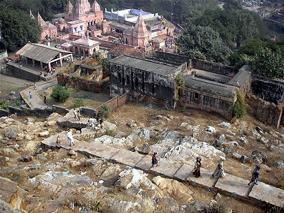 This sacred temple stands beside the Saptadhara, a group of seven hot springs.
The Tapodarama Monastery was located on the site of the hot springs, Now a Hindu temple is constructed there, called the Lakshmi Narayan Mandir is devoted to Lord Vishnu and his consort, Goddess Lakshmi. Painted in pink.
According to Jayaswal Research Institute Archaeological Explorations this site belongs to Early medieval period.
Maniyar Math :-
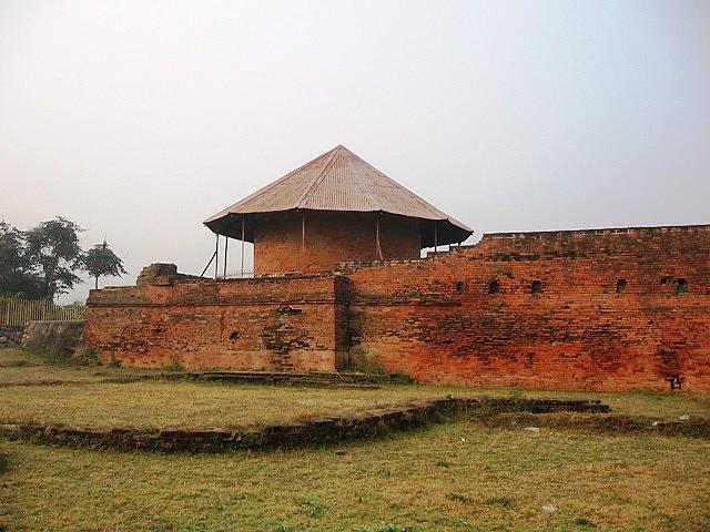 Maniyar Math is a cylindrical brick shrine protected by a conical shelter located about one km north gate (The valley) to west of the road a footpath near a modern well in Rajgir.
About 6 m the stone sculpture with Naja-figures and with the name of Mani Naja occurring on it. This holy shrine, dating from the 1st century AD, is dedicated to the presiding deity of Rajagriha – Mani Nag. People from far and near visit this temple.
Orro or Ondup :- This village is identified with Ondup which was on the southern boundary of Jarasandha capital Rajgir. It finds mention in Buddhist literature. Ruins of brick walls and some stone images have boon found here.
Jain Temple :- On hill crests around Rajgir, far in the distances one can see about 26 Jain Temples. They are difficult to approach for the untrained, but make exciting trekking for those in form.The Jaina built small temples on almost all the hills of Rajgir, installing the images of Tirthankara in them and those still exists.Jain temples on Vaibhara, Vipula, Ratna, Chhatha, Saila, Udaya and Sona Hills.Other jain temples in Rajgir are the Ajaatsatru stupa, Ashok stupa and many other stupa
Swetamber Jain Temple :-
Digambar jain temple :-
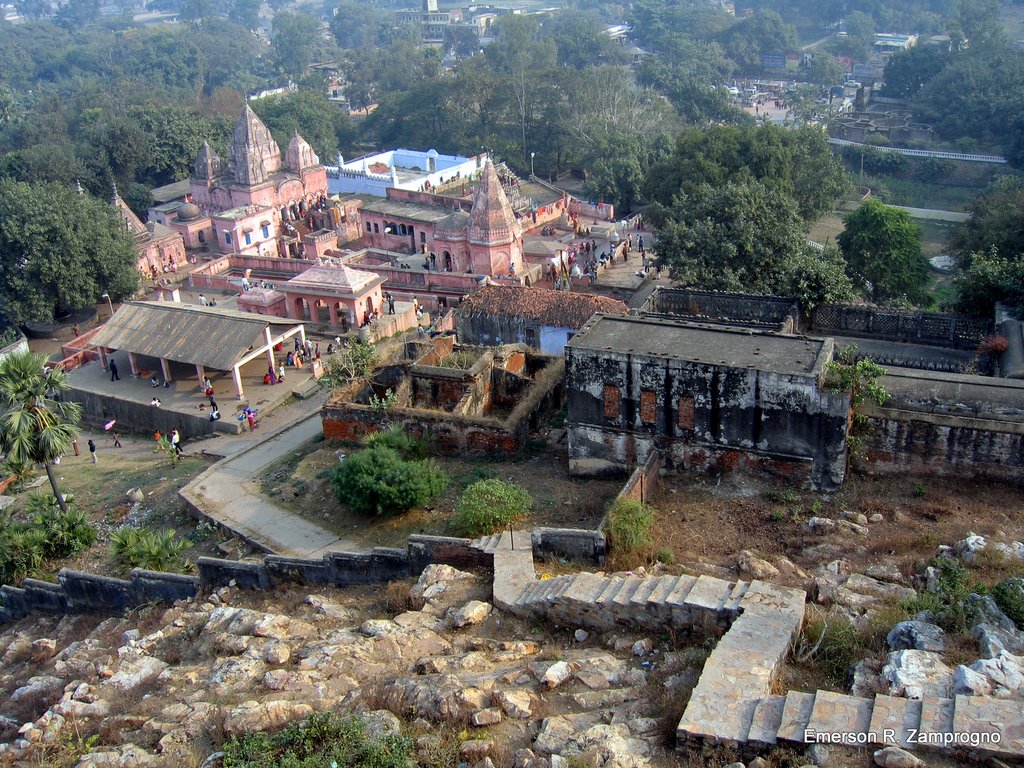 Shree Digambar Jain Siddha Kshetra Rajgir is 15 kilometers from Nalanda and about 97 kilometer from Patna. Rajgir is a very ancient and holy jain pilgrimage known for the complex of jain temples and monasteries. It is located in a beautiful valley covered with lush green forest.
Rajgir Jain Temple-1
Peace Stupa :-
Panch Pahari,
Jain Temple,
Japanese temple:-
Thai Temple
New fort
Gauv Mandir.
Udayagiri :- It is stone masonary of one of the bastion.
Vipulagiri :- It is stone masonary of one of the bastions of the old fort wall. Here Herbal plants are found in abundance.
Vipulachal Parvat, Rajgir:-The KP Jayaswal Research Institute, during in the course of its Archaeological Explorations brought to light the site period Early Historic period.Jain Sarai (Vaibhargiri), Rajgir:- The KP Jayaswal Research Institute, during in the course of its Archaeological Explorations brought to light the site period NBPW phase. Hemantu Muni (Vipulachal Parvat):-The KP Jayaswal Research Institute, during in the course of its Archaeological Explorations brought to light the site period Medieval
Jaradevi Mandir:- The KP Jayaswal Research Institute, during in the course of its Archaeological Explorations brought to light the site period Early medieval. Jain Temple:- The KP Jayaswal Research Institute, during in the course of its Archaeological Explorations brought to light the site period NBPW Phase. Aawa Garh:-The KP Jayaswal Research Institute, during in the course of its Archaeological Explorations brought to light the site period Early medieval. Barri Sangat:- The KP Jayaswal Research Institute, during in the course of its Archaeological Explorations brought to light the site period Early medieval. Mahadevasthan:- The KP Jayaswal Research Institute, during in the course of its Archaeological Explorations brought to light the site period NBPW phase
Barhauna (Lat. 25° 8′ 25” N; Long.85° 21′ 15” E):-This site of early historical mound, located 21 km south-west to Nalanda on Silao-Chhabila Pur road, has been converted into agricultural field. The pottery collected from the site includes degenerated N.B.P.W., black slipped ware, grey ware ,red ware and sculpture of Pala period .
Naunia Ghat (Goraur):-The KP Jayaswal Research Institute, during in the course of its Archaeological Explorations brought to light the site period Pre NBPW. Katari Early:- The KP Jayaswal Research Institute, during in the course of its Archaeological Explorations brought to light the site period medieval.Vishesheswar Nagar:-The KP Jayaswal Research Institute, during in the course of its Archaeological Explorations brought to light the site period NBPW phase Manjaitha:-The KP Jayaswal Research Institute, during in the course of its Archaeological Explorations brought to light the site period Early medieval. Nahu:-The KP Jayaswal Research Institute, during in the course of its Archaeological Explorations brought to light the site period Early medieval. Khata:- The KP Jayaswal Research Institute, during in the course of its Archaeological Explorations brought to light the site period NBPW phase. Miyar:- The KP Jayaswal Research Institute, during in the course of its Archaeological Explorations brought to light the site period NBPW phase. Hasanpur:- The KP Jayaswal Research Institute, during in the course of its Archaeological Explorations brought to light the site period Early medieval. Tilaiya:- The KP Jayaswal Research Institute, during in the course of its Archaeological Explorations brought to light the site period Early medieval. Barhari:-The KP Jayaswal Research Institute, during in the course of its Archaeological Explorations brought to light the site period Early medieval.
Garhpar (Lodipur, Lat. 25°02’68” N; Long.85°17’36”E):-This site also known as garh-par located on the right bank of the Paimar river is 21 km south-west to Nalanda and 17 km west to Rajgir . It extends in an area of about 40m south-west and 90 m east-west and rises upto the height of about 3 m. Surface finds collected from here include red and black slipped wares with medium and course fabrics. Other finds comprise terracotta bangle fragment and terracotta bead. The Material remains suggest that this site was occupied from late NBP phase .
Chandaura (Lat. 25°3’58” N; Long.85°23’25”E):-
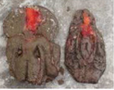 An early historical mound of this village , situated 15 km south-west to Nalanda and 2 km from Khata village on Silao-Chhabila Pur road has been destroyed by the locals and converted into agricultural field. The main ceramic industries recovered are NBPW, black slipped ware, fine grey ware and red ware along with the hop-scotches. Fragments of stone sculptures placed at Devi Asthana include two notable stone plaques depicting Vishnu of late Pala period. A broken terracotta plaque comprising human figurine of Gupta period is also kept with them. A medieval. stone sculpture of Surya is placed in another modern temple.
Khata (Lat. 25°4’10”N; Long. 25°24’35”E):- This village is situated about 13 km south-west of Nalanda on Silao-Chhabila Pur road. Remains of two ancient tanks have been noticed here. The approximate dimension of the site is 300 m× 200 m with an elevation of about 2.3 m from the surrounding levels. The pottery collected from the surface consists mainly black slipped, NBP, black-and-red, grey and red wares. Other finds include terracotta gamesman and legged stone quern. Stone Sculptures of Surya ,Uma Mahesvara and Vishnu datable to Pala period are also founded at Devi-Asthana .
Miar (Lat. 25°3’30”N; Long.85°22‘42′‘E) :- The remains of this site indicate that it was occupied during the last phase of NBP culture and flourished up to the Pala Period.This village is situated at a distance of 17 km(south-west) from Nalanda . Major portion of the site has been badly damaged by locals for the construction work and for procuring earth for different purposes.
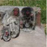
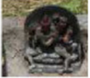
The pottery collected from the site constituted mainly black slipped, red slipped and red wares. An image of Varahi placed at Durga -Asthana is worshiped as Varaha Bhagwan. Legged stone quern, terracotta dabber along with stone sculptures datable to Pala period including Buddha in Dharma-Chakra-Pravartana pose Siva-Linga are installed at Mahadeo-Ashana. Apart from them a stone sculpture of Vishnu is kept at Gauraiya-sthana.
Satokhari:- The KP Jayaswal Research Institute, during in the course of its Archaeological Explorations brought to light the site period Early medieval. Panditpur:- The KP Jayaswal Research Institute, during in the course of its Archaeological Explorations brought to light the site period Early medieval. Bichhakol:- The KP Jayaswal Research Institute, during in the course of its Archaeological Explorations brought to light the site period Late medieval. Pathraura:- The KP Jayaswal Research Institute, during in the course of its Archaeological Explorations brought to light the site period Early medieval. Banganga valley (Rock paintings):- The KP Jayaswal Research Institute, during in the course of its Archaeological Explorations brought to light the site period Mesolithic.
Banganga:- Archaeological findings in the past have revealed that the use of beads is one of the oldest art forms, older than cave paintings, reaching back to the cradle of civilization. Rajgir Valley, developed since ancient times, is replete with ancient stone tools from the Paleolithic period up to the Neolithic period as reported by DR. Col. A. B Prasad.Banganga Village south of Rajgir Valley is a treasure chest full of these ancient beads.The KP Jayaswal Research Institute, during in the course of its Archaeological Explorations brought to light the site period NBPW phase
Bholenath and Harikeshwar Temple:- The KP Jayaswal Research Institute, during in the course of its Archaeological Explorations brought to light the site period Early medieval. Bhui:-The KP Jayaswal Research Institute, during in the course of its Archaeological Explorations brought to light the site period Early medieval.
KARAI PARSURAI
Rahmatpur:- The KP Jayaswal Research Institute, during in the course of its Archaeological Explorations brought to light the site period Early medieval. Chaurasi:- The KP Jayaswal Research Institute, during in the course of its Archaeological Explorations brought to light the site period Early medieval. Choti Bigha:- The KP Jayaswal Research Institute, during in the course of its Archaeological Explorations brought to light the site period Early medieval. Diawan Dih:- The KP Jayaswal Research Institute, during in the course of its Archaeological Explorations brought to light the site period medieval. Rasalpur:- The KP Jayaswal Research Institute, during in the course of its Archaeological Explorations brought to light the site period Early medieval. Rupuspur- The KP Jayaswal Research Institute, during in the course of its Archaeological Explorations brought to light the site period Early medieval. Pakri- The KP Jayaswal Research Institute, during in the course of its Archaeological Explorations brought to light the site period Early medieval. Badi Inara:- The KP Jayaswal Research Institute, during in the course of its Archaeological Explorations brought to light the site period Early medieval.
Paswan Tola (Karai):-The KP Jayaswal Research Institute, during in the course of its Archaeological Explorations brought to light the site period Early medieval. Kuri Pokhar:-The KP Jayaswal Research Institute, during in the course of its Archaeological Explorations brought to light the site period Early medieval. Gularia Bigha:-The KP Jayaswal Research Institute, during in the course of its Archaeological Explorations brought to light the site period Early medieval. Raja Bag:- The KP Jayaswal Research Institute, during in the course of its Archaeological Explorations brought to light the site period Early medieval. Chandkura:- The KP Jayaswal Research Institute, during in the course of its Archaeological Explorations brought to light the site Early medieval. Sandh:- The KP Jayaswal Research Institute, during in the course of its Archaeological Explorations brought to light the site period Early medieval. Sirsi:- The KP Jayaswal Research Institute, during in the course of its Archaeological Explorations brought to light the site period Early medieval.
ISLAMPUR BLOCK
Beswak(Lat. 25°11’N; Long. 25°14’E):- :-
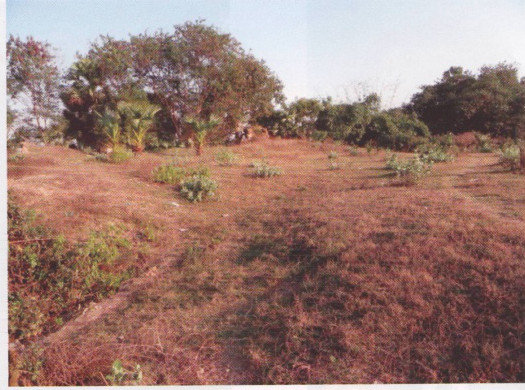 The Beswak site is about 12 km north west of great nalanda Mahavihar, 8 km north-eat of Islampur.There are two enormous tank to the east of the village and three massive mounds situated at different location in the village, locally known as Barigarh, Chhotigarh And Kabristhan. The first two garh are actually mud forts having bastions at the four corners. The mound of Kabristan is a temple site.
Remains of a Buddhist temple and image of Buddha, Uma – Mahesvara, Vishnu etc are found here during the exploration done by ASI in year 1974-75. Beswak was first reported by A.M.Broadley in 1872. According to the Aini-Akbari this place also gave its name as a pargana which contained 35318 bighas.
According to Jayaswal Research Institute Archaeological Explorations this site belongs to Early medieval period.
Shiva Temple(Netau Well):-
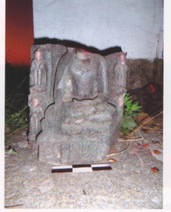 To the south -west corner of the village a modern Siva Temple is situated, where some fragmentary pieces of stone sculptures are lying.
Goraiya sthan:-
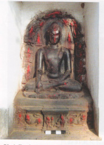
At the mound locally known as Barigarh to the south of the village there is a place known as Goraiya sthan. Here is a beautiful image of earth touching Buddha who is locally worshipped as Goriya Baba following Brahmanical norms. About 25 years ago, this magnificent image of earth touching Buddha has been found from the village while ploughing a paddy field.
Devi asthan:-
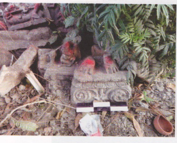
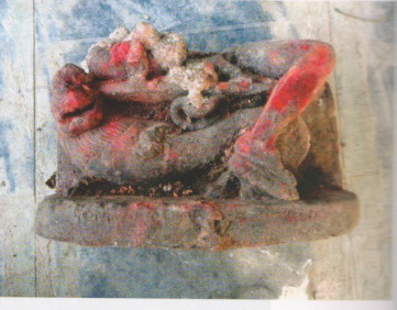 At the north-east corner of the village a modern Siva temple is situated and it is locally known as Devi sthan. At the courtyard of the temple some Buddhist as well as Brahmanical sculptures are kept, among them are splendid image of Avalokitesvara along with two broken images of Simonada and Avalokitesvara.
Mahadev sthan(Barki pokhara):-
To the east of the village some sculpture fragments kept at a cemented platform are worshipped, locally called Mahadev sthan. It is situated at the bank of a large tank called Bari Pokhar. Many Brahmanical image as well as two Buddhist images are also there.
Devisthan (Mohanpur):-
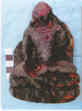
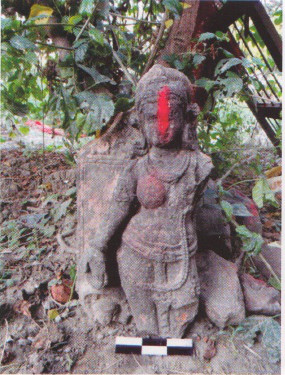
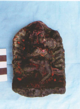
The site is about 650 m west from Beswak. To the south-east of the village there is a modern temple.Just outside of the temple rare image of Hevajra, Image of Tara and Buddha are kept and they have been found from the Barki Pokhar tank at Beswak.
According to Jayaswal Research Institute Archaeological Explorations this site belongs to Early medieval period.
Isalampur :- There are remains of a Garh a Palace surrounded by houses for the staff of the landlord, other 200 year old buildings near a big Taalab (a clay and brick built pond) that says volumes about this places past history. There are two ancient settlements, Bauli Baugh and Pakki Talao, nearby housing many antiquities of note. The remains of a large Buddhist monastery or temple exist at the extreme west of the village and some of granite columns are still intact.
Town Hall:-
Kutubkhana Quadorea (Islampur) :-This village also noted for its library known as Kutubkhana Quadorea which has many Persian and Arabic manuscripts.
Temple of Mahakali (Islampur) :-There is a temple of Mahakali which is also very popular in this area.
Pakki Talao :-
Delhi Darbar (Baoli Bagh):-
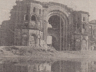 Delhi Darbar is a tourist attraction. It is an old building similar to the Red Fort in Delhi. The original construction dates from 1345 CE and took around 200 years. It was the work of a local Zamindar, Chaudhary Jahur. Mr Jahur Chaudhry had one weakness in him that if some friend of him commented that a particular part of construction was not good , he ordered for breaking of that portion and start reconstruction. Also on the 20 acres (8.1 ha) site are the Purani Masjid, the 52-room Bawan Kothri, and the Tirpan Darwaja. The main building was never completed in part because of Jahur’s vacillation.
Jahu Saheb ka Maqbara :–
Surya Mandir:-
Ghost’s house:- An old hospital situated at Shivpuri is known as Ghost’s house. Many people come and visit with terror and Interest.
Tombs of Yusul Sah (Kashmiri Chak) :-It is situated 6 km north of Islampur railway station, famous for tombs of Yusul Sah and his son Yakub Sah, believed to have been rebels from kashmir, hence the name of the village.
According to Jayaswal Research Institute Archaeological Explorations this site belongs to medieval period.
Khanqah Asdaqya (Peer Bigha):-
Hz Syed Shah Moshahid Asdaque
Ichhos :- It is about 1.5 km south-east of Islampur.A site of a great Buddhist Temple and monastery.
According to Jayaswal Research Institute Archaeological Explorations this site belongs to Early medieval period.
Sanda :- Sanda village situated about 5 km south west of Islampur Railway station. It was an ancient centre for Buddhist studies. Remains of Stupas, Temple and Stone-slabs with inscriptions have been found in the village.
According to Jayaswal Research Institute Archaeological Explorations this site belongs to Early medieval period.
Ashrafpur-
Dapthu :- Buddhist temple and stone buddhist image dating from the 4th to 12th Century still exist The temple and sculptures at the village today are all Brahmanical. The village is located only a few km from Islampur. Mubarakpur:-The KP Jayaswal Research Institute, during in the course of its Archaeological Explorations brought to light the site period Early medieval. Pahari Tar Tola:- The KP Jayaswal Research Institute, during in the course of its Archaeological Explorations brought to light the site period Mauryan. Imadpur:- The KP Jayaswal Research Institute, during in the course of its Archaeological Explorations brought to light the site period Early medieval. Chottaki Aungari:- The KP Jayaswal Research Institute, during in the course of its Archaeological Explorations brought to light the site period Early medieval. Mohan Chak:- The KP Jayaswal Research Institute, during in the course of its Archaeological Explorations brought to light the site period Early medieval. Talab Par:- The KP Jayaswal Research Institute, during in the course of its Archaeological Explorations brought to light the site period Early medieval. Ayodhya Thakur Badi (Maharana Pratap Nagar):- The KP Jayaswal Research Institute, during in the course of its Archaeological Explorations brought to light the site period Early medieval. Pratap Nagar:- The KP Jayaswal Research Institute, during in the course of its Archaeological Explorations brought to light the site period Early medieval. Daura Garh:- The KP Jayaswal Research Institute, during in the course of its Archaeological Explorations brought to light the site period Early medieval. Baba Bhagat Bhagwan Ki Gaddi:- The KP Jayaswal Research Institute, during in the course of its Archaeological Explorations brought to light the site period medieval. Sarai Tola:- The KP Jayaswal Research Institute, during in the course of its Archaeological Explorations brought to light the site period medieval. Sarthua Dih:- The KP Jayaswal Research Institute, during in the course of its Archaeological Explorations brought to light the site period Early medieval. Panhar:- The KP Jayaswal Research Institute, during in the course of its Archaeological Explorations brought to light the site period Early medieval. Atama Dih:- The KP Jayaswal Research Institute, during in the course of its Archaeological Explorations brought to light the site period Later Gupta.
Akodi (Ankuri):-
Ankhuri Garh (Lat. 25°01′ 46” N;Long. 85° 15′ 97” E):- The site known as Ankhuri Garh is situated on the left bank of the Paimar River about 1.5 km. south of Ankhuri Bazar village.This site covers an area of about 30 × 30 m with an elevation of about 3 m.
The maximum part of the site has been converted into agricultural land. Black slipped ware and redware (with fine, medium and coarse fabric) are the main potteries recovered from this site. The finding indicates that this would have been occupied from the late phase of N.B.P.W. onwards
Auragarh (Lat. 25° 2’15” N; Long.25°14′ 57” E):- This site, located about 30 km west from Rajgir, extends in an area of about 50 × 50 m with an elevation of about 4 m, is at a distance of about 1.5 km south to the village. Surface-collection from the site includes mainly red ware and coarse red ware. Noteworthy shapes among them are carinated handi , bowls and vases. The site possibly represents single culture occupation of early medieval. period.
Khudaganj:- The KP Jayaswal Research Institute, during in the course of its Archaeological Explorations brought to light the site period Early medieval. Rasalpur:- The KP Jayaswal Research Institute, during in the course of its Archaeological Explorations brought to light the site period NBPW phase. Punchrukhiya:- The KP Jayaswal Research Institute, during in the course of its Archaeological Explorations brought to light the site period Late medieval. Sarathua Sarai:- The KP Jayaswal Research Institute, during in the course of its Archaeological Explorations brought to light the site period Early medieval. Harsingara:- The KP Jayaswal Research Institute, during in the course of its Archaeological Explorations brought to light the site period Early medieval. Parsarai:- The KP Jayaswal Research Institute, during in the course of its Archaeological Explorations brought to light the site period Early medieval.
RAHUI BLOCK
Dosut (Lat.25019’N; Long. 85031’E):- The village Dosut is 29km north to the ruins of Nalanda. The mound situated to the south of the village is extended into 100 x 100m with an extant height of 10m containing potsherds of red and red slipped ware. Wena:- The KP Jayaswal Research Institute, during in the course of its Archaeological Explorations brought to light the site Early period medieval.
Bokna:-The KP Jayaswal Research Institute, during in the course of its Archaeological Explorations brought to light the site period Early medieval. Nawadapar:-The KP Jayaswal Research Institute, during in the course of its Archaeological Explorations brought to light the site period Early medieval. Moratalab:-The KP Jayaswal Research Institute, during in the course of its Archaeological Explorations brought to light the site period Early medieval. Patasang:-The KP Jayaswal Research Institute, during in the course of its Archaeological Explorations brought to light the site period Early medieval. Samabad:-The KP Jayaswal Research Institute, during in the course of its Archaeological Explorations brought to light the site period Early medieval. Musepur:-The KP Jayaswal Research Institute, during in the course of its Archaeological Explorations brought to light the site period Early medieval. Pachasa:-The KP Jayaswal Research Institute, during in the course of its Archaeological Explorations brought to light the site period Early medieval.Sahokhar:-The KP Jayaswal Research Institute, during in the course of its Archaeological Explorations brought to light the site period Early medieval.
Khidar Chak:-The KP Jayaswal Research Institute, during in the course of its Archaeological Explorations brought to light the site period Early medieval. Baburbanna:- The KP Jayaswal Research Institute, during in the course of its Archaeological Explorations brought to light the site period Early medieval. Khaje Aitbar Sarai:-The KP Jayaswal Research Institute, during in the course of its Archaeological Explorations brought to light the site period Early medieval.
KATRISARAI BLOCK
Mirchaiganj:-During exploration done by ASI in year 1973-74, an image of Buddha in Bhumisparsa- mudra was found. Chhachhu Bigha:-The KP Jayaswal Research Institute, during in the course of its Archaeological Explorations brought to light the site period Early medieval. Maira:-The KP Jayaswal Research Institute, during in the course of its Archaeological Explorations brought to light the site period NBPW phase. Maira Barith:-The KP Jayaswal Research Institute, during in the course of its Archaeological Explorations brought to light the site period NBPW phaseJawahar Chak:-The KP Jayaswal Research Institute, during in the course of its Archaeological Explorations brought to light the site period Late medieval. Ahiya Chak:-The KP Jayaswal Research Institute, during in the course of its Archaeological Explorations brought to light the site period Early medieval. Sunderpur:- The KP Jayaswal Research Institute, during in the course of its Archaeological Explorations brought to light the site period Early medieval. Katauna:-The KP Jayaswal Research Institute, during in the course of its Archaeological Explorations brought to light the site period medieval.
ASTHAWAN BLOCK
Benar:-The KP Jayaswal Research Institute, during in the course of its Archaeological Explorations brought to light the site period Early medieval. Jiyar:-The KP Jayaswal Research Institute, during in the course of its Archaeological Explorations brought to light the site period Early medieval. Mustafapur Malti:-The KP Jayaswal Research Institute, during in the course of its Archaeological Explorations brought to light the site period Early medieval. Rajawan:-The KP Jayaswal Research Institute, during in the course of its Archaeological Explorations brought to light the site period Early medieval. Sherpur:-The KP Jayaswal Research Institute, during in the course of its Archaeological Explorations brought to light the site period Early medieval. Kaila:- The KP Jayaswal Research Institute, during in the course of its Archaeological Explorations brought to light the site period Early medieval. Asthawan:-The KP Jayaswal Research Institute, during in the course of its Archaeological Explorations brought to light the site period NBPW phase Amanwan:-The KP Jayaswal Research Institute, during in the course of its Archaeological Explorations brought to light the site period Late medieval.
Amawan House :-This is the Zamindari Kutchery which was built in 1270, by Babu Nunu singh. It has both male and female apartment
Amawan Thakurbari :-A room of Amawan House is used as a private Thakurbari where seva puja is performed every day throughout the year. Tank with Pucca ghat(Amawan) :–A tank with pucca ghat on the south inclosed by high brick built walls, so that ladies may freely walk in it without the least fear of exposure it is the thought of at that time.
Utarthu:-The KP Jayaswal Research Institute, during in the course of its Archaeological Explorations brought to light the site period Early medieval. Jhamtapar:- The KP Jayaswal Research Institute, during in the course of its Archaeological Explorations brought to light the site period Early medieval. Hargawan:- The KP Jayaswal Research Institute, during in the course of its Archaeological Explorations brought to light the site period NBPW phase
BEN BLOCK
Mohommadpur :- During exploration done by ASI in year 1973-74, an image of Buddha in Bhumisparsa- mudra was found. Mari:- The KP Jayaswal Research Institute, during in the course of its Archaeological Explorations brought to light the site period Early medieval. Muhammadpur:-The KP Jayaswal Research Institute, during in the course of its Archaeological Explorations brought to light the site period Early medieval.
Karjara (Lat.25006’89”N; Long. 85022’98”E):-Karjara is about 10 km west from the ruins of Nalanda. The mound extended into 30 x 25m with an extant height of 5m is located to the west of the village yield in red ware, red slipped ware, black ware and black slipped ware.According to Jayaswal Research Institute Archaeological Explorations this site belongs to Early medieval period.
Ben:-The KP Jayaswal Research Institute, during in the course of its Archaeological Explorations brought to light the site period Early medieval. Maha Bigha:-The KP Jayaswal Research Institute, during in the course of its Archaeological Explorations brought to light the site period Early medieval. Janakpur:-The KP Jayaswal Research Institute, during in the course of its Archaeological Explorations brought to light the site period Early medieval.
Eksara(Lat.25°10’05”N; Long. 85°23’46”E):-Eksara village is 7 km north-west from the ruins of Nalanda. The south-west portion of the mound is inhabited by the present villagers. Potsherds of red ware, black ware, black slipped ware and NBPW (silver and golden) were recovered during exploration. A few sculptures including a broken statue of Marichi made of black basalt are kept in the Goraiya Sthan and Thakurbari.
According to Jayaswal Research Institute Archaeological Explorations this site belongs to Early medieval period.
Ranu Bigha:-The KP Jayaswal Research Institute, during in the course of its Archaeological Explorations brought to light the site period Early medieval. Balchand Bigha:-The KP Jayaswal Research Institute, during in the course of its Archaeological Explorations brought to light the site period Early medieval. Hari Bigha:-The KP Jayaswal Research Institute, during in the course of its Archaeological Explorations brought to light the site period Early medieval. Salim Bigha:-The KP Jayaswal Research Institute, during in the course of its Archaeological Explorations brought to light the site period Early medieval. Saidpur:-The KP Jayaswal Research Institute, during in the course of its Archaeological Explorations brought to light the site period Early medieval. Maheshpur:-The KP Jayaswal Research Institute, during in the course of its Archaeological Explorations brought to light the site period Early medieval. Mathpar:-The KP Jayaswal Research Institute, during in the course of its Archaeological Explorations brought to light the site period Early medieval.
Akauna:-The KP Jayaswal Research Institute, during in the course of its Archaeological Explorations brought to light the site period Early medieval. Bahadur Bigha:-The KP Jayaswal Research Institute, during in the course of its Archaeological Explorations brought to light the site period Late medieval.
Arawan (Lat.25°12’N; Long.85°22’E):-The village Arawan is 16 km south-west from the ruins of Nalanda. The mound located to the south-west of the village yielded red ware,black ware and black slipped ware.
According to Jayaswal Research Institute Archaeological Explorations this site belongs to NBPW phase period.
Makhdumpur(Lat.25°8’94”N; Long. 85°20’82”E) :-Makhdumpur is located near Ben is about 12 km west to the ruins of Nalanda and about 22 km south-west from Bihar Sharif. There is a mound in the middle of the village yielding red and red
slipped ware and fragment of sculptures, in black basalt, kept at Mahadevsthan.
According to Jayaswal Research Institute Archaeological Explorations this site belongs to NBPW phase period.
Khedu Bigha:-The KP Jayaswal Research Institute, during in the course of its Archaeological Explorations brought to light the site period Early medieval. Bhatu Bigha:-The KP Jayaswal Research Institute, during in the course of its Archaeological Explorations brought to light the site period Early medieval. Kutlupur:-The KP Jayaswal Research Institute, during in the course of its Archaeological Explorations brought to light the site period Early medieval. Murgama:-The KP Jayaswal Research Institute, during in the course of its Archaeological Explorations brought to light the site period Early medieval. Sehri:-The KP Jayaswal Research Institute, during in the course of its Archaeological Explorations brought to light the site period NBPW phase
Saura (Lat. 25°08’04”N; Long.85°23‘22‘‘E):
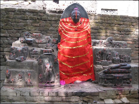 The village is situated about 5 Kilometers south-west from Bargaon or Nalanda. The site was seen by Broadley in 1872 . Broadley wrote in his ‘Annals’; “I found there the remains of a large stupa and nine very perfect Buddhist idols. The ruins here were apparently associated with the famous Buddhist ruins of Nalanda and would more or less belong to the same age.” But at present the site is totally vanished due to various activities of the villagers. However fifteen fragments of black stone images of sthanaka-Buddha in abhaya-mudra, Sankisha miracle and an unidentified deity could be found placed at a Devasthan ,
Black Buddha Image (Teliya Baba):-
The image of the Buddha just outside the boundary wall of the ancient ruins to the west,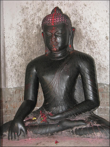 famously known as “Teliya Baba” and considered to have efficacious powers to cure chronic illnesses, was earlier part of the images within the compound of the ASI boundary. The Brahmins, who claim its ownership as a deity, fought a bitter legal battle with the ASI and finally won complete control over the site. The colossal Buddha is seated in the Dharma Cakra Mudra Today the site has become popular with a group of Thai pilgrims who have implicit faith in the image. Behind this project is Ven. Withoon Putamee, an eminent Monk from Thailand.
Lakshman Bigha:-The KP Jayaswal Research Institute, during in the course of its Archaeological Explorations brought to light the site period Early medieval. Bhagwan Bigha:-The KP Jayaswal Research Institute, during in the course of its Archaeological Explorations brought to light the site period Early medieval.
Bara(Lat. 25°6’89”N; Long. 85°22’18”E) :-The Bara village is 8 km south-west from the ruins of Nalanda. The mound extended into 200 x 200m with an extant height of 12m is located to the south of the village yielding red ware and black ware. Sculptures are kept at Thakurbari and Brahmasthan located on the east and south of the village.
According to Jayaswal Research Institute Archaeological Explorations this site belongs to Early medieval period.
Nohsa:-The KP Jayaswal Research Institute, during in the course of its Archaeological Explorations brought to light the site period NBPW phase
Badi-ant (Lat. 25°11′ 45”N; Long.85°24′ 28”E):-A 7-10 m high early historical mound is situated at a distance of 12 km (north-west) from Nalanda.
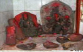 A good number of Buddhist and Brahmanical sculptures, datable to Pala period are placed in modern temples of Gauraiya-sthana and Sati-Asthana, among them Buddha in Bhumisparsa pose , Ganesha, Uma-Maheshwar, Brahma, Tara,and red ware. Other finds include terracotta dabber,human figurine and hop-scotches.
.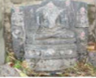 Fragments of stone sculptures, datable to early medieval period have been noticed at Mahadeo-Asthana, Gauraiya-sthana and Brahmasthana . Among them Uma-Mahesvara , Vishnu and Sahasra Buddha panel are noteworthy.
 A stone axe (celt)having 7.5 cm length is also worshiped as Siva-linga at Sati-Asthana .
Koshnara (Lat. 25°09’67”N; Long.85°22’54”E):-The site is about 10 km west to the ruins of Nalanda. There is a mound to the south of the village covering an area of 35 x 25m with an extant height of 7m. Potsherds of red ware, black ware and black slipped ware were recovered during exploration.
According to Jayaswal Research Institute Archaeological Explorations this site belongs to NBPW phase period.
Khaira(Lat. 25°10’97”N; Long. 85°21’33”E):-The village Khaira is 16 km north-west from the ruins of Nalanda. Besides potsherds of red ware, some Buddhist and Brahmanical sculptures, among which one is inscribed, made of black basalt are kept to the north of the village at Brahmasthan.
THARTHARI BLOCK
Narari:-The KP Jayaswal Research Institute, during in the course of its Archaeological Explorations brought to light the site period Early medieval. Kachanaria:-The KP Jayaswal Research Institute, during in the course of its Archaeological Explorations brought to light the site period NBPW phase. Asta:-The KP Jayaswal Research Institute, during in the course of its Archaeological Explorations brought to light the site period Early medieval. Mehtarwan:-The KP Jayaswal Research Institute, during in the course of its Archaeological Explorations brought to light the site period Early medieval. Tharthari Dih:-The KP Jayaswal Research Institute, during in the course of its Archaeological Explorations brought to light the site period Early medieval. Bhatahar:-The KP Jayaswal Research Institute, during in the course of its Archaeological Explorations brought to light the site period Early medieval. LakhaChak:-The KP Jayaswal Research Institute, during in the course of its Archaeological Explorations brought to light the site period Early medieval. Therthari Bazar:-The KP Jayaswal Research Institute, during in the course of its Archaeological Explorations brought to light the site period Early medieval.
Katriyawan:-The KP Jayaswal Research Institute, during in the course of its Archaeological Explorations brought to light the site period Early medieval. Dhibrapar:-The KP Jayaswal Research Institute, during in the course of its Archaeological Explorations brought to light the site period Early medieval. Barki Chharari:- The KP Jayaswal Research Institute, during in the course of its Archaeological Explorations brought to light the site period NBPW phase
PARBALPUR BLOCK
Pilich (Lat. 25°13’50”N; Long. 85°21’25”E):-This site is situated at a distance of 25 km north-west from Nalanda . It can be approached by Biharsharif-Ekangarsarai route. The village is settled on the ancient site (mound). A very small portion of the mound (5×5×2 m) remains undisturbed. One intact and twenty fragmentary stone images datable to Pala period have been noticed placed at two places of worship called Gauraiya-Asthana located at different areas of the site. The intact one made of black basalt is of Uma-Maheshwar . 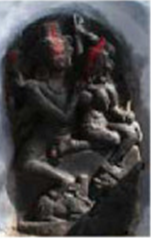 Amongst the fragmentary stone images placed at second Gauraiya-sthana the images of Uma-Maheshwar,Buddha , Avalokiteshvara, Vishnu, Tara, Marichi are noteworthy.Sculptures of Brahmanical pantheon specially Uma-Maheshwara out number those belonging to the Buddhist pantheon.
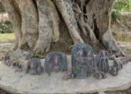
Khirauti:-The KP Jayaswal Research Institute, during in the course of its Archaeological Explorations brought to light the site period Chalcolithic.
Dumri:- It contains a brick-built stupa.
According to Jayaswal Research Institute Archaeological Explorations this site belongs to NBPW phase period.
Sonchari (Lat. 25°11’24”N; Long. 85°19’91”E):-The village Sonchari is 19 km northwest from the ruins of Nalanda. The mound located to the south of the village yielded red and red slipped ware.
According to Jayaswal Research Institute Archaeological Explorations this site belongs to Early medieval period.
Badauni (Lat. 25°12’N; Long. 85°20’E):-Vedagram was the ancient name of village Badauni which is located 19 km north-west from the ruins of Nalanda. To the east of the village is a mound extended into 12 acres with an extant height of 3m yielding red and red slipped ware.
Chausanda:-The KP Jayaswal Research Institute, during in the course of its Archaeological Explorations brought to light the site period Early medieval. Jago Bigha:-The KP Jayaswal Research Institute, during in the course of its Archaeological Explorations brought to light the site period Early medieval.Shivnagar:-The KP Jayaswal Research Institute, during in the course of its Archaeological Explorations brought to light the site period NBPW phase. Fatehpur:-The KP Jayaswal Research Institute, during in the course of its Archaeological Explorations brought to light the site period Early medieval. Tara Bigha:-The KP Jayaswal Research Institute, during in the course of its Archaeological Explorations brought to light the site period medieval. Mai:-The KP Jayaswal Research Institute, during in the course of its Archaeological Explorations brought to light the site period Late medieval. Bana Bigha:-The KP Jayaswal Research Institute, during in the course of its Archaeological Explorations brought to light the site period Early medieval.
Talab & Mandir Parisar (Alawan):-The KP Jayaswal Research Institute, during in the course of its Archaeological Explorations brought to light the site period Early medieval. Sinawan:-The KP Jayaswal Research Institute, during in the course of its Archaeological Explorations brought to light the site period Early medieval. Larhuari:-The KP Jayaswal Research Institute, during in the course of its Archaeological Explorations brought to light the site period Early medieval. Bikrampur:-The KP Jayaswal Research Institute, during in the course of its Archaeological Explorations brought to light the site period Early medieval.
Arawan(Lat 25° 11’95″N, Long 85° 22′ 344″E):-It is situated 18 km north-west to Nalanda .The approximate dimensions of the site is 300 m (east-west) x 200 m (north south) comprising about 8.00 m thick cultural deposit. The most elevated portion of the site has been converted into agricultural field, only a small part of it having an area of about 50 m x 40 m is remaining at present. The pottery collected from the site includes mostly red ware and a few sherds of black slipped ware. Noteworthy pottery types include bowl with straight sided rim, vase, carinated handi and storage pots.
A good number of stone sculptures of Pala period have been founded such as Uma-Mahesvara , Vishnu, Surya ,Karttikeya and Tara at Bhairava-Asthana, Buddha , Chamunda , Buddha in bhumisparsa pose at Brahma-Asthana and pedestal depicting saptaratna, Buddha in bhumisparsa pose , Vishnu and pilaster Mahto-Baba-Ka-Asthana.
Recent Archaeological Investigations highlight this site on the basis of material remains, is datable from late phase of N.B.P.W. period to Kushana period onwards.
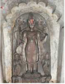 north to Badimatha on Biharsharif-Ekangarsarai route. The main ancient mound of Shankar dih, extending in an area of about 70 m east-west x 70 m north-south, contains about 3 m thick cultural deposit. A school building has been constructed on it. Another small mound located in the village comprises an area of 30×30 m with about 3m thick habitation deposit. Ceramic Assemblage collected from the surface contains red, black, black slipped and N.B.P. wares. Among their important shapes mention may be made of basin, bowl, dish etc. Other finds include remains of broken terracotta ring-well. At a modern Kali-Asthan temple , various stone sculptures of Chamunda, Vishnu , Navagraha panel, Mahishamardini and Buddha of Pala period has been kept
NURSARAI BLOCK
Machachaldiha :-During exploration done by ASI in year 1973-74 a large number of Pala Sculptures including images of Dhyani- Buddha,a broken head of Vishnu, Maitreya and Avalokitesvara besides votive stupas were found. Mustafapur :-During exploration done by ASI in year 1973-74 an images of Buddha of the Pala period in preaching attitude seated in bralambapada – mudra with lion figures on either side was found.
Mamurabad Dih:-The KP Jayaswal Research Institute, during in the course of its Archaeological Explorations brought to light the site period medieval. Paparnosa:-The KP Jayaswal Research Institute, during in the course of its Archaeological Explorations brought to light the site period Early medieval. Jagdishpur Tiyari:- The KP Jayaswal Research Institute, during in the course of its Archaeological Explorations brought to light the site period Early medieval.
Rukministhan (Lat. 2506’N; Long. 85025’E):-The mound of Rukministhan is located about 2km south-west of the ruins of Nalanda. The mound covering an area of 90 x 50m with an extant height of 6m has a modern temple to enshrine a life-size image of Buddha (2.92 x 1.98 x 0.85m) in bhumisparsha mudra made of black stone of Pala period. There is a depiction of the life-history of Buddha by intricate engraving on the outer surface of the image.One another image of Buddha is also found in the same posture but the head is broken. Potsherds of red ware were collected from the surface during exploration. Kaparsari:-The KP Jayaswal Research Institute, during in the course of its Archaeological Explorations brought to light the site period Early medieval.
Kundi(Lat. 25°14’37”N; Long.85°26’71”E):-Kondi is about 10km north to the ruins of Nalanda. Fragment of sculptures are found in the southern and western parts of the village.
According to Jayaswal Research Institute Archaeological Explorations this site belongs to Early medieval period.
Bara Khurd (Lat.25°14’54”N; Long. 85°25’23”E):- It is 13 km northwest from the ruins of Nalanda. To the south of village there is a small mound measuring 25 x 20m in area with an extant height of 6m yielding red ware and black ware and a carved pillar measuring 95 x 23cm.
Dharampur:-The KP Jayaswal Research Institute, during in the course of its Archaeological Explorations brought to light the site period Early medieval. Daruara:-The KP Jayaswal Research Institute, during in the course of its Archaeological Explorations brought to light the site period Early medieval.
Begampur (Lat 25° 25’20“E, Long 81° 54’ 31”E):-It is situated about 5 kilometers north of Nalanda Railway station and 1.5kms north from the ruins of Nalanda Mahavihara.
It consists two big tanks Dighi and Sanoroha. About 400 feet to the south of the hamlet is a large square mound with ruined brick structures. The whole mound is under agriculture and owned by the villagers. Presently the area of the mound is approximately 300 x 300 mtrs and height is about 5 mtrs from the surrounding place.
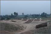 ASI carried out an excavation at the site in 2007-08. Structural activities are found in form of brick walls, mud floor with remains of hearth. Mud mortar is used as binding material in all structures. Few walls are forming a rectangular shaped structures divided into three cells.
The important antiquities unearthed at the site are terracotta gamesman, beads, birds, human and animal figurines, terracotta plaque, stopper, armlet, sling-balls, hopscotches, rattle handle, iron ring and nails, terracotta mould of horse, moulds and sealing. One of the most important antiquities is a fragment of sealing which shows a deer and inscriptions in Brahmi script.
According to Jayaswal Research Institute Archaeological Explorations this site belongs to Early medieval period.
Dighi Tank(Begampur):-
Sanoroha Tank(Begampur):-
Machhaldiha:-The KP Jayaswal Research Institute, during in the course of its Archaeological Explorations brought to light the site period Early medieval. Sargaon:-The KP Jayaswal Research Institute, during in the course of its Archaeological Explorations brought to light the site period Early medieval. Mustafapur:-The KP Jayaswal Research Institute, during in the course of its Archaeological Explorations brought to light the site period Early medieval. Nari:-The KP Jayaswal Research Institute, during in the course of its Archaeological Explorations brought to light the site period Early medieval. Kishunpur:-The KP Jayaswal Research Institute, during in the course of its Archaeological Explorations brought to light the site period Early medieval.
Sakrorha (Lat.25°10’55”N; Long.85°25’31”E):-This village settled on an ancient site is situated 5km east from Nalanda.The mound contains ancient brick sand potsherds of red ware on the surface. An ancient brick wall was also found. At south-west of the village, about 60×50 m area of the mound (with3 m height), is still undisturbed. An ancient well made of wedge shaped bricks, having the diameter of 130 cm is also located in the periphery of village.The surface finds include red ware mainly represented by vase, bowl, marinated handi etc. The site possibly represents single cultural occupation of Pala period.The village has scores of Buddhist and Brahmanical black stone sculptures placed in a modern Siva temple, which include two sculptures of four handed Vishnu in Sthanaka pose, Siva Linga and Buddha in Bhumisparsa pose. A beautifully carved image of Durga is kept at Durga-Asthana while the straight of Buddha in Dharma-Chakra-Pravartan pose Sahasra Buddha panel, and Navagraha panel were noticed at Gauraiya-Asthana.
Mathurapur:-The KP Jayaswal Research Institute, during in the course of its Archaeological Explorations brought to light the site period Early medieval.
Ajaypur(Lat. 25° 10′ 13” N; Long.85° 32′ 24” E):- Recent explorations undertaken has brought to light this archaeological sites. It is located 15 km north-west to Nalanda. The early historical mound to the south of the village covering an area of 100 x 90m with an extant 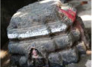
height of 6m. The main ceramic industries recovered are Black-and-Red ware, N.B.P.W., black slipped ware and red ware. Among noteworthy shapes dish, bowl, basin, vase and spouted pots are notable. Other finds include beads, fragment of terracotta rings of ring-well. Two ancient tanks and brick-well were also noticed at the site. Eighteen stone sculptural fragments, among them Uma- Maheshwar, Surya, Vishnu, Chamunda , birth of Buddha and an inscribed votive stupa datable from post-Gupta to Pala period, are noticed at Gauraiya-Asthana.
Ajnaura site (Lat. 25°13’N; Long. 85°24’E):-It is about 13 km north-west to the ruins of Nalanda. A large number of Brahminical and Buddhist sculptures are scattered in the middle and the southern portion of the village.
Kewai-dih (Lat. 25°13’20” N;Long. 85°26’35”E):-This ancient site is situated at a distance of 10 km(north-west) from Nalanda .Most of it has been converted into agricultural field. Its approximate dimension is 15×40 m. The pottery collected from the site includes red, black slipped, degenerated N.B.P. and grey wares. A ring-well was also noticed at the site.The fragmentary stone sculptures placed at Gauraiya-Asthana an image of Vishnu of Pala period.
Chandasi(Lat. 25°16’N; Long. 85°28’E):-The village Chandasi is 15 km north to the ruins of Nalanda. The mound situated to the north-east of the village is extended into 70 x 50m with an extant height of 5m potsherds of red and red slipped ware were collected from the surface of the mound.
Charuipar(Lat.25°17’N; Long.85°28’E):-The village Charuipar is 19 km north to the ruins of Nalanda. The mound situated to the east of the village is extended into 60 x 50m with an extant height of 3m including potsherds of red and black ware along with a few terracotta beads etc.
Milkipar:-The KP Jayaswal Research Institute, during in the course of its Archaeological Explorations brought to light the site period Early medieval.
GIRIAK BLOCK
Pawapuri :- Pawapuri, also known as Apapuri (“the sinless town”)is a sinless or pure city and a great pilgrimage center of the Jains. It is situated at a distance of 47 km from Nalanda and 5 km north of Giriak. Of all holy places of the Jains in northern India, this is the most sacred place. Lord Mahavira, the greatest propounder of Jainism had delivered his last sermon took Mahaparinirvana and was cremated here. and believed to be the place where Lord Mahavira died. Mahavira died in 527 B.C In side the village there is a temple dedicated to Mahavira.
According to Jayaswal Research Institute Archaeological Explorations this site belongs to NBPW phase period.
Jal Mandir :-
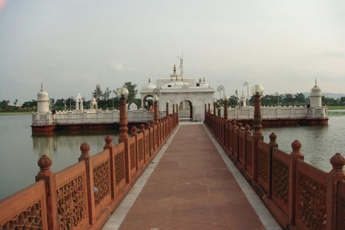 A beautiful temple here of exquisite architecture built in white marble dedicated to Lord Mahavir, the last and 24th Tirthankar of the Jain religion is situated at a short distance to the south of the village. The Temple is situated in the middle of a tank with lotuses. There is a long bridge inside the tank for reaching the temple. Legend has it that the tank was found as a result of mass removal of sand from around the funeral pyre of Lord Mahavir in order to meet the demand for his ashes.
Gaon Mandir :-It is situated North of the Lake . According to the priests it is built on the spot where Mahavira died, the Jal Mandir being the place of his cremation.It is said that this temple was built by King Nandivardhan, elder brother of Lord Mahavira.
Samsharam :-
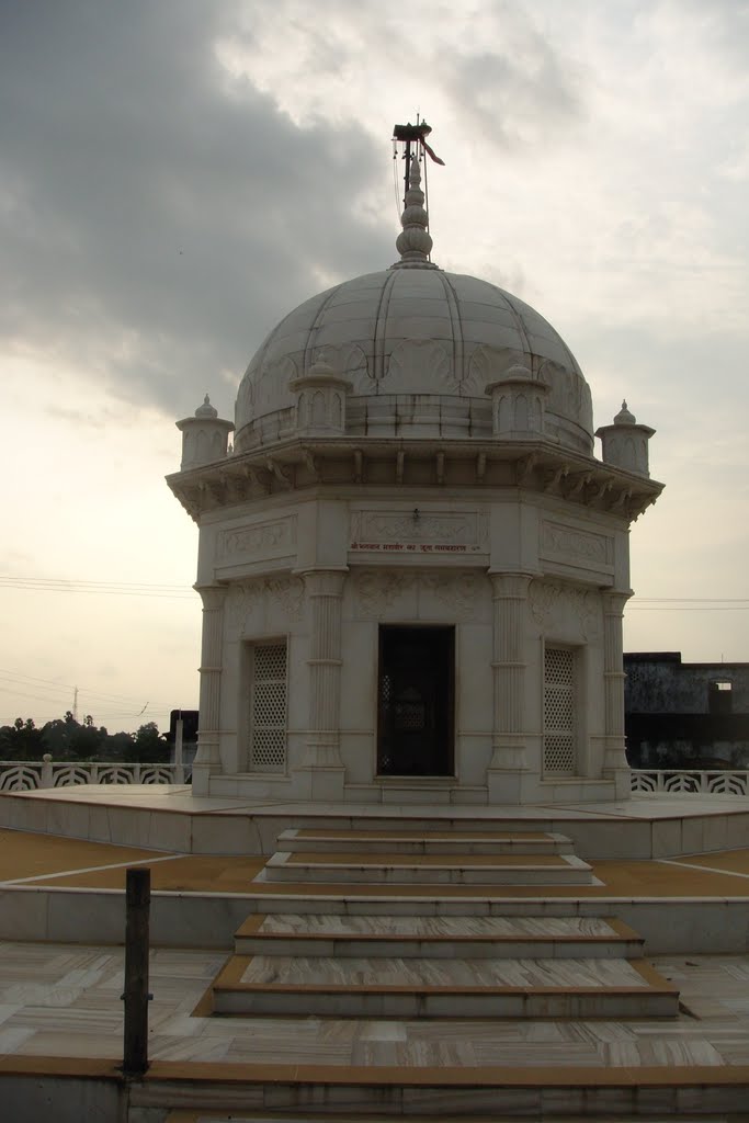 Another Jain temple containing the foot-print of Mahavira, called Samosharan is located between Jal Mandir and the lake, where the Lord Mahavira delivered his last teaching to his disciples.
The New Samosaran:-In new Samosaran temple of Swetamber accommodations is available with all facilities.
Temple built by Bibi Mehtab Kumari
Digambar Jain Temple :-To the east of the Jal Mandir a grand temple with garden has been erected by the Digambar sect of the Jains where the seva puja of Mahavira is performed by them in their own way.
Shwetambar Jain Mandir :-
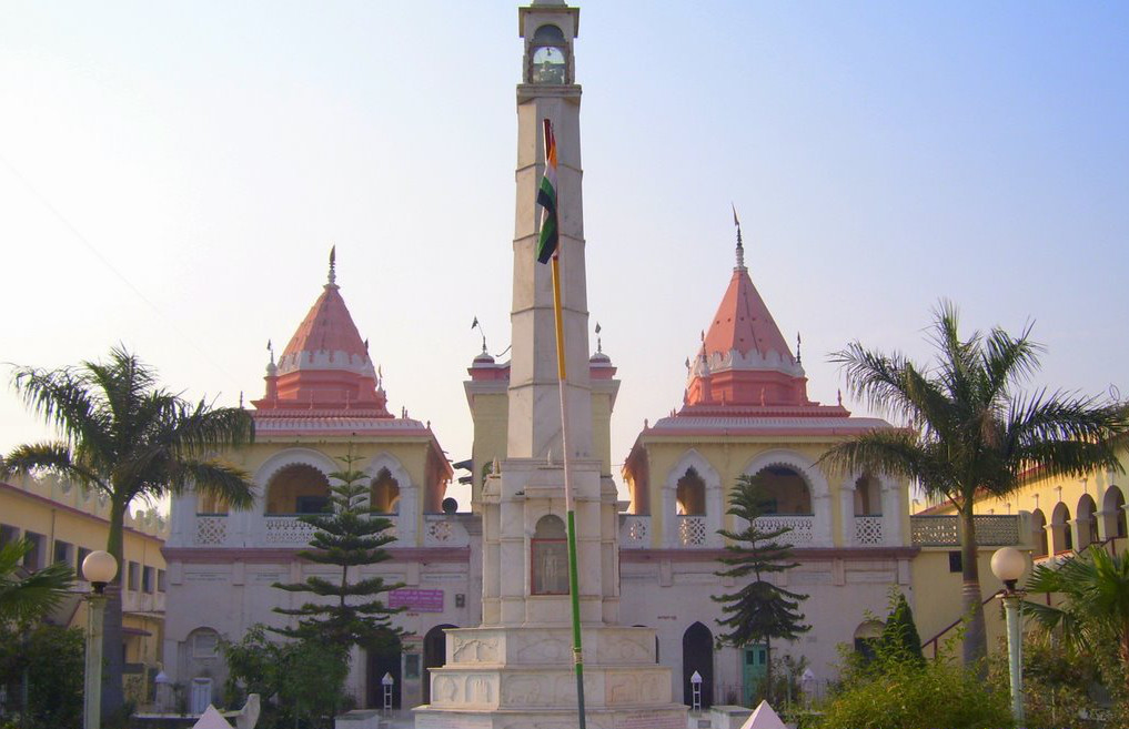
Mosque (Deo Pawapuri ) :-The mosque was erected by Shershah Suri in 1545 to commemorate his reignd”
New Mandir ( Digambari sect ):- To the East of the Jal-Mandir a grand temple with garden built by the Digambari sect before year 1917.
Sikandar Par{-The KP Jayaswal Research Institute, during in the course of its Archaeological Explorations brought to light the site period Early medieval.
Chandimao (Lat. 25° 03’ N ; Long. 85° 30’):-It is a small village situated on the western bank of the Panchane River and about 4 km north -west of Giriyak. The mound locally known as Tilhapar roughly measured 70×60 sqm situated in the south western corner of the village. An ancient remains found here. Mr. Broadley recovered “a very fine statue 5ft 3 inches high, seated on a throne, and the pieces of an enormous Buddha .
 ASI carried out an excavation at the site in 2001 and remains of a brick-built Buddhist temple and votive stupas on a brick -paved floor, which seems to be the courtyard of the temple were unearthed.
  The votive stupas are of various shapes and dimension. Twelve votive stupas were exposed in the northern and the southern side of the temple. Most of the votive stupas eastern part of the mound, are circular in shape from base to the hemispherical top but four of them are raised on a square brick platform.A good numbers of fragments of circular bricks with a central hole, collected around these stupas, suggests that they might have been used as Chhatra-Vali to fix on the top of the these votive stupas.
Another apsidal brick structure has been noticed towards the western part of the mound. The front portion of the structure is 7 mts. in length the width could not be determined as rest of the portion could not be exposed. The northern end is semi-circle with a radius of 1.40mts. The brick sizes are 35cmX26cm, 34cmX25cm. The patches of thin lime plaster are also observed on the brick floor.
This site was visited by Xuanzang and Fahien and they have left detailed account of these sites.
The antiquities found of the area such as bead, scaling and plaques of terracotta, besides stone sculptures of Hindu and Buddhist deities were assignable from 8 to 10 th century A.D. This place may be associated with Sariputra.
Ghosrawon village(Lat- 25° 05’, N, Long- 85° 34’ E) :-It is 3 Km east of Pawapuri. The village is famous for its art of carving relief on stone. Some ancient stone images have also been found in the village.The mounds that were essentially the remains of huge religious structures were full of rich materials that were repurposed extensively by the newly settling populations. As per the Inscription discovered by Kittoe in 1848 amongst the ruins, this was the site of Vajrasana Vihara erected by Monk Viradeva. The inscription states that Monk Viradeva had earlier in his life studied in the monastery of Kanishka. He then found his way to this part of ancient Magadha where he stayed at a Vihara of Yasovarmanpur and was consequently appointed to govern the monastic establishment of Nalanda.
In the modern days the village is a popular destination for Hindu devotees. This temple is popularly called Maa  Ashapuri temple.The statue of Maa Ashapuri is about two cubits high made of black sand-stone and said to be of the old Hindu Period. An old inscription on the lintel above the doorway was found but could not yet decipher it. A large number of ancient images are stored here. The temple stands on a mound or tilha which is full of interesting old figures and statues. According to local say, It is among the 84 sidh piths and worship of the goddess is continued from ninth century. On every Tuesday lots of devotees flock to sacrifice Goat. It is believed by performing such sacrifice at this temple wishes comes true. A big temple housing old pala period sculpture is constructed over an old temple.
According to Jayaswal Research Institute Archaeological Explorations this site belongs to Early medieval period.
Fort:-It is situated on the southern outskirts of the village.
Kanya Pathshala :-
Dharmashla :-It Is north of the Asa Devi Temple.
Mahismardini:-
Singhbahini:-
Vajrasana Vihara :-Remains of a great Buddhist temples erected by Devapal in the latter half of the 9th century A.D. What is left of this great monastery is nothing but some strewn rubble, partial remains of a mound which has been cut away by the local villagers to create land for agriculture. An inscription found by Kittoe around 1848. It recorded the erection of the Vajrasana Vihara by the monk Vira Deva, who was originally a resident of Nagarahara in Uttarapatha in the north-western frontier of the country (now in West Pakistan). The inscription states that Vira Deva had spent many years of his life studying at the Vihara of Kanishka probably somewhere near modern Peshawar. He then found his way to Bihar and resided for a long time in the Vihara at Yasovarmmapura where he found the patronage by the Pala king Devapala and was subsequently appointed to govern the monastic establishment of Nalanda. The inscription was removed from the site by Broadley to the then Bihar Museum and is now in the Indian Museum, Kolkata.
Giriyak :- A recent exploration undertaken has brought to light these archaeological sites.
This site, situated 20 km south to Bihar-Sharif in block-Giriyak., and surrounding area was first surveyed by Buchanan who had noticed two mounds here named Boragara and Chotagar.Boragara, presently known as Ghora Katora mound, is a centrally protected site.The excavations carried out at this site, by the Archaeological Survey of India in 2007-08 and 2008-2009, have revealed occupational deposits placed under a five-fold cultural sequence from Chalcolithic to Pala Period.Chotagar, referred by Buchanan, covering an area of 900 x 400 m, is about 100 m southeast from Ghora Katora mound. It is under cultivation. Two brick kilns are also situated on it. This area falls under Daktar-English mauja near Giriyak. Presently digging operation is being carrying out in this area by the brick manufacturers for procuring earth.The main ceramic industries recovered are black-and-red, black slipped, grey and red wares. In black-and-red ware main shapes are dish-on-stand, bowls and vase. The site appears to have been settled at least in Chalcolithic period and remained in continuous habitation during the NBPW period. The site may be considered among the large Chalcolithic settlements in Bihar.Unfortunately it is under fast devastation process due to brick industries.
Girivajra Parvat:-The KP Jayaswal Research Institute, during in the course of its Archaeological Explorations brought to light the site period NBPW phase
Giriyak peak (Lat- 25° 01’, N, Long- 85° 30’ E):-Giriyak peak is currently proposed to be the first spot between Rajgir and Parvati to be developed as tourist attraction.The Giriyak peak is one of the most massive structures in the region and is visible from distance. It consists of a 25 ft brick pillar from Gupta period and a massive cubical shaped rock structure with dimensions around 60 X 60 X 60 Meters. The evidences on the site suggest that this was once a very lively place with frequent monastic activities. This brick structure and the stone structure have witnessed some happening times during Gupta and Pala period as suggested by the massive remains.
The site is a must see for all Patrons of Buddhist art and architecture. It is about a 300-meter walk to the top of the hill where the stupa(Hansa Stupa) is situated and the views of river Panchane to its east are incredibly beautiful.
Giriyak Bahbolpur:-It is situated on the NH31 about 21 kms south of Biharsharif. The Giriyak Rajgir hill range is started from the west part of this village.The hill top in the village has a round temple, believed to build by Jarasandha, the king of Magadha during the Mahabharata age.
The Gidhadwari cave :-On the souther face of the ridge towards the vally which separates the two ranges of hill, there is a small cave known as Gidhadwari. The position and appearance of which corresponds exactly to the cave wherein Houen Tsisng says is the scene of Inra’s interrogation of Buddha called Indra sila Guha or Indr’s hill cave It is the site,There is no trace of human work manship, but at its entrance there is a small platform about 20 ft. in length supported by a wall of old masonary. It is said that there is a passage inside the cave which communicates with Jarasandh ka Baithak.
Asuren Bandh(Giriyak Hill) :-It is an embankment skirting the northern slope of the hill towards the north-west, enclosing a large sheet of water. It is said that, Jarasandh therefore promised the hand of his daughter and half his kingdom to any one who would water it in a single night from the Ganges. A Kahars by cast then began lifting the water with swing baskets in successive stages and Jarasandha was in despair in having to marry his daughter to a Kahar. A Pipal tree came to his rescue and assuming the form of a Cock crowed loudly.Hearing the sound the kahars thinking it was morning, and fearing the king would take vengeance on them for presuming to seek the hand of his daughter fled in terror as far as possible.The cakes and balls of rice which they took to sustain them turned to stone and were left behind in their flight and still be seen on the the hill.
The Fort:-It is a mud fort.On the east bank of the Panchane river there is an extensive mound of ruins about a km long with a small mud -fort in the middle of it with remains of two paved ascents on the river side and of three more on the opposite of the mound. British was constructed a very large reservoir to embanked the gorge on the east and a bungalow was constructed on the plain about a furlong to the east of this reservoir.
Agindhara :-It is located about 5 km south from the above said government bungalow. Water flows into a pond through a natural drain from the foot of the hill close by. The water is very hot and smoke emanating from the water so all the area are covered with that smoke, and is that account called Agindhara or stream of fire and the whole place is known by the epithet Agindhara.
Agni Kund;The KP Jayaswal Research Institute, during in the course of its Archaeological Explorations brought to light the site period Early medieval.
Ghorakatora (Lat. 25° 25’ N ; Long.85° 54’ E ) :-
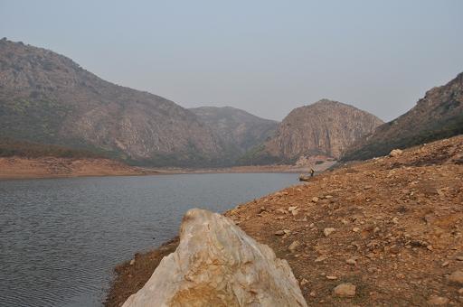 It is situated 300 mt west from Giriyak Police Station, between Bihar Sharif and Nawada on the National Highway No. 31. The River Panchana flows west of the site and also connects with the motorable road leading to Tapovan, Jethian and Rajgir . It is a massive mound measuring about 900 meters (north-south) x 500 mtrs (east-west) x 40 to 500 feet in height, first noticed by Buchanan.
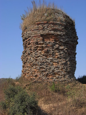
There was a tomb of Hussan-Hussain at the northern portion of the mound according to the local villagers. At the center of the mound was a small square fort with bastion at the four corners.
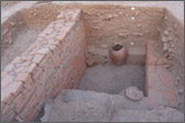
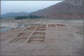 ASI carried out an excavation at the site in 2007-9. The ceramic found is red ware, black slipped ware, N.B.P. and black and red ware potsherds. Some antiquities have also been collected such as terracotta beads, gamesman and fragment of Sunga plaque. It indicates that the site may start from chalcolithic culture leading to Northern Black Polished Ware culture, Sunga-Kushana up to the medieval. period.
Ancient remains are known as Garh. Other places associated with Jarasandha are Gridhav Dwar at the Ghoda Katora which was the eastern entry point to the mountain fortress. The Krishna and his army entered Grihvjra (Rajgir) from this eastern gate. Jarasandha was cremated at Ghoda katora on Kartik Poornima after he was killed in the duel. An annual ritual called Kartik snan daan is still held at the place every year.
Ghora katora is also the place where the army of Lord Krishna camped before finding a suitable place to enter the Grihvjra. Jara Devi temple on Gaya Highway is associated with the birth of Jarasandha. Two big stone platforms on the Ghorakatora hill and Vaibhava hills are associated with legend of Jarasandha.
The State is privileged to have this bird known as Garuda, the Vahana of Lord Vishnu at this site.It is existing now only in India and Cambodia
Ghora Katora Dam :-C.M Nitish Kumar inaugurate the Ghora Katora Dam the first Eco-tourism developed site of state on 29.01.2011. It has a two-way 15 km green stretch at the foothills of Ratnagiri hills
.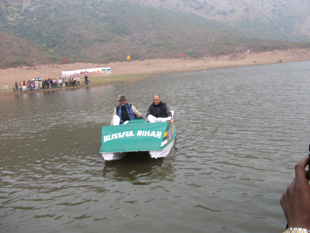
The site promises is a great tourist attractions dotted as it is with lush green meadows, valleys, hills and even a lake.There is a watchtowers at a top, from where tourists can watch. So many rare birds flying all around. The site is a pollution free Zone, motorized vehicles are not allowed inside, Polythene bags are also ban.Visitors would have to ride either a Bicycle or a Tango.
The state tourism development corporation offer a Tanga ride package and a bicycle ride package at the spot. The package includes a 15- minute boating in the lake besides the ride. An identity proof is a must to avail of the facility.
People can also try their hand at fishing in the lake.We can do Paragliding and rock climbing in the vicinity.
HARNAUT BLOCK
Seodah:-The KP Jayaswal Research Institute, during in the course of its Archaeological Explorations brought to light the site period Early medieval. Tira:- The KP Jayaswal Research Institute, during in the course of its Archaeological Explorations brought to light the site period NBPW Phase. Dihri Garh:- The KP Jayaswal Research Institute, during in the course of its Archaeological Explorations brought to light the site period NBPW phase.Kichni:-The KP Jayaswal Research Institute, during in the course of its Archaeological Explorations brought to light the site period Early medieval. Nehusa:- The KP Jayaswal Research Institute, during in the course of its Archaeological Explorations brought to light the site period Early medieval. Chhatiyara:- The KP Jayaswal Research Institute, during in the course of its Archaeological Explorations brought to light the site period Early medieval.
Barah(Lat. 25°23’N; Long.85°29’E):- Barah village is located about 38 km north from the ruins of Nalanda on the border of Nalanda and Patna districts. The mound situated to the east of the village is extended into 70 x 50m with an extant height of 5m yielding red, red slipped, black and black slipped ware. Kushana and Gupta brick-bats are noticed in the section. Remains of 21 steps are still intact to climb on the mound. According to Jayaswal Research Institute Archaeological Explorations this site belongs to Early medieval period.
Poari:-The KP Jayaswal Research Institute, during in the course of its Archaeological Explorations brought to light the site period Early medieval. Chero:- The KP Jayaswal Research Institute, during in the course of its Archaeological Explorations brought to light the site period Early medieval. Gonawan:- The KP Jayaswal Research Institute, during in the course of its Archaeological Explorations brought to light the site period Early medieval. Mirdahachak:- The KP Jayaswal Research Institute, during in the course of its Archaeological Explorations brought to light the site period Early medieval. Langhaura:- The KP Jayaswal Research Institute, during in the course of its Archaeological Explorations brought to light the site period Early medieval. Gosain Math:- The KP Jayaswal Research Institute, during in the course of its Archaeological Explorations brought to light the site period Early medieval.
Telmar(Lat. 25026’N; Long. 85026’E) :-The village Telmar is 40 km north to the ruins of Nalanda. The mound situated to the east of the village is extended into 70 x 50m with an extant height of 3m containing potsherds of red ware. According to Jayaswal Research Institute Archaeological Explorations this site belongs to Early medieval period.
Soradih:-The KP Jayaswal Research Institute, during in the course of its Archaeological Explorations brought to light the site period Early medieval.
Kolawan(Lat. 25023’N; Long. 85027’E):-The village Kolawan is 36 km north to the ruins of Nalanda. Remains of mud-wall are noticed in the southern section of the mound. According to Jayaswal Research Institute Archaeological Explorations this site belongs to Early medieval.
Sartha:- The KP Jayaswal Research Institute, during in the course of its Archaeological Explorations brought to light the site period Early medieval. Kalyan Bigha:- The KP Jayaswal Research Institute, during in the course of its Archaeological Explorations brought to light the site period Early medieval. Basniwan:- The KP Jayaswal Research Institute, during in the course of its Archaeological Explorations brought to light the site period Early medieval.
BIND BLOCK
Lodipur :-During exploration done by ASI in year 1973-74 a image of crowned Buddha was found.
Bind:- The KP Jayaswal Research Institute, during in the course of its Archaeological Explorations brought to light the site period Early medieval. Kathrahi:- The KP Jayaswal Research Institute, during in the course of its Archaeological Explorations brought to light the site period Early medieval. Nanor:- The KP Jayaswal Research Institute, during in the course of its Archaeological Explorations brought to light the site period Early medieval. Lodipur:-The KP Jayaswal Research Institute, during in the course of its Archaeological Explorations brought to light the site period Late medieval. Jakhaur:- The KP Jayaswal Research Institute, during in the course of its Archaeological Explorations brought to light the site period Early medieval. Sadarpur:- The KP Jayaswal Research Institute, during in the course of its Archaeological Explorations brought to light the site period Early medieval. Govindpur:- The KP Jayaswal Research Institute, during in the course of its Archaeological Explorations brought to light the site period Late medieval. Barhog:- The KP Jayaswal Research Institute, during in the course of its Archaeological Explorations brought to light the site period Early medieval. Jamsari:- The KP Jayaswal Research Institute, during in the course of its Archaeological Explorations brought to light the site period NBPW phase. Muradpur:- The KP Jayaswal Research Institute, during in the course of its Archaeological Explorations brought to light the site period Early medieval. Rasalpur Pachihar:- The KP Jayaswal Research Institute, during in the course of its Archaeological Explorations brought to light the site period Early medieval. Rasalpur:- The KP Jayaswal Research Institute, during in the course of its Archaeological Explorations brought to light the site period Early medieval. Nagsthan:- The KP Jayaswal Research Institute, during in the course of its Archaeological Explorations brought to light the site period Early medieval. Khanpur:- The KP Jayaswal Research Institute, during in the course of its Archaeological Explorations brought to light the site period Late medieval. Nirpur:-The KP Jayaswal Research Institute, during in the course of its Archaeological Explorations brought to light the site period medieval.
EKANGARSARAI BLOCK
Telhara(Telhada)(Lat- 25° 13’, N, Long- 85° 10’ E) :-
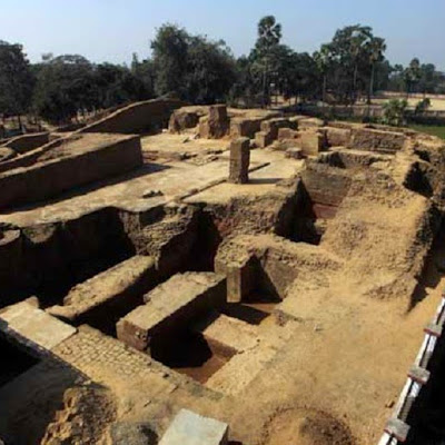 It is situated on a narrow strip of land between the Sona and Kattar river about 32 km west of Nalanda and 1.5 km south-east of Taregna Railway station . An Another ancient university Tiladhak has been discovered in Bihar which is already home to great universities like Nalanda and Vikramshila, the pilgrimage of learning in ancient India
Telhara or Teladhaka was one of the monastic establishments most extensively described by Heun-Tsang, who visited India in the the 7th Century A.D. A large number of stone sculptures were noticed by Broadley from Telhara. The famous Maitreya and twelve armed Avalokiteswar image are at present displayed in the Indian Museum Kolkata. Perhaps the best known Pala sculpture from Telhara is now in Rietbarg Museum, Zurich. Even today, many Buddhist as well as Hindu sculptures are found in the village Telhara. Telhara monastic site was first mentioned in 1872 by A M Broadley, the then Magistrate of Nalanda and letter on 1875-78 by Alexander Cunningham.
The excavation work on nearly 35′ high Bulandi mound at Telhara by a team of archaeologists of state Govt. 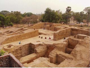 unearthed the evidence of three-stored structural remains, as mentioned by Hiuen Tsang in his travel account. Evidence of prayer hall and residential cells for monks in the Monastery, have been found in course of the recent diggings.
A large number of antiquities, including the basalt image of Yamantak, with seven faces and a stone figurine of Marichi have been found. A unique piece of Terracotta seals with inscription having the symbol of Chakra flanked by deer have been found indicative of monastic seals, besides this more seals with inscriptions, on top of which are the symbol of bull & lions are found. After decipherment of the seals, the date regarding monastery remains can be determined with exact chronology of the site. However, during the course of current excavation some copper coins have also been encountered.
During an excavation at the site five gold-plated teeth of dating back to seventh century, of an individual aged between 16 to 20 years, who might have been a monk, has recovered.
Sangi-Masjid (Telhara) :- The Sangi Masjid stands on a mound about two furlong to the north east of the Buddist ruins at Bulandi. It does not look like a Masjid. It is a plain half with flat roof supported by pillars which are of many kinds. Most of them are of a coarse kind of granite and a few are of sandstone. The hall is quite open in front. An inscription found on the lintel mention the name Taladhaka.
Dargah (Telhara):- To the east of the masjid is a courtyard paved with pillars, architraves and other remains.The entrance is the through two small narrow chambers facing east.It is a Dargah of Sayed Yusuf Ikbal surrounded by a brick wall.
Temple (Telhara):- It is situated at the north-west end of the village, contains a fine image of an eighteen-armed female dignite in black basalt.
Brick Tomb (Telhara) :- It is situated near the temple. It is an old ruined brick tomp, a square surmounted by a dome.
Goddess Durga (Telhara):- It was unearthed in a nala close by the Dargah kept in a kucha house on the southend out skrits of the village. It has eighteen arms and a made of black sandstone
Ekangar Dih:- The KP Jayaswal Research Institute done it’s Archaeological Explorations. It is brought to light the site period NBPW phase.
Kundwapar (Lat. 25013’N; Long. 85015’E):- The village Kundwapar is 29 km north-west to the ruins of Nalanda. The mound situated to the east of the village is extended into 150 x 100m with an extant height of 3m containing potsherds of red, red slipped, black and black slipped ware.
Mandach:- This site is marked by The KP Jayaswal Research Institute as NBPW phase period during Archaeological Explorations.
According to Jayaswal Research Institute Archaeological Explorations the following Villages have a site marked his Historical period as indicated in front of : Mohammadpur:- Early medieval. Amnar (Narainpur):- Early medieval. :-Oriawan:- NBPW phase Teliya Mai:- Early medieval. Khojpura (Rasalpur):-NBPW phase. Jagjiwan Nagar Tola:- NBPW phase. Barari:- NBPW phase. Dahaur Bigha:- Early medieval. Kosiyawan (Godariya Bigha):-Early medieval. Pirojatol:-Early medieval. Saidpur:-Early medieval.Chamhera:- Early medieval. Rasisa:-Early medieval. Chaurai:-NBPW phase. Rasulpur:-NBPW phase. Dhurgaon:-Early medieval. Barsiawan:- NBPW phase.
According to Jayaswal Research Institute Archaeological Explorations the following Villages have a site marked his Historical period as indicated in front of: Mahuabag:-Early medieval. Bijokhari:- Early medieval. Jamuawan:- Late medieval. Pir Bigha:-Late medieval. Bandraj:- Early medieval. Kurwapar:-NBPW phase. Op:-NBPW phase. Madanpur:-Early medieval.
Sun Temple (Ongari Dham):-It is An ancient Temple of Sun God. According to Jayaswal Research Institute Archaeological Explorations this site belongs to Early medieval.
According to Jayaswal Research Institute Archaeological Explorations the following Villages have a site marked his Historical period as indicated in front of: Pasanghi:-NBPW phase. Kadilpur:- Late medieval. Laphpet Bigha:-Early medieval. Gulamichak:–Early medieval. Mundipur:-Late medieval. Datu Bigha:- Early medieval.
HILSA BLOCK
Hilsa:-Hilsa has a significant past dating back to the mythological era. According to the historical inscriptions available, during the ancient times of Mahabharata era, Lord Krishna came along with his brother Balarama to this region as part of their sojourn. Lord Krishna felt thirsty upon which Balarama dug deep into the ground in search of a source of water. The exact location later came to be known as “Pakki Talab“, which is located near to Kali Asthan.
According to Jayaswal Research Institute Archaeological Explorations this site belongs to Early medieval period.
Surya Mandir :-
Mazar of Hazrat Syed Jamal-ud-din Madar (Hilsa):-Hazrat Syed Jamal-ud-din Madar of Makanpur (Uttar Pradesh) who had come over to Bihar was a well-known representative of the Madaria order. His mausoleum at Hilsa contains a dated inscription.
Mosque (Hilsa):-It is a simple square brick building covered by one dome, and containing seven tombs, of which the westernmost is said to be that of saint Shah Jamman Jati. (1604-05)
Dargah of Shah Jamman Jati (Hilsa):-A inscription of the Sur Dynasty from the dargah of Shah Jamman Jati , pertain to the reign of Sher Shah and is interesting in that the letter is mentioned as having been ‘raised’ by Darya Khan Nuhani. It refers to repairs carried out to the tomb of the saint.Repaired in 1543
Juniar:–The KP Jayaswal Research Institute, during in the course of its Archaeological Explorations brought to light the site period Early medieval.
Gaura(Lat. 25016’02”N; Long. 85019’52”E):- Gaura village is about 21km north-west from the ruins of Nalanda. The mound extended into 60 x 50m with an extant height of 8m is located to the south-west of the village yielding red ware, red slipped ware, black ware and black slipped ware along with a few antiquities.
According to Jayaswal Research Institute Archaeological Explorations this site belongs to Early medieval pereiod.
Nav Diha:-The KP Jayaswal Research Institute, during in the course of its Archaeological Explorations brought to light the site period Medieval. Ramgarh:-The KP Jayaswal Research Institute, during in the course of its Archaeological Explorations brought to light the site period Early medieval. Kapsiyawan:-The KP Jayaswal Research Institute, during in the course of its Archaeological Explorations brought to light the site period Early medieval. Arpa:– The KP Jayaswal Research Institute, during in the course of its Archaeological Explorations brought to light the site period Early medieval. Kurtha:- The KP Jayaswal Research Institute, during in the course of its Archaeological Explorations brought to light the site period Early medieval. Nadwar:- The KP Jayaswal Research Institute, during in the course of its Archaeological Explorations brought to light the site period Early medieval. Akbarpur:- The KP Jayaswal Research Institute, during in the course of its Archaeological Explorations brought to light the site period Early medieval. Puna:-The KP Jayaswal Research Institute, during in the course of its Archaeological Explorations brought to light the site period Early medieval. Marphapar:- The KP Jayaswal Research Institute, during in the course of its Archaeological Explorations brought to light the site period Early medieval. Jhari Bigha:- The KP Jayaswal Research Institute, during in the course of its Archaeological Explorations brought to light the site period Medieval. Milkipar:-The KP Jayaswal Research Institute, during in the course of its Archaeological Explorations brought to light the site period Early medieval. Baradih:-The KP Jayaswal Research Institute, during in the course of its Archaeological Explorations brought to light the site period Early medieval. Bhadaul:- The KP Jayaswal Research Institute, during in the course of its Archaeological Explorations brought to light the site period Early medieval. Madhopur Gulni:- The KP Jayaswal Research Institute, during in the course of its Archaeological Explorations brought to light the site period Early medieval. Shekhopur:-The KP Jayaswal Research Institute, during in the course of its Archaeological Explorations brought to light the site period NBPW phase. Malamagarh:- The KP Jayaswal Research Institute, during in the course of its Archaeological Explorations brought to light the site period Medieval. Bhokilapar:- The KP Jayaswal Research Institute, during in the course of its Archaeological Explorations brought to light the site period Early medieval. Dabaul:- The KP Jayaswal Research Institute, during in the course of its Archaeological Explorations brought to light the site period Early medieval. Chak Johra:-The KP Jayaswal Research Institute, during in the course of its Archaeological Explorations brought to light the site period Early medieval. Bari Ghosi:-The KP Jayaswal Research Institute, during in the course of its Archaeological Explorations brought to light the site period Early medieval. Chhotki Ghosi:- The KP Jayaswal Research Institute, during in the course of its Archaeological Explorations brought to light the site period Early medieval. Lohanda:- The KP Jayaswal Research Institute, during in the course of its Archaeological Explorations brought to light the site period Early medieval. Khewan Bigha:- The KP Jayaswal Research Institute, during in the course of its Archaeological Explorations brought to light the site period Early medieval. Sultanpur:- The KP Jayaswal Research Institute, during in the course of its Archaeological Explorations brought to light the site period Early medieval. Kaba:- The KP Jayaswal Research Institute, during in the course of its Archaeological Explorations brought to light the site period Medieval. Jaitipur:- The KP Jayaswal Research Institute, during in the course of its Archaeological Explorations brought to light the site period Early medieval. Bhat Bigha:-The KP Jayaswal Research Institute, during in the course of its Archaeological Explorations brought to light the site period Early medieval. Balabhadra Sarai:- The KP Jayaswal Research Institute, during in the course of its Archaeological Explorations brought to light the site period Early medieval.
NAGAR NAUSA BLOCK
Lohanda:– The KP Jayaswal Research Institute, during in the course of its Archaeological Explorations brought to light the site period Late medieval. Bampur:- The KP Jayaswal Research Institute, during in the course of its Archaeological Explorations brought to light the site period Early medieval. Korari:– The KP Jayaswal Research Institute, during in the course of its Archaeological Explorations brought to light the site period Early medieval. Akhtiyarpur:- The KP Jayaswal Research Institute, during in the course of its Archaeological Explorations brought to light the site period Early medieval. Gilani Chak:– The KP Jayaswal Research Institute, during in the course of its Archaeological Explorations brought to light the site period Medieval. Bodhi Bigha:– The KP Jayaswal Research Institute, during in the course of its Archaeological Explorations brought to light the site period Early medieval. Nagarnausa:– The KP Jayaswal Research Institute, during in the course of its Archaeological Explorations brought to light the site period Late medieval Lodipur:- The KP Jayaswal Research Institute, during in the course of its Archaeological Explorations brought to light the site period Late medieval. Anker:- The KP Jayaswal Research Institute, during in the course of its Archaeological Explorations brought to light the site period Early medieval. Rampur:- The KP Jayaswal Research Institute, during in the course of its Archaeological Explorations brought to light the site period Early medieval.
SARMERA BLOCK
Parhawan :- This village is situated 5 km west of Sarmera block headquater of Rajgir sub-division. Ther is a old temple called Mahatoji’s temple. One day fair is held every year on the occasion of Baisakh Purnima.
Sarmera:-The KP Jayaswal Research Institute, during in the course of its Archaeological Explorations brought to light the site period NBPW phase. Sadha;- The KP Jayaswal Research Institute, during in the course of its Archaeological Explorations brought to light the site period Early medieval. Husena:- The KP Jayaswal Research Institute, during in the course of its Archaeological Explorations brought to light the site period Early medieval. Sondiha:-The KP Jayaswal Research Institute, during in the course of its Archaeological Explorations brought to light the site period Early medieval. Sasaur:– The KP Jayaswal Research Institute, during in the course of its Archaeological Explorations brought to light the site period Early medieval. Isua:–The KP Jayaswal Research Institute, during in the course of its Archaeological Explorations brought to light the site period Early medieval. Chero:– The KP Jayaswal Research Institute, during in the course of its Archaeological Explorations brought to light the site period NBPW phase. Nayagarh:- The KP Jayaswal Research Institute, during in the course of its Archaeological Explorations brought to light the site period Early medieval.
CHANDI BLOCK
Bahadurpur (Lat. 25020’N;Long. 85025’E):- It is located 19 KM towards North from District head quarters Bihar Sharif, 9 KM from Chandi and 55 KM from Patna. Bahadurpur village is situated on the eastern bed of Mohane river and 36 km north to the ruins of Nalanda. The mound extended into 100 x 70m with an extant height of 4m is located to the south of the village yielding red and red slipped ware.
Birnawan (Lat. 25019’N; Long. 85029’E):- It is situated 10km away from sub-district headquarter Chandi and 20km away from district headquarter Biharsharif. Birnawan village is about 26km north-east from the ruins of Nalanda. The mound extended into 110 x 90m with an extant height of 5m is located to the south of the village yielding red, red slipped and black slipped ware.
As per Potsherds collected from the site The KP Jayaswal Research Institute is identifying the archaeological culture as Early medieval period.
Sirnawan:- Sirnawan is a Village in Chandi Block. It is located 20 KM towards North from District head quarters Bihar Sharif. It is 7 KM from Chandi and 55 KM from Patna. The KP Jayaswal Research Institute, during in the course of its Archaeological Explorations brought to light the site period Early medieval. Nawadda:- It is located 7 KM towards North from District head quarters Bihar Sharif, 4 KM from Rahui and 63 KM from State capital Patna.The KP Jayaswal Research Institute, during in the course of its Archaeological Explorations brought to light the site period NBPW phase. Naili:- It is located 14 KM towards North from District head quarters Bihar Sharif, 7 KM from Chandi and 56 KM from State capital Patna. The KP Jayaswal Research Institute, during in the course of its Archaeological Explorations brought to light the site period Early medieval. Utra:- It is situated 5 km away from sub-district headquarter Chandi and 30 km away from district headquarter Biharsharif. The KP Jayaswal Research Institute, during in the course of its Archaeological Explorations brought to light the site period Early medieval. Satnag:- It is in Bhagwanpur Panchyat.This village having very proud History. It is located 19 KM towards west from District head quarters Bihar Sharif. 3 KM from Chandi. 50 KM from State capital Patna. The KP Jayaswal Research Institute, during in the course of its Archaeological Explorations brought to light the site period Early medieval.
Barhauna(Lat. 25018’N;Long. 85025’E):-It is situated 8km away from sub-district headquarter Chandi and 20km away from district headquarter Biharsharif. The village Barhauna is 21 km north-west from the ruins of Nalanda on SH78. The mound situated to the north of the village is extended into 70 x 50m with an extant height of 5m. A few sculptures including an image of Uma-Maheswara in black stone are kept to the south of the village.
The KP Jayaswal Research Institute, during in the course of its Archaeological Explorations brought to light the site period NBPW phase.
Mokimpur Garh:- It is situated 12km away from sub-district headquarter Chandi and 25km away from district headquarter Biharsharif. Belchhi is the gram panchayat of Mokimpur village. The KP Jayaswal Research Institute, during in the course of its Archaeological Explorations brought to light the site period Early medieval.Belchi:- It is located 20 KM towards North from District head quarters Bihar Sharif. 25 KM from Biharsharif. 52 KM from State capital Patna. Indira Gandhi when she was out of power 1977 visited Belchi where 11 persons eight Harijans and three sonars (goldsmiths) were ruthlessly murdered on May 27,1977, to meet victims. This helped her regain power.The KP Jayaswal Research Institute, during in the course of its Archaeological Explorations brought to light the site period Late medieval. Gauri Bigha:-The KP Jayaswal Research Institute, during in the course of its Archaeological Explorations brought to light the site period Early medieval. Narsanda:- It is situated 8km away from sub-district headquarter Chandi and 20 km away from district headquarter Biharsharif.Narsanda village is also a gram panchayat.The KP Jayaswal Research Institute, during in the course of its Archaeological Explorations brought to light the site period Later Gupta. Mahkar Bigha:– It is located 29 KM towards North from District head quarters Bihar Sharif. 1 KM from Nagarnausa. 40 KM from State capital Patna. The KP Jayaswal Research Institute, during in the course of its Archaeological Explorations brought to light the site period Early medieval. Bheria:– It is located 16 KM towards North from District head quarters Bihar Sharif. 5 KM from Chandi. 54 KM from State capital Patna. The KP Jayaswal Research Institute, during in the course of its Archaeological Explorations brought to light the site period Early medieval. Araut:- It is located 16 KM towards North from District head quarters Bihar Sharif. 12 KM from Chandi. 58 KM from State capital Patna. The KP Jayaswal Research Institute, during in the course of its Archaeological Explorations brought to light the site period Early medieval. Saidpur:- It is located 21 KM towards South from District head quarters Bihar Sharif. 90 KM from State capital Patna. The KP Jayaswal Research Institute, during in the course of its Archaeological Explorations brought to light the site period Early medieval. Hasli:- The KP Jayaswal Research Institute, during in the course of its Archaeological Explorations brought to light the site period Early medieval. Mal Bigha:- It is situated 9km away from sub-district headquarter Nagar Nausa and 32km away from district headquarter Biharsharif. Goraipur is the gram panchayat of Mal Bigha village.The KP Jayaswal Research Institute, during in the course of its Archaeological Explorations brought to light the site period NBPW phase. Salehpur:- It is situated 4km away from sub-district headquarter Chandi and 30km away from district headquarter Biharsharif. Salehpur village is also a gram panchayat.The KP Jayaswal Research Institute, during in the course of its Archaeological Explorations brought to light the site period NBPW phase.
Dayalpur(Lat. 25020’N; Long.85024’E):- The village Dayalpur is 28km north-east to the ruins of Nalanda. The mound situated to the east of the village is extended into 90 x 80m with an extant height of 5m containing potsherds of red and red slipped ware. The KP Jayaswal Research Institute, during in the course of its Archaeological Explorations brought to light the site period Early medieval. Hanumangarh:– It is situated 5km away from sub-district headquarter Chandi and 25km away from district headquarter Biharsharif. Hasni is the gram panchayat of Hanumangarh village.The KP Jayaswal Research Institute, during in the course of its Archaeological Explorations brought to light the site period NBPW phase.
Rukhaya:- The KP Jayaswal Research Institute, during in the course of its Archaeological Explorations brought to light the site period Early NBPW. Malahtoli:- The KP Jayaswal Research Institute, during in the course of its Archaeological Explorations brought to light the site period NBPW phase. Tulsi garh:– It is located 21 KM towards North from District head quarters Bihar Sharif. 1 KM from Chandi. 49 KM from State capital Patna. The KP Jayaswal Research Institute, during in the course of its Archaeological Explorations brought to light the site period NBPW phase.
Madhupur Garh(Lat.25020’N; Long. 85023’E):- Madhupur Garh village is 29km north to the ruins of Nalanda. There are two mounds extended into 100 x 80m with an extant height of 4m located to the south of the village yielding red, red slipped, black and black slipped ware. The KP Jayaswal Research Institute, during in the course of its Archaeological Explorations brought to light the site period Early medeivel.
Rukhaigarh (Lat. 25019’N;Long. 85022’E) :-The village Rukhaigarh is 29 km north to the ruins of Nalanda. There are two mounds situated to the south of the village extended into 100 x 100m with an extant height of 15m yielded potsherds of red, red slipped, black, black slipped and NBPW . Kushana bricks are also noticed in the section. A few stone sculptures are scattered at various places in the village.