Munger District
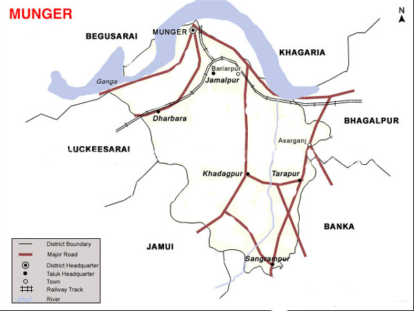 Munger District is located in the southern part of Bihar and its headquarters is located on the southern bank of river Ganges. Munger district occupies an area of 1,419 square kilometres (548 sq mi), comparatively equivalent to Russia’s Urup Island. Munger has seen five districts partitioned off from its territory: Begusari in 1976; Khagaria in 1988; and Jamui in 1991; Lakhisari and Sheikhpura in 1994. The district is currently a part of the Red Corridor.The Red Corridor is the region in the eastern, central and the southern parts of India that experience considerable Naxalite-Maoist insurgency..
How To Reach
By Air(Airport):-
Munger has a small airport with no commercial service and used only for VIP movements. Nearest domestic airport with commercial service is Patna airport around 180 km away.
By Rail :-
Munger city has two railway station Jamalpur Junction main rail head and purabsarai act as suburban Railway Station connecting Jamalpur to the city. Jamalpur Junction (code:JMP) is situated around 9 km from Munger city center. Munger is well connected to major cities of India .
By Road :-
Well connected to other city through National Highway -80 SH-22,72 Other road – Gaighat Sangrampur Road,Kharagpur Tarapur Road, Munger Jamalpur Road. The Munger Ganga Bridge is link Munger to various districts of North Bihar and north-eastern India.
Popular tourist destinations
MUNGER BLOCK
Bihar Kesari Pustkylay:- The foundation-stone of the building was laid on the 21st December, 1947 by Shri Jairam Das Daulat Ram, the then Governor of Bihar. The institution 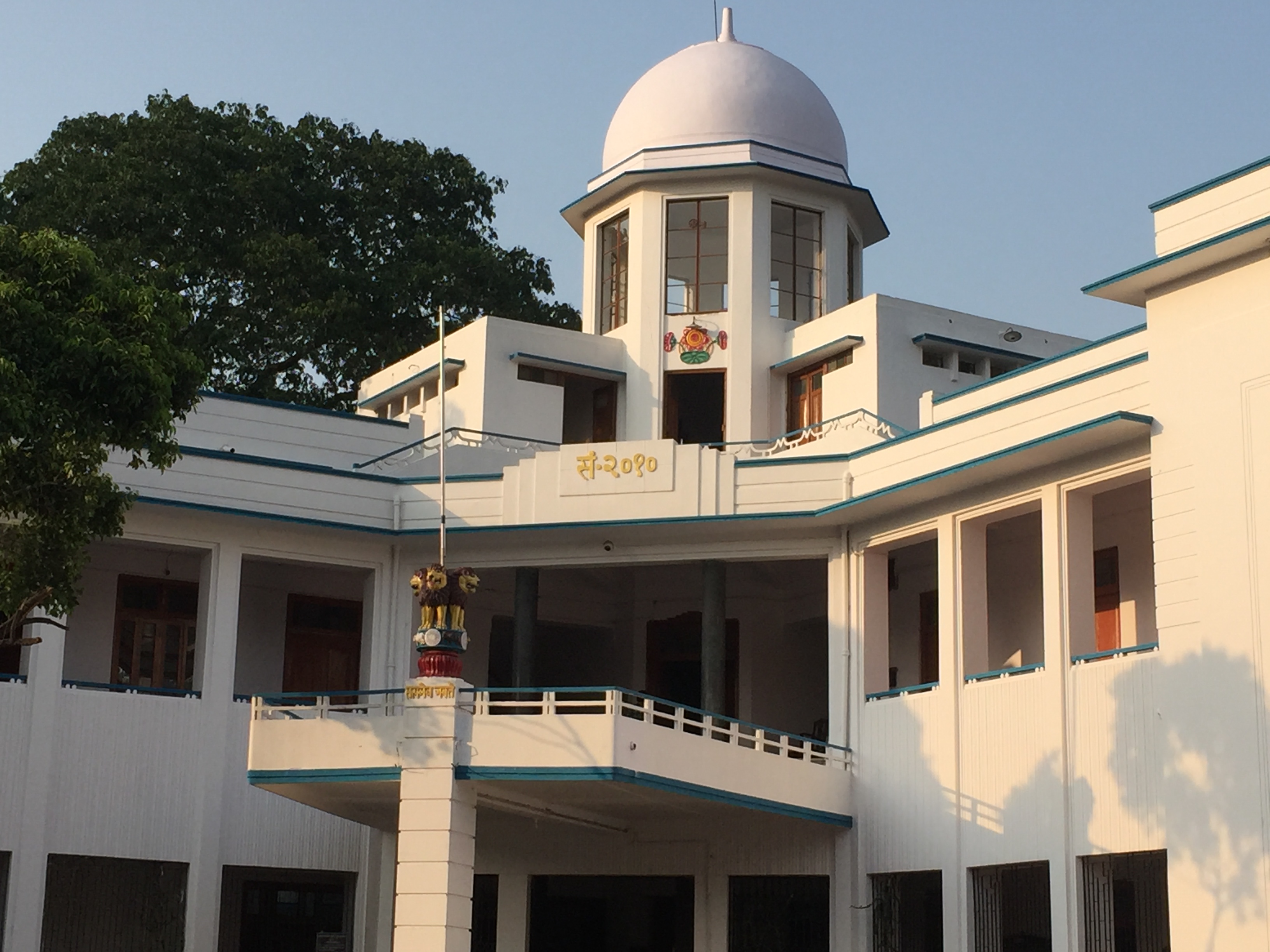 has also published a book “Sri Krishna Abhinandan Granth” which was presented to the Chief Minister, Dr. S.K.Sinha by Shri Purushottam Das Tandan in 1949. A big colection of books was donated by Shri Raghubar Narain Singh in the year 1949. The building was completed in 1953. The Pustkylay was formally inaugurated by Pandit Jawahar Lal Nehru on the 31st October, 1953. Dr. Sri Krishna Sinha has donated his personal library consisting of about 17,000 books to the institution (1959). As per counting of books done in 1983, there were total 69307 books in the library which are 26178 Hindi, 31865 English, 679 Bangla and 1387 Urdu, Persian and Arabic books.
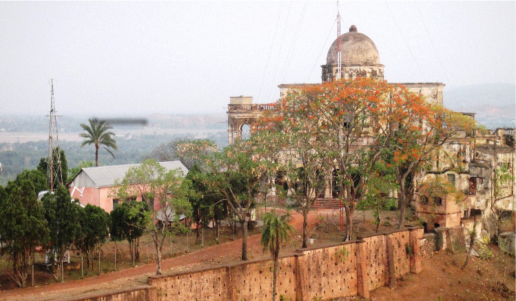
Munger Fort:- It is build on a rocky eminence projecting into the river Ganga which protects it from west and partly from the north, 
the extra sides being defended by a deep moat.The rampart was provided with four gateways, one on each side, and with circular or octagonal bastions, at regular intervals, carrying the usual battlements. Of the gates only the northern gate, called Lal Darwaza, is somewhat preserved, with some carved stones built into it, which originally belonged to some Hindu or Buddhist structure. The fort encloses an region of about 222 acres and has a route of 4 kms. Its history is not completely dated but it is believed that it was built during the early rule of Slave dynasty of India.
The Munger town where the fort is situated was under the control of Muhammad bin Tughlug of Delhi (1325-1351 AD).
The fort has two prominent hills called the Karnachaura or Karanchaura, and the other a built up rectangular mound deduced to be the
location of a citadel of the fort with historical links.
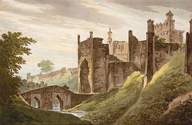
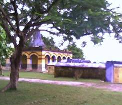
The fort houses a number of religious and historic monuments such as the Tomb of Pir Shah Nufa (died 1497), Palace of Shah Suja, Tomb of Mulla Muhammad Said (died 1704 AD), the Kashtaharini Ghat on the Ganges River, Chandisthana (an ancient temple) and an 18th century British Cemetery. In recent times, a famous School of Yoga has been established here.
(Old Painting Image of Fort)
Pir Shah Nafah Shrine :-In the present fort area the oldest building inside the fort is a sacred Muhammadan shrine. It is said that it was a mazar of a Pir or Saint whose name is still unknown. He is said to have traveled from Persia to Ajmer and from there came down to Munger under the instructions from Khwaza Moin-Uddin Chisti- the famous Sufi Saint and Lived at Munger for many years and also died here in 596 A.H, corresponding to 1177 A.D. He was buried in an obscure place near the ramparts and with the lapse of years exact burial place was forgotten. Ultimately, in 1497 A.D. when the ramparts of the fort being repaired by the Governor, Prince Danyal, who ordered a mosque to be built over that place.So since 1497 the particular place has been known as the Dargah of Shah Nafah.
.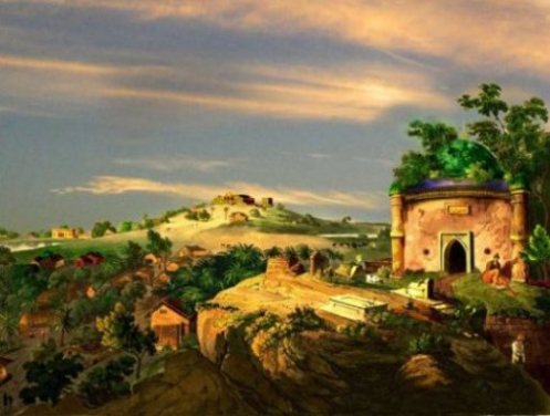 Over the gateway there is an inscription set up by Prince Danyal and a round the Shrine are many old tombs in a dilapidated state. There is a popular tradition that Prince danyal got a divine dream about the exact location of the Dargah of Shah Nafah. A hint was given to him that the Dargah existed where the earth gave out the fragrance of Nafah (Kasturi).
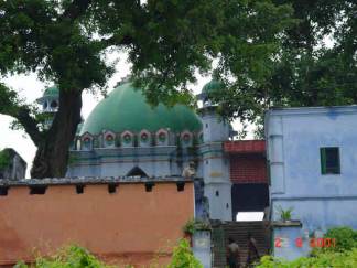
The building is raised inside the southern gate of the fort on the top of a small mound, about 25 ft high, which represents the ruins of some Buddhist structure. The building of the tomb consists of a domed tomb chamber with a prayer room or mosque and a shrine, are to be seen embedded in the low platform to the south of the tomb, and disfigured with unsightly holes or depressions made by those who believed in their efficacy to cure certain diseases of children.
(Old Painting Image of Pir Shah Nafah Shrin )
There is an inscription on the entrance of the Dargah which speaks:
“Bari Aalee Teri Sarkar Hai Nafah-Shah;
Mashaa-Allah Sakhi Darbar Hai Nafah-Shah.’
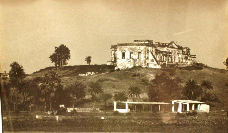
Palace of Shah Suja :- This building occupies as one of the finest sites inside the fort and has now been converted into a Jail. Though locally known as the palace of the Mughal 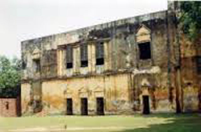 Prince Shuja. It is inferred to have been built earlier by Nawab Mir Qasim Ali, who also ruled from Munger. The building is enclosed by a high wall on three sides and by the river on the fourth or west side. It consists mainly of a Khas Mahal or Zenana Palace (now used as “the under trial ward”), the Diwane-I-Am or Public Audience Hall (now used as a school for prisoners), and the Top-Khana or Armoury with 10′ – 15′ thick walls (now used as the dormitory). There was also once a small mosque on the west side of the palace, now in ruins, but used as ration godowns. An interesting feature noted below the floor of the mosque is a dry well or pit of 10–12 feet (3.0–3.7 m) depth, which leads to several underground tunnels running in different directions. The well was, in earlier times, connected to the river through an opening, which has since been shored up.
Mullah Mohammad Sayyid Grave :-This is situated on the top of the bastion at the southwest of the fort. The Mulla was a Persian poet and had come to India from Mazandaran near the Caspian Sea, during the reign of the Emperor Aurangzeb, who employed him as a tutor to his daughter Zebunnisa Begum. He was a poet of repute and enjoyed the favours of Prince Azim-us-shan, Aurangzeb’s grandson. The poet died at Munger in 1704 on his way to Mecca and was buried there. His grave is within the fort. The Mullah died in 1704 A.D. and his tomb existed, till the early years of the 20th Century, when it was demolished and the grave removed. This information is based on the District Gazetteer. But it is seen that Buchanan, who visited Munger hardly hundred year after the Mullah’s death, says nothing of him, nor does Hunter mention him in his Statistical Account of the district.
Kasta Harni Ghat :- The Ganges river that flows in front of Munger is Uttar Vahini for which it has got great importance.There is a cluster of six temple. It is believed that in the 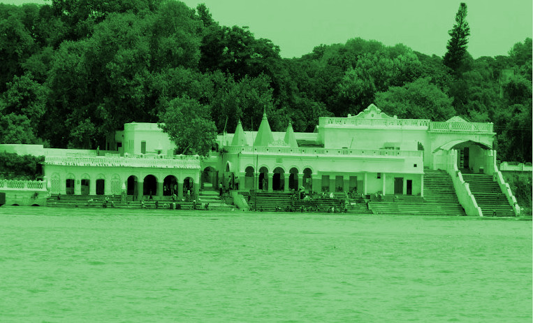
16th century A.D, a Hindu sage, named Mudgal Muni, appeared in the city and established two shrines, one at a rock at Kashtaharini Ghat. It is said that Lord Rama has rested here with his Consort Sita after crossing the stream on their way back from the encounter with Taraka, the demoness. The relaxation they had, gave rise to the name of Kashtaharini Ghat stands. It is believed that – One who takes a dip in this ghat receives solace and cure from bodily pains. The sanctity of the place may be of considerable antiquity, as is perhaps indicated by the inscription of the Gahadvala King Govind Chandra of Kanauj, which records a grant made by the king after bathing in the Ganges at Mudgagiri on the occasion of Akshaya Tritiya festival. On the wall of the gateway near the ghat is an inscription of about the 10th century A.D. which mentions the king Bhagiratha and the construction of a Siva temple.
(Old Painting Image)
Numerous carvings and sculpture have been discovered from this area by Bloch in 1903. An inscribed image of Dhyani Buddha bearing the usual Buddhist Creed is now in the Indian – Museum, Kolkata.
According to Jayaswal Research Institute Archaeological Explorations this site belongs to Early medieval period.
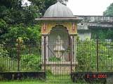
Chandi Sthan(Shakti Peeth):-Chandi Asthan, close to the Ganga and very close to it on the eastern side in the Samashan or cremation site, is just 2 one kilometer away from the 
Munger town. It is traditionally believed that left eye of the Sati fell at Munger,which subsequently developed into a place of worship of the Divine Mother Chandi.This spot, with the shrine thereon, is mentioned as Vikrama Chandi, which is, but a hole in a rock sacred to Chandi, the Gramadevata (the village deity) of the place and covered by a small building of brick. Among the different shakti piths Chandi Asthan is famous for the cure of eye troubles. Another legend connected with Chandi Asthan is regarding Raja Karna. He used to sacrifice himself by plunging in hot boiling oil in the karah. Mother Chand pleased by his devotional sacrifice used to make him alive as well as give him gold worth his weight.Which he donated among poors of the area. This is called Karan chaura.
During the 10 days of Durga Puja , Sannyasis and Tantriks come here from Kamakhya to perform their Tantric Siddhis. It is still a place where goats are sacrificed on every Tuesday.
According to Jayaswal Research Institute Archaeological Explorations this site belongs to Early medieval period.
Karnachaura :-
Inside of the Munger fort there is a natural rocky eminence called as Karnachaura associated with the Raja Karna. Buchanan mentioned that this king built a house on this hill. The ruins of which were occupied under the British by a saluting battery; but later General Goddard built the present bungalow on the site as the residence of the Commanding Officer, since it commands a fine view of the surrounding country. An old platform in front of the Bungalow near the hill are also locally considered to be the work of the king Karna and his wife.
(Old Painting Image)
Damdama Kothi :- Inside of the Munger fort there is another hillock, on the other side of the tanks, is an artificial rectangular mound which once probably formed the citadel of the fort. There is no ancient local name given to this hill, but it is stated that there once stood here a building known as Damdama Kothi which was demolished by the British, to make room for the Collector’s Bungalow. This Kothi was built of very strong masonry, for it had to be blown-up by gunpowder, bit by bit, since the ordinary methods of demolition could make no impression on it. While removing the debris from its site numerous holes were discovered showing the former existence of underground rooms. Inside a well in the compound, just above the water level, two arched passages were found, one leading towards the house and the other, in the opposite direction; towards the ground now occupied by the Jail. The Kothi would appear to be the work of the Mohammedan rulers, raised perhaps on still earlier Hindu ruins, as would be evident from the traditional association of the nearby tanks and the Karan-Chaura Hill with the earlier rulers of Hindu tradition. It may be pointed out that Buchanan noticed on the inside of the rampant of the fort, at points where the plaster had fallen number of stone carving and sculptures, built into the masonry.
British Cemetery:- It is a cemetery of 18th century.
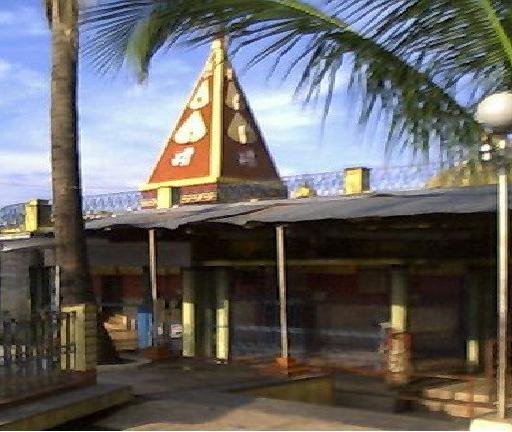
Bihar School of Yoga:- It is about 172 kms from Patna. It is situated within the Ganga Darshan Complex in Munger. It is founded by Swami Satyanand Saraswati in 1964 to impart traditional Yoga teachings to the world is headquartered inside the Munger fort. Apart from providing spiritual instruction to candidates, the school undertakes yoga projects and medical research in association with other agencies. It is the World’s first Yoga University and a deemed university. It attracts students from all over the world.
It is on the top of a hill overlooking the river Ganges and is pinpointed to become a spiritual oasis in the technological desert of the 21st century. Being unparalleled center of International repute for learning of the Indian Yoga Science, it offers scholars, scientists, doctors and Yoga aspirants from all over the world an opportunity to work together in order to formulate a scientific basis for the integration of Yoga into modern society.
The eternal flame, Akhand Jyoti, that Sri Swamiji lit fifty years ago in Munger continues to burn bright in Jyoti Mandir.
Indoor stadium-cum-auditorium and museum:- Chief minister Nitish Kumar inaugurated the newly-constructed indoor stadium-cum-auditorium and museum each entailing an expenditure of Rs 3.5 crore inside the fort area on Thursday 23 May, 2013 noon during his ‘Seva Yatra’ of the district. The Chief Minister was the first one to write in the guest book.
The museum has housed several prehistoric idols and artifacts. It has housed several ancient idols of Lord Buddha, Lord Ganesh, besides a large number of gods and goddesses. The history of Munger is on display. The display also shows the various battle fought at Munger by the Indian nationalist rulers including Mir Qasim and others during the British rule.
Sri Krishna Vatika :– In the name of First Chief Minister of the Bihar state Dr. Sri Krishna Sinha, is a very beautiful enclosed garden just opposite to Kashtaharni Ghat. To have the pleasure of both a green place and the holy river Ganga it is one of the most beautiful visiting place for the tourists. Sri Krishna Vatika has also one of the most interesting as well as adventurous venue available, as it has two “Surangs” (tunnels) also known as- Mir Kasim’s Surang
.
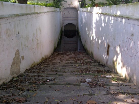 Some efforts in the past had been made to pass through the tunnels but these have only proved to be life taking. There are tombs of Princess Gul and Prince Bahar, wards of Mir Kasim Ali.It is said that Princess Gul and Prince Bahar used to hide under the tunnels by the river side in order to weak vengeance upon the British officers. They used to clothe themselves with tiger skins during the nights. Once Bahar, on his rounded in a dark night was caught sight of by a British officer who instantaneously shot the Prince dead. The truth was revealed next morning and the Prince was said to have been buried by the dargah of Pir Shah-Nafah-Gul. The Princess Gul was found dead in a man’s attire by the side of her brother’s tomb, where she was also buried. The officer, responsible for Bahar’s and incidentally Gul’s death ordered for a daily salute of guns in the evening to mourn the loss of these children.
Bindwara:- As per exploration done by KP Jayaswal Research Institute marked Period of site as Early medieval. Sandalpur:- As per exploration done by KP Jayaswal Research Institute marked Period of site as Early medieval. Hazi Sujan:- As per exploration done by KP Jayaswal Research Institute marked Period of site as Medieval. Sojhi Ghat:- As per exploration done by KP Jayaswal Research Institute marked Period of site as Early medieval. Shivganj:- As per exploration done by KP Jayaswal Research Institute marked Period of site as Early medieval. Shiv Temple ( Kankar Ghat):- As per exploration done by KP Jayaswal Research Institute marked Period of site as Early medieval. Babua Ghat:- As per exploration done by KP Jayaswal Research Institute marked Period of site as Early medieval. Hasanganj:- As per exploration done by KP Jayaswal Research Institute marked Period of site as Early medieval. Quilla (Company Garden):- As per exploration done by KP Jayaswal Research Institute marked Period of site as Early medieval. Maksuspur:- As per exploration done by KP Jayaswal Research Institute marked Period of site as Early medieval. Lal Darwaja:- As per exploration done by KP Jayaswal Research Institute marked Period of site as Early medieval. Purani Police Line (Munger):- As per exploration done by KP Jayaswal Research Institute marked Period of site as Early medieval. Jail Campus (Munger):- As per exploration done by KP Jayaswal Research Institute marked Period of site as Early medieval. Neem Talla:- As per exploration done by KP Jayaswal Research Institute marked Period of site as Early medieval.
Sita kund (Kalyan Chak):- A village about 6 Kms East of the Munger town, contains a hot spring known as the Sita Kund, besides this there is a Hindu temple
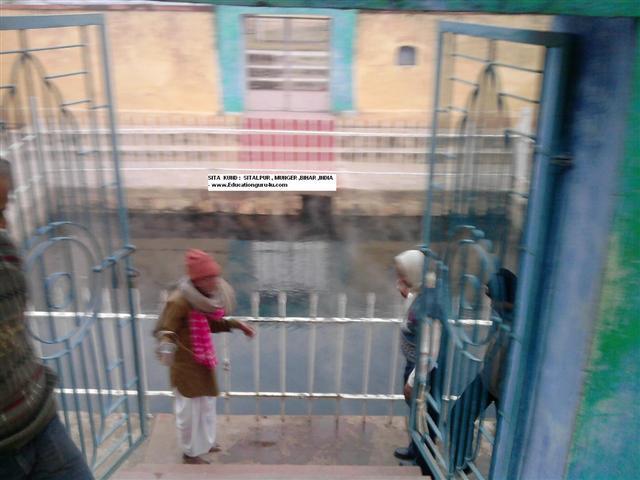
 and to the north is a reservoir of cold water, known as Ramkund, while to the west there were three more kund called after the three brothers of Ram, namely Lakshman Kund, Bharat Kund, and Shatrughan Kund. According to mythological story Ram, after rescuing his wife Sita from the demon king Ravan, Ram to satisfy all public opinion asked Sita to prove her chastity , and Sita, agreed to the Agni Pariksha and enter into a blazing fire. She came out of the fiery ordeal
 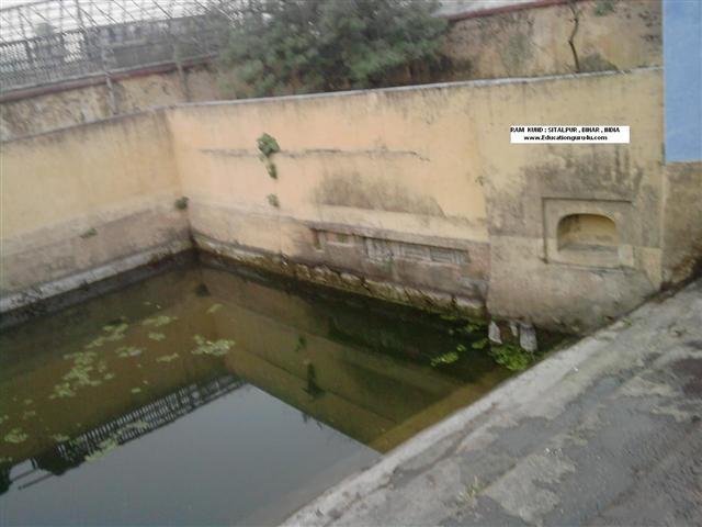 unscathed, and imparted to the poun in which she bathed, the heat she had absorbed from the fire. The hot spring is now enclosed in a masonry reservoir and is visited by large number of pilgrims, especially at the full moon of Magh.The water is beautifully clear and limpid, and sends up numerous bubbles from its rocky bed. The temperature of this spring varies in a remarkable manner and goes to the highest of 138o F and even above. A big mela is held every year on the occasion of Maghi Purnima since the days of Ram.
According to Jayaswal Research Institute Archaeological Explorations this site belongs to Early medieval period.
Sita kund Fall :-
Manpatthar (Sita Charan):- The rock is situated about a kilometer off from the fort very close to Kastaharni Ghat. It is a rock, 250 meter long and 30 meter wide, in the bed of 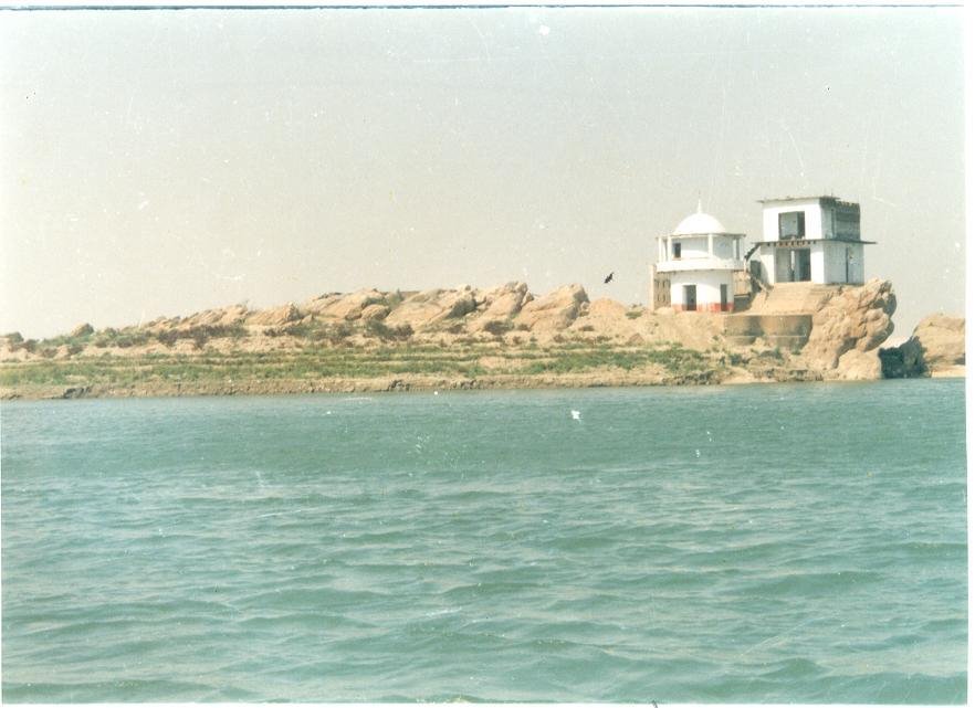
river. On this rock one can find the impression of two feet believed to be the foot prints of Sita who had touched the rock while crossing Ganga.The rock is called locally as Manpatthar and contains small temples also.
Dariapur (Pir Pahari):-Dariapur is about 6 km of the Munghyr Town. It has a hill called Pir Pahar on the name of an old 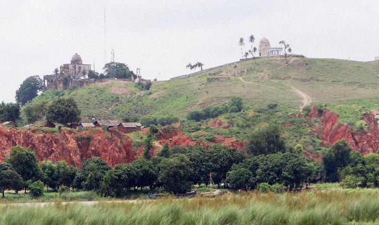
Mohammedan saint, from the top of which offers an excellent view of Monghyr and its surroundings. There is a grave of this saint on the hilltop,whose name is no longer remembered, though devotees occasionally come to worship at his grave, now in ruins. There are two old tombs side by side at the foot of the hill. On one of them has an inscription to the memory of one Mary Anne Beckett, who died in 1832, while the other has a damaged inscription showing, till a few years ago, that it is in memory of a person named Only; the portion containing the name has now disappeared.The former is somewhat unconventional in form and character, consisting of a mausoleum surrounded by four walls open to the sky, and has a memorial tablet inserted in the northern wall, with the uncommon and not unaffecting inscription “Be still, she sleeps”. It is not known who was Mary Anne Beckett , but several legends are current about the manner in which she met her death. One is to the effect that she was a young girl who was killed when riding down the hill, another is that she threw herself down the hill owing to some love trouble. Another account says that she was the Kashmirian wife of a Colonel Beckett. Nothing is known about the person to whom the other tomb was erected, but Sir Warren Hastings D’Oyly, formerly Collector of Munger, to whom a reference was made, states that it is possible that he or she was a relative of a D’Oyly, who was formerly an indigo planter in the district. The inscription which is now obliterated shows that he or she died in 183-, i.e., between 1830 and 1840.
On the top of the hill there is an old house which may be identified with the residence which, according to the Sair-Ul-Mutakharin, was erected for himself by Ghurghin Khan, the Armenian general of the Nawab Kasim Ali Khan. This is referred to in the Sair-Ul-Mutakharin as the house on the hill of Sitakund, though the sacred springs of Sitakund are two miles away and we learn that when Vansittart, the Governor of the East India Company, visited Munger in 1762, it was assigned to him for his residence. Thirty years later it appears to have been known as Belvedere and a pleasing description of it is given by Mr. Twining in “Travels in India a Hundred years ago”. Former Collectors of Munger resided in this house, which commands one of the finest views one can obtain along the Ganga. Both house and hill are now the property of the sons of the late Babu Upendra Nath Mandal of Chandernagore. Close by, on the summit of another small hill, is a house belonging to Babu Ram Lal Mukherjee, a public-spirited Bengali gentleman, who placed a large sum at the disposal of Government for the relief of the distressed in times of famine and flood.
According to Jayaswal Research Institute Archaeological Explorations this site belongs to Medieval period.
Doordarshan unit:- The Pirpahar estate earlier owned by the Tagores in Munger. The history of two houses in the Pirpahar is steeped in memories of Tagore. At present, it houses a Doordarshan unit. The other property associated with the poet here is the house of the Srish Chandra Majumdar. Present owners of the house have no sentiment for this property and have allowed it to fall into a dilapidated condition.
Gurdwara Pakki Sangat(Piparpanti):- It is believed that the father of Guru Govind Singh, Sri Teg Bahadur jee, the 9th Guru, in route to his journey to Assam to settle a dispute, had chosen to stay, at Munger in a temple on the Piparpanti road just opposite the Dak-Bungalow for a few days on Magh 1724 Vikrami. It was during his stay here that he got the news of the birth of Guru Gobind Singh. Raja Ram Singh was selected by Aurangzeb during his 10th year of his rule to lead a contingent of army to Assam, had met Guru Teg Bahadur at Munger. He requested the Guru Teg Bahadur to accompany him to Assam and he agreed to go there along with him. It is on record that from here he had written a letter to his wife, who was then at Patna awaiting the delivery of a son, who subsequently, became famous as Guru Gobind Singh jee. This temple converted into gurudwara is gaining importance for the local Sikh population. Its old building also damaged badly by the 1934 earthquake was, however, rebuilt within a year. It is a rectangular room with a verandah in front and is served by Brahman priests. Two relics, a cot and a pillow said to have been used by the Guru during his stay here, are kept in the same room where Guru Granth Sahib is seated.
Goenka Sivalaya ( Machchli Talab):-It is one of the most beautiful places of Bihar that deserves frequent visits from tourists.Being one of the oldest, it is one of the important 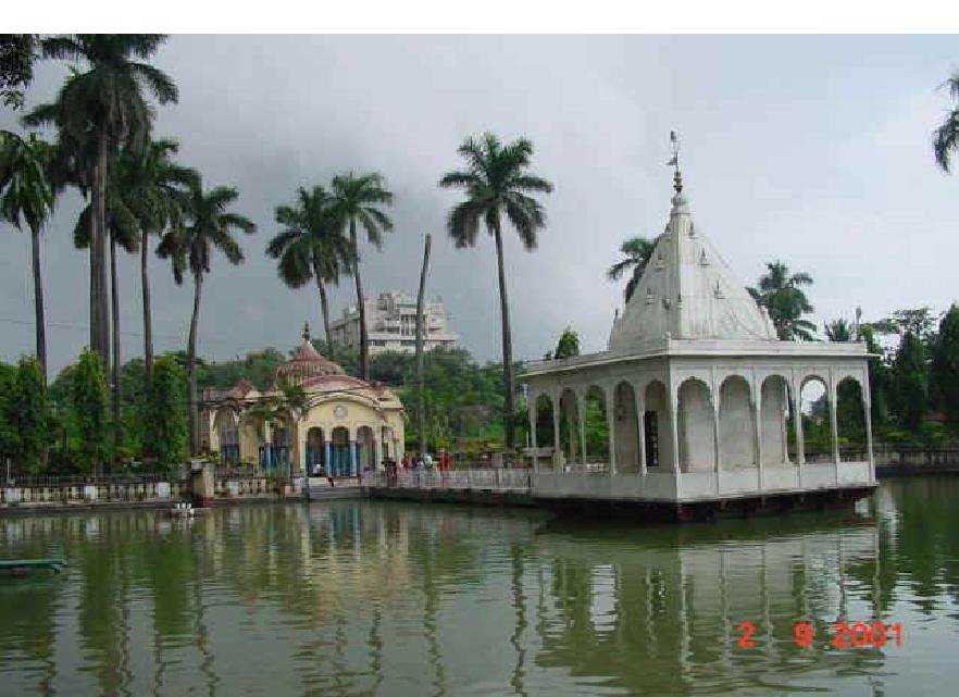
religious places for Hindu pilgrims. The Shiva temple is built in the midst of a big water tank, which is full of big and beautiful fishes. A rock-solid bridge road of white marble joins it from the main campus. Around the temple a very beautiful garden with flowers and greeneries are kept fully maintained.
Baptist Mission :- Munger has also been famous from the point of view of christianity with a large number of christian population here. According to the district Gazetteer of 1909 the Baptist Mission is said to have been established at Munger in 1860. The translation of Hindi New Testament at present in use in different churches is the work of one of the Munger Missionaries. This hindi translation was published from Calcutta in 1884. There is a reference to one Baptist Missionary named Andrew Leslie who came to India in 1824. and was posted at Munger and died in 1870. There is also a reference of that another Baptist Missionary called John Parsons, who was associated with the Hindi translation of the New Testament came to India in 1840 was stationed at Munger and died in 1869.
The cemetery:- The cemetery towards Sita kund has the grave of Baptist Missionary Johan Parsons and it is mentioned on grave that he had made the Hindi translation of THE NEW TESTAMENT. This received Persons was born at Loporton, Sommerset (England).The inscription of the grave, thus, indicates that it was probably Persons and not A.Leslie who made the first hindi translation of new Testament which is in the use.
The cemetery has also the grave of Hershchell Dear born at Dobrz-you (Russian Poland) who spent most of his life at Munger. He died in October 1887 at Mussoorie, his remains were brought and buried at Munger. Dear was famous for his charities for the different institutions existing at that time.This cemetery has also the grave of major General charles Murray.Born in Landon in 1827 he had served the Gwalior Campaign (1843-44), Punjab Campaign (1848-49), Battle of Chaianianwala , Kohat Expedition Insurrection of 1857 and Bhutan wars. Charles Murray was a resident in Munger from 1871 till his death in Munger in 1893 both Mr. Dear and Murray contributed largely to the development of Munger and some of the existing residential quarters in the fort area remind us of there name and contributions.
Safiabad- Mirza :– Mirza Safiy retitled Saif Khan, was the husband of Malka Banu, eldest sister of Mumtaz Mahal, the lady of the Taj. When Saif Khan became the Governor of Bihar in 1628 A.D. he undertook construction of public utilities. Peter Mundy speaks very highly of them. The inception of safiabad township near Jamalpur and Safina Sarai and a big well in Munger are commonly attributed to saif Khan.
Gun Making Industry- In Medieval India very few cities like Agra and Munger along with some others had expertise for the manufacture of firearms. It was done quite efficiently during Shershah. It was of course banned by Mughal Emperor Akbar. However some times after Agra lost this industry but Munger technicians kept alive their traditional industry. The gun manufacture facilities to be a factory for the selection of Munger by Mir Kasim Ali as his capital. Previously, here cannon were made at Topkhana Bazar but subsequently it came to Guns firstly like ML Guns and then to capped gun. Gun manufacturing got fresh impetus during Mir Kashim regime. Till the Shifting of the factories to the jail Campus it was being done at Chuabag and Kasim Bazar. Britishers banned the use of guns by private persons by enforcing Acts viz. Act 18 in 1841, Act 30 in 1854. its manufacture was then also banned by Act 28 of 1857, then up to 1860 by Act 31 of 1860.
In 1879 New Arms Act came into existence on 6th March, 1879 and provisions were made for the manufacture of guns under licenses scheme. The then Collector Mr. Lee highly appreciated the craftsmanship of the gunsmiths of Munger, who were selling their Gun only for Rs. 10 only despite their inseparable condition.
During the First world war period the Munger Gun manufacture again came into prominence and production of cartridge gun was also developed. Munger was perhaps the only city in India where gun manufacturing took the shape of a cottage industries and became popular profession.
I.T.C. Ltd.:– The present I.T.C. factory, which is popularly known as the Chatkal or Cigarette factory, is one of the biggest tobacco factories of India and its big campus cover an area of 17.38 acres. The factory was built at Basudeopur, 1.5 miles from Munger Station. Presently, this factory is a unit of multinational British-American Tobacco Company (BATCO). It was Started by the Peninsular Tobacco Company on 6th November, 1907 in Munger, presumably because of its proximity to a suitable Tobacco cultivating area and also due to the availability of transport facilities by rail, road and river. It commenced its manufacturing operation in the year 1908. In 1910, the Imperial Tobacco Company of India limited came into existence as a private company, as a selling and distributing organization. On 12th December 1925, a printing factory was also set up for the printing needs of this factory. In 1928, the Peninsular Tobacco Company went out of business in India and its Cigarette production activities were taken by the Tobacco Manufacturing (India) Ltd., While Printers (India) limited took over the printing business in Munger inside the factory campus itself. After the great damages during 1934 earthquake, the factory received certain renovation and reorganization.
Shah Mustafa Sufi’s Grave( Dilawarpur):- The quarter known as Dilawarpur contains the residence of a leading Muhammadan family known as the shah family. It traces back its descent to Hazrat Maulana Shah Mustafa Sufi, a man of great learning. Who was a native of Seistan in Persia. The fame of his learning reached the ears of Akbar, who invited him to his court in Delhi, where Akbar marched south to crush the rebellion of the Afghans in Bihar and Bengal, he was accompanied by Shah Mustafa Sufi, who distinguished himself in the field and made it clear that he possessed supernatural powers. Hearing of the holy life led by a saint of Munger, called Hazrat Shah Allahabad Arafin, and of the miracles he wrought; he gave up the idea of worldly career and came to Munger to meet the saint. As soon as Shah Mustafa Sufi looked upon the saint, he become insensible, and when he revived, found himself in possession of divine secrets. He became the disciple of the Hazrat, who made him Sajjada-nashin, and on his death in 1050 A.H. (1650 A.D.) he was buried in Dilawarpur, where his tomb can be be seen. His descendants still reside at Dilawarpur.
Khanquah Rahmani:- It was established in Munger in 1901 by the eminent scholar Hazrat Maulana Mohammad Ali Mungeri (R.A.), for the reformation of societies and 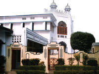
purification of souls following the order of his Shaikh Hazrat Maulana Fazl-e-Rahman Ganj Muradabadi. Following his order, Maulana Mungeri left his birthplace of Kanpur, U.P and migrated to Munger and established the Khanqah. Since its inception, by the mercy of Allah, the Khanqah has witnessed numerous transformed souls who have found peace and tranquility in the message of Islam. People come here to take a solemn pledge (bay’ah) to abandon sins, believe in the Islamic creed and follow Islam, by being kind and just to one-selves and to fellow human beings.
Rahmani Foundation:- A Non-Governmental Organization (NGO) was established in 1996 by Hazrat Maulana Mohammad Wali Rahmani Sahib to formalize various charity work of the Rahmani Mission. Since its inception it has been active in the fields of Public Health, Education, Social Justice, Environment and others. Hundreds of education centers, vocational training institutes and healthcare centers are run under the auspices of the Rahmani Foundation.
Jamia Rahmani:- It is among the most prominent sites of Islamic learning in India and over the past century has played a pivotal role in Islamic education and produced 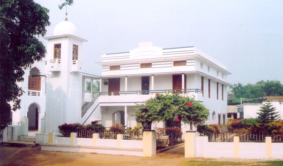
graduates that have been internationally recognized for their intellect and service to mankind. This institution has also played a crucial role in the development of the Madaris and other educational institutions and their curriculum not only in the states of Bihar, Bengal, Orissa but rather India as a whole. This Madrasah turned Jamia was established in the year 1927 by the eminent scholar Hazrat Maulana Mohammad Ali Mungeri (R.A.), the founder of Nadwatul Ulama, Lucknow.
TARAPUR BLOCK
Shiva Temple (Rangnath):- Tarapur police-station has a Shiva Temple called Rangnatha. A big mela is held on Shivaratri day and it continues for five days. This police-station is situated on the road to Bhagalpur.
Bishai:- As per exploration done by KP Jayaswal Research Institute marked Period of site as Early medieval. Narainpur Dih:- As per exploration done by KP Jayaswal Research Institute marked Period of site as Early medieval. Jamunagarh (madhura):- As per exploration done by KP Jayaswal Research Institute marked Period of site as Early medieval. Ratneshwar Nath temple (Rangaon):- As per exploration done by KP Jayaswal Research Institute marked Period of site as Early medieval. Tarapur:- As per exploration done by KP Jayaswal Research Institute marked Period of site as Late emedieval Shahid Smarak (Thana Chauk, Tarapur,tamtam stand):-
Ulta Mahadev Mandir (Tarapur, Main Market):-
Krishna Kali Bhagwati (Dhouni):-
Tildih temple (Haribanspur):- Teldia Mandir stands with pride for over Hundred years. It is known for its special worship based on Bang la Tantra Vidhi. It is widely believed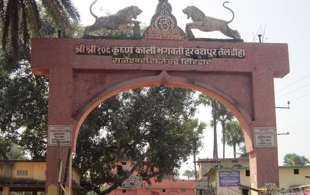
that parents willing for a child gets their wish fulfilled.
Sandi Prachin Shiva mandir:-
Gajipur:-
ASARGANJ BLOCK
Dhol Pahadi (Asarganj):–
Brahmankur sthan (Dhol pahadi, Asarganj):-
Asarganj:- As per exploration done by KP Jayaswal Research Institute marked Period of site as Late medieval. Jalalabad:- As per exploration done by KP Jayaswal Research Institute marked Period of site as Late medieval
SANGRAMPUR BLOCK
Sangrampur:- As per exploration done by KP Jayaswal Research Institute marked Period of site as Late medieval
Teghda Pahad( Sangrampur):-
TETIHA BAMBOR
Raja Rani Talab:- As per exploration done by KP Jayaswal Research Institute marked Period of site as Medieval. Dewghara:- As per exploration done by KP Jayaswal Research Institute marked Period of site as Gupta
KHARAGPUR BLOCK
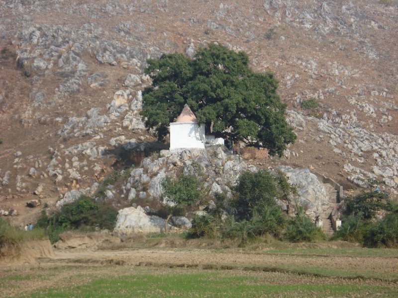
Deoghar :- This is a village in Sangrampur named after the Deoghara hill situated off the Sangrampur-Gangta road in Kharagpur block . There is a small masonry temple of Lord Shiva at the summit of the hill, which is approachable with some difficulty. Another, stone and brick built temple is located at a lower height.A big mela is held in Fagun on Shivaratri day and it continues for three days.
Maruk:- A hill in the Kharagpur subdivision, situated in Kharagpur Hills 13 miles south of Munger. An interesting account of the hill is quoted in an article on the Kharagpur Hills by Captain Sherwill. The origin of the name Maruk is not known, but it is probably so called after the maharuk tree (Ailanthus Excelsa). An ideal picnic spot but hardly used.
Ucheswar Nath :-In Kharagpur area, there is a very important temple of Lord Shiva which is famous as Ucheswar Nath . It is also important for Santhals and a public fair is held here,where is Santhal boys and a girls marry, according to their tribal custom.
Rangnath Pahar (JMaghaiya):- As per exploration done by KP Jayaswal Research Institute marked Period of site as Early medieval. Thana Road (Hawali Kharagpur):- As per exploration done by KP Jayaswal Research Institute marked Period of site as Early medieval. Kharagpur:- As per exploration done by KP Jayaswal Research Institute marked Period of site as Late medieval. Muluktanr:- As per exploration done by KP Jayaswal Research Institute marked Period of site as Early medieval. Dariapur:- As per exploration done by KP Jayaswal Research Institute marked Period of site as Medieval.
Bhimbandh:- While during Mahabharata period, after being defeated by Kauravas in Chaupar the Pandavas had to live in unknown places and in disguise at several places in jungle .This site Bhimbandh is one of such places. There are big stone slabs near hot spring stream.It appears as if somebody has kept these slabs to cross the stream.But hear say is that Pandawas while in disguised period helped the villagers by damming a stream which was flowing with high velocity. Bhim being physically most capable the dam was named after his name.These stone slabs are remnant of the same dam. Presently it is known for its hot spring It was called green forest in 7th century AD. as mentioned by Hiuen Tsang in his tour diary.
The site under mention has hot springs at 6 places in the valley portions and at the foothills, namely Bhimbandh, Rishi kund , Rameshwar kund, Shringi rishi kund, Hingania and Bharari stream. All the hot springs maintain nearly same temperature round the year, and seasonal fluctuation of discharge is also nominal. Among them the Bhimbandh group of springs have the maximum temperature (52° C to 65° C) and discharge (0.84-1.12 cum/sec) and constitute the best area for the exploration of geothermal energy potential.
All the thermal springs of sanctuary have a common geological frame. The spouts issue from the contact of massive quartzites (jointed and crushed) with states and phyllites (Kharagpur Group).
All the springs are situated at topographic lows within the quartzite. The aqueducts formed due to fracturing are long and narrow zones of fissures and broken rocks.
Bhimbandh Sanctuary(Kharagpur Hills):- It is situated between the Kharagpur hills of Munger and hills of Jamui The Kharagpur hills have been notified as Bhimbandh 
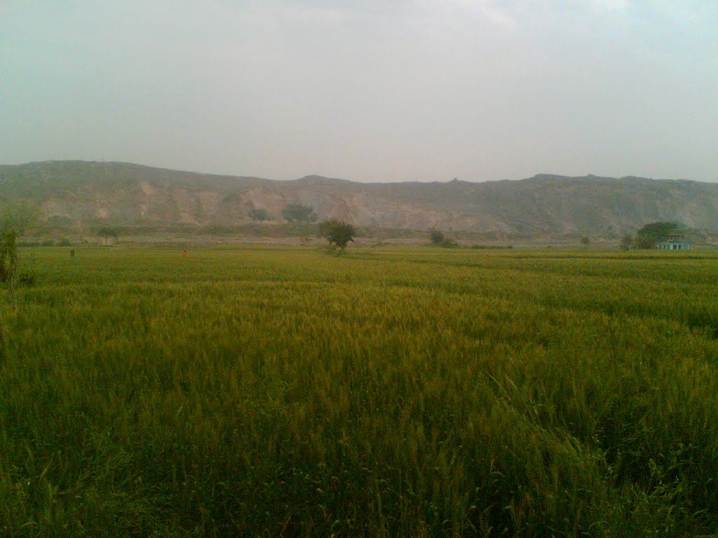
forest life sanctuary since 1976. It is located in the south west of Munger at a distance of 56 km. The forests cover an area or 681.99 sq.km. The vegetation of these forests is very rich where Sal, Kend, Semal and other trees grow side by side the hilly terrain, protecting from the sun’s rays the forms and humble creepers which grow below.
A host of animals such as Tiger, Leopards, Sloth Bear, Nilgai, Sambhar, Barking deer, Wild Beer, four hornedAntelope use to abide by in these forests.
Rameshwar kund:- It is situated in Kharagpur police station on the north-west corner of the khargpur lake.The legend goes that during the Muslim invasion one of the General camped at this site and dug the earth for water and accidentally a hot water spring came out.
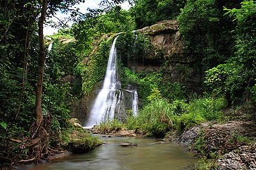
Haha Punch Kumari:- It is the westeen side of Rameshwar kund. It is a waterfall coming from the hills with straight drop. The natural scenery is beautiful. This fall is named after the five girls of Hindu Raja of Kharagpur whose daughters committed sucide by jumping from the hill top to escpe capture by the Muslim invders.
Sawa lakh baba:- The site is situated between Lakshmipur and Bhimbandh. A deity who is worshiped by local Kora,Rai,and Khaira,Naia,Hansda, Hembram and Murmu etc scheduled tribes.
Morbana hill:- National bird peacock is seen here in open field
Malnipahar:-A hill in the Kharagpur subdivision, situated in the Kharagpur Hills about seven miles north-east of Bhimbandh. There are several springs, known as Janam Kund, at the bottom of the hill, which form the source of the Anjan River. One spring, which issues at all seasons of the year directly from a crevice in the rock, is apparently that of which the temperature was tested by Buchanan in 1811. Mr.V.H.Jackson, making tests at different seasons, has found that its temperature varies from 147.2` to 149`. A second series of springs, the existence of which was suspected by Buchanan, was discovered in 1912. These occur along the bed of the Anjan for about 150 yards, at a quarter of a mile from the source. Their highest temperature yet observed is 140.
Rishikund:- It is situated about 6 km south-west of Ratanpura railway station and about 30 km north-west of Kharagpur 10 km south of Sitakund at the head of a picturesque little valley between two ridges of the Kharagpur Hills. It is a hot water spring. It has been made a place of worship and a reservoir, about 140 feet square, has been built to collect the water. The bottom is in some places sandy, in others rocky; and the water seems to issue all along the western side from numerous crevice in the rock. Bubble rise from the whole extent of the pool near the hill, and where the gas issues from among sand is formed cavities like minute craters. According to observations taken by Buchanan on the morning of the 8th April, 1811 the thermometer in the air stood at 720 in the water where it issued from the crevice of a rock, it rose to 110o, and one of the cavities to 114o.Every year in the Malmas, a big mela is held which has a religious sanctity.
Bhaduria-bhur :- There is a hot spring about 3-kms from Rishikund, on the other side of the Kharagpur range of hills, not far from the village of Dariyapur in the Jamalpur P.S. The name means the cleft of Bhaduria Hill, and the spring is much cooler than the Rishikund spring of which it is locally believed to be a branch. It emerges at the foot of the Bhaduria Hill from among masses of quartzite rocks, accompanied by a free discharge of gaseous bubbles, devoid of smell and uninflammable. Men and cattle drink the water of this hot spring. Its temperature goes up to 98.5o F.
Buddhist Ruins :- A little below the southeastern side of the summit of the solitary hill near the village is a spot as Lorik-ka-ghar. It is surrounded on three sides by vaguely columnar rock, slightly suggestive of rude walls. Lorik is one of the most famous legendary heroes known to the folklore of Bihar. Col. Waddell, however, identified the spot with the house of the man-eating Yaksha – Bakula – of the Buddhist tradition, which claims that Buddha ultimately converted the Yaksha. Hiuen-T-Siang, the Chinese traveler also refers to this tradition and to the stupa, which was erected, to mark the spot of conversion. In further support of his view Waddell mentions the prevailing worship of the image of Ban-Bakura-Nath or Savage Lord Bakura at the village Jalalabad 12-kms away. The other Buddhist ruins discovered by Waddell on the same hill, which are referred, to below, also tend to confirm Waddell’s identification.
Buddhist Monastery site at northeastern foot of the hill :- The rocky spur of the hill on this side is seen divided into various terraces, which were seen littered with bricks, pieces of Buddhist images, hewn stones, door-lintels and frames etc. The mounds of ruins are locally known to represent the site of the fort of King Indradyumna, the last Hindu king of the region ruling at the time of Mohammedan invasion. The ruins cover a very extensive area.
The rock carvings near the Stupa site :- Nearby the stupa some figures of stupas or chaityas of most elaborate patterns on the rock was observed, supplemented in some cases with figures of lota or water vessel, the latter being very specially and prominently displayed. These are besides on the rock, other carvings representing some religious marks and emblems.
Stupa ruins near the footprint mark:- At a short distance from the above spot, there is a small brick mound with traces of thickly plastered walls. It appears that on the top of the mound a Hindu shrine was built in later times, the traces of which were also observed by Col. Waddell. According to Waddell this was the site of the stupa, which marked the spot of Bakul’s conversion by the Buddha.
Basauni Shiv Kund:-
Church(Basauni):-
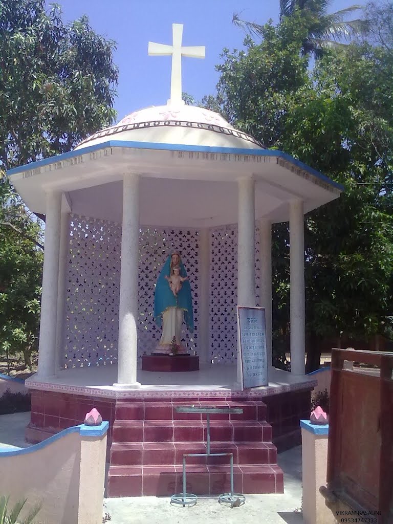
Dholakia Hill(Basauni):-
JAMALPUR BLOCK
Kali Pahar:- A small hill Situated in the village Ashikpur just south of The Jamalpur Town. It is a favorite picnic spot.
Jamalpur Railway workshop :- The Railway age in Eastern India started on August 15, 1854, exactly ninety-three years before Independence. A locomotive, carriage and wagon 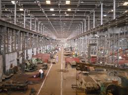
workshop was set up in Howrah to put to commission imported rolling stock of EIR and also to render economic repairs to them. The railways spread very fast, perhaps faster than the anticipation of EIR. Within a short span of eight years, it became necessary to shift the site of shop, as there was hardly any scope for expansion at Howrah.The British chose Jamalpur as the new site of this workshop due to ready availability of skilled workers who were descendants of acclaimed gun makers and fabricators of weapons of steel for the Nawabs of Bengal and Orissa. Jamalpur is also geographically well located, on the western side of a hill range while the Ganges flow 7 KMs north of it. It was founded on 8 Feb 1862.
The workshop has a number of FIRSTS to its credit, a few of which are: –
The FIRST to manufacture a steam locomotive and a locomotive boiler- 216 of which were manufactured between 1899 and 1923.
The FIRST to have set up a rolling mill not only on the railways, but probably in the country in 1870.
The FIRST to establish a railway foundry in the year 1863.
The FIRST to manufacture a rail crane in the country with indigenous know-how in 1961.
The FIRST to manufacture high capacity electrical lifting jacks and ticket printing, ticket chopping, ticket slitting and ticket counting machines.
The FIRST and the only railway workshop to manufacture electrical arc furnaces of ½ tonne in 1961 for production of steel castings.
This is the only workshop in the country manufacturing 140 T ART cranes for Railways to-day
Jamalpur Workshop has the proud privilege of being the only railway workshop , where broad gauge cranes for railway’s use are manufactured. This is the only railway workshop where large, microprocessor controlled 140-Ton capacity break down cranes for Indian Railways are manufactured indigenously with very little import content.
This is the only workshop in Indian Railways to have been equipped with its own 5 MVA power house.
The first to manufacture a steam locomotive
(The first one, CA 764 ‘Lady Curzon’, was produced in 1899.) at a cost of Rs. 33,000/- which served for 33 years. The manufacture of Steam locomotive was stopped in the year 1923 .
Jamalpur Workshop built 216 locomotives and locomotive boilers – between 1899 and 1923. The first to have set up a rolling mill not only on the railways, but probably in the country in 1870.(now closed)The first to establish a railway foundry in the year 1893.
The first to build a rail- travelling crane in India with indigenous know-how in 1961.
The first to manufacture high capacity synchronised electrically operated lifting jacks popularly known as “Jamalpur jacks” in 1962 and ticket printing, ticket chopping, ticket slitting and ticket counting machines.
The first and the only railway workshop to manufacture electrical arc furnaces of ½ tonne capacity in 1961 for production of steel casting
‘The Express’ – the sister of ‘Fairy Queen’ built 1855.
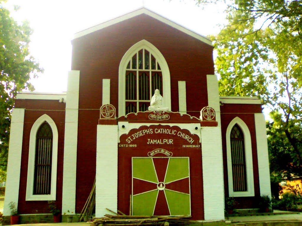
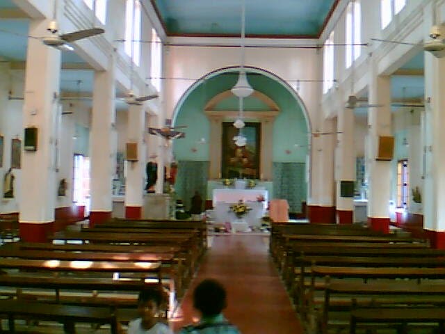
St Joseph’s Catholic Church:-
Jamalpur Railway Colony Temple :-
Amunition valley (Jamalpur): –
BARIARPUR BLOCK
Bariarpur:- As per exploration done by KP Jayaswal Research Institute marked Period of site as Late medieval. Asha Tola:- As per exploration done by KP Jayaswal Research Institute marked Period of site as Early medieval.