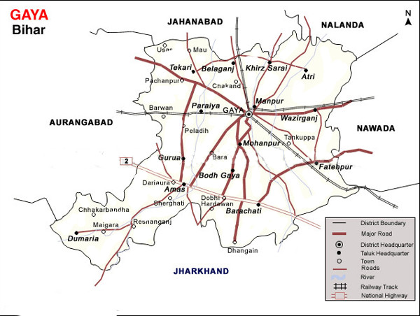
GAYA DISTRICT
Gaya derives its name from the mythological demon Gayasur (which literally means Gaya tha demon), demon (asur, a Sanskrit word) and Gaya. Lord Vishnu killed Gayasur, the holy demon by using the pressure of his foot over him. This incident transformed Gayasur into the series of rocky hills that make up the landscape of the Gaya city. Gaya was so holy that he had the power to absolve the sins of those who touched him or looked at him; after his death many people have flocked to Gaya to perform Shraddha sacrifices on his body to
 absolve the sins of their ancestors. Gods and goddesses had promised to live on Gayasur’s body after he died, and the hilltop protuberances of Gaya are surmounted by temples to various gods and goddesses. These hilltop temples at Rama Shila, Mangla Gauri, Shringa Sthan and Brahma Yoni are part of the pilgrimage circuit, and grand staircases have been built up to most of them. In Vishnu Pad Temple, Guruji Shri Vishnukant Mishra Ji is the main “priest” of this temple and Shri Shashikant Mishra is the eldest son of Guruji.Tilkut, Kesaria Peda, Lai, Inarsa of Ramana road and tekari road are the most popular sweets that bear the trademark of Gaya.Gaya formed a part of the district of Behar and Ramgarh till 1864. It was given the status of independent district in 1865. Subsequently, in May 1981, Magadh Division was created by the Bihar State Government with the districts of Gaya, Nawada, Aurangabad and Jehanabad. All these districts were at the level of sub-division when the Gaya district was created in 1865. About the origin of the name ‘Gaya’ as referred to in Vayu Purana is that Gaya was the name of a demon (Asura) whose body was pious after he performed rigid penance and secured blessings from Vishnu. It was said that the Gayasura’s body would continue to be known as Gaya Kshetra.
How To Reach
By Air (Airport):-
 Gaya Airport, also known as Bodhgaya Airport.Gaya Airport is the only international airport in Bihar and Jharkhand taken together. It is an international airport connected to Colombo, Sri Lanka through two airline operators; Bangkok, Thailand; Singapore, and Paro, Bhutan. It is said to be being developed as a stand-by to the Kolkata airport. Gaya Airport is served by Indian Airlines for domestic flights and Srilankan Airlines, Mihin Lanka, Druk Air, Jet airways and Indian Airlines for international flights. Thai Airways flies non stop between Bangkok and Gaya. The distance of Gaya airport to National Heritage site “Bodh Gaya” is about 5 Kilometers.
By Rail :-
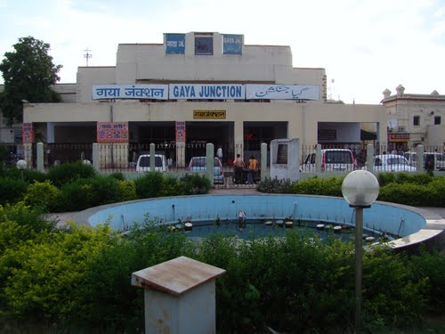 Gaya is the second most important station in Bihar after Patna. It is a junction and is connected to all the four metropolis New Delhi, Kolkata, Mumbai and Chennai through Important Broad Gauge Routes (direct trains). Now it is also directly connected to Guwahati (N-E India) and Chennai (South India). There is a direct non-stop train, Mahabodhi Express from New Delhi to Gaya daily. It takes around 15 hours to reach Gaya from New Delhi by train.
There are direct trains from Gaya to other important stations in India like Kolkata, Mumbai, Chennai, Guwahati, Ranchi, Bokaro, Varanasi, Lucknow, Kanpur, Allahabad, Agra, Mathura, Jabalpur, Bhopal, Indore, Nagpur, Puri, Ahmedabad, Jodhpur, Amritsar, Dehradun, Kalka, Jammu, Gwalior, etc. There are also two other broad gauge train lines from Gaya, one to Patna and the other to Kiul.
By Road :-
Well connected to other city through National Highway-2,82,83,99 SH-4,7,69,70,71 Other road-Gaya-Sherghati Rd,Rafiganj Road ,Gaya-Sherghati Rd,Manpur Sarbahdra Road,Fatehpur Wazirganj Road,Gaya-Bodhgaya Rd,Tapovan -Banganga.The Grand Trunk Road (NH-2, which has undergone a revival under The Golden Quadrilateral project) is 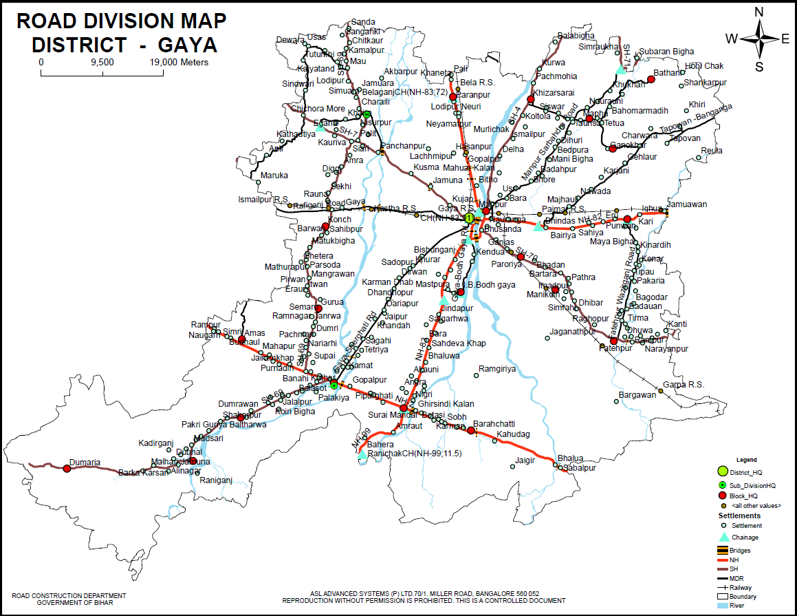 about 30 km from Gaya. Thus, Gaya is well connected to Patna, Ranchi, Jamshedpur, Bokaro, Rourkela, Hazaribag, Kolkata, Varanasi, Allahabad, Kanpur, Delhi, Amritsar, and to the Pakistani cities of Lahore and Peshawar. The highway connecting Gaya to Patna, Gaya to Nawada, Rajgir and Bihar Sharif are well maintained.
Where To Stay
Popular tourist destinations
Inscription
(I). Dated Vikram 1277(AD 1219-20), this sanskrit inscription in Nagari characters refers itself to the rule of a Sultan named Mojadina and records the performance of sraddha-ceremony by the Manhesvara kamdeva.(ASI61-62)
(II). Two terracotta balls ,of which one bearing an inscription Bhudatta devasya in fifth century A.D. characters and the other with an inscription recording Mahidhara Daksh deva in eighth century A.D characters were obtained. (ASI 77-78)
(III).A material Persian inscription from Sherghati records the death of Shah Sa’id who seems to be a saint AH 1194(AD176-80-81) (ASI-90-91)
(IV). An inscription from Sherghati, composed by Saif, mentions commencement of construction of the mosque in AH 1229 (AD 1813-14) and its completion after one year by Maulvi’ Abdu’r-Rahman. (ASI-90-91)
(V).An inscriptions mentions King Prataparudra and records that Gauri, the wife of the kings preceptor Mallikarjuna, performed her husband’s shraddha at Gaya. This Mallikarjuna may be identical with the great Saiva teacher Mallikarjuna-penditarodhya and Prataparuda with the Kakatiya king Prataparudra I, also called Rudra (AD 1163-65).(ASI, 57-58)
(VI). An inscriptions mentions Appana, a priest of the Hoysala King Vira-Narasimha, and records the establishment of a matha by the former for the use of the pilgrims who visited Gaya.(ASI, 57-58)
(VII). Two other inscriptions mention the Vijayanagara king krishnadevaraya and his successor Achyutaraya. Krishnadevaraya’s epigraph, dated saka 1444 (AD 1521), records the setting up of the king’s vijaya-sasana and mention’s the poet Mukku-Timmana, one of his court poets, as the author of the sasna.The record further quotes a verse from the poet’s Parijatapaharnamu.(ASI, 57-58)
(VIII). An inscription is dated in the Salivahana-Saka(a mistake for vikrama-samvat)1588, Vikarin (AD 1531), and states that it was a dharmasastra of king Achyutaraya at Gaya. A person named Timmananna performed the sraddha of the kings of Vijayanagara at Gaya, apparently on behalf of Achyutaraya.(ASI, 57-58)
GAYA SADAR(CHANDAUTI) BLOCK
Gautam Buddha Sanctuary :-
Gautama Buddha Wildlife Sanctuary is amongst the most ancient wildlife reserves in the northern part of the country. The sanctuary was privately owned during the British Raj and even post Indian Independence Day, till the year 1950 and it served as a popular Game Reserve which was often passed between the royal hands, British Empire in India and later, the Indians. Eventually, the place was proclaimed an official wildlife sanctuary during the year 1976 by the Government of Bihar, who later named it as the Gautam Buddha Wildlife Sanctuary.
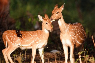 Gautama Buddha Wildlife Sanctuary is situated in the south eastern part of Gaya district. It is spread across an area measuring about 259 square kilometres, half of its area extending over a plateau belonging to the area of Chota Nagpur Plateau and another portion of it extending over the fertile Gangetic plains.
Gautama Buddha Wildlife Sanctuary boasts of a varied species of fauna which is inclusive of mammals and birds. Tiger, Blue Bull, Wild Buffalo, Spotted Deer, Barking Deer, Wild Dog and Leopard are some of the wild creatures which dwell inside this sanctuary. This region is also filled with plenty of birds or avifauna consisting of Pea Fowl, Water Fowl and many others.
The climate of the region is a mixture of subtropical and deciduous temperatures. The summers are hot and dry with heavy rains in the monsoon and low temperatures in the winter. Subsequently the best time to visit the Gautam Buddha Wildlife Sanctuary is in the winter, between November and March, completely avoiding summer and rain.
Pitrapaksha Mela :-
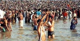
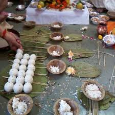 Pitrapaksha Mela is being organised every year which starts from the day of “Anant Chaturdashi of Bhadra Sukla Paksha according to the Hindi Calendar. This Mela is very important for religious, Mythological & Historical reason. Large number of Pilgrims belonging to Sanatan Hindu religions come to Gaya every year to offer “Pinda” for obtaining Moksha to their ancestors and for this reason offer “Pinda” & perform religions ceremonies on “Vedis” located at Vishnupad Temple, Falgu River, Akshaywat & Various other places.
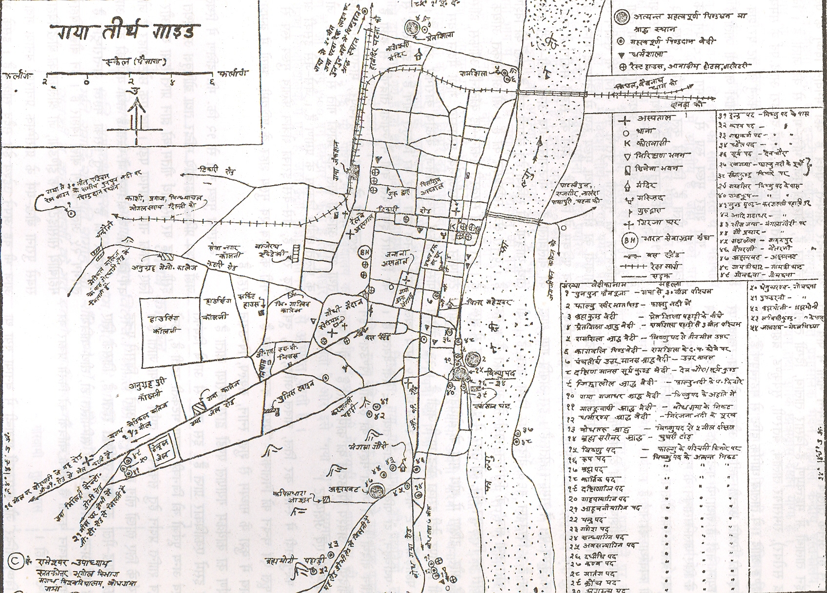
Vedis in Gaya Town :- The important Vedis situated in and around Gaya Town where Pilgrims could offer “Pinda” are as follows :-
1. Vaitarni Kund 2. Brahma Sarovar 3. Rukmani Kund 4. Godawari Kund
5.Ramshila 6. Ramkund 7. Dharma kund 8. Pretshila
9.Gayasur 10. Falgu (Devghat) 11. Jihwalol 12. Dhwajpad
13.Gayakup 14.Dharmaranya 15. Aadi Gaya 16. Akshaywat
17. Kagwali 18. Gadalol 19. Panch Tirtha Vishnupad 20. Bhimghula
21. Goprachar 22. Ramgaya 23. Sita Kunda 24. Mund Prashta
25. Uttar Manus (Pita Maheshwar) 26. Dakshin Manus (Suryakund)
27. Bodhgaya 28. On some or all vedis of “Saraswati Vedi” according to the faith of the pilgrims.
The rite is observed in three ways, Eka Drishti, Darshani, and Khaper. In Eka Drishti the rituals are performed at Phalgu river, Vishnupad hill and Akshayava tree. In Darshani the rituals are performed at 35 Vedis or Shraadha spots. Offerings have to be made at 45 different spots.
The Sharaadha spots can be classified in regard to their association with prominent deities. Akshayava, Brahma Sarovar and Dharmaranya are important sites associated with Lord Brahma. Adi Gaya, Bhima Gaya and Bodh Gaya are associated with Lord Vishnu. Matangvapi and Mudraprastha have their linkage with Lord Shiva. Vedis and Kankhal are linked with the Sun god. Ramshila and Preet shila are consorted with Yama god.
Vedigide :-
Adi-Gaya Vedi (24°46’37.76” 85°00’24.12”) :-
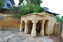
 It is located in Karsilli, which is southwest of the Vishnupada Temple over top of an adjoining hill. Adi-Gaya Vedi has sculptures from the early medieval period. The Temple and structures for this Vedi has been constructed in last few centuries. Adi-Gaya is said to be the oldest site in Gaya. It has a stone upon which pinda-dana is performed. Adi-Gaya Vedi has a temple built in the Shikhara style. Adi-Gaya Vedi has a yellow-plastered brick courtyard, which is divided into several spaces (on different levels). To the east is a two-story, single-chamber Shikara temple. Immediately in front of this temple is an open square. In front of this courtyard, to the east, is a small, 6-pillar mandapa (5’ in height; contains two carvings).
Dhautapada Vedi (24°46’35.93” 85°00’21.44”):-
 It is located in Karsilli, which is southwest of the Vishnupada Temple over top of an adjoining hill. Mundaprishtha Vedi has sculptures from the early medieval period. The shrine and structures for this Vedi has been constructed in last few centuries. Dhautapada seems like an early modern construction. Dhautpada is a single-chamber shrine with an open courtyard (natural stone coming out of floor). Dhautapada Vedi is a square-roofed platform with natural stone emerging from the floor. The roof is made of stone sheets and steel beams.
Mundaprishtha Vedi (24°46’39.08” 85°00’25.24” ):-
 It is located in Karsilli, which is southwest of the Vishnupada Temple over top of an adjoining hill. Mundaprishtha has early medieval sculptures. Mundaprishtha Vedi is a single-chamber shrine with an open rectangular courtyard. South of the courtyard is a space for pilgrims to perform pinda-dana and hangout.
Gaya-Kupa Vedi (24°46’34.77”, 85°00’30.40”):- It is located south-west slope of Mundapristha Hill.
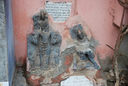
 Gaya-Kupa Vedi is mentioned in the Gaya Mahatmya text. Gaya-Kupa Vedi is linked to the Gayasura legend, identified as the navel of the Gayasura. Gaya-Kupa has a small shrine within which 3 old sculptures are placed . There is a tree within the complex and a sculpture is placed on one side. Lastly, there is a well where the pilgrims offer pinda. Gaya-Kupa Vedi is pinda-offering shrine.
The KP Jayaswal Research Institute, during in the course of its Archaeological Explorations brought to light the site period Early medieval
Gaya-Sira Vedi (24°46’36.24”, 85°00’32.35” ):- It is located south-west slope of Mundapristha Hill
 Gaya-Sira Vedi is mentioned in the Gaya Mahatmya text, though the structures at the site seem to be of recent origin. Gaya-Sira Vedi is linked to the Gayasura legend, identified as the head of the Gayasura. Gaya-Sira Vedi is housed within a new building. Gaya-Sira Vedi is pinda-offering shrine.
The KP Jayaswal Research Institute, during in the course of its Archaeological Explorations brought to light the site period Early medieval
Bhima-Gaya Vedi (24°46’32.60”, 85°00’12.21” ):-
 Bhima-Gaya is on the southwestern slope of Bhasmakuta hill. It is linked to the Gaya Mahatmya and is mostly used for Gaya-Sraddha but also Pinda-dana, Darshana Bhima-Gaya. Vedi is an open courtyard with shrines in three corners.
The KP Jayaswal Research Institute, during in the course of its Archaeological Explorations brought to light the site period Early medieval
Go-prachara Vedi (24°46’2.84”, 85°00’8.16”):-
 Go-prachara is on the northeastern slope of Bhasmakuta hill.
It is linked to the Gaya Mahatmya and is mostly used for Gaya-Sraddha but also Pinda-dana, Darshana
Go-prachara Vedi is housed in a 19th century structure with hoof marks on the rock.
Gadalola Vedi (24°03’2.76”, 85°00’6.66” ):-
 Gadalola is on the flat ground south of Akshayavata.
It is linked to the Gaya Mahatmya and is mostly used for Gaya-Sraddha but also Pinda-dana, Darshana
Gadalola Vedi seems to be a new rectangular hall with a small shrine located in the southeast corner. There is a new roadside shrine on the way from Go-prachara Vedi to Gadalola Vedi, which has been created through plastering a few old, broken sculptures.
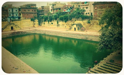
Brahma Sarovara Vedi (24°46’26.67”, 85°00’15.48”) :-
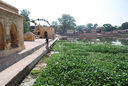 It is located 500 meters southwest of the Vishnupada temple. One can reach here either from the Vishnupada side or from the Gaya-Rajgir highway side. On Gaya-Rajgir road, there is a northward road that leads to the Vishnupada temple. The Sarovar (tank) is located on the west side of this road. The tank seems to be located at the southwestern edge of Mundaprishtha hill (Vishnupada and other shrines). Hence location of the tank at the edge/base of this hill may have helped the tank in the past to collect rainwater from the hill, but now it’s mostly from rains. The tank dates from an earlier time, but it was plastered in the 20th century. At the northwestern edge of the tank is a pinda-dana site. As the name suggests, the tank is associated with Lord Brahma. Low ceiling pillared hall and a Single chamber temple on the northern edge of the tank. A few other structures exist on the western and north bank of the tank.The tank is plastered on all 4 sides and there are steps leading to the tank. A number of structures including open pillared halls and single chamber temples exist on the western and northern corner of the tank.
Brahma Sarovara Vedi is mentioned in the Gaya Mahatmya text.
Kakbali Vedi (24°46’26.67”, 85°00’15.48”):- It is located 500 meters southwest of the Vishnupada temple. One can reach here either from the Vishnupada side or from the Gaya-Rajgir highway side. On Gaya-Rajgir road, there is a northward road that leads to the Vishnupada temple.The Sarovar (tank) is located on the west side of this road and on the Northern edge of tank is Kakbali Kakbali Vedi site may date from an earlier time, but the shrine (a rectangular mandapa: pillared hall and small single-chamber shrine) dates from the 20th century. The Devanagari inscriptions installed on the outer wall of the mandapa confirm these dates. One of the inscriptions records a donation from the Dalmia family in the vikran samvat 2062. Kakbali is one of pinda sites, where pilgrims performed Pinda-dana. The site doesn’t seem to be very important. Kakbali for pinda-dana and tank for rituals, bathing and other uses.
Bridge Nearby (south of the Sarovara)24°46’17.94”, 85°00’17.10”:-
 It is located 500 meters southwest of the Vishnupada temple. One can reach here either from the Vishnupada side or from the Gaya-Rajgir highway side. On Gaya-Rajgir road, there is a northward road that leads to the Vishnupada temple. The Sarovara (tank) is located on the west side of this road. A few meters south of the tank is a small bridge on this road, and several sculptures are installed on this bridge.
Phalgeshvara-It is The Lord of the Phalgu River. According to Jayaswal Research Institute Archaeological Explorations this site belongs to medieval period.
Markandey Temple :- According to Jayaswal Research Institute Archaeological Explorations this site belongs to Early medievalperiod.
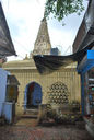
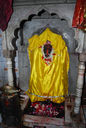
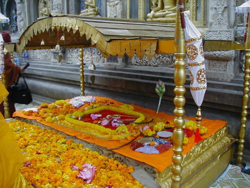
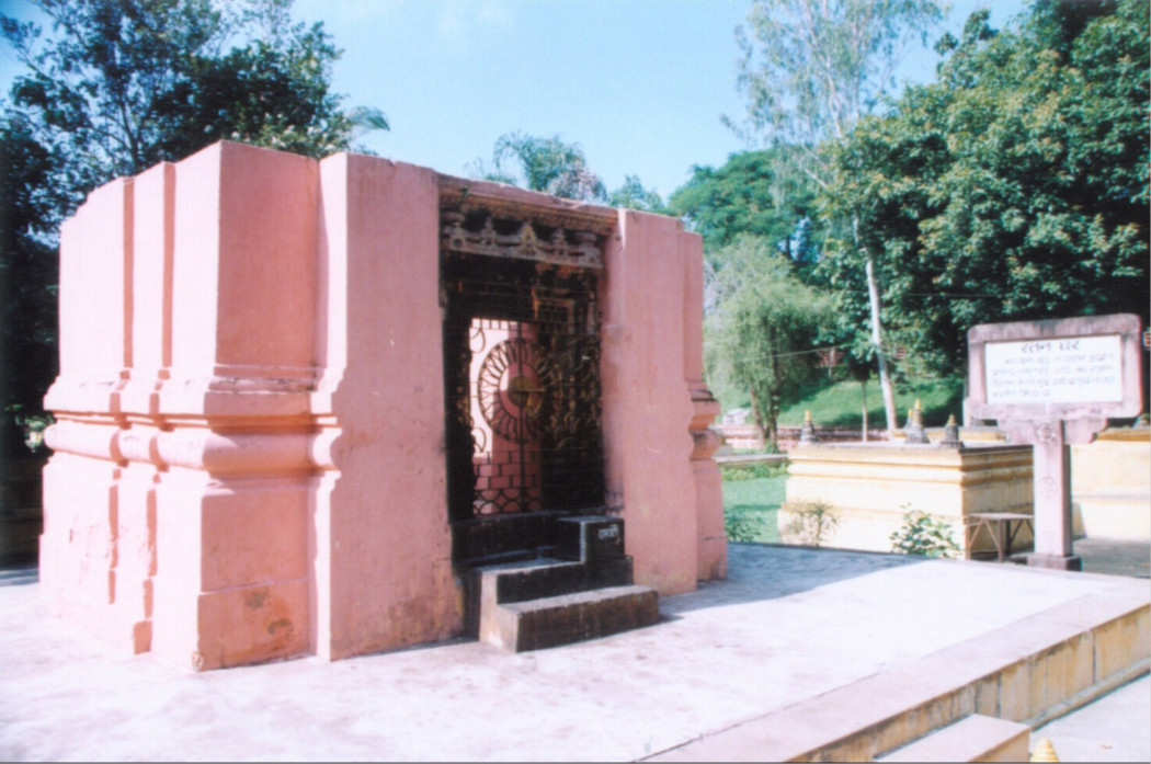
Vishnupad Temple complex & Vishnupad Temple(24°46’38.42”, 85°00’33.32”) :- This is one of the greatest Vaishnavite Temples and is the most sacred Pinda Daana Vedi in Gaya. The spot on which it stands is associated with the famous mythological event of God Vishnu killing the demon Gayasura and leaving marks of his footprint on the basalt rock, called Dharmasila, which is the main object of worship in the temple. The footprint lies in a silver trough. Buddhist tradition regards the footstep, as a footstep of Buddha.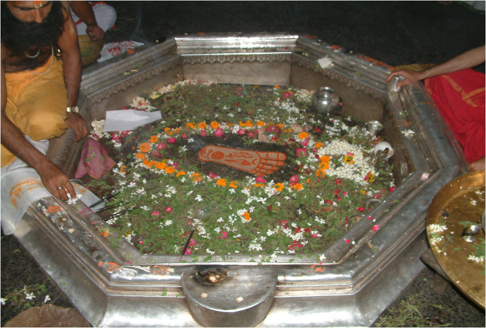
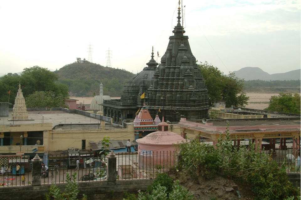
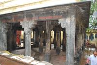
The construction date of temple is unknown and it is believed that Rama along with Sita had visited this place.The present day structure was rebuilt in 1787 on the bank of the river Phalgu by the Maharani of Indore Ahilya Bai Holkar who brought about 1,200 sculptors from Jaipur (Rajasthan), who quarried the grey granite stone from Patherkatti (a hill in Gaya district) and took about twelve years to complete the construction of the temple.This temple faces the East and it is octagonal in plan with its tower about hundred feet high, with a lofty pyramidal roof, with the golden Kalasha.In front of the shrine is the spacious Sabha Mandapa – or an open pillared hall. It is a double height space accessed by galleries all around. This hall has 42 pillars disposed in two stories. Within the courtyard is a large baradari or pillared pavilion of sixteen granite pillars called as Solah Vedi where ‘Pindas’ are also offered by the pilgrims coming from all over India. Over the central portion is a graceful dome, 80 feet high formed by overlapping of stones. The pillars contain various artistically executed motifs.
There are a Gayawal inscription on the silver wall & on the silver umbrella above the footprint .
There are minor shrines dedicated to Shiva and Lakshmi adjacent to the Sabha Mandap.Temples of Gadadhara (1040 CE), Narasimha, Gayeswari (1459) are some of the ancient temples in the complex. The shrines, cells and courtyards around the temple contain hundreds of beautiful stone images mostly belonging to the Pala and Sena Periods. (800-1300 CE). The beautiful style of this temple, with its impressive Sabha Mandap represents the Indian architectural glory of a comparatively recent date.
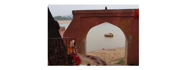
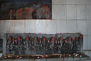
There is a path from the northern entrance of the Vishnupada eastwards to the Sangat Ghat on the bank the Phalgu river. On the south of this path is Uttaradi math whereas Adi-Gadadhara is on the northern side. The sculptures are plastered into various walls, buildings, and niches along this path up to the ghat. Several images are plastered the western wall of the northern entrance; only two are grilled. Two images can be found on the eastern wall. Several images were in a niche within a small 5’ shrine. On the southern wall, there is both a shiva linga and small fragment in a small chamber. There are four panels: two stuck in a water tank and another two stuck to the wall on the way to the ghat. At the exit to the Gadadhara ghat are three images.
Adi-Gadadhara Temple (24°46’39.50”, 85°00’35.17”):-
 It is located northeast of the Vishnupada Temple, in a gully, near the Sangat Ghat. The pillars look medieval, although from the top the structure looks to be from a similar time period as the Vishnupada Temple. The temple is divided into an inner sanctum and two mandapas. The inner sanctum is located on the westernmost side of the temple; it houses an image of Adi Gadadhara.
 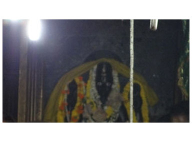 The mandapa, closed on the northern and southern sides, is erected on 20 stone pillars (inner mandapa). This mandapa leads to a second open mandapa, which is erected on 21 pillars (front mandapa). This mandapa houses both an open shrine of Sakshi Gopal and a small shrine for Mangala Devi (in the southwest corner). The top of the outer wall is tiled. Interestingly, the shrine is protected by Dhami pandas and not Gayawals. There is a new inscription by the entrance and another on the top of the eastern wall.
Gayeshwari Devi Temple(24°46’40.32”, 85°00’34.26” ):-
It is located on the alley leading to the north entrance of the Vishnupada Temple.Early medieval sculptures and inscriptions are housed in the 19th century shrine. There are two chambers and passageway to north of sanctum, which have sculptures.This site contains an extensive collection of early medieval images.According to Buchanan the deity inside should represent the presiding deity of the town Gaya.
Lalita Devi Temple (24°46’39.24”, 85°00’34.20” ):-
It is situated 10 meters north of northern back entrance to Vishnupada Temple, in the gully. The gully leads to the Surya Kunda. Gully connects Vishnupada temple and Surya Kunda (sun tank). “L” shaped courtyard type temple in which images were stuck on western and southern wall. Courtyard had an open memorial, 8-10’ high. The central Lalita Devi figure is displayed beneath a beautiful, early medieval lintel depicting the traditional Vishnu Dasavatara. In the center of the courtyard is a memorial pillar, on which is inscribed a passage from the Vishnu Purana in Sanskrit. Navaratri Festival is celebrated in this temple.
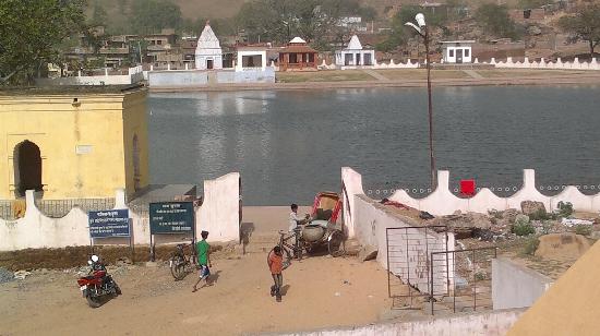
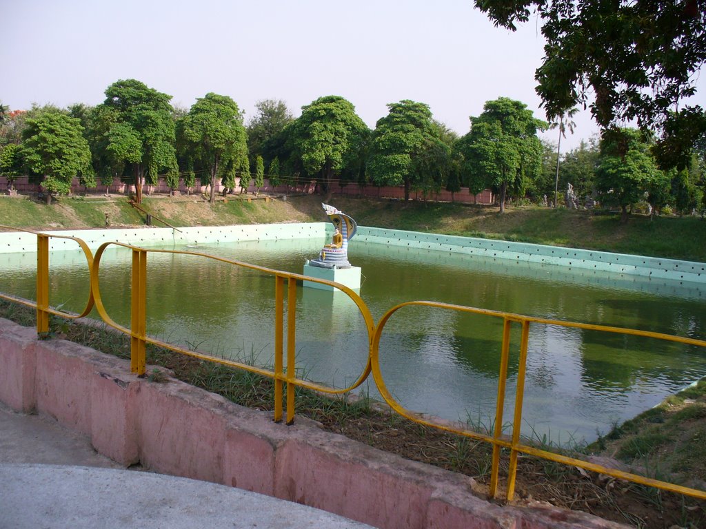
Surya Kund or the Dakshina Maanas Tank :-
 It is a deep tank with masonry wall, called as Surya Kund situated to the west of the Vishnupad Temple. The walls , it appears , were erected by Raja Mitrajit of Tekari sometimes before Buchanan’s visit to the place in 1811. A festival of the Sun God is celebrated here in the month of Chaitra and Kartik of the Hindu calendar. A fair is also held during this festival.
Dakshinaarka Temple (Sun Temple) :- It is situated a little to the north of the Vishnupad Temple. A fine statue of the Sun God with his seven horses driven by Arun on the pedestal enshrined in the Temple.The current structure dates back to the 13th century, where the South Indian emperor Prataparudra of Warangal is said to have built it. The granite image of Aditya (this particular image here is also referred to as Dakshinaarka) or the Sun God worshipped here is portrayed as wearing a jacket, a waist girdle and high boots in the Iranian tradition.The temple is a simple and plain one, with a dome over it. The comparatively larger sabha mandapa stands in front of the sanctum. Massive pillars line the mandapa where there are graceful stone sculptures of Shiva, Brahma, Vishnu, Surya and Durga.
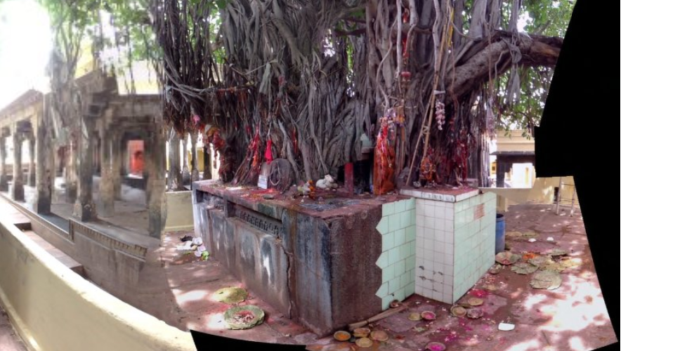
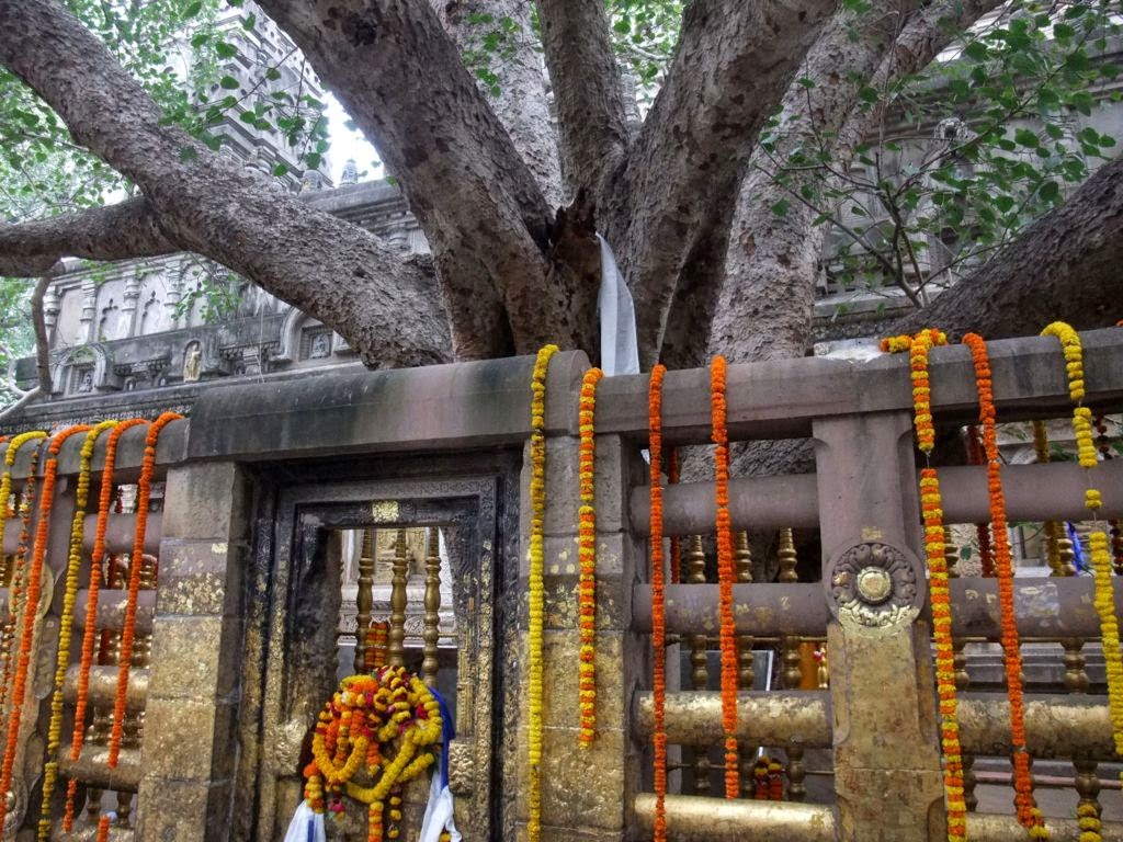
Akshayavat:- Akshayavat or Akshay Vat (“the indestructible banyan tree”) is a sacred fig tree mentioned in the Hindu mythology.
According to a legend, once the sage Markandeya asked Lord Narayana to show him a specimen of the divine power. Narayana flooded the entire world for a moment, during which only the Akshayavat could be seen above the water level.
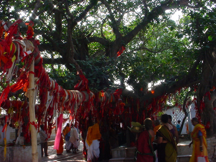 The immortal Banyan tree that stand in the courtyard of the Vishnupad Temple, where Buddha said to have meditated. It is believed a person reaches heaven if his last rites are performed here. According to Ramayana, when Lord Rama came to Gaya along with Sita for pitri paksha (or to perform pinda danam), Sita cursed the Falgu River following some disobedience on the part of the river. The mythology states that on account of this curse, Falgu River lost its water, and the river is simply a vast stretch of sand dunes. At the same time Sita blessed a banyan tree to be immortal. This tree is known as Akshayavat. Akshayavat is combination of two words Akshya (which never decay) and Vat (Banyan tree). Once a year every banyan trees shed leaves, but this particular tree never sheds its leaves which keeps it green even in times of drought.
According to Jayaswal Research Institute Archaeological Explorations this site belongs to Early medieval period.
Rukmani kund :-
 Nearby the Akshayavata is a sacred tank now called as Rukmani Kund. This name was not known to Buchanan, who called it by the name of Gadalol and was told of an interesting local legend current about it.
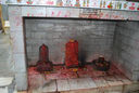
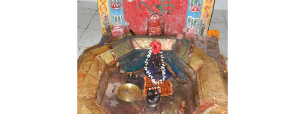
Mahadeva Temple (24°46’38.42”, 85°00’23.45” ):-
 It is located to northeast of 16 Vedis in the Vishnupada Complex. It seems to have origins in the early medieval or medieval period. The exact date of the construction of the temple is difficult to determine because of lack of historical sources. There are images and inscriptions, but others may have been removed. It consists of an inner sanctum, which houses a Shiva Linga, and a twenty-pillared mandapa. The Narasimha Temple (east of Mahadeva Temple) is a small rock temple. Like Narasimha Temple, Saraswati Temple (east of Narasimha Temple) is a small rock temple. Two single-chamber shrines face the Narasimha Temple. All five shrines are treated as one unit in the Vishnupada Complex.There is a Kakatiya inscription in the mandapa of the temple.
Rama-Sita-Lakshmana Temple (24°46’38.43”, 85°00’33.25”) :-
 It is located south of the Vishnupada Temple within the complex. The area is called Chand Chaura. This temple has early medieval sculptures and inscriptions. The structure of the temple may have been constructed in the 19th or 20th century. Subsequently, the temple has gone through repairs as evidenced by a number of marble sculptures and inscriptions plastered on the floor of the mandapa of this temple. The haphazard organization of the sculptures in and around this temple indicates a rematerialization of sculptures. Rama-Sita-Lakshmana temple has a rectangular courtyard with a sanctum.
 Panca Ganesha Temple is located west of 16 Vedis’ Courtyard. Hanuman Temple is located directly south of the Indra Temple, on the same wall. Pancha Ganesha is an old rock shrine with two well-sculpted pillars. It is an old structure, origin during the early medieval period.
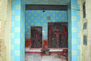
Both Hanuman Temple and Indra Temple are recent shrines.
Ram Mandir, Durga Shrine, and Kanyakumari Mandir (24°46’41.44”, 85 00’34.18” ):-
 These three temples are located on the way to Dev Ghat from the Vishnupada northern back alley entrance. Some of the images in these shrines are from the early medieval periods, but the temples and their current context seem to be of early modern or modern period. Rama Temple seems to be a modern temple. Rama Temple is in the Shikhara style.Rama Temple consists of a chamber with a courtyard on two sides. The southern wall of the Temple features a large Hanuman figure with Rama and Sita on his shoulders. In the sanctum are beautiful lintels painted red and green.
 Durga Shrine has also been constructed recently. Local tradition associated with site is Sadananda Gurda, a Gaywala Brahmana (aged 80 in 2011), narrated the story of the Durga sculpture. This particular Durga sculpture is from Upardeeh. A local doctor’s daughter found the sculpture in a well, and installed it in her house. Later, her whole family perished in a plague, which was brought by some people from Himachal Pradesh state of India, including the daughter. The doctor attributed this misfortune to the installation of the statue in his house, and as a result threw the sculpture in a cremation ground in Gaya. Later, the sculpture was brought to the temple to be installed in a grilled enclosure in the Durga Shrine. Durga Shrine is a single chamber. The Durga Shrine is outdoors and gated on one side.
 Kanyakumari Temple is a single-celled shrine. Kanyakumari Temple is a purple single-celled shrine with a red gate.
Devaghat:- According to Jayaswal Research Institute Archaeological Explorations this site belongs to Early medieval period.
Shamashana Kali Temple (24°46’42.03″, 85°00’33.64″ ):-
 Shamashana Kali Temple is located on the inner path from Vishnupada Temple to Surya Kunda, about sixty meters north of the northern entrance of the Vishnupada Complex on the western side of the gully. It is a modern shrine that houses sculptures from the early medieval period.
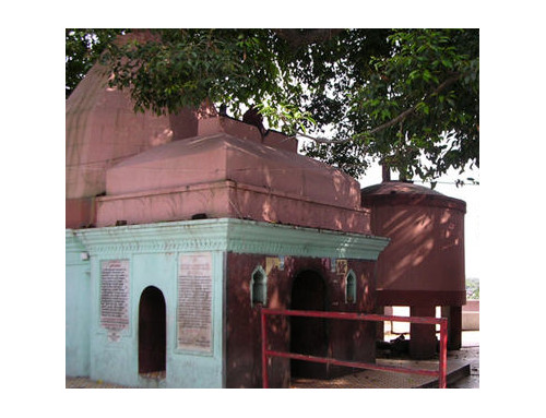
16 vedis and Chota Akshayavat:-
16 Vedis is a medieval shrine, whereas Surya Shrine and Chota Akshayavat are relatively recent shrines with early medieval sculptures. Stone-roofed courtyard with 16 internal pillars and 21 pillars on the perimeter — small annex-mandapa with 4 pillars, floor is natural stone of hill. Small one cell entrance to the Chota Akshayavat south of 16 padas. Cell has one major sculpture of Surya and two other sculptural fragments. Exit of cell leads to Chota Akshayavat shrine, which is a plastered platform around the tree. There are numerous sculptures, panels and fragments plastered into platform and kept around the tree.
Mangalagauri Temple (Mangalagauri hill) :-
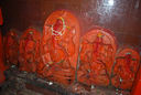
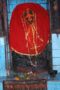
 The temple is situated on top of the Mangalagauri hill. A flight of steps and a motorable road lead to the temple. The Mangalagauri temple in Gaya has been mentioned in Padma Purana, Vayu Purana and Agni Purana and in other scriptures and tantric works. The present temple dates back to 1459 AD. The shrine is dedicated to Shakti or the mother Goddess. Mangala Gauri is worshiped as the Goddess of goodwill. This temple constitutes an Upa-Shakti Pitha. According to mythology, it is believed that a part of the body of Sati fell here. The Mangla Gauri shrine is marked by two rounded stones that symbolize the breasts of the mythological Sati, a symbol of nourishment and it also houses some finely carved ancient relief sculptures. There are also two minor shrines dedicated to Shiva and images of Mahishasura Mardini, Durga and Dakshina Kali.
According to Jayaswal Research Institute Archaeological Explorations this site belongs to Early medieval period.
Ram Gaya and Sita Kunda complex:-
 Exactly opposite to Vishnu pad temple but on the other banks of Falgu river is a small temple depicting the spot where sita devi performed pinda dana for her father-in-law. This lila is depicted in form of a beautiful deity of sita devi offering the pinda with sand balls of river phalguni(now phalgu) & hand of Dashrath appearing from the earth to accept it.
According to Jayaswal Research Institute Archaeological Explorations this site belongs to Early medieval period.
Bamhani Ghat Temple:- According to Jayaswal Research Institute Archaeological Explorations this site belongs to Early medieval period
Temple of Surya (Brahmani ghat):- It is situated at the Brahmani-ghat and another Sun temple closed to the Vishnupad Temple . A large statue of the Sun-God enshrined in the Temple.
Dev Ghat:– The KP Jayaswal Research Institute, during in the course of its Archaeological Explorations brought to light the site period Early medieval. Lakhanpura:- The KP Jayaswal Research Institute, during in the course of its Archaeological Explorations brought to light the site period Early medieval. Gularia Chak:–The KP Jayaswal Research Institute, during in the course of its Archaeological Explorations brought to light the site period Late NBPW. Gulani:- The KP Jayaswal Research Institute, during in the course of its Archaeological Explorations brought to light the site period Early medieval. Charowa:- The KP Jayaswal Research Institute, during in the course of its Archaeological Explorations brought to light the site period Early medieval.
Uttaraka temple (Sun Temple):- It is situated near the Uttara Maanas tank.
Gayaditya temple(Sun Temple ) :- It is on the bank the river Falgu.
Sankata Devi Temple (24°46’27.51″, 85°00’33.32″):-
 It is 500 meters south of the Vishnupada temple complex.The temples are housed in two adjoining rooms, which seem to be modern, whereas the sculptures are of early medieval origin. A small rectangular temple within which multiple sculptures have been plastered. Marble and tiles have been used to beautify the shrine. There is a pipal tree just across from the temple, beneath which a platform has been raised. Several broken and eroded images have been placed on the platform.
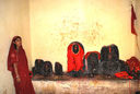
Prapita Maheswara temple :-
 The Prapita Maheswara temple is one of the oldest temples in Gaya and it dates back to the Pala dynasty of the 11th century as inscribed on the stone inscriptions nearby.Prapita Maheswara is said to be a witness deity for the performance of the offerings of the pindas to ancestors. It has been referred to in the Agni Purana.This temple is built of black basalt and it stands adjacent to two hills (Bhramayoni and Vasmakuta). The temple faces east and is attached to a sabha mandapa in the front.The massive stone slabs of the hall are supported by huge polygonal stone pillars placed one above the other. Five graceful domes top the mandapa. The enormous size and height of the mandapa are not in consonance with that of the temple. What is seen today is a result of innovative work carried out in the 14th century. The pyramidal tower of the temple shikhara is surmounted by an amalaka and a broken iron trident.
Grave of Peer Mansur : – A Muslim sacred site, which is situated near Prapita Maheswara Temple.
Dargah Bitho Sharif (Bitho) :-
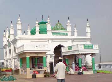 Bitho Sharif Dargah is about 600 years old Khanqah of Hazrat Makhdoom Durwesh Ashraf Rahmatullah situated on the banks of Falgu river 10 km from main city on Gaya-Patna road. It is one of the oldest muslim holy place of Gaya district where every year 3 day ‘Urs-Qul’ is organized on 10th to 12th of Shaban(Urdu Calendar).
The Dargah is spread in the land area of about 6-7 acres with a Masjid and a primary to secondary education school, MDA Public School, also in the name of Hazrat Makhdoom Durwesh Ashraf Rahmatullah.
Khanqah e Ashrafia:-
Hz. Syed Shah Sahid Sahab
Khanqah e Quadria Ashrafia Chistia:-
Hz Syed Shah khalid Quadri
Khanqah Ashrafia (Panchaitya Aakhara):-
Hazrat Syed Shah Kashfuddin Ashrafi
Gaya Museum (Gaya) :- It is located near the Tank .The private collection belonging to Late Shri Baldeo Prasad was taken over by Bihar Govt in the year 1970 and declared as Gaya Museum. With its new building the Museum is proposed to be developed as the Gaya Museum-cum Magadh cultural centre with the view to collect, display and make available all the relevant information regarding living cultural heritage of the Magadha region under one roof. Museum has a good collection of Bronzes,stone sculpture of the Pal period, art specimens of bygone days and coins of different periods manuscripts, terracotta figurines ranging right from Mauryan (3rd cent BC) to Gupta period (4th-5th cent A.D)
Thai temple :- It is located in Gaya District. It is a beautiful temple with sloping roofs and gold lacquered tiles. The temple houses the image of a magnificent Buddha with curly hair. In order to accommodate devotees and Thai Buddhist monks, rooms are provided behind the temple.
Shahi Mosque (Gaya) :- An inscription of Jahangir is to be found on the this mosque, which is stated therein to have been built through the blessings of the saint Shaikh Barmazid, by Mirak Husain al- Bakshi al-Qawafi, in A.H 1026(AD 1617).
Jama Masjid :- The largest mosque in Bihar. It is situated in heart of the Gaya city. It’s also famous for Shabina (special worship on 27th night of Ramadan) and Tabligh etc. It was constructed around 200 years ago by Royal Family of Muzaffarpur.
Gurdwara Sri Guru Tegh Bahadur Ji – Gaya is an ancient Hindu pilgrimage center on the bank of Falgu River, a tributary of the Ganges, where the pilgrims go to have worship and ceremony conducted by local priests for the benefit of their ancestors. Guru Nanak Dev and Guru Tegh Bahadur visited it and tried to explain to the people that it was one’s own good actions during the life-span on this earth and not the rituals of one’s descendants that would benefit a departed soul. Gurdwara Sri Guru Tegh Bahadur Ji near Vishnupad is controlled by Udasi priests. As in Gurudwara Chacha Phaggu Mal at Sasaram, here too three copies of Guru Granth sahib in Gurmukhi and Devanagari script are seated side by side in a rectangular pavilion on a raised platform.
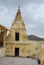
Pretshila Hill:-
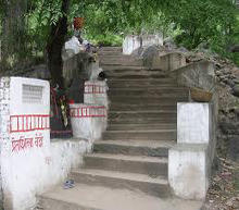 It is situated to the North-West of Gaya is also a sacred place for the Hindus where ‘pindas’ are offered by the Hindu to their ancestors. It is said that there used to be a demon called Gaya who was very much shocked at the distress caused by death. He expressed his sorrow to Lord Vishnu. Lord Vishnu was very happy to see that a demon had such a kind heart and gave him a boon by virtue of which he could forgive the sinners. On the top of the hill is a temple of the Pretaraja or God Yama of Hindu mythology. This temple was originally built on this spot by Rani Ahilya Bai of Indore . An inscription dated 1744 A.D. in the temple on the hill recorded the construction of the flight of steps having been done at the expense of Sri Manmohan Datt of Calcutta.
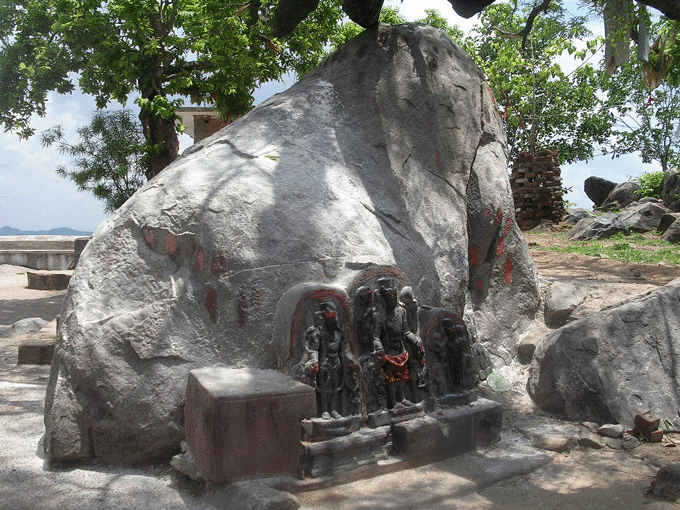 Earlier several images of Surya, Vishnu, Mahishamardini Durga and some Buddhist divinities were found in and around the hill which indicates the existence of earlier shrines in the locality during the ancient period. At the foot of the hill are three tanks named Sati, Nigra and Sukha, and there is a fourth tank called Ramkund on the summit near the temple of Yama, in which it is said that Rama himself bathed.
According to Jayaswal Research Institute Archaeological Explorations this site belongs to Early medieval period.
Ramshila Hills :-
 The Ramshila Hill situated on the south-east fringe of Gaya is one of the most sacred hills in Gaya and it also appears to have had a considerable antiquity. A number of stone sculptures belonging to the ancient period can be still noticed on and around the hill which suggests the existence of some earlier structures or temples since very early times. The temple situated on the top of the hill called as Ramesvara or Pataleshwar temple was originally built in 1014 A.D. In front of the temple is a pavilion, built in 1811 A.D. where ‘pindas’ are offered by the Hindu devotees during pitru paksha for their ancestors. The name of the hill is associated with Lord Rama and so images of Rama, Sita and Hanuman are also installed in a temple on the hill. It is believed that Lord Ram had offered ‘pinda’ on the hill.
According to Jayaswal Research Institute Archaeological Explorations this site belongs to Early medieval period.
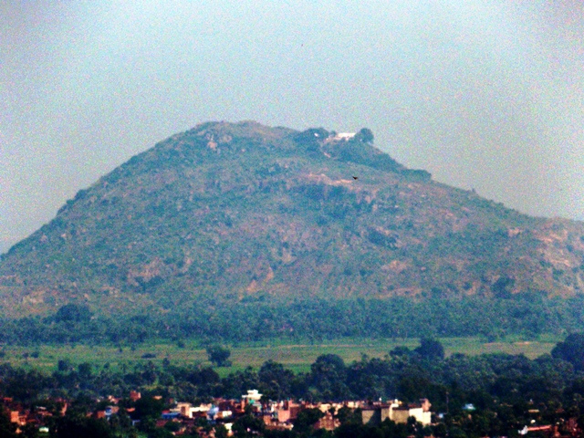
Brahma Yoni Hills :-
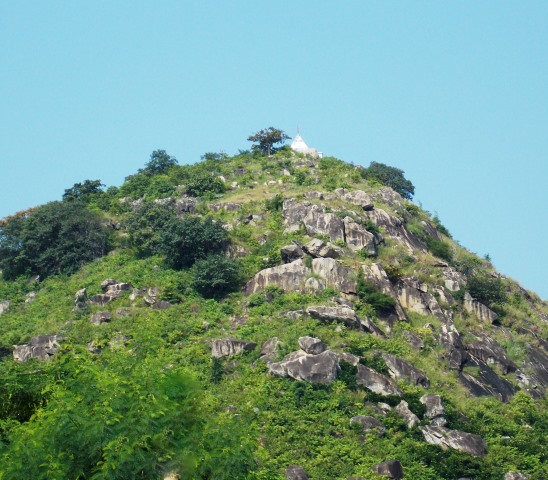 It is located 1 km away to the south west of Gaya.In Brahm Yoni Mountain range there are 3 mountain peaks. Middle mountain peak in related to Buddhist Circuit & Right side mountain peak is related to Hindu circuit.
Also popular for picnic spot and photography.It is the highest hill in Gaya and named after a natural fissure on its top which is believed to represent the female energy or yoni of the God Brahma. In a small temple on the hill a five-headed female image is worshipped as a female energy of Brahma i.e. Brahma Yoni. This temple was built by one Maratha chief named Balaji Pandit. An inscription on the hill records the construction of a flight of steps from the foot of the hill to the top by Rao Bhau Saheb in the reign of Jayaji Rao Scindia of Gwalior in about 1843 A.D.The Brahma Yoni Hill is a sacred place for the Hindus and pindas are offered here during the Pitrapaksha mela in large numbers.
Earlier images of Buddha in Bhumisparsa mudra , votive stupa and three stone pieces with inscriptions in Pali language were found in and around the hill which indicates the existence of earlier shrines in the locality during the ancient period.
For Buddhists, Gaya is an important pilgrimage place because it was at Brahma Yoni hill that Buddha preached the Fire Sermon (Adittapariyaya Sutta) to a thousand former fire-worshipping ascetics, who all became enlightened while listening to this discourse. At that time, the hill was called Gayasisa.
There are two interconnected narrow caves on the hill- Brahmayoni & Matriyoni. There is a belief that if one passes through the caves he would become free from cycle of life and death.
On the middle of peak there is an Ashoka Stupa. It is believed that Ashoka the Great had got constructed a stupa here.
According to Jayaswal Research Institute Archaeological Explorations this site belongs to Late medieval period.
Shringa-Sthan :-
Krishna Dwarika Temple:- Buchan describes this temple as “a pretty large” one “which is not mentioned in the Gaya- Mahatmya, nor has it acquired any considerable celebrity.” The Bengal list of Monuments, 1896, says that the status of krishna Dwarika is considered the most beautiful image of Vishnu in Bihar. It was discovered during the excavation of a well at a later date than the Mohammedan invasions, which probably accounts for its excellent preservation. Buchanan says nothing about this image. In 1931 Sarkar saw this image of Radha Krishna worshipped inside the Shrine. The temple had not acquired much celebrity in Buchanan’s time.(Tourism Perspective in Bihar -By Nishi Sinha)
Shrine of Ata Hussain Fani:- Ata Hussain Fani Chishti was a sufi saint of the Chishti Order and was ordered spiritually by the Prophet Muhammad to arrive here and preach Islam. He arrived in the mid 19th century and settled here. Presently his tomb is situated in the heart of gaya and is visited by believers of all faith.
Pattharkatti Colony :- Collections of Bronzes, Terracottas, paintings and idols of various kinds can be found, good for buying.
Swami Sahajanand Saraswati ashram (Niyamatpur) :- The village was a bastion of the Indian National Congress and Kisan Andolan during the British period. Pandit Yadunandan Sharma at the instruction of Great nationalist and leader of Kisan Andolan Swami Sahajanand Saraswati established an Ashram here in 1933 ,which later became the centre of freedom struggle in Bihar. All the prominent leaders of Indian National Congress visited there.In 1935, Jawaharlal Nehru came to the Ashram and donated a bag of 450 silver coins to the Deen Bandhu Library established by Amarnath Diwan. The library was subsequently renamed after Nehru’s wife Kamla to Kamala Pustakalaya. In July 1936, a meeting of Central Committee of Akhil Bharatiya Kisan Sabha was held at Niyamatpur chaired by Dr Rajendra Prasad . A legislation was passed and the ‘Red Flag’ was adopted as the flag of Akhil Bharatiya Kisan Sabha. In 1942, bullets were fired at the Ashram and the library Kamala Pustakalaya was damaged by a British Police Officer “Tomeo”. In 1950, Mohan Singh, the Commander General of the Azad Hind Fauj (Indian National Army) visited the Ashram. “Sarvodaya Neta” Jaiprakash Narayan visited the Ashram in 1958 after he joined the Sarvodaya Movement. Jagjivan Ram, then the Defence Minister of India visited the Ashram and the village in 1973 on the occasion of 40th Anniversary of the Ashram. Pandit Yadunandan Sharma spent later part of his life at the Ashram where he died in 1975 and his body was cremated here and a Smarak built. The Ashram subsequently went into decadence and only its ruins can be seen at the site.
Maranpur:- The KP Jayaswal Research Institute, during in the course of its Archaeological Explorations brought to light the site period Early medieval. Kandi:- The KP Jayaswal Research Institute, during in the course of its Archaeological Explorations brought to light the site period Early medieval. Dubahal:- The KP Jayaswal Research Institute, during in the course of its Archaeological Explorations brought to light the site period Early medieval. Naily:- The KP Jayaswal Research Institute, during in the course of its Archaeological Explorations brought to light the site period Early medieval. Jamuna:- The KP Jayaswal Research Institute, during in the course of its Archaeological Explorations brought to light the site period Late medieval. Ander Gaya:– The KP Jayaswal Research Institute, during in the course of its Archaeological Explorations brought to light the site period Early medieval. Janardan Temple:- The KP Jayaswal Research Institute, during in the course of its Archaeological Explorations brought to light the site period Early medieval. Churi:- The KP Jayaswal Research Institute, during in the course of its Archaeological Explorations brought to light the site period Early medieval. Godawari:- The KP Jayaswal Research Institute, during in the course of its Archaeological Explorations brought to light the site period Early medieval. Akash Ganga (Bhairav Asthan):- The KP Jayaswal Research Institute, during in the course of its Archaeological Explorations brought to light the site period Late medieval. Jogia Bagicha (Gaya south):- The KP Jayaswal Research Institute, during in the course of its Archaeological Explorations brought to light the site period Early medieval. Jambha Karan (Bishunganj):– The KP Jayaswal Research Institute, during in the course of its Archaeological Explorations brought to light the site period Medieval. Sankatasthan (Lakhanpura):– The KP Jayaswal Research Institute, during in the course of its Archaeological Explorations brought to light the site period Early medieval. Hanuman Temple (Beldari Tola):- The KP Jayaswal Research Institute, during in the course of its Archaeological Explorations brought to light the site period Early medieval. Khiriyawan:– The KP Jayaswal Research Institute, during in the course of its Archaeological Explorations brought to light the site period Early medieval. Baba Sidhnath Temple (Dandi Bag):- The KP Jayaswal Research Institute, during in the course of its Archaeological Explorations brought to light the site period Early medieval.
Ram Sagar:-
The KP Jayaswal Research Institute, during in the course of its Archaeological Explorations brought to light the site period Early medieval.
Khanqah Munamia Abul Ulaiya(Ramsagar):-
Hazrat Syed Shah Munami
Baikunthghat (Upardih Muhallah):- The KP Jayaswal Research Institute, during in the course of its Archaeological Explorations brought to light the site period Early medieval. Gayatri Ghat:- The KP Jayaswal Research Institute, during in the course of its Archaeological Explorations brought to light the site period Early medieval. Nai Godam:- The KP Jayaswal Research Institute, during in the course of its Archaeological Explorations brought to light the site period Early medieval. Khajuria:– The KP Jayaswal Research Institute, during in the course of its Archaeological Explorations brought to light the site period Late medieval. Koiri Bari:- The KP Jayaswal Research Institute, during in the course of its Archaeological Explorations brought to light the site period Early medieval. Bahadurgir:- The KP Jayaswal Research Institute, during in the course of its Archaeological Explorations brought to light the site period Late medieval. Chamar Dih:- The KP Jayaswal Research Institute, during in the course of its Archaeological Explorations brought to light the site period Early medieval. Kharkhura:– The KP Jayaswal Research Institute, during in the course of its Archaeological Explorations brought to light the site period Medieval. Chakand Garh:- The KP Jayaswal Research Institute, during in the course of its Archaeological Explorations brought to light the site period NBPW phase. Niagipur:– The KP Jayaswal Research Institute, during in the course of its Archaeological Explorations brought to light the site period NBPW phase. Kewali:– The KP Jayaswal Research Institute, during in the course of its Archaeological Explorations brought to light the site period Medieval. Kusma:- The KP Jayaswal Research Institute, during in the course of its Archaeological Explorations brought to light the site period Early medieval. Channa Garh:- The KP Jayaswal Research Institute, during in the course of its Archaeological Explorations brought to light the site period Early medieval. Kujapi:- The KP Jayaswal Research Institute, during in the course of its Archaeological Explorations brought to light the site period Early medieval. Sherpur:- The KP Jayaswal Research Institute, during in the course of its Archaeological Explorations brought to light the site period Gupta. Korma:- The KP Jayaswal Research Institute, during in the course of its Archaeological Explorations brought to light the site period Kushan. Kendui:- The KP Jayaswal Research Institute, during in the course of its Archaeological Explorations brought to light the site period Late medieval. Shahbazpur:- The KP Jayaswal Research Institute, during in the course of its Archaeological Explorations brought to light the site period Early medieval.
BODHGAYA BLOCK
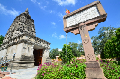
Bodhgaya :- It is 60 kms away from Patna and 13 km from Gaya,beside river Nirjuna, where Lord Buddha attained enlightenment under the Bodhi tree. There is archaeological evidence of occupation in the area as far back as 1100 BC.Scores of stupas of varying sizes were built at Bodhgaya over the past 2500 years,most of which are noted for their elegant construction and ornamental relief carvings.
Mahabodhi Temple :-
The temple stands in the east to the Bodhi Tree.The present Mahabodhi Temple is believed to have been built between the 5th and 7th centuries BC.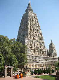 Repairs and renovations were later done as and when needed.The inscription in English on the door of the temple shows that it was thoroughly repaired in 1880 by the Lieutenant Governor of Bengal at the expense of Government.
Mahabodhi Temple is constructed of brick and is one of the oldest brick structures to have survived in eastern India. It is considered to be a fine example of Indian brickwork, and was highly influential in the development of later architectural traditions. According UNESCO, “the present temple is one of the earliest and most imposing structures built entirely in brick from Gupta Period (300–600 CE). Mahabodhi Temple’s central tower rises 55 metres (180 ft). The central tower is surrounded by four smaller towers, constructed in the same style.
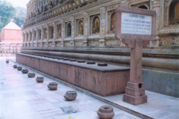
The Mahabodhi Temple is surrounded on all four sides by stone railings, about two metres high. The railings reveal two distinct types, both in style as well as the materials used. The older ones, made of sandstone, date to about 150 BCE, and the others, constructed from unpolished coarse granite, are believed to be of the Gupta period. The older railings have scenes such as Lakshmi, the Hindu goddess of wealth, being bathed by elephants; and Surya, the Hindu sun god, riding a chariot drawn by four horses. The newer railings have figures of stupas (reliquary shrines) and Garudas (eagles). Images of lotus flowers also appear commonly.
Inside the temple, there is a gigantic black stone statue of Buddha which is believed to be around 1700 years old. He is shown seated with his right hand upon the earth,the posture he held while attaining enlightenment.
The entire courtyard of the temple is studded with large number of votive stupas. These stupas are of all sizes built during the past 2500 years ago. Most of them are extremely elegant in structural beauty.
The Mahabodhi Temple remains an important pilgrimage destination and has become a UNESCO World Heritage monument on the 26th of June, 2002.
Bodhi Tree :-

 At the western side of the Mahabodhi temple in Bodhgaya, stands a
large and historic pipal tree (Bodhi tree) under which Shakyamuni Buddha, then known as Gautama, attained enlightenment some 2500 years ago.
The earliest records on the tree are in the ‘Kalingabodhi Jataka’, which gives a vivid description of the tree and the surrounding area prior to the enlightenment, and the ‘Asokavadana’, which relates the story of King Asoka’s (3rd century B.C) conversion to Buddhism. His subsequent worship under the sacred tree apparently angered his queen to the point where she ordered the tree to be felled. Ashoka then piled up earth around the stump and poured milk on its roots. The tree miraculously revived and grew to a height of 37 metres. He then surrounded the tree with a stone wall some three meters high for its protection.
In 600 AD, King Sasanka, a zealous Shivaite, again destroyed the tree. The event was recorded by Hiuen-Tsang, along with the planting of a new Bodhi tree sapling by King Purnavarma in 620AD. At this time, during the annual celebration of Vaisakha, thousands of people from all over India would gather to anoint the roots of the holy tree with perfumed water and scented milk, and to offer flowers and music. Hiuen-Tsang wrote “The tree stands inside a fort like structure surrounded on the south, west and north by a brick wall. It has pointed leaves of a bright green colour. Having opened a door, one could see a large trench in the shape of a basin. Devotees worship with curd, milk and perfumes such as sandalwood, camphor and so on.”
Much later the English archeologist Cunningham records, “In 1862 I found this tree very much decayed; one large stem to the westward with three branches was still green, but the other branches were barkless and rotten. I next saw the tree in 1871 and again in 1875, when it had become completely decayed, and shortly afterwards in 1876 the only remaining portion of the tree fell over the west wall during a storm, and the old pipal tree was gone. Many seeds, however, had been collected and the young scion of the parent tree were already in existence to take its place.”
The present Bodhi tree stands behind the Mahabodhi Temple and is at least the fourth descendant of the original one under which prince Siddhartha attained enlightenment.
A Sapling from the original bodhi tree under which Buddha sat was carried to Sri Lanka by Sanghamitta ( Daughter of Emperor Ashoka’s)and where the King, Devanampiyatissa, planted it at the Mahavihara monastery in Anuradhapura. It still flourishes today and is the oldest continually documented tree in the world.
A cutting from it was carried back to Bodhgaya when original tree here died.
Vajrasana or Diamond Throne:-
 It is a red sandstone seat under the Bodhi tree which marks the spot where Lord Buddha sat Vajrasana (Diamond throne or thunder seat) Vajrasana is the large rectangular slab of polished chunar (red sandstone), covered with a gold canopy, under the Bodhi tree. Built in the 3rd century B.C. by Emperor Ashoka. This is the spot, it is popularly believed, where Buddha was sitting when he attained enlightenment. The top is decorated with an unusual geometric design that has faded considerably. Visiting monks decorate the place with flowers and place an urn on it to collect donations or offerings.
As per legend when Tathagata received the grass of good omen he walked on the four sides of the Bodhi tree from point to point. At each of these four points the earth trembled but when he came to the diamond throne then all was quiet and peaceful and then he began his meditations there with an unshakable vow not to leave the asana till he attained enlightenment.
Venerable Ashwaghosh in his Buddhacarita reveals that this is the Navel of the Earth. Fa-Hien mentions that all the past Buddhas attained Enlightenment here and the future Buddhas too will attain the enlightenment on this spot
The most important are the locations in which the Buddha spent in the seven weeks after his enlightenment. The first week was spent under the tree of enlightenment (the Bodhi Druma) itself. The places where the other six weeks were spent are:
.The Animesh Lochana Chaitya:-
 This temple stands slightly off the walk to the north east of the Mahabodhi temple. It is believed that the Buddha spent Second one week here looking towards the great Bodhi tree out of gratitude, without twinkling his eyes. Hindu pilgrims also frequent this spot since they worship Buddha as the ninth incarnation of Vishnu.
In the memory of this divine state,we now see an ancient stupa here built of brick with inscriptions and figures on it.
The Ratnachankama , Chankamana (Promenade or Lotus walk), Jewel Walk :- .
 This is the walking meditation track of the Buddha in the third week. This is a raised platform to the north of the Mahabodhi temple and is part of the temple complex. The structure marks the place where the Buddha paced to and fro in meditation. Legend has it that wherever he stepped, a lotus flower (a symbol of knowledge) sprang up and this is depicted through the 19 lotus flowers carved on the platform.
Ratnaghara Chaitya.
 The Ratanaghara or the Jewel House is the place where the Buddha spent the fourth week in meditation. Situated in the north-west of the Temple, the Buddha meditated here reflecting on the Patthana or the Law of Dependent Origination. A ray of six colours was said to have emanated from his body during that period and the Buddhists have designed their flag based on these colours.
The Ajapala Nigrodh tree.
The pillar marks the spot where the Neat-heard’s banyan tree once stood marking the place where the Buddha spent the fifth week in meditation after his attainment of Enlightenment and delivered a discourse on the equality of mankind, and its shade is the secret spot where Brahma, the benign Brahmanical deity waited upon the newly enlightened master and persuaded him to promulgate his doctrine for the good of all. The place is mentioned by Fa Hian as one of the historic spots .
The Muchalinda pond.
 Significance of this pond is due to the fact that while Buddha was spending sixth week mediating by the side of the river, a thunderstorm is reported to have occurred. Legend says that the serpent (cobra) king Muchalinda who was the owner of the sarovar circled around Buddha and covered his head with the serpent hood to protect him from rain . The location now indicated is based on Huen Tsang’s claim that it was on a lake to the south of the great temple. There is now a body of water at the place indicated. A statue of the Buddha under the Cobra’s hood is erected in the middle of the pond somewhat in the Thai style.
The Rajayatan Tree.
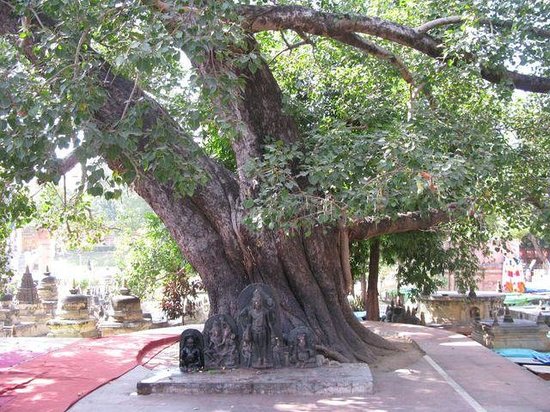 Situated in the south of the Temple, this is the tree under which the Buddha spent a week in meditation.
As per the legend, Bodhisattva broke his fast under the Rajayatana tree after six years of rigid penance and austerities by accepting a bowl of rice-milk offered by Sujata, the daughter of the local chieftain.
It is said that two merchants from Burma (presently Myanmar) named Tapassu and Bhallika while passing this way offered rice cake and honey to the Buddha and took refuge in the Buddha and His teachings ‘Buddham Saranam Gacchami, Dhammam Saranam Gacchami’ but they could not take refuge in the Sangham because the Sangha was not constituted then, thus they became the first lay devotees in the Buddhist world.
Meditation Park
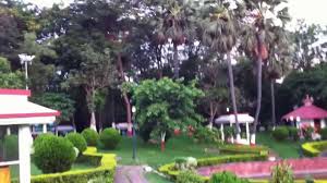 The park situated at the south-east of the temple is newly developed as a Meditation park inaugurated by His Holiness, the Dalai Lama. It has facilities for meditation huts, congregation and discussion courts and two huge prayer bells and two water fountains besides a lotus pond.
Jai Prakash Narayan Park.:–The Jai Prakash Narayan Park located immediately to the west of the Mahabodhi temple complex is the only planned park in the town. This park adds to the serenity of the temple area.
The Kalchakra Maidan:- It is the only maidan/community open space within the town. The maidan is used during festivals and is a neglected, unused space during the rest of the year.
Bodhi Sarover :- It is a pound to the west of the Bodhi Temple. It is believed that Buddha took bath in this pound before going for meditation.
Stone railing :-
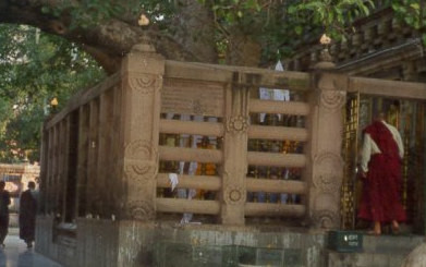 The railing was erected in the period between the first century BC and first century AD. The pillars and architraves are decorated with a variety of floral, animal and mythological symbols attributed to the Ashokan period. Medallions on the pillars portray themes typical of early Buddhist art: the Bodhi tree, a stupa and many more.
Maya Sarovar :-
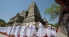 Maya Sarovar situated near Thailand Monastery (½ km. from Mahabodhi Temple). The Maya sarovar area has beautiful garden with pound and boating facilities.
Votive Stupas :-
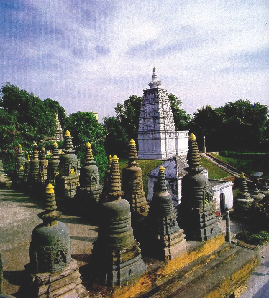 The Mahabodhi temple complex is dotted with an abundance of stupas. A majority of them date back to the Pala period (8th to 12th century) though there are older ones too. These stupas were built by pilgrims who came from Buddhist countries like Burma (Myanmar), Sri Lanka, and Tibet. You can easily identify the colourfully painted Tibetan stupas.
Taradih mound :-
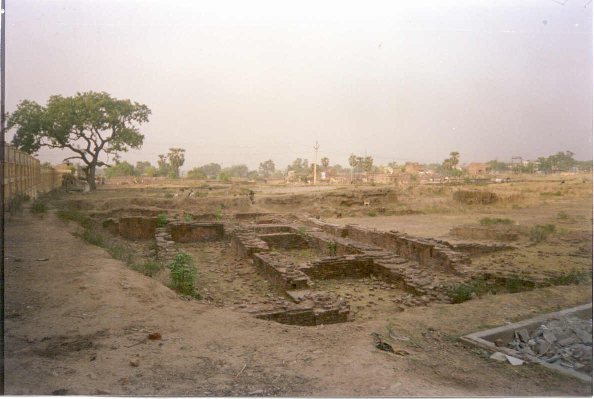 It is situated at south-west of the famous Mahabodhi temple. A monastic complex of Gupta and Pala period, having cells with a common verandah and brick platform discovered in excavation. Antiquities recovered in course of excavation are terracotta wheels, balls,earlobes, gamesman, animal and human figurines, a terracotta panel, sealings etc. Sealing mostly belong to Pala periods, representing the Buddhist creed. Sculptural pieces found in the excavation include votive stupas, panels showing thousand Buddhas, harmikas, chhattravali and pedestals of various size, image of Vishnu, etc. One thousand and ninety-nine silver coins each being of the values of a rupee, were found. Among these one thousand seventy one were issued by Queen Victoria, eleven by William IV and seventeen by Edward VII.
The site is one of the most ancient and dates back before the time of the Buddha-starting from the neolithic period down to the Pala period. Excavations reveal seven cultural phases from the neolithic period, (25th cent. – 17th cent. B.C.) Chalcolithic (17th cent. – 11th cent. B.C.), iron age (10th cent. – 7th cent. B.C.), the Buddha -Asokan period (6th cent. B.C. – 1st cent. B.C.), Kushana period (1st cent. – 3rd cent. A.D.), Gupta period (4th cent. – 8th cent. A. D.), Late Gupta and Pala period (9th cent. – 12th cent. A.D.).
Hindu Temples:-Also within the premises of the Mahabodhi temple, is a row of Hindu shrines. These temples probably came up during the period of struggle between Brahmanical and Buddhist sects. The first of these shrines has an interesting collection of Buddha statues that are now confusingly dressed up to look like Hindu deities.
Ashoka’s Pillar :-
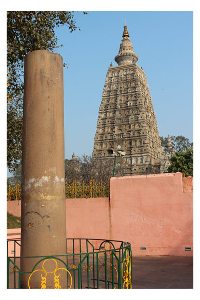 At the south-east corner of the Mahabodhi temple stands a part of the Ashokan pillar. Originally erected at Bakraur, and which was set up in Gaya in 1789. A Persian inscription shows that it was set up in its present position (Gaya) in 1789. In 1956, it was moved from Gaya and erected at the south-east corner of the Mahabodhi temple
Ramsagar Tank:- This is one of the oldest tank of Gaya district.On its east lies the pious Gayatri Maan Temple.
International Meditation Centre :-
 It is situated in Bodhgaya established in 29 January 1970 and is the first registered Vipassana Meditation centre in India. It offers courses on meditation and Buddhist philosophy. The centre also conducts retreats round the year where the meditators from all over the word come together to participate. Buddhists from different parts of the world come together for Kathina Civara Dana or The Rope- offering Ceremony, which is held after the Vasa Vasa or The Rainy Retreat. The ceremony is organized to offer robes to the venerable monks by the devotees.
Dhamma Bodhi Vipassana Meditation Centre:-
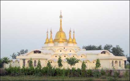 Dhamma Bodhi Vipassana Meditation Centre is situated at about 6 Km. distance from the Mahabodhi Mahavihara at the Southern end of the Magadh University Campus at a very quiet and calm atmosphere. Inside structures are a Dhamma-hall, office-building and many meditation cottages. This is one of the centres being run under the internationally renowned meditation teacher Dr. S. N. Goenka. The centre conducts meditation courses twice a month, except only in May-June. Each session is for 10 days.
Mahabodhi Meditation Centre::-
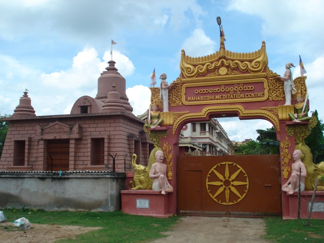
Art of living Ashram :-
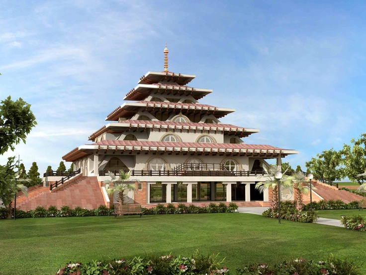 It is situated one km away from Mahabodhi temple. It is inaugurated by the founder of the Art of Living Foundation, Sri Sri Ravi Shankar on the dated January 2012.The lush green ashram spread over 15 acres has facilities to cater to national and international visitors and an architectural marvel hall where over 500 people can meditate.The ashram provide accommodation facilities for over 1000 devotees.
Jai Shree Mahabodhi Mahavihar:-
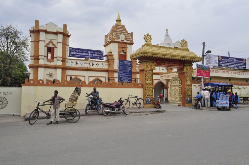 Important tourist spot built by the Mahabodhi Society of India in 2007. In this temple, the Ancient Relic Casket of ‘Sariputra’ & ‘Mahamalyayan’, main disciples of Lord Buddha is preserved. It was shifted from Mahabodhi Society of Kolkata Headquarter in 2007. This was first disclosed by Alexander Cunningham (1869 – 1870) in his archeological excavations in Sakchi (Varanasi U. P.)
Thai Temple :-
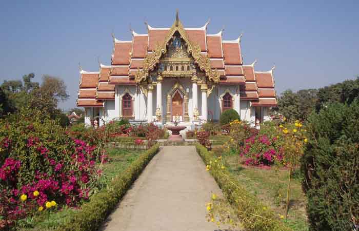 The temple is erected by Thailand,devoted to the Lord Buddha . the Thai temple is one of the more impressive monasteries in Bodhgaya. It was built in 1956 by the Thai King and the Indian Prime Minister as an initiative to strengthen relations between the two countries. The temple stands facing the main road, next to the tourist bungalow.The Thai Temple has a typical sloping, curved roof covered with golden tiles.
Inside the Uposatha building (temple) there is a huge Astadhâtu statue of the Buddha. There are beautiful paintings in the niches of the walls of the building. This Temple also has a guest house where pilgrims from Thailand come and stay.
Chinese Temple:-
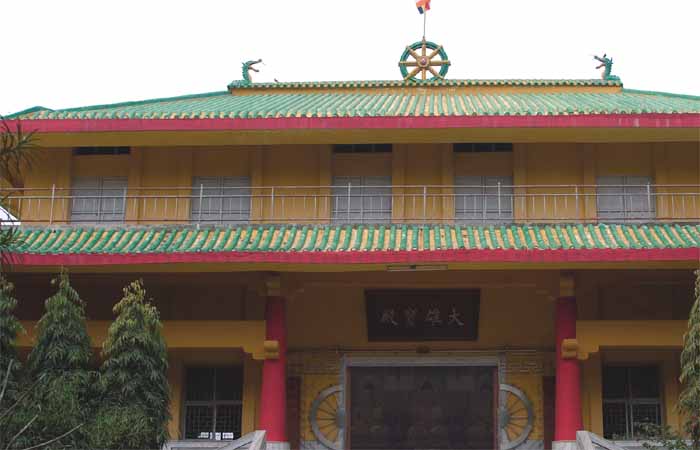 The Chinese Monastery stands about one hundred metres north-west of the Mahabodhi Mahavihara. The Temple was one of the oldest and had extricate decorated woodwork but due to decay was rebuilt in the year 1997.
Chinese temple or vihåra of Bodhgaya was built in 1945 by SITING CHEN, a Chinese monk. The temple then had enshrined a black stone image of Mukutdhâri Buddha with golden polish. At present the Temple houses three very beautifully carved Buddha Statues in three different forms in golden colour.
Japanese Temple(the Daijokyo):-
 The Daijokyo Buddhist Temple has been constructed on the 2 acres of land allotted by the Government of Bihar. This Temple was inaugurated on Feb. 13, 1983 by the then President of India, His Excellency Giani Zail Singh. The Temple is a two storey concrete building with a three storey pagoda on the top in Japanese style. The Buddha image enshrined inside the Temple is in the meditation posture made of bronze and brought from Japan.
Japanese Temple (Indosan Nipponji):-
 The construction of Indosan Nipponji was completed in November 1973, and was formally inaugurated by Sri V. V. Giri, the then President of India on 8th December 1973, under the auspices of KOKUSAI BUKKYO KORYU KYOKAI (International Buddhist Brotherhood Association)
Japanese temple of Bodhgaya is built on the pattern of an ancient Japanese wooden Temple and it seems to present a natural beauty without any artificial decoration and design. Interior of the Temple wall depicts paintings connected with some of the important events of the life of the Buddha.
It has a 150 ft high gold statue of the meditating Buddha brought from Japan.
The Myanmar (Burmese) Temple :-
 The present Burmese Vihara is located 1 kilometres north of the Mahabodhi Temple on the banks of the river Niranjana on the Bodhgaya-Gaya road and was founded by Ven. Nandamala in the year 1936.
The monastery consists of two worship halls, each containing the statue of Lord Buddha. Besides, there is also a newly constructed meditation Hall and a spacious guest house for the use of pilgrims.
Mahabodhi Society of India:-
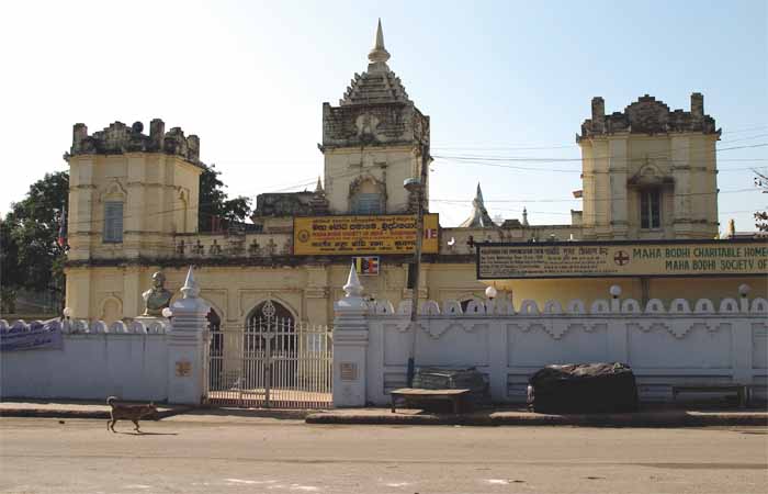 The Mahabodhi Society of India is the oldest Buddhist Society at Bodhgaya. It was founded by Devamitta Anagarika Dharmapala in 1891 when he was on a pilgrimage to India.
Tibetan monastery :-
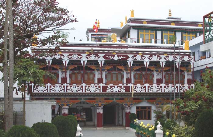 This monastery represents the Mahayana sect of Buddhism and is one of the biggest monasteries at Bodhgaya, where Tibetan monks reside. It was founded by Lama Kanpo- Ngawang Samten in 1934. The monastery exists at about 100 metres away west of the Mahabodhi Mahavihara. Its architectural style is very unique as it has been influenced with Tantrayåna Buddhist Art & Paintings. A “Dharmachakra-Wheel”, very big in size is located on the ground floor measuring about two hundred quintals. It is believed that if rotated one may get remission from their committed sins.
They also have a guest house and a Dharmashala which can house many pilgrims at affordable rates.
Royal Bhutan Monastery:-
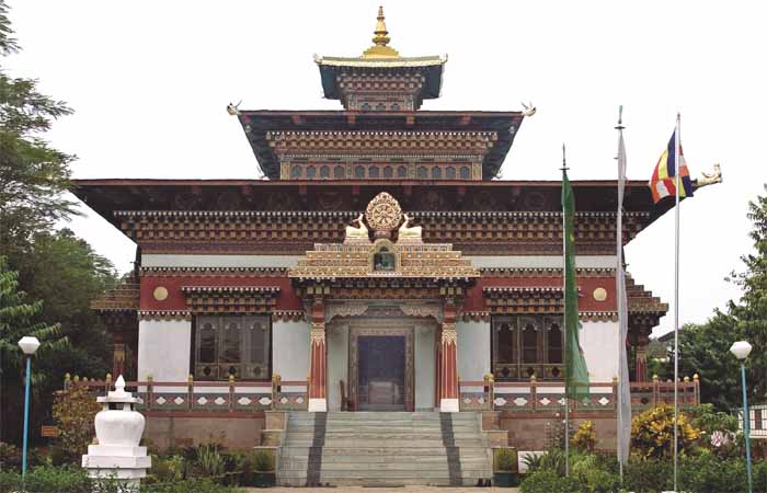 Just north of the Japanese Temple is the Bhutan Monastery of the Royal Government of Bhutan. The Land was donated by the State Government for building the monastery.This temple is built in Bhutan architectural style.The Temple is very beautiful in the sense that every inch of wall and ceiling has been used to depict the life events of the Buddha. The walls are not painted but decorated with Clay-Carvings and in variety of fast and deep colors.
Vien Giac Institute (Vietnam Temple):-
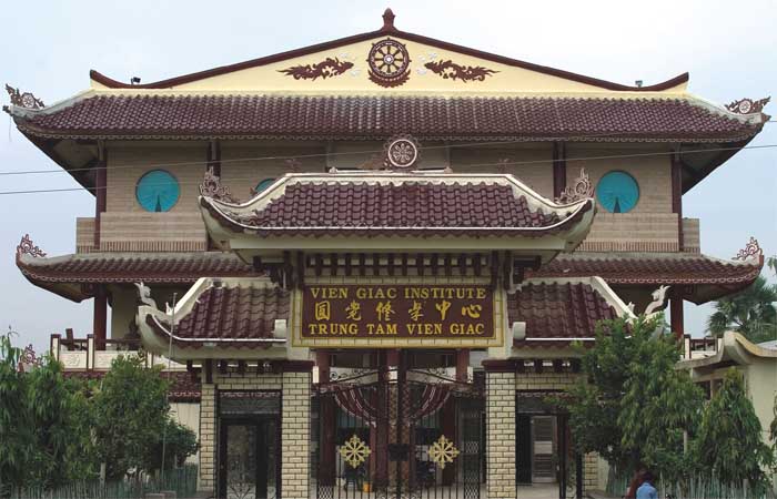 This institute has been established in the year 2002. It belongs to Lin Tzi Zen Tradition but practises Pure Land Buddhism. This is situated at the west of the Kalachakra Ground and is at the distance of five minutes walk from the Mahabodhi Mahavihara. The one pillar Temple at the entrance represents the symbol of Vietnamese Buddhism. In the temple is a statue of relaxed Avalokitesvara. On the third floor there is a prayer hall with the Buddhas of the three times’ Amitåbha of the Past, Sakyamuni of the present and Maitreya of the future. In the temple there are statues of Eighteen Arhats also. The Library of the institute contain books in Vietnamese and English.
Karma Tibetan Temple:-
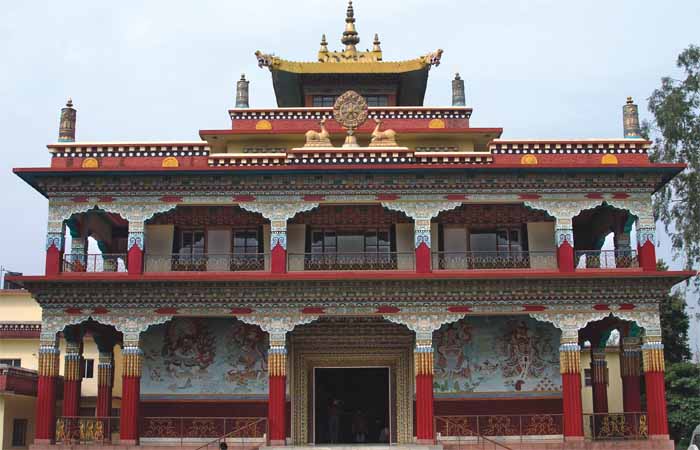 This Kadgyu Karma Tibetan Temple is a beautiful Tibetan Temple situated just beside the Daijokyo Japanese Temple and just west of Indosan Nipponji. This temple was opened some fifteen years ago.
The Temple wall is finely depicted with the paintings of the event of the Buddha’s life. These paintings preach unique mixed view in the sense that the theme is Indian, the style is Tibetan and the painter has given western influence through their brush-work.
Shechen Monastery:-
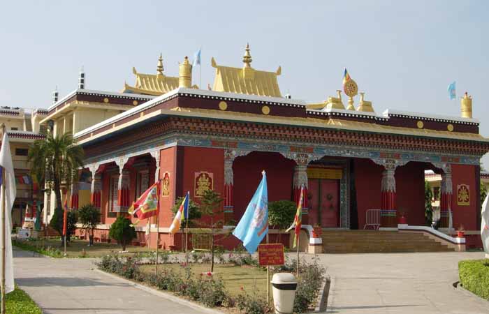 Shechen Monastery is a Tibetan Nyingma Monastery situated beside the Chinese Temple. This is a very beautiful Temple with many other massive structure in its premises. It was opened in 1997 by H. H. the Dalai Lama. It has a Meeting hall, Prayer hall, Library and Research Institute.
Bangladesh Buddhist Monastery:-
Giant Buddha statue:-
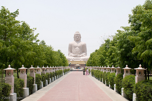 The Giant Buddha statue, which is 24 m tall is situated nearby Japan’s Nippon Temple,and has the Buddha seated in the Dhyan Mudra position. Its unveiling ceremony was performed by His Holiness the Dalai Lama on the 18th November, 1989.
The great Buddha statue was designed in Japan and its one fourth size model was prepared by an Indian artist of Calcutta. This statue’s interior construction is of concrete pillars and several cells inside where more than 20 thousand small bronze Buddhas have been enshrined. This Great statue, however symbolises the greatness of the Buddha Dhamma as followed by his disciples. At present this statue is the highest Buddha Statue in India.
Root Institute for Wisdom Culture:-
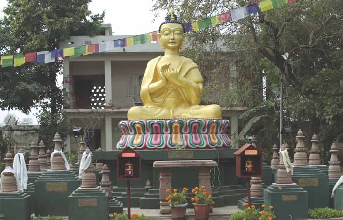 Root Institute is a charitable trust which was founded in 1984 by the late Lama Thubten Yeshe, a Tibetan Buddhist Scholar and teacher. It was Lama Yeshe’s wish to create a high quality Cultural, Social, Educational, Religious Centre as an offering in recognition of India’s kindness as the original source of Buddhist Philosophy and Culture and for the support to the Tibetan people after the political events of 1959.
Root Institute has established a building in which they have a meditation hall and guest rooms for visitors and students attending meditation classes. The institute also has “outreach Projects” which include Root Village Reconstruction Project, Community Project, Leprosy Project, School, Cultural Programmes and a Destitute Home. At present the premises has a beautiful Temple enshrining the statues of Kadampa Lama, two chief disciples of the Buddha, Medicine Buddha, Manjusri, Avalokitesvara, Tara etc.
Archeological Museum Bodhgaya :-
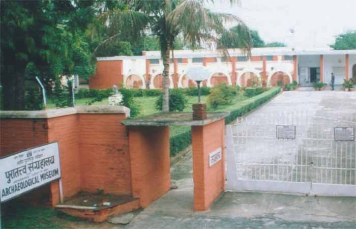 The museum was established in the year 1956 with a view to preserving locally scattered sculptures and other precious antiquities. It is situated a short walk distance from the temple opposite Jaiprakash Park .It has a large, interesting collection of relics (Buddhist and Hindu) along with terracotta seals, scriptures and metal images belonging to the Pal’s and to the first century B.C. The museum consists of two galleries. The first gallery exhibits sculptures including standing Yakshi figure having elaborate coiffure, crowned Buddha in Bhumisparsamudra, Maitreya, images of Buddha in different attitude, standing image of Manjusri, terracotta plaque depicting Buddha in Bhumisparsha mudra, railing pillar depicting Surya, panel showing Sahasra Buddha, copper antimony rod, miniature pot, etc.
In second gallery are exhibited sculptures associated with Buddhist and Brahmanical faith. Among them mention may be made of panel showing Sapta matrika, Dikpalas, Dashavatara of Lord Vishnu.
The courtyard of the museum contains stone railing pillars which were originally placed in the Mahabodhi Temple complex. These pillars were constructed in the 1st century B.C. and in the 7th century A.D. The earliest pillars are made of red sandstone with artistically articulated carvings depicting the Sunga Folk Art. On them are found the depiction of the scene related to Jâtaka, flora and fauna, astronomical signs, yakshi, surya, stupa, Bodhi tree, Vajrâsana etc. Amongst these, the most remarkable are depiction of Surya, jâtaka scenes, chaitya, yakshi climbing on tree etc. The granite railing pillars were constructed by the king Purnawarman in the 7th cent. A.D. On them are depicted chaitya, stupa, astronomical motifs, flora and fauna, auspicious sign motifs such as Kirtimukha and cow with calf etc.
Closed Fridays.
Bodhgaya Multimedia Museum:-
It is in old PWD building. It is situated next to the Mahabodhi Temple.
 This museum will give a thorough study dating back 2500 years in a more interesting and informative manner, that is in a visual format. The entire show is divided into four sections which are dedicated to different things – 3D animation, historical background, geographical coverage and thoughts of Lord Buddha. It is arranged exactly at the passage of Mahabodhi temple.this is a grand spot who don’t know much about Buddha It is a 45 min show. It is demonstrated in Hindi, english, japanese, sinhalese and Thai relying upon group. Open all 7 days of the week.
Nawan:- The KP Jayaswal Research Institute, during in the course of its Archaeological Explorations brought to light the site period Early medieval. Kurmawan:- The KP Jayaswal Research Institute, during in the course of its Archaeological Explorations brought to light the site period Early medieval. Amawan:- The KP Jayaswal Research Institute, during in the course of its Archaeological Explorations brought to light the site period Early medieval.
Mora Hill or Pragbodhi mountain or Dhungeswara mountain :-
Dungeshwari Cave(Mahakala caves) Temple
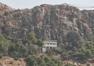 Prag Bodhi mountain, popularly known as Dhungeswara, is situated close to Khiriyawan village in Gaya, about 5 Kilometers to the north-east of Bodh Gaya on the eastern bank of the river Phalgu. Gautama Siddhartha is believed to have piously meditated at this place for six years before he went to Bodhgaya for the final realisation. Two small shrines are built to commemorate this phase of Buddha. A golden emaciated Buddha
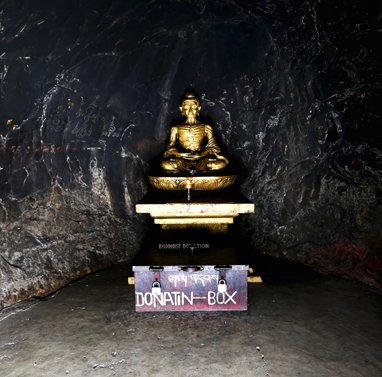 sculpture memorising the rigid penance is enshrined in one of the cave temples and a large (about 6’ tall) Buddha statue in the other.
A Hindu goddess deity Dungeshwari is also placed inside the cave temple.Dungeshwari cave temples are also popular as Sujata Sthan to local people. An interesting story is being famous on this temples. It is believed that when Buddha was doing his self-mortification, he became frail, feeble and starved. When he rested under a Banyan tree, a doomed village women named Sujata offered him food. Buddha accepted her offerings and consumed the food, his explicit approval presented him with a divine truth that neither extreme self indulgence nor self-abasement is the right way to attain enlightenment. Buddha attained the knowledge that follow the middle path was require to attain the supreme nirvana. Sujata Sthan or Dungeshwari Temple stands as a symbol commemorating this event.
The literal meaning of the word Prag Bodhi is ‘prior to enlightenment’. The hill has been identified by Alexander Cunningham with the Prag Bodhi Mountain of the Buddhist tradition, where the 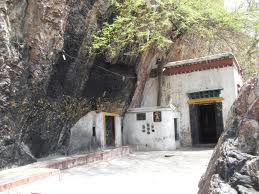 Buddha lived for six years before he proceeded to Uruvela (modern Bodh Gaya).Half-way up the western slope of the hill, facing the river Phalgu, quite hidden from below by a wall of rock ,is a natural fissure or cavern, where the Bodhisattva Siddhartha is said to have lived. Both Fa Hian and Hiuen Tsiang visited and described the cave of the Prag Bodhi Mountain and their accounts according to Cunningham, would perhaps refer to this cave. At the back or east side of the cavern there is “a ledge of rock, which probably served as a pedestal for the shadow of the Buddha which was figured on the rock.A broken stone image of an eight-armed goddess, with a few letters of the Buddhist formulae in Kutila characters of perhaps the 9th or 10th century, lies in the cave. Above the cave, along the summit of the hill, are the remains of some seven stupas of different sizes which Hiuen Tsiang says were built by Asoka.
Upper Palaeolithic tools comprising scrapers points and blades of quartzite and chert in the vicinity of the Dungeshwari cave were found.
Jamari:– The KP Jayaswal Research Institute, during in the course of its Archaeological Explorations brought to light the site period NBPW phase. Koshila:- The KP Jayaswal Research Institute, during in the course of its Archaeological Explorations brought to light the site period Early medieval. Guri:- The KP Jayaswal Research Institute, during in the course of its Archaeological Explorations brought to light the site period NBPW phase. Khajawati:– The KP Jayaswal Research Institute, during in the course of its Archaeological Explorations brought to light the site period Early medieval. Ilra:- The KP Jayaswal Research Institute, during in the course of its Archaeological Explorations brought to light the site period NBPW phase. Parharia:- The KP Jayaswal Research Institute, during in the course of its Archaeological Explorations brought to light the site period Medieval. Bataspur:– The KP Jayaswal Research Institute, during in the course of its Archaeological Explorations brought to light the site period NBPW phase.
Bakraur Village:- Bakraur was a village situated in the neighbourhood of Uruvela on the bank of the Nairanjana. It formed a part of the Uruvela forest tract that covered a large area. As per the legend, this was the place where Buddha accepted the bowl of rice-milk offered by Sujata, the daughter of the local chieftain
Sujata’s Stupa(Bakraur) :-
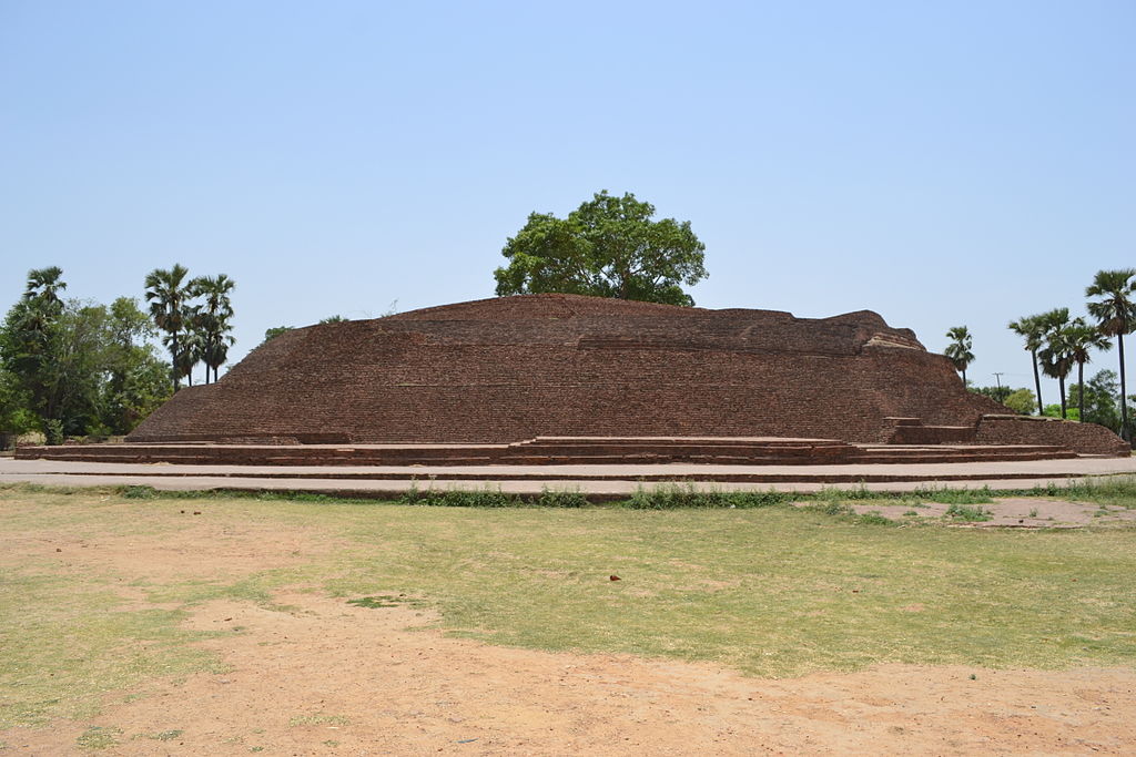 Bakraur village is located on the right bank of the river Niranjana about 1 km from Bodhgaya. To the north of the village are the remains of a large brick stupas and a short distance from it is the stump of a sand-stone pillar, the shaft of which was set up in Gaya in 1789.The site is traditionally known by various names like Sujata kuti, Sujata Quila, Sujata garh or Sujata’s stupa named after the maiden Sujata, the daughter of the chief of the village. According to legend, Sujata offered some kheer (milk-rice) to the Buddha after he had undergone severe austerities for six year to gain Enlightenment, which helped him recover miraculously.The excavation revealed that the stupa was found to be built in three stage, the earliest occupation of the site was in the second-first century B.C. and the third was to a date between eight and tenth century A.D. Several plaques of Buddha in Bhumisparsha-mudra were found near the damaged top of the stupa. The important finds of the excavation include,a fragmentary ear-ornament of gold, small terracotta plaques, beads of agate and terracotta, a punch -marked coin; head, torso and multiple Buddha in stone, a few ornamental pieces and a terracotta sealing.
Meditation Hall :-
Sujata temple:-
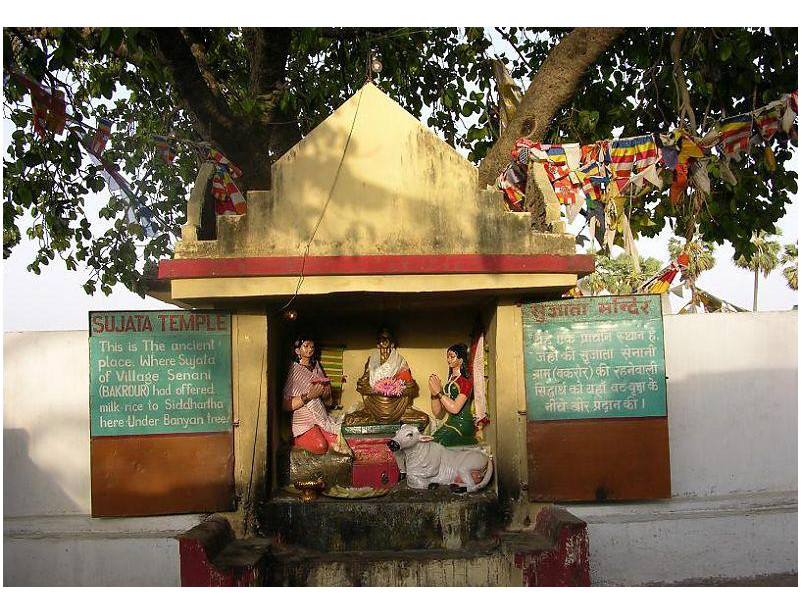 As per the legend, Buddha broke his fast under the Ajaypala Nyagrodha tree by accepting a bowl of rice-milk from Sujata. He is also said to have spent the fifth week of enlightenment under the tree. After many decades later Matang Vapi Rishi came and set up his ashram near the tree. Two temples were constructed then – one of Sujata enclosing the tree and the other of Shiva. The Buddhists and Hindus revere the former while the latter is revered by the Hindus.
Matang Vapi & Matangeshwar temple (Bkraur):-
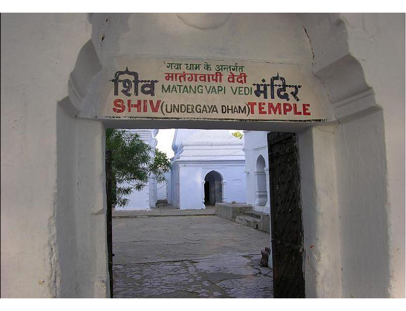
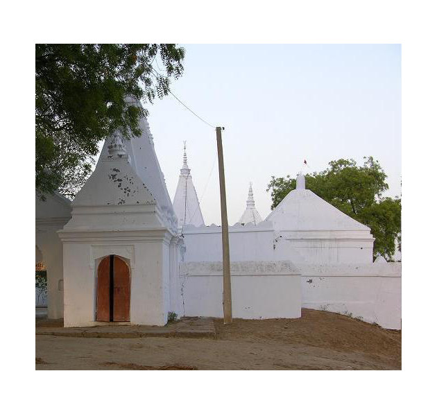 A short distance to the south east of the Sujata stupa there is a sacred place of pilgrimage called Matangi, which contains the remains of a large tank marked by ancient embankment, called Matanga-vapi, and a modern temple with a Lingam of Matangeshwar.There is also a small Hindu Math or monastery and a tank sacred to the sun where an annual fair is held.
According to Jayaswal Research Institute Archaeological Explorations this site belongs to Early medieval period.
Dharam-Aranya :-
It is presently a sandy stretch in the Bakraur. Dharamaranya (dharma or holy forest) is a holy forest
associated with the life of Buddha. It was the site of the ashram of the sage Uruvela Kashyup. Buddha is supposed to have meditated here
Mahayani temple: According to Mahayani sect, Siddhartha sat under a Pipal tree located in the campus. Later on in the late 19th century a temple complex was constructed with idols of Hanuman, Durga, Vishnu and Shiva. The temple complex is located at the bank of river Mohana and is revered by both Buddhists and Hindus.
Dharmaranya:= The place is situated at a distance of 3 km from Bodhgaya and is located near village Silaunza on river Mohane. It is said that Yudhisthira performed a Yagnya (sacrificial offering) at this place some time after the epic war of Mahabharata A pound and few small but well designed temple dedicated to different gods are believed to be associated with this event.The place is also held to be holy by Buddhists, as Lord Buddha is believed to have meditated here for some days.
According to Jayaswal Research Institute Archaeological Explorations this site belongs to Early medieval period.
Shavait:- The KP Jayaswal Research Institute, during in the course of its Archaeological Explorations brought to light the site period Early medieval. Hathiyar:- The KP Jayaswal Research Institute, during in the course of its Archaeological Explorations brought to light the site period NBPW phase. Jindapur:- The KP Jayaswal Research Institute, during in the course of its Archaeological Explorations brought to light the site period NBPW phase. Silaunja:- The KP Jayaswal Research Institute, during in the course of its Archaeological Explorations brought to light the site period Early medieval. Basari:- The KP Jayaswal Research Institute, during in the course of its Archaeological Explorations brought to light the site period Early medieval. Chirki:– The KP Jayaswal Research Institute, during in the course of its Archaeological Explorations brought to light the site period Late NBPW phase. Pathalgarh:– The KP Jayaswal Research Institute, during in the course of its Archaeological Explorations brought to light the site period Medieval. Gothu:- The KP Jayaswal Research Institute, during in the course of its Archaeological Explorations brought to light the site period Late NBPW. Shekhwara:-_The KP Jayaswal Research Institute, during in the course of its Archaeological Explorations brought to light the site period Early medieval.
Bodh-Gaya Math (Shankaracharya Math and temples),Shaiv Math:-
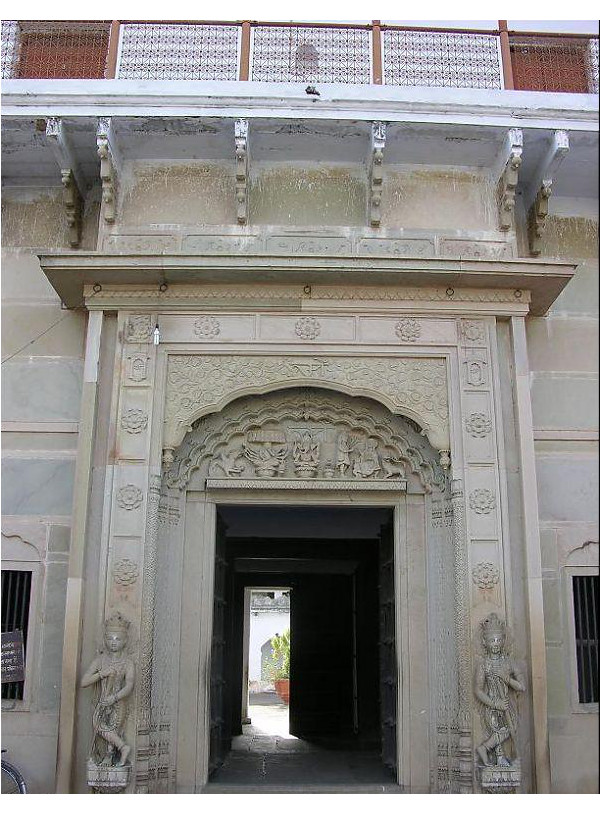
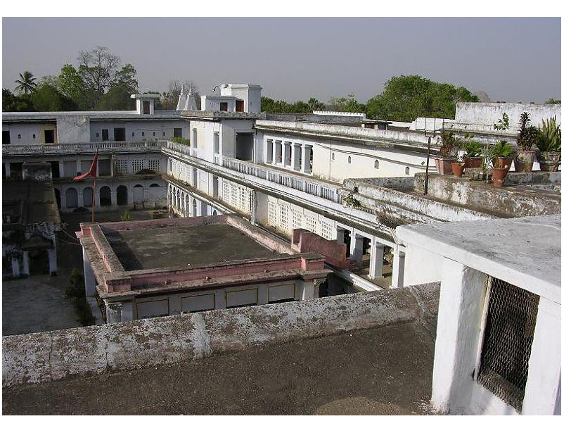 The Bodhgaya Math is an ancient monastery of the Hindu Sanyasis who belong to one of the ten orders of Sankaracharyas Saivite School. It traces its origin back to the middle of the sixteenth century of the Christian era. In 1590 AD. A wandering Saiva monk Gossain Ghamandi Giri arrived at Bodh Gaya and decided to make the place his permanent abode. Hence, close to the ruins of the Temple, he erected a small monastery and in course of time this monastery grew in importance and developed into the present enormous Math of the Mahanth. Later on the adjacent villages including the temple were given to him as grants by the Muslim emperor of Delhi. After independence the Temple came into the hands of Bodhgaya Temple Management Committee. At present the Math has a very good collection of Buddhist sculptures.
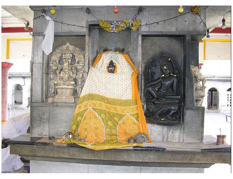
Gossain Ghamandi Giri was the first Mahant and founder of the monastery and after his death his remains were interred in the enclosures of the Mahabodhi temple and a small temple was built thereon.
According to Jayaswal Research Institute Archaeological Explorations this site belongs to Early medieval period.
Niranjana or Falgu River :-
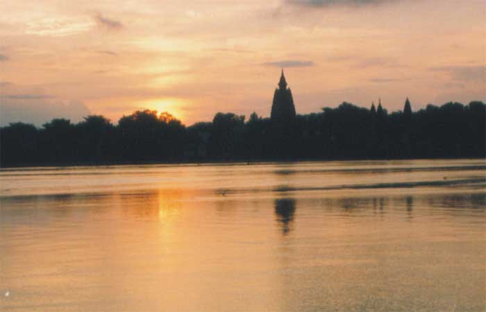 This river is a natural landmark that attracts tourists who like to wade in the water to cool off, especially in the summer. The river is wide, sandy and shallow even in the rainy season. It’s a great picnic spot for tourists who want to sit around on the banks under shady trees.
River Niranjana, running South to North, on the bank of which Bodh Gaya is situated. River Niranjana has an important place in Buddhism. Buddhist Literature places on record how before his attaining Buddhahood the ascetic Siddhartha was charmingly impressed by this locality on his first arrival here. His impression finds a marvelous expression in the following measured terms.
“Pleasantly picturesque is this part of land. Delightful is the sight of the grassy woodland. The river Niranjana is flowing on in glossy stream, showing the bathing places with gradual descents of steps, presenting a charming landscape, and affording glimpses into the neighbouring hamlets easy to access. This must needs be the fitting place for a scion of a noble race strenuously striving after the highest attainments.”
Jani Bigha:- An ancient image of Mahishasurmardini was found here, which is well preserved in the Naradah Museum, Nawada.
TEKARI BLOCK
Tikari:-
 In South Bihar, the most prominent representative of Bhumihar Brahmin was the Tekari Raj family, whose great estate in Gaya dated back to the early eighteenth century.The last great ruler of Magadha was maharaja of Tikari. The fort of Tekari raj is an instance of art and architecture. The King’s palace is built up on a high platform.
It is said that at the distance of 3 kms from the kings palace there was a big pond. The palace and the pond was interconnected with this tunnel. Near that pond there was a beautiful garden.
Panchdevta (tikari Quilla):- The KP Jayaswal Research Institute, during in the course of its Archaeological Explorations brought to light the site period Early medieval. Fatehpur:- The KP Jayaswal Research Institute, during in the course of its Archaeological Explorations brought to light the site period Late medieval. Khanetu:- The KP Jayaswal Research Institute, during in the course of its Archaeological Explorations brought to light the site period Early medieval. Pandey Bigha:- The KP Jayaswal Research Institute, during in the course of its Archaeological Explorations brought to light the site period Early medieval. Badlu Bigha:- The KP Jayaswal Research Institute, during in the course of its Archaeological Explorations brought to light the site period Early medieval. Jogni:– The KP Jayaswal Research Institute, during in the course of its Archaeological Explorations brought to light the site period Early medieval. Bazidpur:- The KP Jayaswal Research Institute, during in the course of its Archaeological Explorations brought to light the site period Early medieval. Jagdar:- The KP Jayaswal Research Institute, during in the course of its Archaeological Explorations brought to light the site period Early medieval. Pali:– The KP Jayaswal Research Institute, during in the course of its Archaeological Explorations brought to light the site period Early medieval. Aghori Bigha:– The KP Jayaswal Research Institute, during in the course of its Archaeological Explorations brought to light the site period Early medieval. Chiraili:- The KP Jayaswal Research Institute, during in the course of its Archaeological Explorations brought to light the site period Early medieval. Jarhipar:– The KP Jayaswal Research Institute, during in the course of its Archaeological Explorations brought to light the site period Early medieval.
Bramsthan (Makpa) :- It is situated in Tekari sub division. Patna museum numismatist Anant Ashutosh Dwivedi has claim to discovered a one-of a kind late Pala period 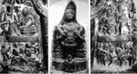 sculpture which is unique in that it represents a convergence of Brahmanism and Buddhism. As per his claim,” it is clear from all the bearing of the main statue that it is the image of the Sun God. In the middle portion of its chest is the image of Tara Devi, a Buddhist deity, seated in Laliteshwar mudra.Her left leg is folded, while her right leg is in a hanging position.Tara Devi also holding a lotus in her left hand.By the side of the main statue is seated Lord Buddha in Abhay mudra.There is several other attending figures on the left and right sides of the main statue.”
This unique stone sculpture of Surya is presently fixed in a niche of the circumambulatory path in a modern temple erected on a small mound near the village.(photos: Melzer & Mevissen 2013).
According to Jayaswal Research Institute Archaeological Explorations this site belongs to Early medieval period.-
Gopalpur:- The KP Jayaswal Research Institute, during in the course of its Archaeological Explorations brought to light the site period Early medieval. Mishir Bigha:– The KP Jayaswal Research Institute, during in the course of its Archaeological Explorations brought to light the site period Early medieval. Madarpur:- The KP Jayaswal Research Institute, during in the course of its Archaeological Explorations brought to light the site period Early medieval. Shankarpur:- The KP Jayaswal Research Institute, during in the course of its Archaeological Explorations brought to light the site period Early medieval. Sikariya:- The KP Jayaswal Research Institute, during in the course of its Archaeological Explorations brought to light the site period Early medieval. Alalpur:- The KP Jayaswal Research Institute, during in the course of its Archaeological Explorations brought to light the site period Chalcolithic.Kailashpur:- The KP Jayaswal Research Institute, during in the course of its Archaeological Explorations brought to light the site period Early medieval. Panchanpur:- The KP Jayaswal Research Institute, during in the course of its Archaeological Explorations brought to light the site period Late medieval. Shiva Bigha:– The KP Jayaswal Research Institute, during in the course of its Archaeological Explorations brought to light the site period Early medieval. Dhebariya:- The KP Jayaswal Research Institute, during in the course of its Archaeological Explorations brought to light the site period Early medieval. Harna:- The KP Jayaswal Research Institute, during in the course of its Archaeological Explorations brought to light the site period Early medieval. Nimsar:- The KP Jayaswal Research Institute, during in the course of its Archaeological Explorations brought to light the site period Early medieval. Bedauli:- The KP Jayaswal Research Institute, during in the course of its Archaeological Explorations brought to light the site period Early medieval. Makhdumpur:- The KP Jayaswal Research Institute, during in the course of its Archaeological Explorations brought to light the site period NBPW phase. Murar Bigha:- The KP Jayaswal Research Institute, during in the course of its Archaeological Explorations brought to light the site period Early medieval.
Kespa:- It is situated about 10 Kilometers north of Tekari or 20 Kilometers west of the Barabar hills and its ancient ruins were first noticed by Buchanan who, however, mentions the name of the place as Kaspa – bahiya. In 1872-73 Beglar also surveyed the village for its ancient ruins and probably Bloch later visited it in 1902; but he says nothing about the ruins.In Buchanan’s time the place had been and still is even today, famous for its temple dedicated to goddess Tara and situated at the west end of the village. A legend that Tara Devi had been an oilman’s wife of great sanctity, whom the tyrannical Raja Bali desired to seize in order to gratify his lust. It is said she prayed to her deity for protection and suddenly both she and the Raja were turned to stone. She is now worshipped as Tara Devi; while the Raja ‘stood’ neglected, in Buchanan’s time at least, represented in a colossal image, more than life size, at a short distance away. The latter image was also found surrounded by ruins of carvings and broken images, thus obviously indicating a site of another temple. Buchanan was further told that there were scattered a number of bricks or mounds in the vicinity and 10 or 12 of them were already ransacked by the villagers for building material. Buchanan further comments: “This place has certainly been a city or situation of an extensive religious establishment. The villagers say it was the residence of Kasyapa,” one of the names of the Buddha himself, according to Buchanan; though it may possibly indicate the name of the famous disciple of the Buddha.”
In July 2008, The Buddhist Heritage conducted a thorough survey of the site including the Tara Devi image in the temple. They were told the myth about Tara and Bali Raja. Tara Devi image without doubt is an image of the Buddha dating to the Gupta period (4th-5th Century CE.) The mud temple seen by Buchanan no longer exists. In place of it is a modern well decorated brick temple. Outside the temple, under a tree, pieces of broken images canstill be seen, these included innumerable heads of Buddha, Tara, and Avalokitesvara as well as floral designs from pieces of pillars that once adorned a Buddhist Temple. Close to the tree is a small temple portraying the image of Hindu Deity smeared with vermillion. Hardly a few feet away from the temple is a low mound of which they were told that it could be the remains of a monastery. In the fields surrounding the mound, in the process of cultivating their fields, villagers have found Buddhist and Hindu images. The images that were intact were sold to the art dealers in Delhi.
Further in the village they found the Buddha image which is still referred to as Bali Raja. On the halo they discovered an inscription in Brahmini script and on reading it found it to contain the usual Buddhist creed formulae. The image has been cemented into a wall. The Buddha image is draped in a Dhoti; similar to the garment worn by the male villagers. The image now stands in the compound of a Brahmin Pujari who owns the image, performs pujas (religious rituals) twice a day and even organizes a special festival for the deity. Strangely, Bali Raja is no longer considered as the potential abductor of Tara Devi, but as a image with powers to answer the prayers of the devotees.
According to Jayaswal Research Institute Archaeological Explorations this site belongs to Early medieval period.
Lau:- The KP Jayaswal Research Institute, during in the course of its Archaeological Explorations brought to light the site period Early medieval. Simuara:–The KP Jayaswal Research Institute, during in the course of its Archaeological Explorations brought to light the site period Early medieval. Paluhanr:- The KP Jayaswal Research Institute, during in the course of its Archaeological Explorations brought to light the site period Early medieval. Belarhi:- The KP Jayaswal Research Institute, during in the course of its Archaeological Explorations brought to light the site period Early medieval. Bhainsmara:- The KP Jayaswal Research Institute, during in the course of its Archaeological Explorations brought to light the site period Early medieval. Bhawanpur:– The KP Jayaswal Research Institute, during in the course of its Archaeological Explorations brought to light the site period Early medieval. Jamuara:– The KP Jayaswal Research Institute, during in the course of its Archaeological Explorations brought to light the site period Early medieval. Paluhanr Garh:- The KP Jayaswal Research Institute, during in the course of its Archaeological Explorations brought to light the site period Early medieval. Bala Bigha:- The KP Jayaswal Research Institute, during in the course of its Archaeological Explorations brought to light the site period Early medieval. Mau:- The KP Jayaswal Research Institute, during in the course of its Archaeological Explorations brought to light the site period Early medieval. Rewai:- The KP Jayaswal Research Institute, during in the course of its Archaeological Explorations brought to light the site period Early medieval. Bohiya garh:– The KP Jayaswal Research Institute, during in the course of its Archaeological Explorations brought to light the site period Gupta.
Khanqah Qutubiya (Miran Bigha):-
Hazrat Syed Shah Tajuddin Ashraf Mirani
DOBHI BLOCK
Ghoraghat:– This is a Pass through the range. The rout leads from Kiri across the northem range of the hills into the open plain beyond. Since early days it has been a much frequented line of communication. Foundation of ancient walls are seen when ascending throuh the defile which leads up to the Pass from south. The remains become far more distinct on the north side.
According to Jayaswal Research Institute Archaeological Explorations this site belongs to Early medieval period.
Hardawan:- The KP Jayaswal Research Institute, during in the course of its Archaeological Explorations brought to light the site period Early medieval. Purasin:- The KP Jayaswal Research Institute, during in the course of its Archaeological Explorations brought to light the site period NBPW phase. Habibpur:- The KP Jayaswal Research Institute, during in the course of its Archaeological Explorations brought to light the site period Chalcolithic. Makhraur Garh:- The KP Jayaswal Research Institute, during in the course of its Archaeological Explorations brought to light the site period NBPW phase. Bajoura Garh:– The KP Jayaswal Research Institute, during in the course of its Archaeological Explorations brought to light the site period NBPW phase. Dobhi:- The KP Jayaswal Research Institute, during in the course of its Archaeological Explorations brought to light the site period Early medieval. Amarut Garh:- The KP Jayaswal Research Institute, during in the course of its Archaeological Explorations brought to light the site period Early medieval. Sita Chak:– The KP Jayaswal Research Institute, during in the course of its Archaeological Explorations brought to light the site period Kushan. Suraj Mandal:- The KP Jayaswal Research Institute, during in the course of its Archaeological Explorations brought to light the site period Late medieval. Bahra Bhurkunda:- The KP Jayaswal Research Institute, during in the course of its Archaeological Explorations brought to light the site period Early medieval. Wari:– The KP Jayaswal Research Institute, during in the course of its Archaeological Explorations brought to light the site period NBPW phase. Ghirsindi Khurd:- The KP Jayaswal Research Institute, during in the course of its Archaeological Explorations brought to light the site period Early medieval. Garh Karmauni:- The KP Jayaswal Research Institute, during in the course of its Archaeological Explorations brought to light the site period NBPW phase. Patti:- The KP Jayaswal Research Institute, during in the course of its Archaeological Explorations brought to light the site period Early medieval. Kesapu Dih:- The KP Jayaswal Research Institute, during in the course of its Archaeological Explorations brought to light the site period Early medieval.
FATEHPUR BLOCK
Fatehpur garh:-The KP Jayaswal Research Institute, during in the course of its Archaeological Explorations brought to light the site period Medieval. Jaipur garh:– The KP Jayaswal Research Institute, during in the course of its Archaeological Explorations brought to light the site period Chalcolithic. Sandeshwar:– The KP Jayaswal Research Institute, during in the course of its Archaeological Explorations brought to light the site period Early medieval. Meari:- The KP Jayaswal Research Institute, during in the course of its Archaeological Explorations brought to light the site period NBPW phase. Gurupad Giri (Gorpa):-The KP Jayaswal Research Institute, during in the course of its Archaeological Explorations brought to light the site period Early medieval.
Gurpa Peak :-
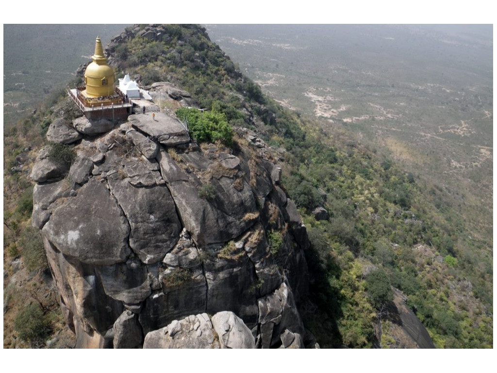
Gurpa is situated about 1.65 Kilometer north of Gurpa Station.The village where this mountain lies is also known as Gurpa.Gurpa was popularly known as Kukkutebadagiri. This magnificent mountain is associated with Maha Kassapa, the successor of Buddha. According to the Buddhist legend has it, when Maha Kassapa, the Buddha’s successor, realized that at the age of 120 years, his life was drawing to a close, he set out for Kukkitapadagiri, his favourite hill where solitude existed and was conducive for meditation. His feeble body could no longer climb the rocks as easily as before, hence he struck a wall of the hill and it opened to let him through. On arriving at the summit, a cavity opened in the rocks and Maha Kassapa entered, fell into a deep meditative trance and the rocks closed around him. Maha kassapa was one of the Buddha’s foremost disciples. After Sariputta and Moggallana predeceased the Blessed one, it was Maha Kassapa who came to be seen as his successor. Legends say that in the distant future when Maitreya, the future Buddha appears in the world, he will come to Kukkitapadagiri, awaken Maha Kassapa, receive the Buddha’s robe from him and then begin to announce the new dispensation. During the time when Buddhism flourished in India, Kukkitapadagiri was one of the most popular destinations for pilgrims because of its association with both Maha Kassapa and Maitreya. The stupa on the mountain’s top, said in the Asokavadana to have been built by King Ajatasattu.There is a steep path from the foot of the mountain, that leads to the base of sheer cliff. This cliff is famous for a huge narrow crack.
The site on the hill is mentioned in the ‘Records of the Archaeological Survey of India’ which mention that the caves and the ruins on the hill were first noticed by R.D. Banerji in 1906 with an additional note thereon appended by Bloch in the Bengal Asiatic Society’s journal of that year. The hill gained the reputation as being the abode of sages and saints. Legends say that one of the saints who is said to have lived on the mountain was the great Mahayanist philosopher Asanga. He spent 12 years meditating in a cave of Gurpa hill hoping to get a vision of the Maitreya Buddha. After 6 years without success, he decided to give up and leave but just as he was about to do so he noticed a bird’s nest, and beside it, the rock was worn smooth by the wings of the occupant brushing against it. Observing this encouraged Asanga to continue his practice and eventually attain his goal.
Many of the Chinese pilgrims who visited India between the 4th and 11th centuries went to the sacred mountain. I-tsing says he dreamed fondly of climbing Kukkutapadagiri even before he left China, a dream he was later able to fulfill. Fa-hian and in particular Huein Tsang, both left detailed descriptions of the place.
On the 2nd of December, 2009, the Sacred Sites of Kukkutapada Giri Stupa on the Gurpa Hill was once again revived to its original glory when His Holiness the 17th Gyalwa Karmapa Urgyen Trinley Dorje Consecrated the two newly built glorious stupas dedicated to Maitreya, Maha Kassapa and Arya Asanga.
The Caves(Gurpa Peak):- There are several tunnels or caves on this hill which go to great distance and from which branches run to different directions.The hill extends from southwest to north-east and has three peaks, the highest at the north-east being 1000 feet. The mouth of a tunnel which after some distance from the entrance, branches off into two passages. One passage goes downwards but is blocked with a mere fissure in the rock. The other goes further to the north-east over a staircase of 28 stone steps and leads to the right to a platform formed by a huge boulder. By the side of the platform is a natural depression or tank in the rock, which is held sacred by the local people. This tank measures only 8×5 feet in which, underneath a huge block of stones, was discovered, it is said, a skeleton more than 6 feet in length. Beyond this, going upwards, another platform is reached from where a second tunnel or a natural archway, formed by the huge boulders leaning against each other, runs across the top of the hill. At the end of the tunnel there is a platform from where steps or niches are seen cut into the rock to provide for a stairway to go to the summit of the peak. On a small boulder along one of the walls of the tunnel were some Buddhist images, one representing the Buddha, now without a head, 8 feet in height and another of the Buddha in bhumisparsamudra. Besides there is a votive stupa with Buddha figures in panels.On the top of this peak were noticed two miniature shrines, 5ft square, made of huge bricks, sculptures and statuary loosely piled together without mortar or cement, which encloses a pair of footprints on stone slabs, a number of Buddhist statues and small votive stupas. The images include figures of the Buddha and the deity Tara, some of them bearing inscriptions containing the usual Buddhist creed formulae.
On the western peak also is a square basement of bricks, representing perhaps ruins of a stupa with some images lying at site. Similarly on the southern peak were found fragments of sculptures and stupas.
R. D. Banerji and Bloch identified the hill with the Kukkutapadagiri of the Buddhist tradition, as described by Hiuen Tsang, who also mentions the same hill by another name of Gurupada Giri, from which the present name seems to have been derived. It is also stated that its distance from Bodh Gaya and the three peaks agree closely given by the 7th century Chinese pilgrim.
MOHANPUR BLOCK
Sinduwar:– The KP Jayaswal Research Institute, during in the course of its Archaeological Explorations brought to light the site period NBPW phase. Diwan:- The KP Jayaswal Research Institute, during in the course of its Archaeological Explorations brought to light the site period NBPW phase. Mohanpur:- The KP Jayaswal Research Institute, during in the course of its Archaeological Explorations brought to light the site period Early medieval. Lakhaipur:- The KP Jayaswal Research Institute, during in the course of its Archaeological Explorations brought to light the site period Medieval. Chorniman:- The KP Jayaswal Research Institute, during in the course of its Archaeological Explorations brought to light the site period Early medieval. Simariya:- The KP Jayaswal Research Institute, during in the course of its Archaeological Explorations brought to light the site period Early medieval. Guriawan:- The KP Jayaswal Research Institute, during in the course of its Archaeological Explorations brought to light the site period Gupta. Teswar:- The KP Jayaswal Research Institute, during in the course of its Archaeological Explorations brought to light the site period Gupta. Kenari:- The KP Jayaswal Research Institute, during in the course of its Archaeological Explorations brought to light the site period Early medieval. Kachanpur:- The KP Jayaswal Research Institute, during in the course of its Archaeological Explorations brought to light the site period Early medieval. Pira Chak:- The KP Jayaswal Research Institute, during in the course of its Archaeological Explorations brought to light the site period Gupta. Shriyawan:– The KP Jayaswal Research Institute, during in the course of its Archaeological Explorations brought to light the site period Early medieval.
SHERGHATI BLOCK
Sherghati:- There is an interesting remains of the old fort containing pillars of polished granite which is said to have been built by the Kol rulers. One of the boundaries of the fort is visible. 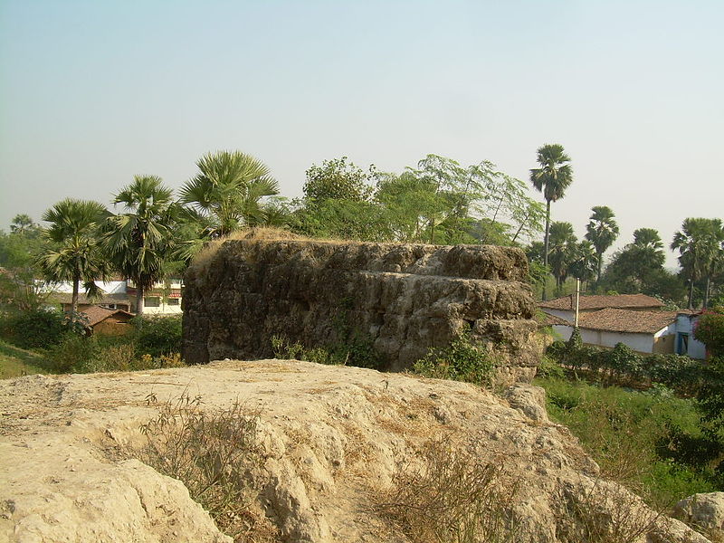 According to the legend, when Aurangzeb attacked Sherghati after conquering Aurngabad, the brave Kols of Sherghati stopped the Mughal army at the bank of Morhar river and did not let them enter the borders of Sherghati. The two brave soldiers of the Mughal army under the Aurangzeb’s rule, Quamar Ali and Sultan Ali were brought to death by the Kols. they were entombed river side near Hamzapur. Now this place is worshiped by both the Hindus and the Muslims.
Later, during the British Raj these adivasis were involved in a series of revolts against the British.
In 1934, a minor earthquake occurred in Sherghati but did not do much damage. In 1976, Sherghati was hit by a huge flood that claimed around 5-10 percent of the total area of Sherghati. The famous staircase well and the old jail-khana were submerged in that calamity.
Palhat Khurd:- The KP Jayaswal Research Institute, during in the course of its Archaeological Explorations brought to light the site period Late medieval. Hemzapur:– The KP Jayaswal Research Institute, during in the course of its Archaeological Explorations brought to light the site period Medieval. Garhpar (Sherghati):- The KP Jayaswal Research Institute, during in the course of its Archaeological Explorations brought to light the site period Early medieval. Chitab Kalan:- The KP Jayaswal Research Institute, during in the course of its Archaeological Explorations brought to light the site period Early medieval. Pachratan:- The KP Jayaswal Research Institute, during in the course of its Archaeological Explorations brought to light the site period Early medieval. Kathar:- The KP Jayaswal Research Institute, during in the course of its Archaeological Explorations brought to light the site period Early medieval. Kamat:- The KP Jayaswal Research Institute, during in the course of its Archaeological Explorations brought to light the site period Early medieval. Bharari:- The KP Jayaswal Research Institute, during in the course of its Archaeological Explorations brought to light the site period Early medieval. Jaypur:- The KP Jayaswal Research Institute, during in the course of its Archaeological Explorations brought to light the site period Shunga.Punah garh:- The KP Jayaswal Research Institute, during in the course of its Archaeological Explorations brought to light the site period Shunga
Chilim:- It is located 31 KM towards South from District head quarters Gaya. 136 KM from State capital Patna. The KP Jayaswal Research Institute, during in the course of its Archaeological Explorations brought to light the site period Chalcolithic.
Tomb of Sultan ‘Ali Shah’ :-
Idgah And Grave:-
ATRI BLOCK
Sheotargarh (Lat. 24o54’56” N;Long. 85o20‘73′‘E):- This village is located on an ancient habitation mound at a distance of 17 km south-west from Rajgir . Presently the mound is densely settled and covered with pucca buildings due to which it is difficult to retrieve archaeological remains from the site. However scores of Buddhi stand Brahmanical sculptures in black stone datable to Pala period could be noticed in a modern temple and at other places. Among them Navagraha panel, Avalokitesvara, Uma-Mahesvara , Surya ,Vishnu are noteworthy. An ancient brick measuring 30×22×10 cm is also noticed during exploration. This village may be identified as “së [vattha] lika“ which has been mentioned in terracotta sealing recovered from Nalanda. The village appears to be contemporary to ancient Nalanda Mahavihara.
Narawat:– The KP Jayaswal Research Institute, during in the course of its Archaeological Explorations brought to light the site period Early medieval. Sinr Garh:- The KP Jayaswal Research Institute, during in the course of its Archaeological Explorations brought to light the site period Early medieval. Bahormadih:– The KP Jayaswal Research Institute, during in the course of its Archaeological Explorations brought to light the site period NBPW phase. Atri Garh:- The KP Jayaswal Research Institute, during in the course of its Archaeological Explorations brought to light the site period NBPW phase. Taunsa:- The KP Jayaswal Research Institute, during in the course of its Archaeological Explorations brought to light the site period Early medieval. Chirawan:- The KP Jayaswal Research Institute, during in the course of its Archaeological Explorations brought to light the site period Early medieval. Upthu:- The KP Jayaswal Research Institute, during in the course of its Archaeological Explorations brought to light the site period Gupta. Jiri:- The KP Jayaswal Research Institute, during in the course of its Archaeological Explorations brought to light the site period NBPW phase.
IMAMGANJ BLOCK
Babhan Dih:- The KP Jayaswal Research Institute, during in the course of its Archaeological Explorations brought to light the site period Early medieval. Nohata:- The KP Jayaswal Research Institute, during in the course of its Archaeological Explorations brought to light the site period Late medieval. Shakarpur:- The KP Jayaswal Research Institute, during in the course of its Archaeological Explorations brought to light the site period Late medieval
AMAS BLOCK
Karmin:– The KP Jayaswal Research Institute, during in the course of its Archaeological Explorations brought to light the site period Early medieval. Chandisthan:– The KP Jayaswal Research Institute, during in the course of its Archaeological Explorations brought to light the site period Early medieval. Kalwan:- The KP Jayaswal Research Institute, during in the course of its Archaeological Explorations brought to light the site period Early medieval.
Amas Garh:- The KP Jayaswal Research Institute, during in the course of its Archaeological Explorations brought to light the site period Shunga.
Votive Stupas(Amas):- Susan L.Huntington’s book The Pala-Sena School of Sculpture describes about this stupas.
Pathara:-The KP Jayaswal Research Institute, during in the course of its Archaeological Explorations brought to light the site period Late medieval
DUMARIA BLOCK
Maigara:- The KP Jayaswal Research Institute, during in the course of its Archaeological Explorations brought to light the site period Early medieval. Kothi:– The KP Jayaswal Research Institute, during in the course of its Archaeological Explorations brought to light the site period NBPW phase.
MUHRA BLOCK
Jethien(Jethien Rajgir Path){ Lat- 24° 56’, N, Long- 85° 20’ E}:–Remains of cyclopeon wall continuing further westwards along the summits of the northern as well as southern ranges of the hill were traced.It was also observed by team of ASI in year 78-79 that both the inner and outer feet of the hills right from the Griyale to Tapovana and 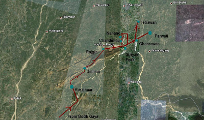 chaleraghatt were also secured with massive defenses, all vulnerable points , giving access to the vally, were found to have been securely plugged.Siddhartha Gautam after enlightenment came to Rajgriha from Gaya and was received by Bimbisara somewhere near yasthivana (now Jethian). Xuanzang’s account describes the whole stretch from Bodhgaya to Rajgriha scattered with auspicious spots associated with Buddha and his disciples, which were part of Buddhist pilgrimage at the time of his visit. There are strong indications that suggest that this pilgrimage path was in frequent use till 14th century and abruptly came to an end without leaving any traces of its existence behind.After the rediscovery of Buddhism in India and identification of places associated with Buddha, the path again came into focus but the condition of the 18km path was not suitable for the Pilgrims to tread.
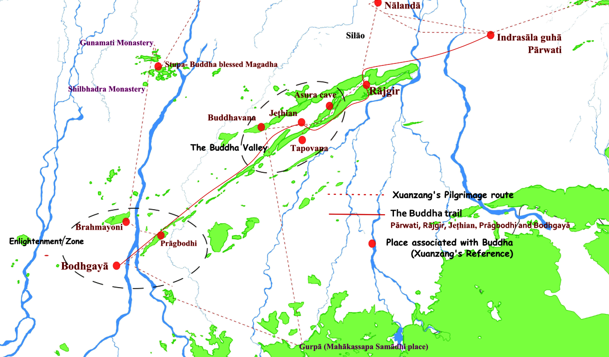 One of the most important effects of CM Nitish Kumar visit to the area and realizing the underlined potential is the revival of the footsteps of Buddha trail that would also include this particular stretch. A 70 Km trail is now in the process of being developed as the first leg of “Engaged Buddhism”.
In the initial phase, the CM Nitish Kumar visited five villages and the plan is to involve the entire community in developing tourism related resources and build capacity for Guide services, home stays of tourists, handicrafts and souvenirs and not to mention some local cuisine would also be part of the palate.
The Rajgir – Jethian Path (approximately 18 km) was a pilgrimage route connecting the important pilgrimage places of Bodh Gaya – Pragbodhi – Jethian – Tapovana – Rajgir – Indrasaila Guha (Parwati). This pilgrimage path is once again ready for the followers of the Buddha to tread in his footsteps.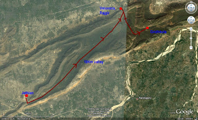
According to Jayaswal Research Institute Archaeological Explorations this site belongs to Early medieval period.
Dam Mound:- It is a brick structure which shapes like a terracestupa. On the top of the brick structure some
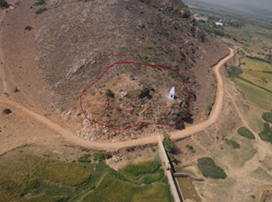
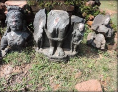
fragments and broken statues of Hindu deities and broken door jambs etc are lying. Some bricks areexposed varied in sizes ranging 48x28x5 cm, 50x 30×7 and 23x20x16 cm. Pot sherds of BRW and NBPW are found.
Buddhavana (Ayer-Pathri):–A very significant pilgrimage place associated with the Buddhacarika (sublime wandering of the Buddha) as mentioned by the 7th century monk-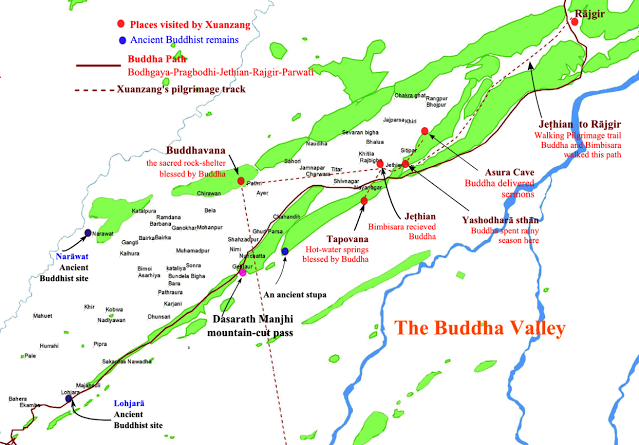 scholar from China Ven situated between Jethian and Bodhgaya.
Remains of Supatiṭṭha cetiya(local name-Buddha Mandap){25° 55’ 40 N, 85° 19’ 15 E}:-
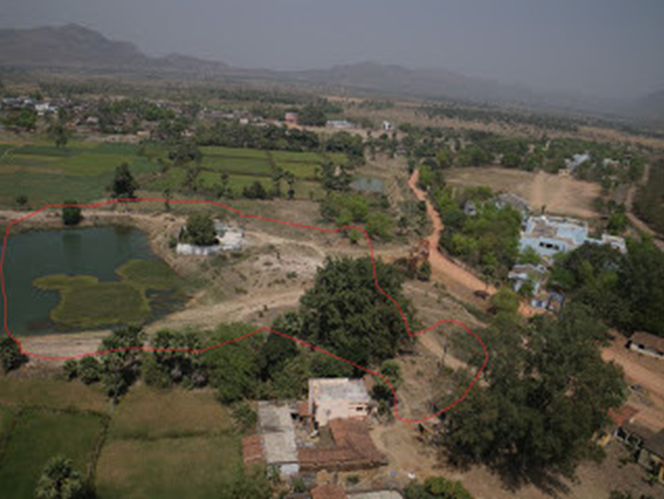 A per Pali reference it was the Supatiṭṭha cetiya, where the Buddha stayed during his first visit to Rajagaha from Gayasisa (Brahmayoni Mountain, Gaya), after the Enlightenment. There Bimbisāra visited him with twelve nahutas of followers, and Uruvela Kassapa dispelled their doubts by declaring his acceptance of the Buddha as his teacher. Xuanzang visited Ashokan Stupa at place where the Buddha preached law.
Asura’s cave ( Local name-rajapinda cave) {25° 56’ 45 N, 85° 20’ 25 E }:-
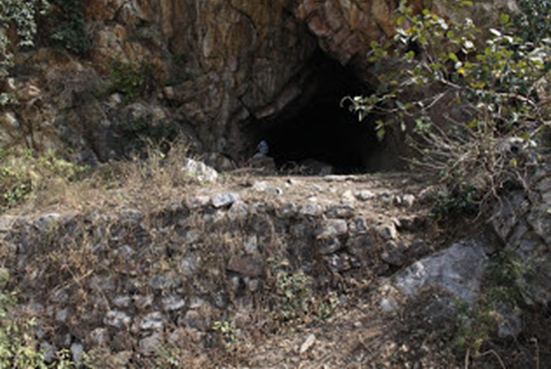 Xuanzang’s Description- and 4 Li further north of rishi Vyasa place was a large Asura Cave on the hill where the Buddha had discouse with Asura. Xuanzang also mentions about a causeway reaching the cave made by raja Bimbisāra to reach the Buddha.
Chandela Garh (24o54’ 14” N; 85o18’8.99.E.):- The site is located at 3.5 km north-east from Tapoban and 10 miles south east from Rajgir. The height of the mound is approx 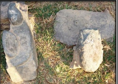 40’ to 50’ fro mthe river bed of Mangura River. The area of the mound is 500 mt x 200 mt. The Chandelagarh site had been inhabited
  by Black and Red ware culture people and gradually developed in a long span of time by Northern Black Polished Ware Culture, Mature NBPw, degenerated NBPw,Sunga-kushana Gupta and up to Pala period respectively. The above chronology is basedon the classification of potteries found from the surface and rain-gulley.
There are somany fragments of sculptures found on the top of the mound which are made of blackstone of Pala period .
According to Jayaswal Research Institute Archaeological Explorations this site belongs to Late NBPW period.
Tapoban:-_The site is adjacent to Chandela Garh on Rajgir- Gaya road. The hot springs, and other ancient ruins were noticed initially by Buchanan in about 1900 A.D. Stein visited Tapoban and described the ruins and his account seems to have been drawn upon by the district Gazetteer. Buchanan mentions, in all, five springs, four of which are hot springs.He also quotes a tradition that famous epic king Jarasandha was born near Tapoban. Buchanan gives the names of the spring as Chanda-Kaushik, Hangsatirtha (Harrisatirtha), Purna Hangsa (Purna-Harrisa), Sanatan-kund and Sanak-Ttirtha. Stein, names only the largest spring as Sanat-Kumar-kun . All the springs are enclosed by stone walls, with stone built steps leading down to water. The images scattered or kept inside the holy tanks represented Siva, Vishnu, Hara-Gauri, Sahastra Siva Linga. Stein noticed a large mound representinga stupa in between the largest spring and the modern temple on the west. The stupa was,at base 75’ to 81’ in diameter, about 45 ’square at top and of about 10’ heights. Stein suggests that this was the stupa which Hiuen Tsang notice as marking the spot Buddha walked for exercise. Hiuen-Tsang further informs that men from far and near use to flock here for holy bathe, after which those who have suffered from disease or chronic affections are healed. The most of the fine images collected around the spring are unprotected and have been theft by antique smugglers.
According to Jayaswal Research Institute Archaeological Explorations this site belongs to Early medieval period
Sarsoo (24o55’ 55.4’ N 85o21’72 E):- There is another most important village situated on the
Rajgir- Jethian road 10 km south-east from Rajgrih. The crow fly distance fromChandelagarh is hardly 2 km north. This site was unexplored or not reported by anyscholar. The village is densely populated. The whole village is settled on a massivemound. The undulation of the mound measuring 12 to 50 m height and 12 km in area. Acircular type of mound seems to be a Stupa (?). This village is in Atari Police Station,Gaya. There is a modern temple which is unroofed and only high square platform ismade approachable by stairs. There are so many magnificent sculptures of Hindu andBuddhist deities kept inside the temple. The site belongs to Pre-Mauryan to pala periodon the basis of potteries and antiquities recovered from the surface of the mound. Thenoteworthy sculptures (Fig. 5-12) found in different locations of the village is beingdescribed as given below.
Arai Keshopur:-
An ancient image of Parvati & Matrika were found here, which are well preserved in the Naradah Museum, Nawada.
According to Jayaswal Research Institute Archaeological Explorations this site belongs to Early medieval period.
Aer Pathri:- The KP Jayaswal Research Institute, during in the course of its Archaeological Explorations brought to light the site period Early medieval. Sauntar Garh:- The KP Jayaswal Research Institute, during in the course of its Archaeological Explorations brought to light the site period Early medieval. Bela:- The KP Jayaswal Research Institute, during in the course of its Archaeological Explorations brought to light the site period Early medieval. Gehlaur:- The KP Jayaswal Research Institute, during in the course of its Archaeological Explorations brought to light the site period Early medieval.
BARACHATTI BLOCK
Gajragarh:– The KP Jayaswal Research Institute, during in the course of its Archaeological Explorations brought to light the site period Medieval. Sarwan Khas:– The KP Jayaswal Research Institute, during in the course of its Archaeological Explorations brought to light the site period Early medieval. Binda Garh:- The KP Jayaswal Research Institute, during in the course of its Archaeological Explorations brought to light the site period Early medieval. Bhagauti:– The KP Jayaswal Research Institute, during in the course of its Archaeological Explorations brought to light the site period Early medieval. Dahiyar:- The KP Jayaswal Research Institute, during in the course of its Archaeological Explorations brought to light the site period Early medieval. Selari:– The KP Jayaswal Research Institute, during in the course of its Archaeological Explorations brought to light the site period Early medieval. Tilaiya khurd:- The KP Jayaswal Research Institute, during in the course of its Archaeological Explorations brought to light the site period Early medieval. Gosain Pesra:– The KP Jayaswal Research Institute, during in the course of its Archaeological Explorations brought to light the site period Early medieval. Darbar Math:- The KP Jayaswal Research Institute, during in the course of its Archaeological Explorations brought to light the site period Early medieval. Goswan:- The KP Jayaswal Research Institute, during in the course of its Archaeological Explorations brought to light the site period Early medieval.
GURARU BLOCK
Guraru:- The KP Jayaswal Research Institute, during in the course of its Archaeological Explorations brought to light the site period Early medieval. Maihiama:- The KP Jayaswal Research Institute, during in the course of its Archaeological Explorations brought to light the site period Early medieval. Dadhpa:- The KP Jayaswal Research Institute, during in the course of its Archaeological Explorations brought to light the site period NBPW phase. Rauna:– The KP Jayaswal Research Institute, during in the course of its Archaeological Explorations brought to light the site period Early medieval. Konchi:- The KP Jayaswal Research Institute, during in the course of its Archaeological Explorations brought to light the site period NBPW phase. Dewakali:- The KP Jayaswal Research Institute, during in the course of its Archaeological Explorations brought to light the site period Early medieval. Sarewa:- The KP Jayaswal Research Institute, during in the course of its Archaeological Explorations brought to light the site period Early medieval. Baikatpur (Itahri):- The KP Jayaswal Research Institute, during in the course of its Archaeological Explorations brought to light the site period Early medieval. Dobur:- The KP Jayaswal Research Institute, during in the course of its Archaeological Explorations brought to light the site period Early medieval. Mangrawan:- The KP Jayaswal Research Institute, during in the course of its Archaeological Explorations brought to light the site period Early medieval. Kanausi Garh:- The KP Jayaswal Research Institute, during in the course of its Archaeological Explorations brought to light the site period Early medieval. Manjhar:- The KP Jayaswal Research Institute, during in the course of its Archaeological Explorations brought to light the site period Early medieval.
NEEM CHAK BATHANI BLOCK
Narauni:- The KP Jayaswal Research Institute, during in the course of its Archaeological Explorations brought to light the site period Early medieval. Mai:- The KP Jayaswal Research Institute, during in the course of its Archaeological Explorations brought to light the site period NBPW phase. Simraur Garh:- The KP Jayaswal Research Institute, during in the course of its Archaeological Explorations brought to light the site period Early medieval. Kamalpur:- The KP Jayaswal Research Institute, during in the course of its Archaeological Explorations brought to light the site period Early medieval. Chausandi:- The KP Jayaswal Research Institute, during in the course of its Archaeological Explorations brought to light the site period Early medieval. Naili:- The KP Jayaswal Research Institute, during in the course of its Archaeological Explorations brought to light the site period Late NBPW. Saren:- The KP Jayaswal Research Institute, during in the course of its Archaeological Explorations brought to light the site period Early medieval. Lalgarh:- The KP Jayaswal Research Institute, during in the course of its Archaeological Explorations brought to light the site period Early medieval.
PARAIYA BLOCK
Dakhner:- The KP Jayaswal Research Institute, during in the course of its Archaeological Explorations brought to light the site period Early medieval. Garh Paraiya:- The KP Jayaswal Research Institute, during in the course of its Archaeological Explorations brought to light the site period Shunga. Nad Paraiya:- The KP Jayaswal Research Institute, during in the course of its Archaeological Explorations brought to light the site period NBPW phase. Ubhai:- The KP Jayaswal Research Institute, during in the course of its Archaeological Explorations brought to light the site period Late medieval. Shungaris:- The KP Jayaswal Research Institute, during in the course of its Archaeological Explorations brought to light the site period Medieval. Kapasiya:- The KP Jayaswal Research Institute, during in the course of its Archaeological Explorations brought to light the site period Late medieval. Laxman Bigha:– The KP Jayaswal Research Institute, during in the course of its Archaeological Explorations brought to light the site period Medieval. Mahodarsthan:- The KP Jayaswal Research Institute, during in the course of its Archaeological Explorations brought to light the site period Early medieval. Bagahi:- The KP Jayaswal Research Institute, during in the course of its Archaeological Explorations brought to light the site period Chalcolithic. Solara Garh:- The KP Jayaswal Research Institute, during in the course of its Archaeological Explorations brought to light the site period NBPW phase. Kastha:- The KP Jayaswal Research Institute, during in the course of its Archaeological Explorations brought to light the site period Early medieval. Maniara Garh:- The KP Jayaswal Research Institute, during in the course of its Archaeological Explorations brought to light the site period Early medieval. Haridaspur:- The KP Jayaswal Research Institute, during in the course of its Archaeological Explorations brought to light the site period Early medieval.
KHIZARSARAI BLOCK
Maksudpur:- The KP Jayaswal Research Institute, during in the course of its Archaeological Explorations brought to light the site period Early medieval
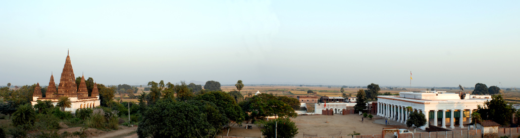 The Fort at Maksudpur has now been in the hands of the family for 300 years. It was conquered by the ancestors of the Rajas of Maksudpur from the Mughal Faujdar of Pargana Sanaut in the year 1710. The Fort remained a stronghold as the family brought the entire Magadh region under its control in the unsettled times following the death of Aurangzeb.
 The Maksudpur Fort stands on a slight prominence, rising from the surrounding moat. Built originally with mud bastions and subject to additions and accretions over a long period of time, it has features of Islamic and Rajput architecture. It was once a maze of 52 courtyards, 3 floors above the ground and several underground chambers and tunnels.
The Fort was used as the residence of the Maksudpur Rajas till 1934, when it was partly damaged by an earthquake centered in North Bihar. It has been abandoned ever since and was vandalized for the last 30 years as a local source of building material.
 Around the forecourt in front of the Fort are the remains of stables for horses and the pilkhana for elephants.
Rajmandir Palace
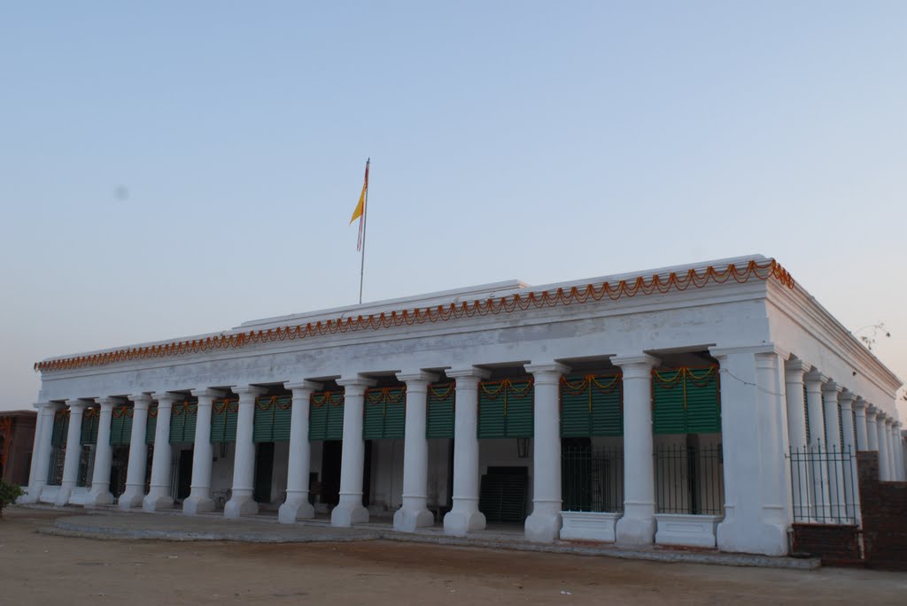 The Raj Mandir Palace was built in the 1860s with a colonial façade as a pavilion for Dussehra celebrations. After the Fort was abandoned, it was modified and expanded to serve as the residence of the Raja.
Over the years this building fell to disrepair and most of the roofs had caved in. In a pioneering self-financed heritage conservation initiative in 2007, all the dilapidated pillars and roofs were pulled down and rebuilt using traditional building techniques of lime mortar and plaster.
Maharani Mata Bhagwati:- Installed in the Andar Mahal of the Raj Mandir Palace.It is the Gaddi Nashin Maharani Mata Bhagwati, the presiding deity of Maksudpur. The Dussehra Puja of the Goddess and Mela (village fair) at that time is a big draw for people from the surrounding areas.
Tank(Talai):-
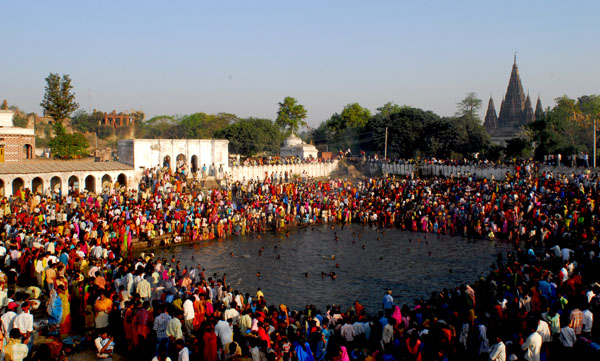 The Bathing Tank (Talai) with the Raj Ghat and other bathing ghats on all sides is used by the local community and has special relevance during the Dussehra and Chhath festivals. During the Chhath Puja the ghats are thronged with devotees from the region making offerings to the setting and rising sun.
Nauratan Mandir:-
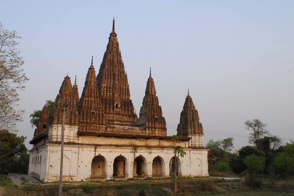 Nine-spired Nauratan Mandir, dedicated to Radha-Krishna and eight other deities as well as the smaller Hanuman Mandir and Surya Mandir.
The Maksudpur Garh welcomes travellers to stay and explore the region around.
Pakki Bagh Guest Rooms:
 The Pakki Bagh was a walled in zenana garden of the Rajmandir Palace. The rooms overlooking this garden have been rebuilt as 3 guest rooms with attached bath.
Kutlupur:–The KP Jayaswal Research Institute, during in the course of its Archaeological Explorations brought to light the site period Early medieval. Mokam Chak:- The KP Jayaswal Research Institute, during in the course of its Archaeological Explorations brought to light the site period Early medieval. Mandai:– The KP Jayaswal Research Institute, during in the course of its Archaeological Explorations brought to light the site period Early medieval. Kurwa:- The KP Jayaswal Research Institute, during in the course of its Archaeological Explorations brought to light the site period Late NBPW phase. Naudih:- The KP Jayaswal Research Institute, during in the course of its Archaeological Explorations brought to light the site period Early medieval. Saidpur Shivala (Khizirsarai):- The KP Jayaswal Research Institute, during in the course of its Archaeological Explorations brought to light the site period Early medieval. Jaru (Ibrahimpur):- The KP Jayaswal Research Institute, during in the course of its Archaeological Explorations brought to light the site period Medieval. Harsingara:- The KP Jayaswal Research Institute, during in the course of its Archaeological Explorations brought to light the site period Early medieval.
TANKUPPA BLOCK
Tankuppa Garh:– The KP Jayaswal Research Institute, during in the course of its Archaeological Explorations brought to light the site period NBPW phase. Jagarnathpur Garh:– The KP Jayaswal Research Institute, during in the course of its Archaeological Explorations brought to light the site period Early medieval. Choar:- The KP Jayaswal Research Institute, during in the course of its Archaeological Explorations brought to light the site period NBPW phase. Sahil:- The KP Jayaswal Research Institute, during in the course of its Archaeological Explorations brought to light the site period Early medieval. Utli Bara:- The KP Jayaswal Research Institute, during in the course of its Archaeological Explorations brought to light the site period Early medieval. Bhadan:- The KP Jayaswal Research Institute, during in the course of its Archaeological Explorations brought to light the site period NBPW phase. Dhibar:- The KP Jayaswal Research Institute, during in the course of its Archaeological Explorations brought to light the site period Early medieval. Naua Khap:- The KP Jayaswal Research Institute, during in the course of its Archaeological Explorations brought to light the site period Medieval.
Maher:- Maher village is around 17km east of Gaya district headquarters on Gaya-Rajauli highway. Many villages in Bihar are situated over the mounds of ancient Buddhist monastic remains. Maher is one such village that has many ancient Buddhist sculptures and pillars from ancient monastery from Pala period ( 8th -12th CE) scattered all over the village.
The statue of Buddha in sitting posture was found at village Maher around five years ago during excavation by villagers for their own purpose like farming. They had kept it under a tree and started worshipping.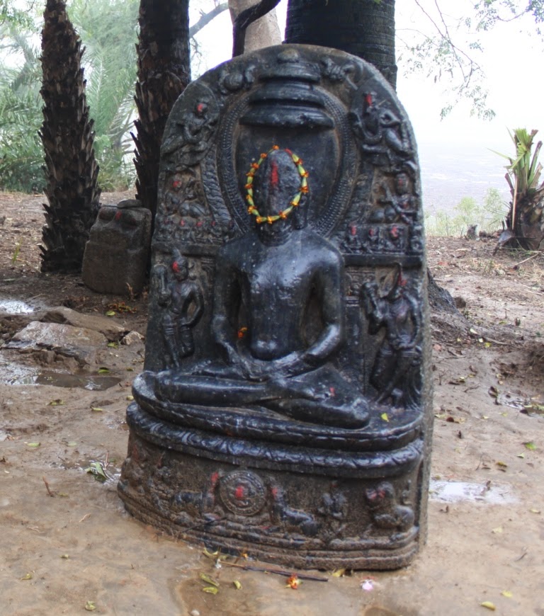 Apart from the statue that was stolen, there are two other statues also in the village that include one in Mahaparinirvana posture and the other one in sitting posture. The statue in Mahaparinirvana posture is a rare find.
 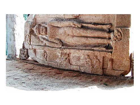 In 2013, Nav Nalanda Mahavihara (NNM), a deemed university functioning at Nalanda, came to know about the three precious statues kept in Maher during documentation of ancient Magadh comprising Patna and Magadh divisions under the Revival of Ancient Buddhist Pilgrimage in Bihar project.
The KP Jayaswal Research Institute, during in the course of its Archaeological Explorations brought to light the site period Early medieval
BANKE BAZAR BLOCK
Thadi Hills (Baltharwa):-The KP Jayaswal Research Institute, during in the course of its Archaeological Explorations brought to light the site period Early medieval. Saifganj:- The KP Jayaswal Research Institute, during in the course of its Archaeological Explorations brought to light the site period Early medieval. Banke dham (Banke Bazar):- The KP Jayaswal Research Institute, during in the course of its Archaeological Explorations brought to light the site period Early medieval. Azamgarh:- The KP Jayaswal Research Institute, during in the course of its Archaeological Explorations brought to light the site period Medieval. Parsawan khurd:- The KP Jayaswal Research Institute, during in the course of its Archaeological Explorations brought to light the site period Early medieval. Juri:- The KP Jayaswal Research Institute, during in the course of its Archaeological Explorations brought to light the site period Early medieval. Dumrawan:- The KP Jayaswal Research Institute, during in the course of its Archaeological Explorations brought to light the site period Early medieval. Shrawanadah:- The KP Jayaswal Research Institute, during in the course of its Archaeological Explorations brought to light the site period Medieval. Nawa Dih:-The KP Jayaswal Research Institute, during in the course of its Archaeological Explorations brought to light the site period Early medieval.
WAZIRGANJ BLOCK
Khanqah Wajidya Qadria (Balyari):-
Dargah Hazrat Syed Shah Wajid Hussain(Balyari):-
Wazirganj:-An ancient image of Parsvanatha was found here, which is well preserved in the Naradah Museum, Nawada.
According to Jayaswal Research Institute Archaeological Explorations this site belongs to Early medieval period.
Amethi:- The village under the Wazirganj Block is about 3 km north of Wazirganj Railway Station. Several stone images have been found near a tank in village. It is believed that Lord Buddha stayed in the village . A big Animal fair is held on the occasion of Shivaratri. Museum & Meditation Hall.
According to Jayaswal Research Institute Archaeological Explorations this site belongs to Early medieval period.
Temple of Trilokanatha (Punawan):- The village is situated about 1.6.Kilometers southwest of Wazir Ganj Railway Station and about 5 Kilometer south-west from Kurkihar. The ancient remains of Punawan were first noticed by Major Kittoe in 1847. Later in 1861-62 Cunningham explored the site. A new temple is erected on the ancient spot using its material. A figure of the ascetic Buddha is kept in the shrine and is worshipped as Triloknath. This temple is situated to the south of the village.
According to Jayaswal Research Institute Archaeological Explorations this site belongs to Early medieval period.
Tanks(Punawan):- In year 1861-62 Cunningham’s site plan show the two tanks of larger and square in shape, being on the north of the village and is known as Budhokhar Tal and The other is situated to the east of the village and is known as Karamar Tal in between the Budhokhar Tal and the ruins of the ancient Trilokanatha temple. It is now stands the village Punawan.
Bishunpur:- The KP Jayaswal Research Institute, during in the course of its Archaeological Explorations brought to light the site period Early medieval. Hansra:- The KP Jayaswal Research Institute, during in the course of its Archaeological Explorations brought to light the site period Early medieval. Malthiya:- The KP Jayaswal Research Institute, during in the course of its Archaeological Explorations brought to light the site period Early medieval. Singhaura:- The KP Jayaswal Research Institute, during in the course of its Archaeological Explorations brought to light the site period Gupta. Munipur:- The KP Jayaswal Research Institute, during in the course of its Archaeological Explorations brought to light the site period Early medieval. Ghuriyawan:– The KP Jayaswal Research Institute, during in the course of its Archaeological Explorations brought to light the site period Early medieval. Kandariya:– The KP Jayaswal Research Institute, during in the course of its Archaeological Explorations brought to light the site period Late Gupta. Karjara:– The KP Jayaswal Research Institute, during in the course of its Archaeological Explorations brought to light the site period Early medieval. Amaitha:- The KP Jayaswal Research Institute, during in the course of its Archaeological Explorations brought to light the site period Early medieval. Eru Garh:- The KP Jayaswal Research Institute, during in the course of its Archaeological Explorations brought to light the site period Early medieval. Kenar Chatti:- The KP Jayaswal Research Institute, during in the course of its Archaeological Explorations brought to light the site period Early medieval. Kinardih:- The KP Jayaswal Research Institute, during in the course of its Archaeological Explorations brought to light the site period Early medieval. Budhaul:- The KP Jayaswal Research Institute, during in the course of its Archaeological Explorations brought to light the site period Early medieval. Kari-Sowa:- The KP Jayaswal Research Institute, during in the course of its Archaeological Explorations brought to light the site period Chalcolithic. Barbigha:- The KP Jayaswal Research Institute, during in the course of its Archaeological Explorations brought to light the site period Early medieval.
Kurkihar Village:– The village of Kurkihar is situated about 5 Km. north-east of Wazirgunj and 22 km east of Gaya. Kurkihar was a Buddhist site which was known all over the Buddhist world for its excellence in metal art. This large mound over which this village lies consists of the remains of a very old Buddhist Monastery.The main mound of Buddhist ruins is to the south of the village. Its antiquity was brought to notice by Major Kittoe in 1847. Approximately 148 bronze artifacts were excavated from this area around the year 1930. Some of the antiquities excavated from Kurkihar have been put up on display in the Patna Museum, while some others are in the Indian Museum in Calcutta. Image of Buddha, Votive stupa , fragment, Vishnu & Ganesha collected from here are also well preserved in the Nawada Museum.
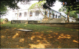
There are two Hindu temples here, out of which one still preserves a commendable collection of Buddhist sculptures discovered from the area.Prominent amongst these is the exquisite statue of Akshobhya Buddha which stands just outside the entrance of the temple.The Hindu temple situated in the north-eastern portion of the village was seen by Cunningham in 1861 with a number of images, both Buddhist and Hindu images which belong to the village and have been preserved here. All the images kept here can be dated to the 10th – 11th Century AD. According to local inhabitants, the kurkihar temple used to be a Buddhist worship place but after sometime it had been changed into a Hindu temple. But the important Buddhist sculptures can be seen.
We can also see a votive stupa in the grounds of the Hindu Temple.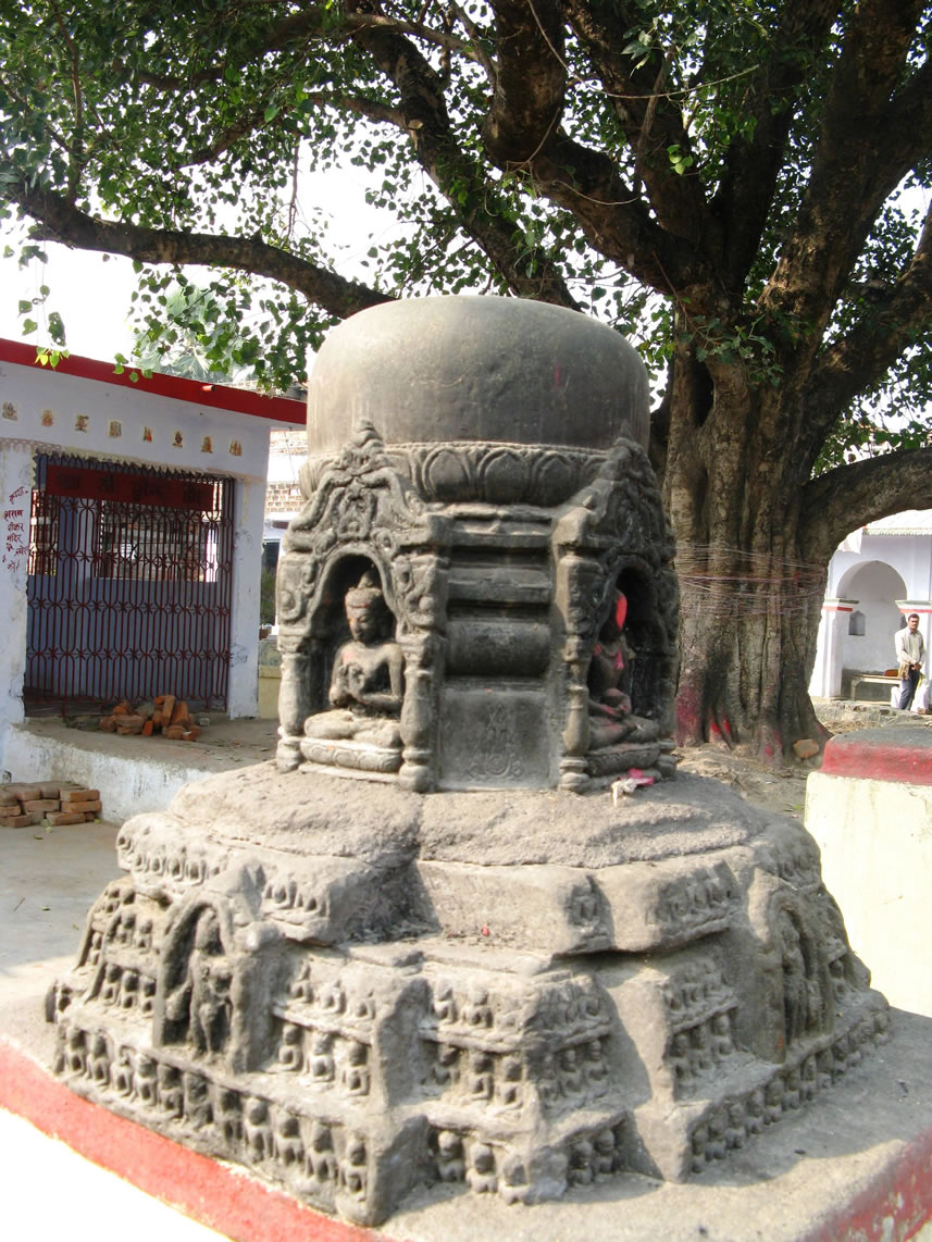
Mother Dih:- The KP Jayaswal Research Institute, during in the course of its Archaeological Explorations brought to light the site period Early medieval. Harahi :- An ancient image of Kankali, Mahishasurmardini & Bhairava were found here, which are well preserved in the Naradah Museum, Nawada. Harahi Asthan:- The KP Jayaswal Research Institute, during in the course of its Archaeological Explorations brought to light the site period NBPW phase. Orail:- The KP Jayaswal Research Institute, during in the course of its Archaeological Explorations brought to light the site period Early medieval.
Hasra Kol(Bishunpurtarwa, Hasra and Jagdishpur ):- It is situated about 15 km south of Kurkihar.Ancient mounds in the valley known as “Hasra Kol”. Numerous stone sculptures were found in the course of Keith’s excavation in year 1907 these are kept in Patna museum as the name of Keith collection.
Sobhnath(Bishunpurtarwa, Hasra and Jagdishpur ):- It is situated about 15 km south of Kurkihar.Ancient mounds in the hill known as ‘Sobhnath’
Baitul Anwar(Gewal Bigha):- It is situated at Gewal Bigha, a famous Khanqah of Ahl-e-Sunnat founded by Shah Noorul Huda, his successor Siraj-e-Millat Allama Sirajul Huda has been a famous religious personality in Bihar.
Pesh:-
Karhona:-
GURUA BLOCK
Lord Shiva Temple (Ramnagar):- Ramnagar village has ancient Temple of Loard Shiva.
Guneri:– It is Located about 10 km west-north from Sherghati block in Gaya dist. Ancient Buddhistic image and other images and sculptures collected underneath a shed.
The village is situated about 5 kms. to the southeast of Manda hills. The numerous sculptures collected from these ruins were kept arranged under a modern shed erected by the Central Archaeology Department. They represent mainly Buddhist and Shaiva divinities. Some of the images, however, bear inscriptions from the style of execution of their carvings they maybe assigned to the medieval period (i.e. 9th to 12th Centuries A.D.). Two of the inscriptions, it may be added, refer to the name Sri Gunacharita that was obviously the ancient name of the place.
According to Jayaswal Research Institute Archaeological Explorations this site belongs to Early medieval period.
Tarapur:-The KP Jayaswal Research Institute, during in the course of its Archaeological Explorations brought to light the site period Gupta. Piprahi:- The KP Jayaswal Research Institute, during in the course of its Archaeological Explorations brought to light the site period NBPW phase. Murli Hills (Chhauchu Bigha):- The KP Jayaswal Research Institute, during in the course of its Archaeological Explorations brought to light the site period Early medieval. Bara Hills:– The KP Jayaswal Research Institute, during in the course of its Archaeological Explorations brought to light the site period Early medieval. Gurua:- The KP Jayaswal Research Institute, during in the course of its Archaeological Explorations brought to light the site period Medieval. Murhut Hills (Baizu Bigha):- The KP Jayaswal Research Institute, during in the course of its Archaeological Explorations brought to light the site period Early medieval. Pirwan:- The KP Jayaswal Research Institute, during in the course of its Archaeological Explorations brought to light the site period Late medieval. Dadu Barma:- The KP Jayaswal Research Institute, during in the course of its Archaeological Explorations brought to light the site period Early medieval. Naser:– The KP Jayaswal Research Institute, during in the course of its Archaeological Explorations brought to light the site period Early medieval. Bharaundha:– The KP Jayaswal Research Institute, during in the course of its Archaeological Explorations brought to light the site period Early medieval. Chilaur:– The KP Jayaswal Research Institute, during in the course of its Archaeological Explorations brought to light the site period NBPW phase. Taroa:- The KP Jayaswal Research Institute, during in the course of its Archaeological Explorations brought to light the site period Early medieval. Nagwan garh:- The KP Jayaswal Research Institute, during in the course of its Archaeological Explorations brought to light the site period Early medieval. Manda hill:- The KP Jayaswal Research Institute, during in the course of its Archaeological Explorations brought to light the site period NBPW phase.
Dhibra Garh:- The KP Jayaswal Research Institute, during in the course of its Archaeological Explorations brought to light the site period Gupta. Deuriya:- The KP Jayaswal Research Institute, during in the course of its Archaeological Explorations brought to light the site period Early medieval. Kulauna:- The KP Jayaswal Research Institute, during in the course of its Archaeological Explorations brought to light the site period Shunga. Rajan:– The KP Jayaswal Research Institute, during in the course of its Archaeological Explorations brought to light the site period NBPW phase. Duba:- The KP Jayaswal Research Institute, during in the course of its Archaeological Explorations brought to light the site period NBPW phase. Bhurha:- The KP Jayaswal Research Institute, during in the course of its Archaeological Explorations brought to light the site period Early medieval. Chunku Bigha (Barua Dih):- The KP Jayaswal Research Institute, during in the course of its Archaeological Explorations brought to light the site period Early medieval. Erur:- The KP Jayaswal Research Institute, during in the course of its Archaeological Explorations brought to light the site period Early medieval.
Arsi kalan:- It is located at 3 kms west of Block. It was the traditional place of abode of the ancient sage Shringi Rishi.
Mangrawan :- Evidence of black- and red, Northern Black Polished and Black-slipped wares were taken notice in year 80-81 by ASI.
Jaipurgarh :-Twelve Pala bronze image including figures of Tara, Hariti, Bodhisattva Lokesvara, Maitreya, Vishnu, Ganesha and replica of the Mahabodhi temple of Bodh-Gaya was discovered here by ASI in year(75-76).
Gusei:- It is situated 10 kms. south –west of Guma block. A large number of images of Lord Buddha have been found in this village.
BELAGANJ BLOCK
Sonepur :- It is situated 3 km west of Bela Ganj railway station on the bank of river Jamune. It consists the Sun temple. A mound situated there was excavated, revealed five successive period, dated back to earlier than 700 BC and last would come down to 50 BC.
According to Jayaswal Research Institute Archaeological Explorations this site belongs to Chalcolithic period.
Rauna Garh:- The KP Jayaswal Research Institute, during in the course of its Archaeological Explorations brought to light the site period Early medieval. Gulariya Chak:- The KP Jayaswal Research Institute, during in the course of its Archaeological Explorations brought to light the site period Early medieval. Singhaul:- The KP Jayaswal Research Institute, during in the course of its Archaeological Explorations brought to light the site period Early medieval. Somar Bigha:- The KP Jayaswal Research Institute, during in the course of its Archaeological Explorations brought to light the site period Early medieval. Zahir Bigha:- The KP Jayaswal Research Institute, during in the course of its Archaeological Explorations brought to light the site period Early medieval. Gaharpur:- The KP Jayaswal Research Institute, during in the course of its Archaeological Explorations brought to light the site period Early medieval. Kadirpur:- The KP Jayaswal Research Institute, during in the course of its Archaeological Explorations brought to light the site period Early medieval. Bishunpur:- The KP Jayaswal Research Institute, during in the course of its Archaeological Explorations brought to light the site period Early medieval. Panari:- The KP Jayaswal Research Institute, during in the course of its Archaeological Explorations brought to light the site period Early medieval. Sindani:- The KP Jayaswal Research Institute, during in the course of its Archaeological Explorations brought to light the site period Early medieval. Belaganj:- The KP Jayaswal Research Institute, during in the course of its Archaeological Explorations brought to light the site period Early medieval. Khaneta:- The KP Jayaswal Research Institute, during in the course of its Archaeological Explorations brought to light the site period NBPW phase. Karmathu:- The KP Jayaswal Research Institute, during in the course of its Archaeological Explorations brought to light the site period Early medieval. Pali:- The KP Jayaswal Research Institute, during in the course of its Archaeological Explorations brought to light the site period Early medieval. Kachnawan:- The KP Jayaswal Research Institute, during in the course of its Archaeological Explorations brought to light the site period Early medieval. Neuri:- The KP Jayaswal Research Institute, during in the course of its Archaeological Explorations brought to light the site period Early medieval. Agandha:- The KP Jayaswal Research Institute, during in the course of its Archaeological Explorations brought to light the site period Early medieval.
Koteshwar Nath Mahadev (Main):- Koteshwar Nath Mahadev is situated on the confluence of the river Morhar and Dargha , famous for highly sacred Lord Shiva Temple at 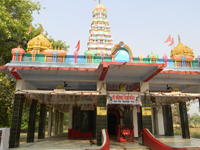
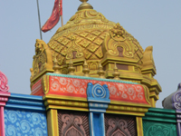
Main village.The temple’s sanctum sanctorum is carved in a single piece of red stone and within it is installed a large sized Shivalinga with around 1,008 miniature Shivlingas around 1200 years back. An amazing thing near the Koteshwar Nath temple is an old Pipal tree, whose large branches have turned towards the temple bending downwards as if offering prayers to Lord Shiva.
There is a reference that Sahastra Shiv Ling idol was established at the end of Dwapara Yuga. This Shiv Ling was established by Usha, daughter of King Banasur of Sonitpur. It says that Banasur’s Main & Dev Kund was situated in a deep forest. Usha used to visit the temple to offer prayers during which Lord Shiva appeared & told her to establish a Sahastralinga to get her wish fulfilled. After that Usha established the Shiva Linga. In result of that Lord Shiva granted her wish and she got married with Aniruddha, grandson of Lord Krishna her husband with whom she went on to live her life.
There are number of sculpture scattered in and around the temple which are affiliated to Brahmanism as well as buddhism. Among the Brahmanism some important image are Umamaheswara, Image of Ganesh, Chaturbhuj Durga, Four armed Durga in seated position, Ashtbhuji Durga , Kamdev, Surya , Agni, Vishnu and among the Buddhist sculpture are Tara and Buddha all can be dated belong to 6-11 CE according to ASI Report published on Koteshwar Nath Dham.
Gauri Shankar Sthan:– A Mukhalinga made of granite stone under the tamarind tree is located in the west of village and north to the Koteshwar Nath Temple. A fragmentary architectural pillar member of granite found nearby indicate existence of a temple here. It is of Pala Period according to ASI Report published on Koteshwar Nath Dham.
Tri Murdeshwar Or Brahmasthan:- It is located on the north-west out skrit of the village where four Shivlinga established on a chabutra, out of which one has of Pala Period and remaining three is of later period according to ASI Report published on Koteshwar Nath Dham.
Jharkhandi Baba:- A Mukhalinga made of black basalt on the north of village. It is of Pala Period according to ASI Report published on Koteshwar Nath Dham.
Koteshwar Mahadeva:- A Shivalinga located in the middle of farming field towards east of the Koteshwar Nath Temple.
Devi Mandir :- It is a modern Temple placed many of Sculpture.
KONCH BLOCK
Koncheswar Mahadeva (Konch):-
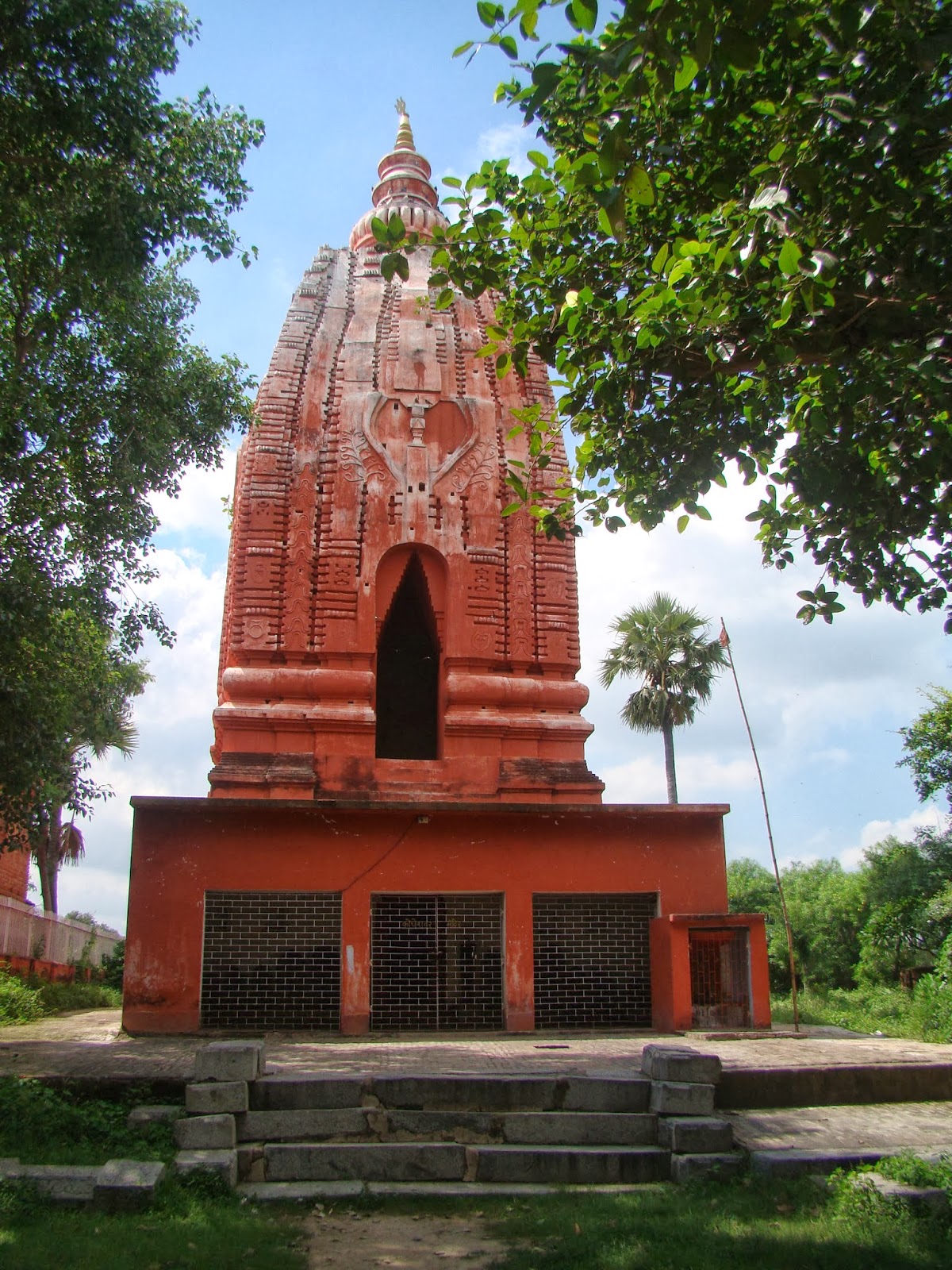
Konch contains remains of numerous temples, but the principal one is an ancient temple entirely of bricks. The temple is a square building, the dimension of which on the outside is 27 feet 6 inches square with a chamber inside 11 feet square. The entrance is to the east. The height is nearly 70 feet. It has two storeys. The lower story is vaulted in the Hindu fashion, that is, it has two arched roofs meeting in a ridge. Bricks overlapping on all the four sides till they meet at a point form the upper storey. The doorway is almost as high as the room inside.The construction of the temple in bricks is a feat of high engineering skill considering the time it was built.There is a lingam of Koncheswar Mahadeva inside the temple. It would seem that a new floor has been constructed later at a somewhat higher level, so that the lingam now appears standing in a hollow. From this hollow a small channel leads to the north to carry off the oblation water poured over the lingam. The outlet of this channel is still there on the north side. This shows that this channel formed a part of the original construction.The temple is built of properly shaped, well-burnt bricks though of different sizes. The statues and other relies, whether insider lying about, is Brahmanical. Inside the temple there are statues of Haragouri and the Ashta Saktis. The most interesting piece inside the shrine is a panel sculpture of the Dasavataras representing, Vishnu. A remarkable fact is that the Konch temple representation of the Dasavataras differs from such representations elsewhere as it divides the Vamana, avatara into two scenes by leaving out the ninth or the Buddha avatara and by representing Vishnu in the tenth or Kalki avatara along with a female deity with a small horse standing in front. These Dasharataras are exquisitely sculptured.A fish standing vertically on its tail represents the fish incarnation. The tortoise incarnation bears a close resem- blance to the Saivic emblems of the argha and lingam with the sole addition of a couple of human figures on the sides holding a string which is wound round the lingam; the lingam thus does the duty of Mount Mandar.This temple of Siva worship is clearly of Brahmanical origin. The construction, the images and the tradition all support this.It has not yet been definitely established as to when this temple was originally constructed. The massiveness of the pillars shows that it must have been built at a very early period.
Radha-Krishna Thakurwari Konch Bazaar:- It’s Founder is Late Nirdhin Sharma. It is situated near Konch Bazaar-Middle School.
Konch Sun Temple (Surya Mandir) with tank:- It is situated next to Konch Bus stand.
Konch Masjid (Mosque)Konch Bazaar:–
Mok:- The KP Jayaswal Research Institute, during in the course of its Archaeological Explorations brought to light the site period Early medieval. Konch Dih:- The KP Jayaswal Research Institute, during in the course of its Archaeological Explorations brought to light the site period Early medieval. Kabar Garh:- The KP Jayaswal Research Institute, during in the course of its Archaeological Explorations brought to light the site period NBPW phase. Rauna Garh:- The KP Jayaswal Research Institute, during in the course of its Archaeological Explorations brought to light the site period Early medieval. Mangraur:- The KP Jayaswal Research Institute, during in the course of its Archaeological Explorations brought to light the site period Early medieval. Egana:- The KP Jayaswal Research Institute, during in the course of its Archaeological Explorations brought to light the site period Early medieval. Beli:- The KP Jayaswal Research Institute, during in the course of its Archaeological Explorations brought to light the site period Early medieval. Hichhapur:- The KP Jayaswal Research Institute, during in the course of its Archaeological Explorations brought to light the site period Early medieval. Koiri Bigha:- The KP Jayaswal Research Institute, during in the course of its Archaeological Explorations brought to light the site period Early medieval. Muhammadpur:- The KP Jayaswal Research Institute, during in the course of its Archaeological Explorations brought to light the site period Early medieval. Hurrahi:- The KP Jayaswal Research Institute, during in the course of its Archaeological Explorations brought to light the site period Early medieval. Sondih:- The KP Jayaswal Research Institute, during in the course of its Archaeological Explorations brought to light the site period Early medieval. Khaira:– The KP Jayaswal Research Institute, during in the course of its Archaeological Explorations brought to light the site period Early medieval. Mathiya:- The KP Jayaswal Research Institute, during in the course of its Archaeological Explorations brought to light the site period Early medieval. Baikatpur:- The KP Jayaswal Research Institute, during in the course of its Archaeological Explorations brought to light the site period Early medieval. Chait Bigha:- The KP Jayaswal Research Institute, during in the course of its Archaeological Explorations brought to light the site period Early medieval. Laxman Bigha:– The KP Jayaswal Research Institute, during in the course of its Archaeological Explorations brought to light the site period Early medieval. Palanki Sekhi:- The KP Jayaswal Research Institute, during in the course of its Archaeological Explorations brought to light the site period Early medieval. Bhimpur:- The KP Jayaswal Research Institute, during in the course of its Archaeological Explorations brought to light the site period Early medieval. Maulaganj:- The KP Jayaswal Research Institute, during in the course of its Archaeological Explorations brought to light the site period Early medieval. Tetariya:- The KP Jayaswal Research Institute, during in the course of its Archaeological Explorations brought to light the site period Early medieval. Amra:- The KP Jayaswal Research Institute, during in the course of its Archaeological Explorations brought to light the site period NBPW phase. Adai:- The KP Jayaswal Research Institute, during in the course of its Archaeological Explorations brought to light the site period Early medieval. Utren:- The KP Jayaswal Research Institute, during in the course of its Archaeological Explorations brought to light the site period Early medieval. Simra:- The KP Jayaswal Research Institute, during in the course of its Archaeological Explorations brought to light the site period Early medieval. Korap:- The KP Jayaswal Research Institute, during in the course of its Archaeological Explorations brought to light the site period NBPW phase. Digghi:- The KP Jayaswal Research Institute, during in the course of its Archaeological Explorations brought to light the site period Early medieval. Sinduari:- The KP Jayaswal Research Institute, during in the course of its Archaeological Explorations brought to light the site period Early medieval. Ahiyapur:- The KP Jayaswal Research Institute, during in the course of its Archaeological Explorations brought to light the site period Late medieval.
Pali:- Photograph of a few standing pillars of a temple at Pali, taken by Thomas Fraser Pepp in 1870. Beglar wrote in a report of 1872-73, ‘A few miles east of Konch on the road to Gaya is the small village of Pali. There are, to the east of the village, the remains of two or three temples; but that now remains are the ruins level with the ground of a large Saivite temple, of which a few pillars alone are standing. The pillars are plain tall shafts with corbelled cruciform capitals.The temple appears to have been a very large one, consisting of a sanctum enshrining a large lingam, an antarala, a maha mandapa, and probably also a mandapa and portico. The temple was built of bricks picked with stone.
According to Jayaswal Research Institute Archaeological Explorations this site belongs to Early medieval period.
Khanqah Haqquania Firdausia (Deora Sharif P.O Usas):-
Hz syed Shah Sharique Zeeshan Usmani Firdosi
Khanqah Burhania Kamalia Firdausia (Deora Sharif P.O Usas):-
Hazrat syed Shah Anwar Ali Usmani Firdosi
MANPUR BLOCK
Bhusanda:-ASI in year 80-81, brought to light several terracotta ring -wells at Bhusanda on the exposed section of the river Phalgu.
According to Jayaswal Research Institute Archaeological Explorations this site belongs to Medieval period.
Manpur:- ASI in year 77-78 located sites yielding Northern Black Polished Ware.
According to Jayaswal Research Institute Archaeological Explorations this site belongs to NBPW phase period.
Khanqah Qadria Faiyazia (Joda Masjid Manpur):-
Hz. Syed Shah Aayaz Ahmad Qadri
Salempur:- The KP Jayaswal Research Institute, during in the course of its Archaeological Explorations brought to light the site period Early medieval. Bhadeja:- The KP Jayaswal Research Institute, during in the course of its Archaeological Explorations brought to light the site period Early medieval. Mirganj:-The KP Jayaswal Research Institute, during in the course of its Archaeological Explorations brought to light the site period Early medieval. Dohari:- The KP Jayaswal Research Institute, during in the course of its Archaeological Explorations brought to light the site period Medieval. Kharhari:- The KP Jayaswal Research Institute, during in the course of its Archaeological Explorations brought to light the site period Late medieval. Chiraila:– The KP Jayaswal Research Institute, during in the course of its Archaeological Explorations brought to light the site period Late medieval. Naroghat:- The KP Jayaswal Research Institute, during in the course of its Archaeological Explorations brought to light the site period Medieval. Buddhgare:- The KP Jayaswal Research Institute, during in the course of its Archaeological Explorations brought to light the site period Late medieval. Bhore:- The KP Jayaswal Research Institute, during in the course of its Archaeological Explorations brought to light the site period Early medieval. Pehani:- The KP Jayaswal Research Institute, during in the course of its Archaeological Explorations brought to light the site period Early medieval. Sonout:- The KP Jayaswal Research Institute, during in the course of its Archaeological Explorations brought to light the site period Medieval. Naudhariya:– The KP Jayaswal Research Institute, during in the course of its Archaeological Explorations brought to light the site period Early medieval. Gopalganj:- The KP Jayaswal Research Institute, during in the course of its Archaeological Explorations brought to light the site period Early medieval. Soharpur:- The KP Jayaswal Research Institute, during in the course of its Archaeological Explorations brought to light the site period Gupta. Saraiya:- The KP Jayaswal Research Institute, during in the course of its Archaeological Explorations brought to light the site period Medieval. Barew:– The KP Jayaswal Research Institute, during in the course of its Archaeological Explorations brought to light the site period Late medieval. Surheri:- The KP Jayaswal Research Institute, during in the course of its Archaeological Explorations brought to light the site period NBPW phase. Bhuiyantola (Mast Alipur):- The KP Jayaswal Research Institute, during in the course of its Archaeological Explorations brought to light the site period Early medieval. Sondhi Garh:- The KP Jayaswal Research Institute, during in the course of its Archaeological Explorations brought to light the site period NBPW phase. Nanauk:- The KP Jayaswal Research Institute, during in the course of its Archaeological Explorations brought to light the site period Early medieval.
Kukra:– ASI in year 77-78 located sites yielding Northern Black Polished Ware.
According to Jayaswal Research Institute Archaeological Explorations this site belongs to NBPW phase period.
Khanqah Mazahiria( Aabgila):-
Hazrat Syed Shah Najam Imam